@iCyclone Sounds like it is best to leave given the uncertainty. Also the majority of the ensemble tracks seem to be to the east of Panacea. A contracting eye could make it a hard chase. Trust you make the right choice.
@VTopouzoglou@MetJam_ Those two Tiddington PWSs currently sitting at 197mm and 172mm for the day. https://t.co/W0Xqm3LHLR
More than 50 PWSs in the Oxford area reported more than 100mm with several in the 140-190mm range
@BMcNoldy One of the vagaries of NHC issuing advisories at intermediate hours is that Francine peaked at cat 2 85 knots at 21Z , but the 6-hourly bdeck data I presume you used shows a peak of cat 1 80 knots.
There seems to be confusion as to which low has been named #StormOlivia by IPMA (Portuguese Met Service). IPMA chart shows it is the low near Ireland on Friday. The deeper low following on Saturday is as yet unnamed.
@wxjerdman A previous Hurricane Dora in 1999 came very close to achieving this feat. Became a hurricane in the EPac and was downgraded to a tropical storm just 0.2 degrees from the Dateline.
@joe_oliver This is actually a tributary of the River Otter which enters the Otter a couple of hundred yards further down. It is normally a small stream which flows through the pub gardens.
Solar eclipse seen casting a shadow across the newly formed first tropical cyclone of the northern hemisphere season - Tropical Storm #Sanvu in the western Pacific Ocean.
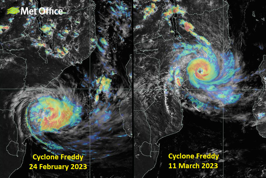
33 days after first being named and 15 days since its first landfall over #Mozambique, Cyclone #Freddy is very slowly moving onshore over Mozambique for the second time.
@philklotzbach There has already been a sudden uptick in the Nino3.4 index in the last few days indicating weakening of the La Niña might already be underway.