U.S. figure skating championships in Wichita, Kansas just a few days ago.
Team USA figure skaters and coaches were reportedly on the flight from Kansas to D.C. which crashed
This Total Precipitable Water loop over the past 48 hours helps us visualize the atmospheric river impacting California.
Note the plume of increased moisture stretching from the subtropics directed at the Golden State.🌧️ #CAwx#CArain
Images courtesy of @UWCIMSS.
A massive "bomb cyclone" is set to explode off the U.S. West Coast with hurricane force winds, flooding rains, and enormous mountain snow from Category 5 atmospheric river.
Central pressure will fall almost 70 mb / 24 hours reaching 942 mb -- similar to Category 4 hurricane.
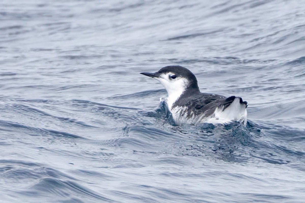
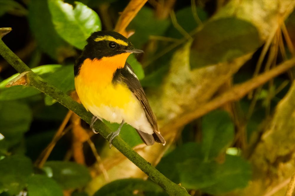
What are the dynamics of #hybridisation between the Critically Endangered Balearic shearwater and the closely related Yelkouan shearwater? Check out our new preprint out on @biorxivpreprint where we investigate the causes/consequences of pervasive gene flow between these species.
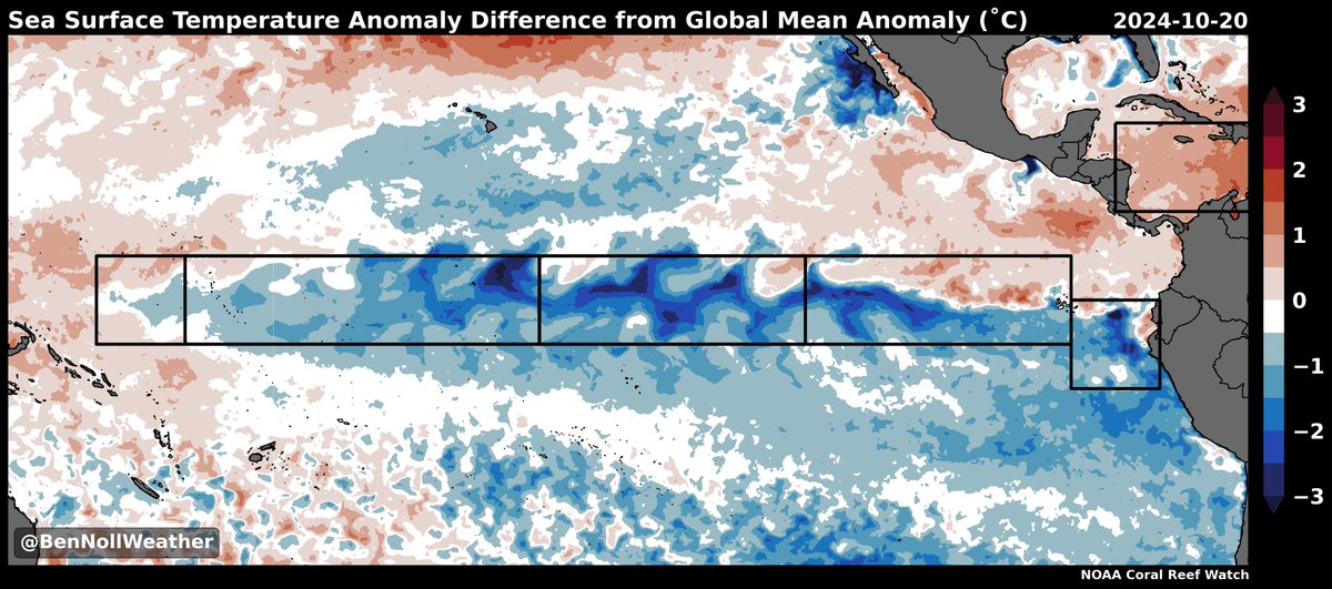
Although a La Niña event has yet to be officially classified, there is a respectable cold tongue in the equatorial Pacific! 🌊
The 30-day relative Niño 3.4 Index (-1.02˚C) is now in moderate La Niña territory, lower than the value at this time in 2022 (-0.94˚C) and 2021 (-0.94˚C).
With abundant off-equatorial warmth in the tropics, the relative index is a better indicator of the potential for anomalous convection. Thus, it has high utility in a warming world and can be viewed as an alternative to traditional indices.
The La Niña signature currently covers the eastern and central equatorial Pacific, having a classical look (not a central-based event at this point).
While a spell of westerly winds will move across the Pacific during early November, I think a moderate (relative) La Niña will still be in place come December, being an important global climate driver into early 2025.
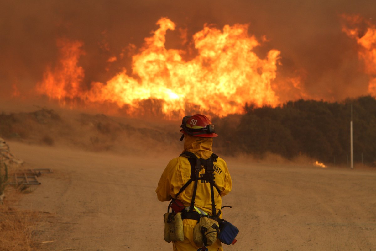
There is the fire weather. But north winds then turning offshore suggests we could have a bird filled morning in prime watch sites in San Francisco, and maybe even farther south. The question is where do we go in San Mateo County to look???
Wx models maintaining the gusty offshore pattern ahead with Thu night-Friday looking like the peak with another ramp up into Sat AM. Wind/RH% at 2,500’ and near the surface show things drying out rapidly overnight into Friday AM with some fairly strong gusts as well for the interior #CAwx 10/16/2024
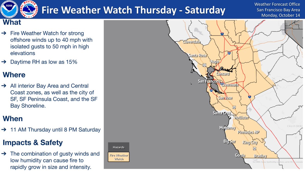
Folks, we are not out of the woods yet. We've issued a Fire Weather Watch in effect Thursday until Saturday evening for the potential for strong offshore winds and low humidity. Areas most likely to see impacts are the higher elevations which could see gusts up to 50 mph.
#CAwx
Increasing confidence in moderate-strong north wind event across parts of SW Calif on Fri. With drying expected, looking for elevated to possibly critical fire weather conditions. New fires may have rapid fire spread/extreme fire behavior. Photo-Jeff hall #LAWeather#cawx
@Weather_West We ornithologists use these data to assess migration nightly. The migration density correlates with wind speed/direction etc https://t.co/2bLMdPsCcg