Home of #Klystron9 radar and Meteorologists Josh Linker, Juli Marquez, @Mike_Clay, Diane Kacmarik, Brian @mcclureWX, @KyleHanson_WX, Alan Winfield & Viki Knapp
The NHC has named Cristobal in the North Atlantic as it moves over cooler water. It is a very weak system and doesn't appear to be much of a storm. It will dissipate by tomorrow out at sea.
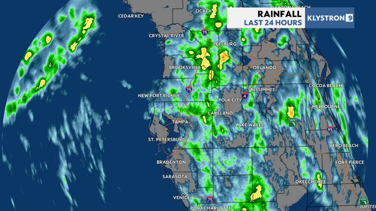
Classic example of a 'low coverage' day here in the Tampa Bay area where there weren't that many t'storms. But the few that did pop up were heavy with 1.00-1.50 inch amounts common. #Florida
A tropical wave will likely become a tropical depression later this week as it moves west in the tropical Atlantic. It is not a concern right now as it is far out to sea and likely to start curving north in the long run.
No tropical threats at this time. The two YELLOW areas aren't a threat. The area in RED is where a Tropical Depression likely will develop this week, but there aren't any clear signals of it being near land at this time. We'll keep an eye on it.
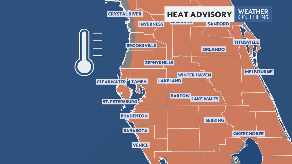
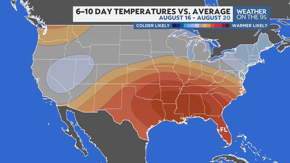
A big ridge of high pressure settles in this week over the northern gulf coast and will persist into next week. This will bring above normal temperatures and below normal rainfall.
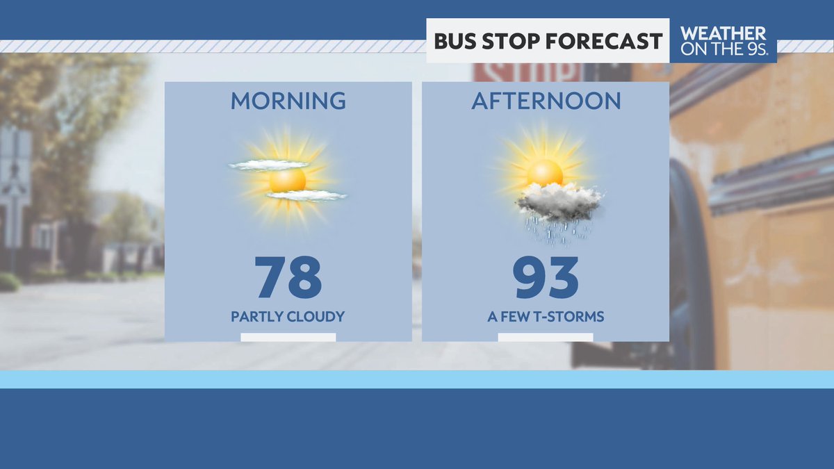
BACK TO SCHOOL FORECAST: It's the first day of school for Hillsborough, Manatee, Sarasota and Citrus county students. It's a warm and dry morning. It will be hot this afternoon with a lower rain chance. Have a great day and a wonderful school year!
We are watching the Atlantic for possible development later this week. Even if something does form out there, it is not likely to make it very far as it will encounter hostile conditions farther west.
Many Bay Area kids go back to school Monday. Look for a fairly typical summer weather day. Sunny and warm for the bus stop in the morning. A few storms will greet them when they get home from their first day. #backtoschool#flwx
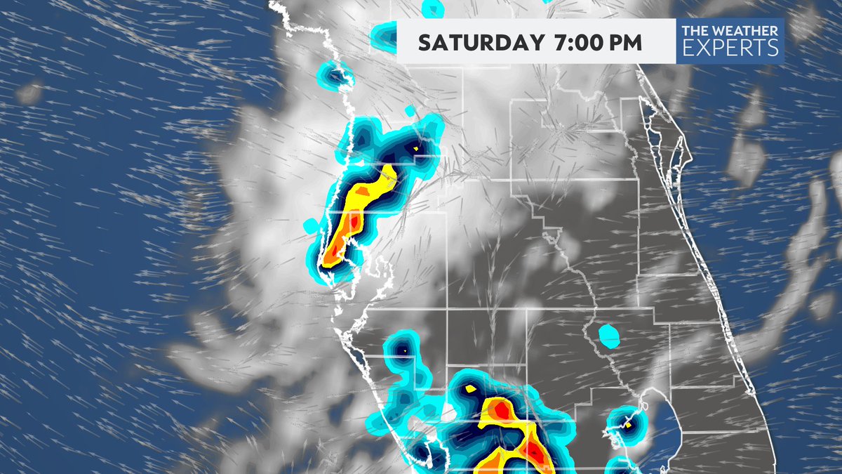
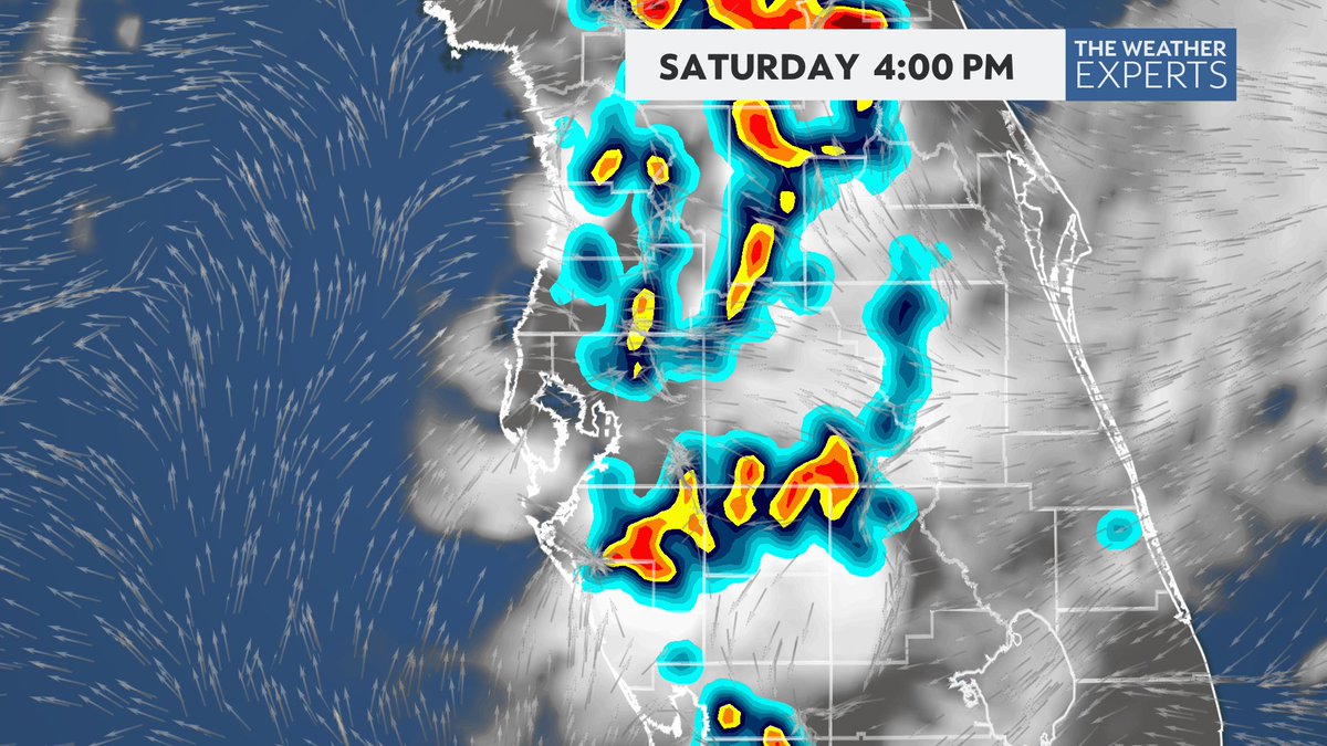
Most of today looks good with sunshine and a few clouds. But, like yesterday, scattered heavy thunderstorms will be the result this afternoon and into the evening. @Jlinkerwx has your forecast details coming up with Weather on the Nines.
Look for another round of PM storms today coming in from the east. Some will be heavy. Most areas should be dry through 2 pm with temperatures getting to around 90. @Jlinkerwx has your forecast coming up with Weather on the Nines.
Storms moved west into the Gulf this evening, leaving behind some clouds and sprinkles. The sunset views were fantastic!
Thanks to Willow, Judith, and Ryan for these great shots.
FRI: Tampa has had at least .37" of rain for 6 days in a row, tied for 2nd for the most days. In June 2003, we had 9 straight days in a row. Today, no measurable rain at TPA, just a trace. Thanks to Klimate Kyle for the info.