For anyone to who isn’t aware. I don’t use this account anymore. My new acct is @dspringzWX Maybe new met vids in the future¿ 🤷🏻♂️
Follow me there ill follow ya back. LFGM #Mets
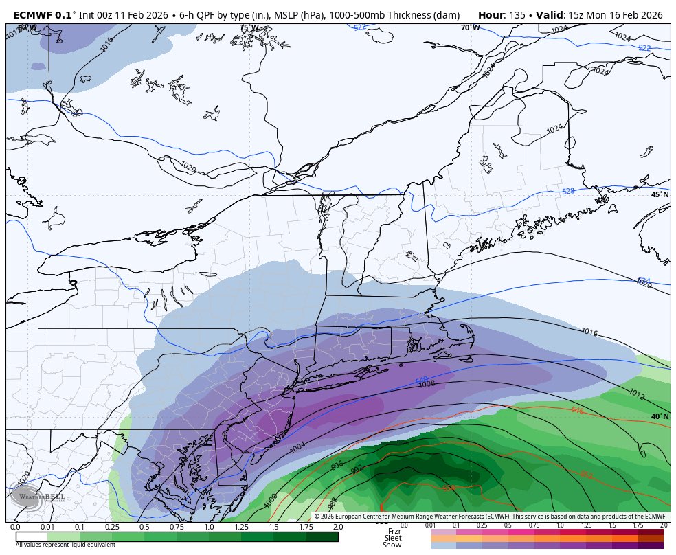
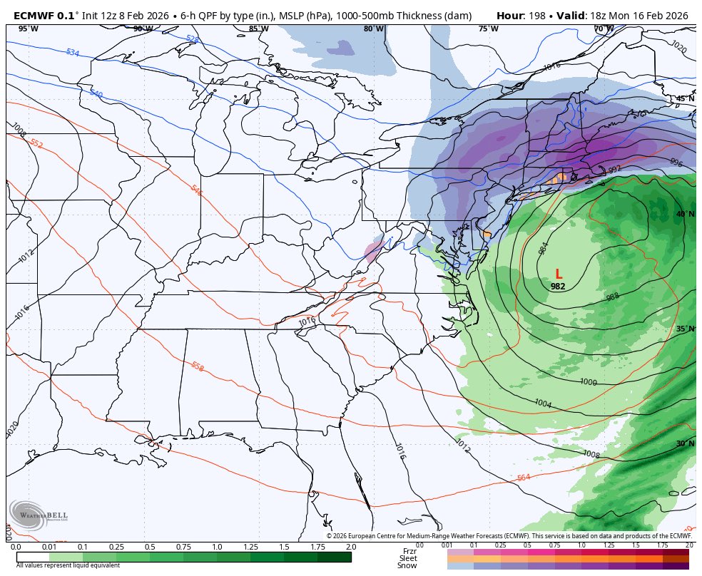
Monday/Tuesdays Storm Update ⛈️
Storm Threat {🟡}
- Rain will begin early Monday morning with pockets of heavy downpours/thunderstorms throughout the day and night
- 40-55mph wind gusts (worst Mon Night)
- .5 - 1.5” of rainfall potentially higher amounts in the T-Storms
Watching the potential for Heavy Rain, Thunderstorms and High Winds Monday-Tuesday
Current Storm Threat Level {🟡}
Rainfall: 1-2”+
Wind-gusts: 40-55+mph
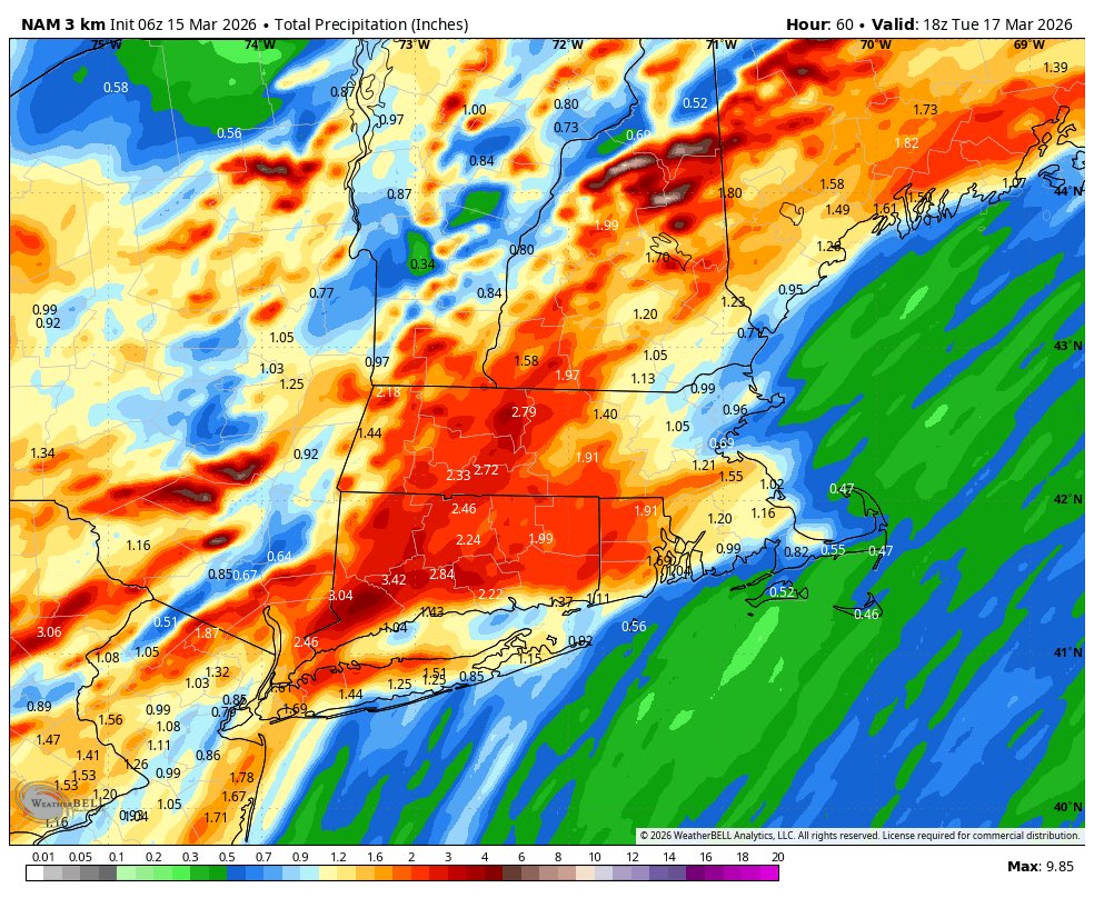
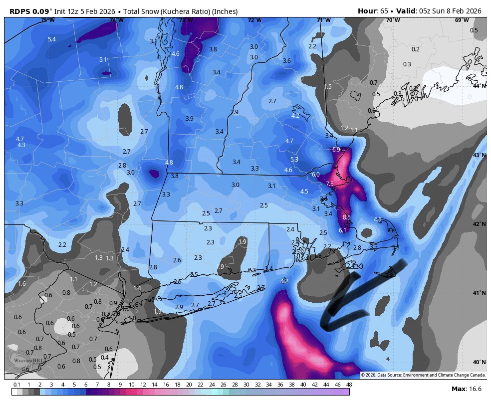
12z Rgem:
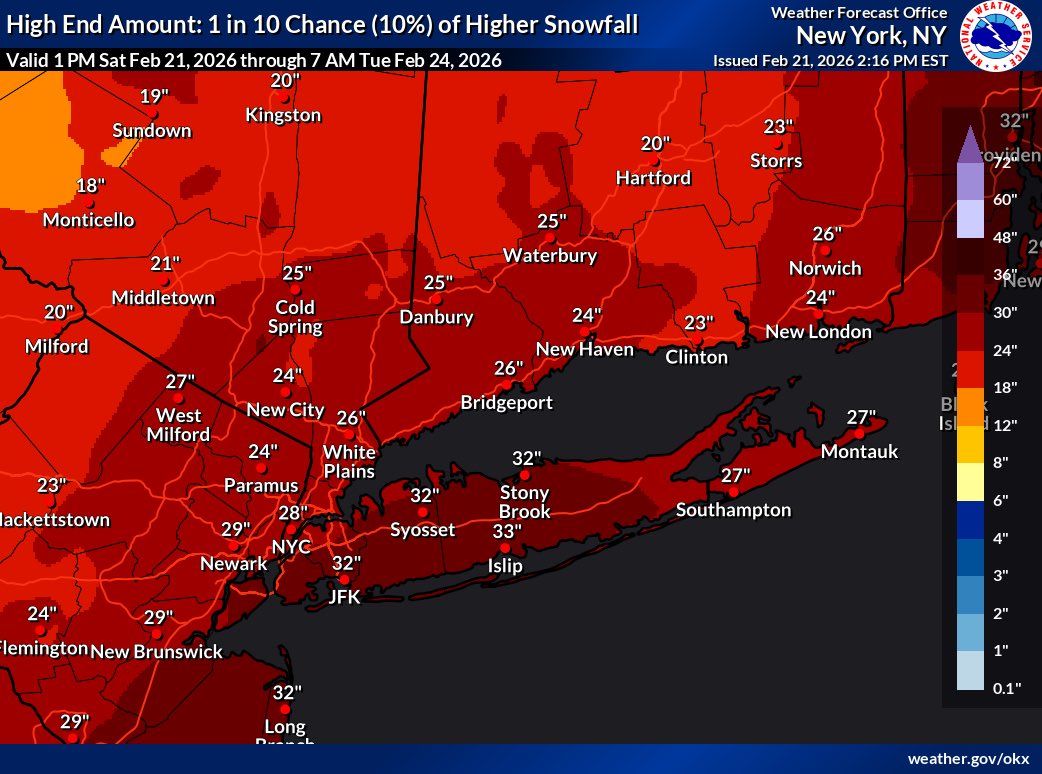
Looks like a general 1-3” for LI
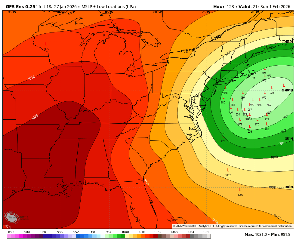
The wildcard however is the potential inverted trough with this system. As seen just offshore SE of Longisland. Where that sets up you could be talking about 3-6”+ potentially.
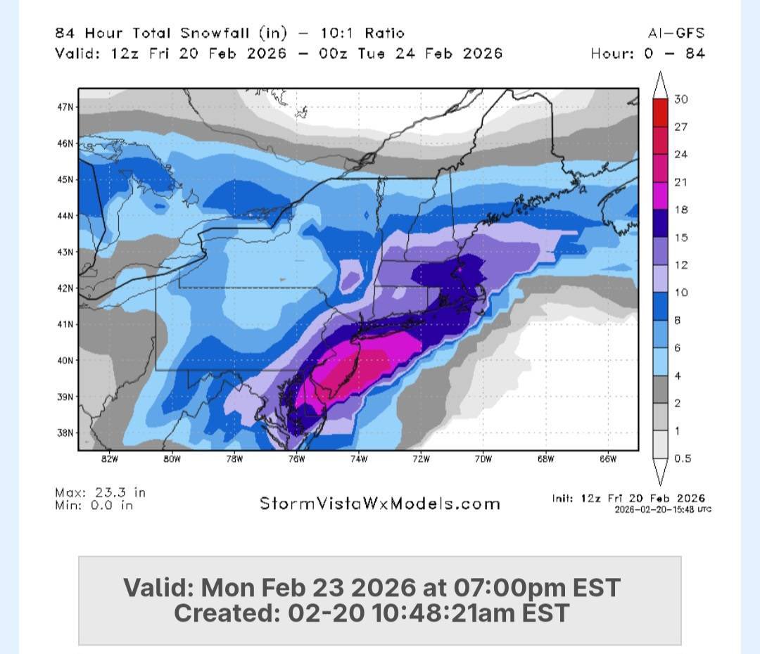
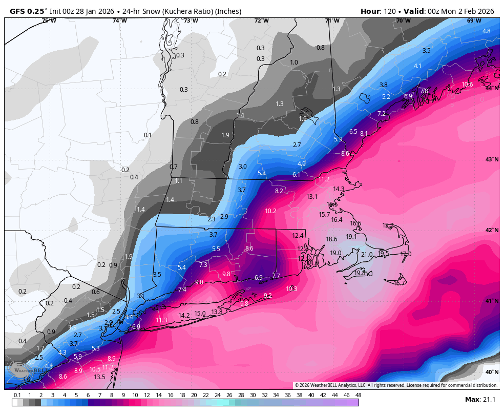
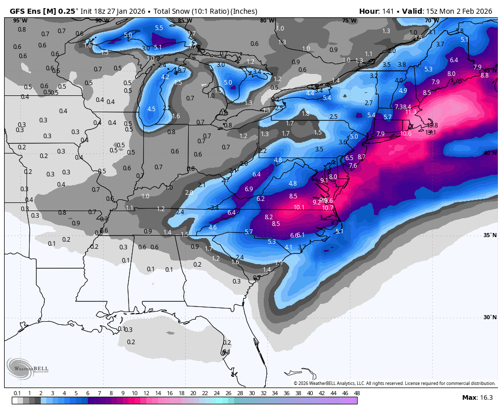
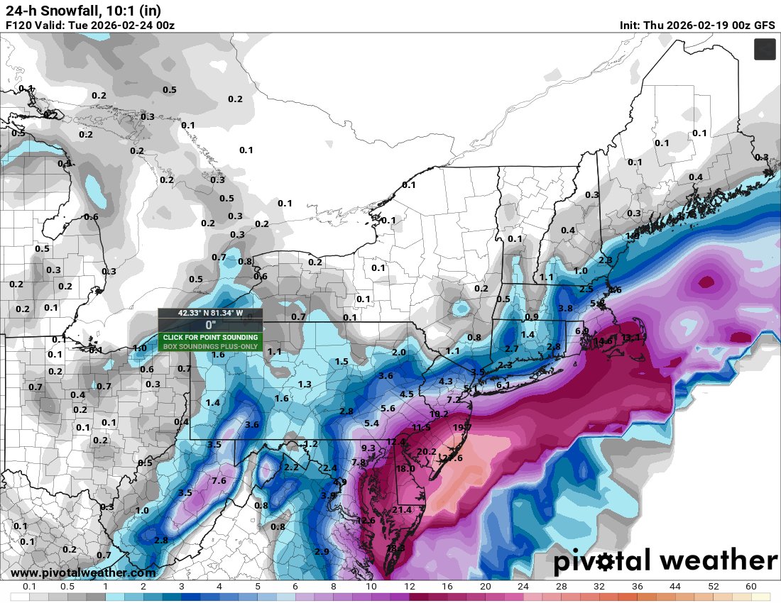
*FIRST CALL* PREDICTION FOR LI*
w/ nostalgic weather channel jazz
8-12” North shore
6-10” South shore
This is not a real forecast, this is just my opinion of what I think we will get. This can change depending on what the short range models show late tonight and tomorrow.