AI can now find your location in photos. “PIGEON system could identify the location of a Google Street view image anywhere on earth. It guesses the correct country 95% of the time and can usually pick a location within about 25 miles of the actual site” https://t.co/huPgfKG1zN
What are you doing next week???📆
Don't forget to clear some space in your (no doubt hectic) schedules for National Geography Awareness Week (November 13-17)!
https://t.co/HQFu7k2mYN
The #geospatial domain operates w/in a framework of policies & regulations that profoundly influence scientific #research & #tech advancements. Understanding this impact is crucial for fostering innovation while ensuring ethical & responsible use of data. https://t.co/bJngo27fbz
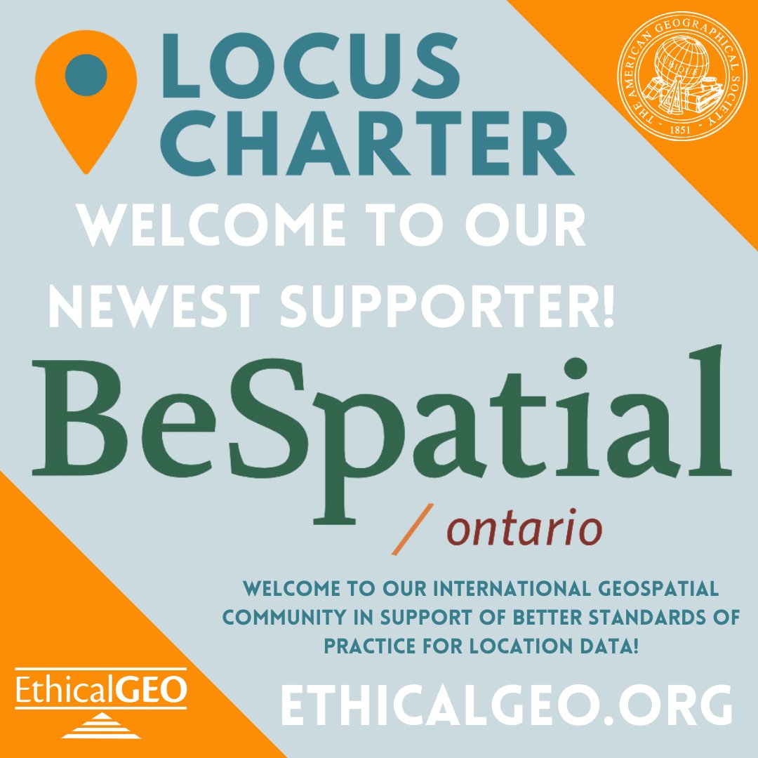
Welcome to our newest @EthicalGEO Locus Charter Supporter, @BeSpatialON ! We're happy to have you as part of our international #geospatial community in support of better standards of practice for location data. Thank you for standing with our 10 founding principles! @PLANETucker
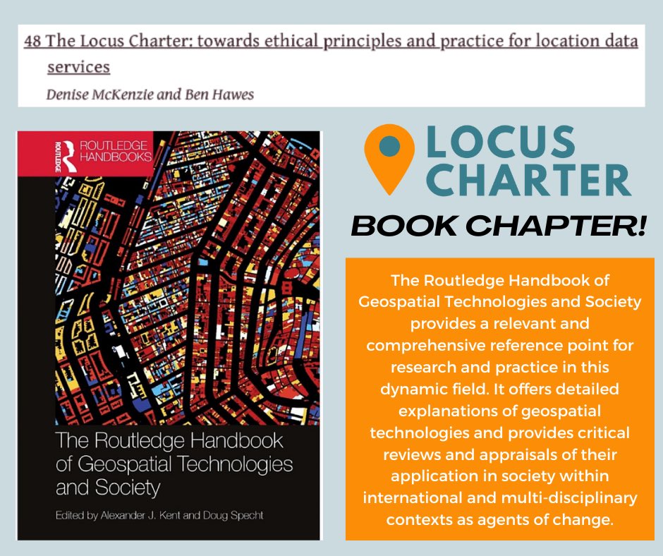
BIG NEWS! @LocusCharter is featured in brand new @routledgebooks Routledge Handbook of #Geospatial Technologies and Society, in a chapter written by Ben Hawes and Denise McKenzie! 🌟 Check it out here: https://t.co/vJyT2noHJw
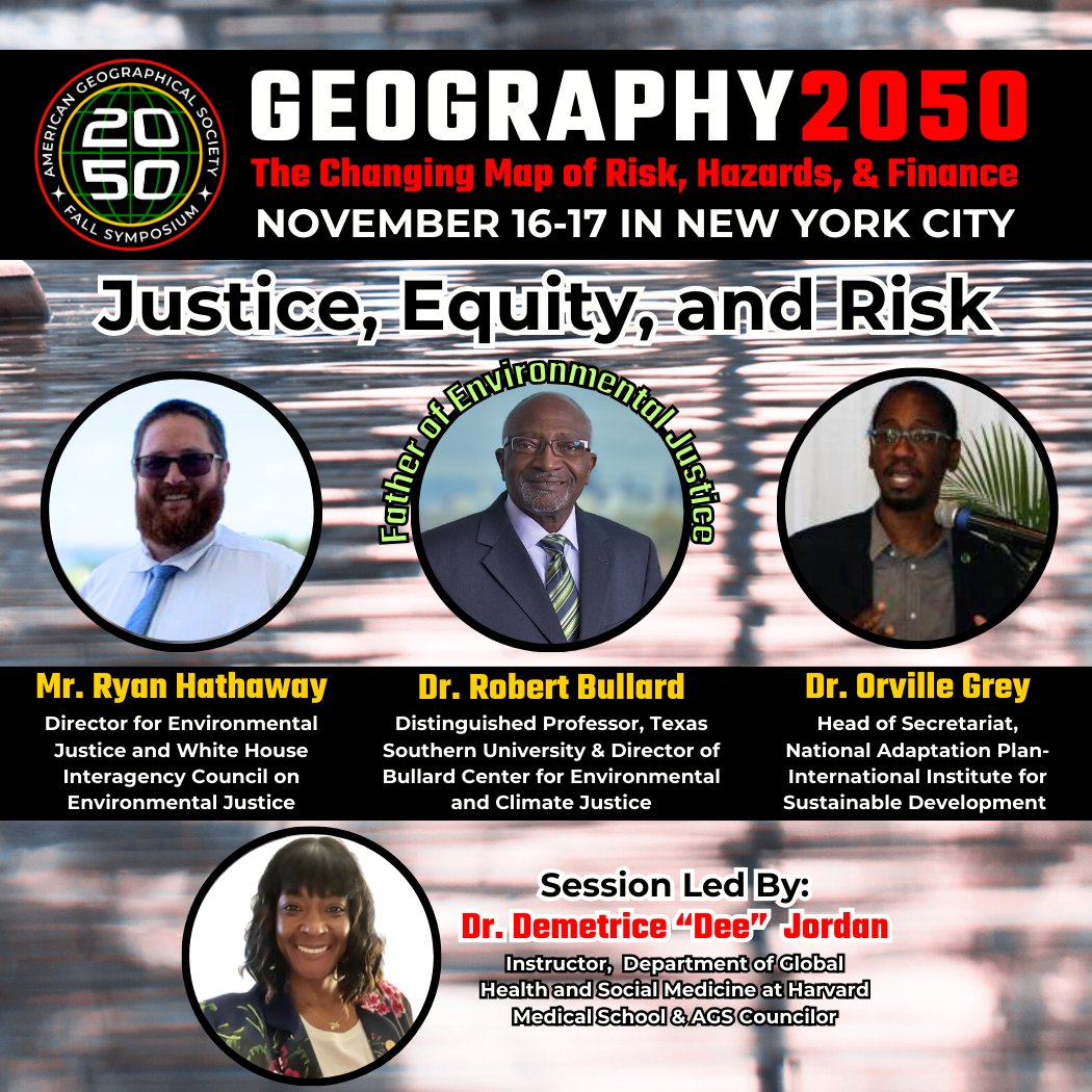
#Geographers are at the cutting edge of #climate! Join us at Geography 2050, Nov. 16-17 at Columbia University, NYC. Connect with #science, #policy, & #tech leaders & convene around our world’s greatest challenges. Submit lightning talks & register early! https://t.co/LsAQp3MeFj
Homes in neighborhoods of color are appraised at much lower values than those in White neighborhoods across major US metros. Racial disparities in appraisals have worsened over time, contributing to the racial wealth gap.
Read more: https://t.co/FUBEvP30p0
How can Geospatial data and AI work together?
Image recognition, combined with geospatial data, GIS, and lidar, can be a powerful tool to analyze the Earth's surface.
Read more here: https://t.co/5EMkgJZGmv
Online behaviors have come to form #CyberSocial terrains that now constitute a new dimension of Geography. Check out our Conceptual Foundation video featuring Dr. John Kelly (@Graphika_NYC) as part of the new AGS #ProximityProject!
https://t.co/Qk2z57PYY9
Is your organisation looking to raise its profile and take a more active role in the #GeoCommunity?
As an Associate Member you would be fully connected into the UK's geospatial community and be offered a range of benefits
🔗 Membership Benefits: https://t.co/TzN20uf3g3
Last year @ClintonGJohnson won WGIC DEI Trailblazer – Individual Champion Award for his contributions to advancing #DEI in #geospatial community.🏆
👉WGIC continues to acknowledge #DEI champions. Submit your #DEITrailblazerAwards nominations before July 31 https://t.co/IsMeHSxm39