Those people are correct. The earth goes in cycles and we are naturally warming at this time... but science shows us that our emissions have amplified the warming making it faster than nature would have. Adaptation is tougher for coral for example that can't move to cooler water and isn't getting recovery seasons.
We have confirmed the path of the tornado in Cape May Point. This tornado started as a waterspout before coming onshore. Here is the link to the storm summary: https://t.co/20miA0SeBs
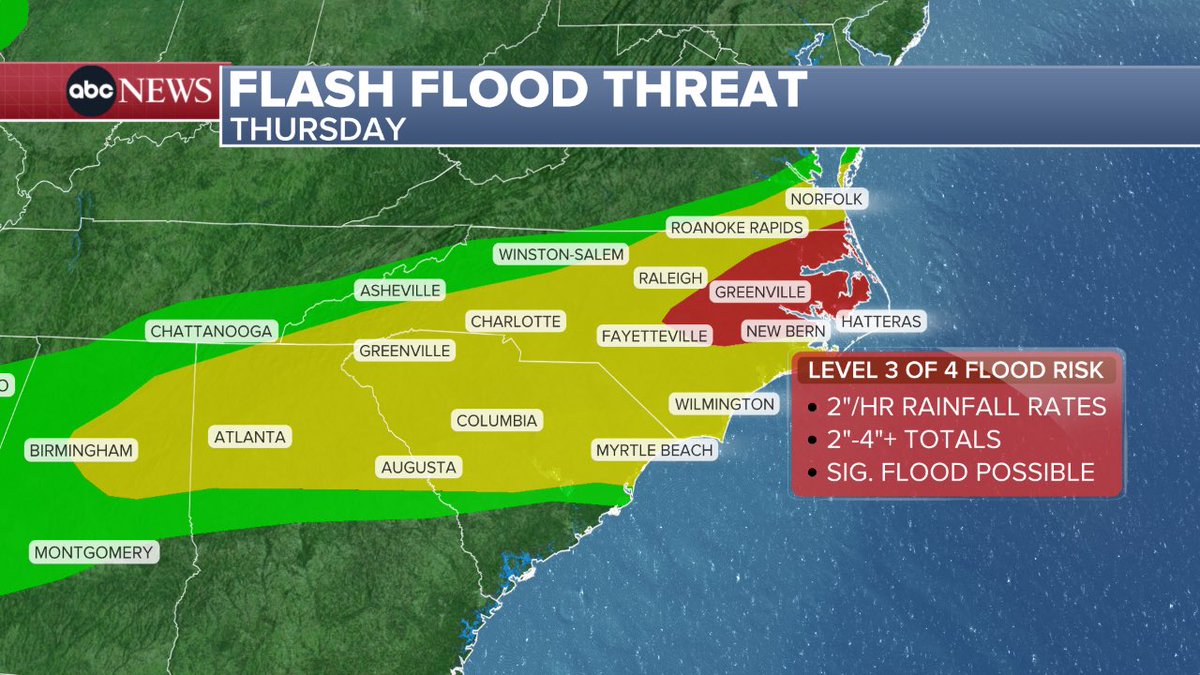
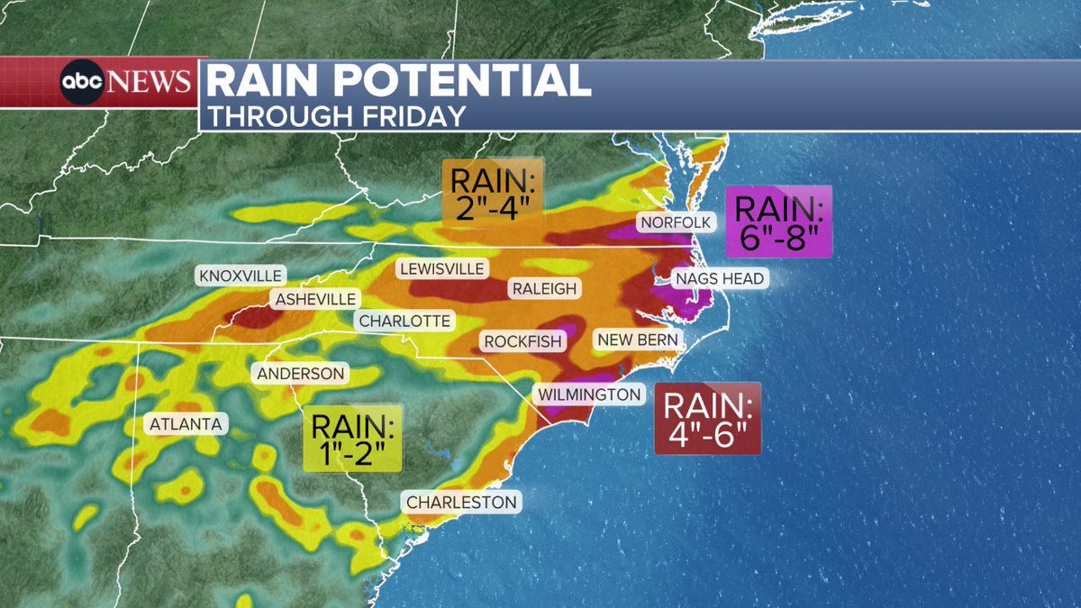
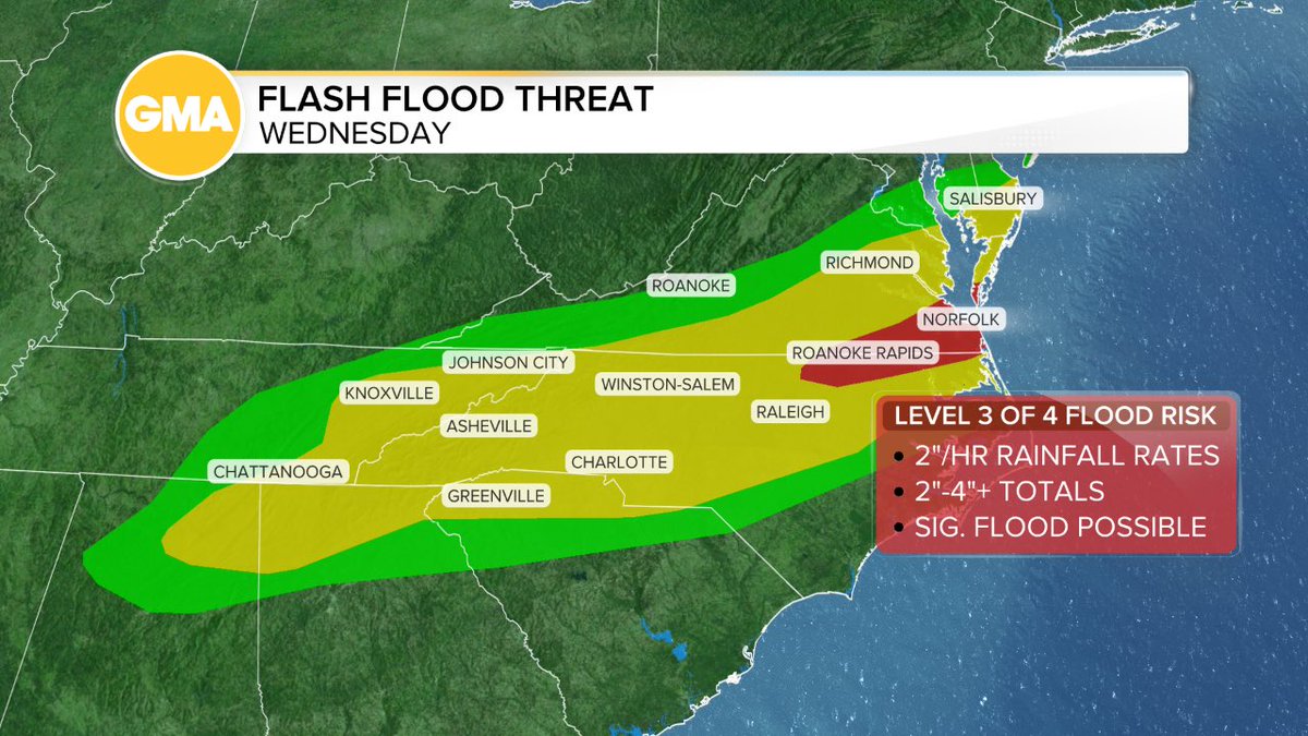
People love a named storm (Bertha) but I think flash flood threat in Virginia and North Carolina is a bigger impact story — this is the same front that brought tornadoes from KY to NJ, now becomes stationary & drench eastern NC/southeastern Virginia through the end of this week!
Have seen embedded tornado warnings in the storms in northern New Jersey and this watch goes until 9 pm. Atmosphere is rolling! Have two ways of getting warning as another line is moving through northeastern Pennsylvania into the tristate this evening:
@PrashanthM32946 There are so many factors. Packed summer schedule, ATC staffing and anticipation of storms = mess. They try to be preventative by cancelling.
7/21/26
Level 3/5 for severe storms (winds over 70 mph in some of these storms) for big cities like Philadelphia and Baltimore (hundreds of flights already cancelled in anticipation).
NORTH CAROLINA: ICYMI this morning— the same front making storms in the northeast today will bring heavy rains as it stalls out over NC through the end of the week. 8” plus on some of the modeling. Beware!
7-20-26
Air quality alerts plus a serious severe weather threat for parts of Wisconsin, Michigan, Illinois, Iowa.
And the video from Utah yesterday from the burn scar of the Cottonwood fire getting hit with a half to one and a half inches of rain, causing debris flows and mudslides.
And a wrap up from some of the severe storms that caused nearly 19,000 flight delays over the weekend thanks to storms in the Northeast
San Felipe Creek - Del Rio TX. July 16, 2026. 10:09 am - Vid 1: looking up to Dr. F. Calderon BLVD back to DR Amphitheater. 10:18 am -Vid 2: taken downstream at Johnson/Bridge St. #EWXSpotter#TXWX#Texas@ChrisSuchanWOAI@Ginger_Zee@JimCantore
Dangerous flooding is impacting central Texas after more than 20 inches of rain fell in some areas, causing rivers and creeks to overflow. Rescues and evacuations are underway. @ReporterFaith has more.
10:30 am AQI : Anything over 150 you want to limit time outdoors
Grand Rapids to Detroit, Michigan 400-600
Toledo, Ohio 517
Minneapolis 337
Green Bay 315
Check your AQI: https://t.co/rf92mV9P0m
7-16-26 Frightening situation this morning in Kerr and Kendall County Texas. Latest update has one of the river gauges on the Guadalupe River rising 16 feet in 30 minutes. This is a potentially deadly situation. @reporterfaith is in Texas for us and you can watch this live on @ksatnews
At one point this morning Detroit’s AQI was 600. That is wild. Please be safe and check https://t.co/kvn2DHRjSl before you head out from Minneapolis to Manchester, NH to Virginia Beach today and tomorrow!