Owner of Central Kansas Emergency Photography - News/Weather Stringer, Kansas Firefighters Museum Volunteer, IFBA Region 5 Member, Derby FD Photographer.
A storm system is expected to spread light to modest snow accumulations across the region. There remains some uncertainty, stay tuned as we refine forecast details the next few days. #kswx
2:30pm CDT #SPC Day3 Outlook Slight Risk: Over parts of southwest/south-central Kansas, western/central Oklahoma, and the eastern Texas/Oklahoma Panhandles https://t.co/K89lXjsmlK
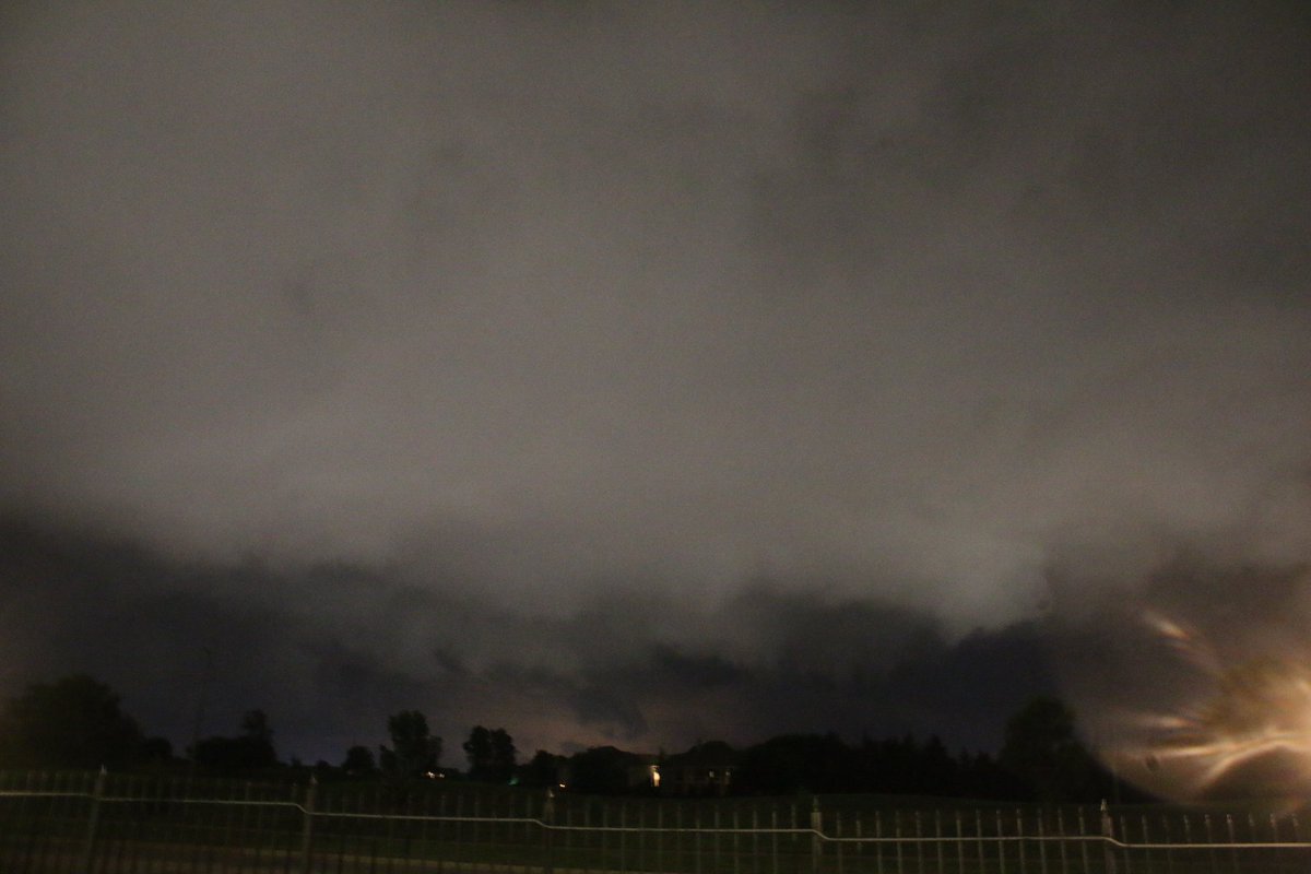
Tonight's thunderstorm as it was passing over Derby (Sedgwick Co) at 22:30hrs (Estimated Wind Gust 55-60 at reported time) #kswx@NWSWichita@LisaTeachman
#kswx#okwx#newx
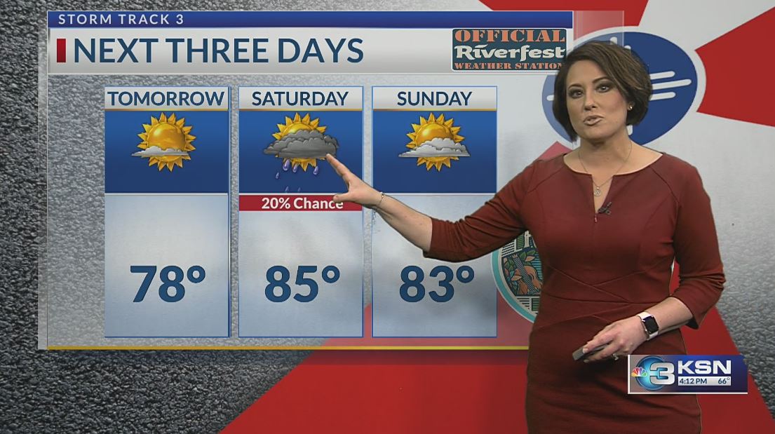
STORM TRACK 3 FORECAST 5-29-25: Just about time for Wichita's biggest party of the year -- Wichita @Riverfest ! The @KSNNews@KSNStormTrack3 weather team is the official weather sponsor this year. We could not ask for better weather for the Sundown Parade! Catch us walking in it with Storm Tracker 3. Click below for your updated forecast...
https://t.co/42yPdIVgZx
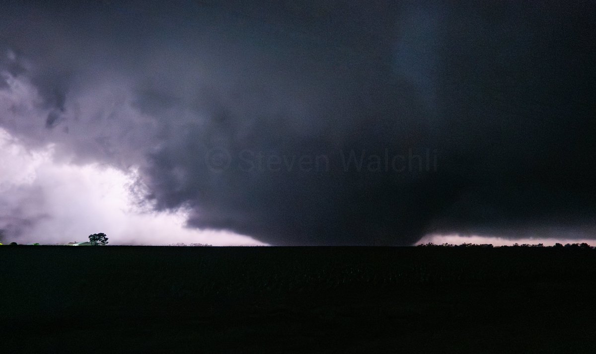
Wedge tornado from last night just NW of Turon, KS at approx. 10:32PM. We were under a mile from this tornado at the time, the roar could easily be heard and was very loud.
Shot at 28mm full frame uncropped.
#kswx#Tornado
Photos from Derby looking at the Severe Thunderstorm in the area at 23:30hrs (I believe these are only SLC's nothing severe or tornadic) #kswx@NWSWichita@LisaTeachman@MaxVelocityWX
Off and on rain chances will remain through Saturday with the highest chances looking to be Friday morning. Some snow is expected to mix-in with the rain on Saturday night. Below normal temperatures are also anticipated through the weekend. #kswx
Which "media" added taglines of "terrifying" and "devastating?" Sure was not us. We share reports from NWS chat and have our newsroom make calls to verify -- careful to NOT sensationalize. If fingers are going to be pointed, point them in the right direction. "Media" should not be clumped together, giving us all a bad name. #kswx