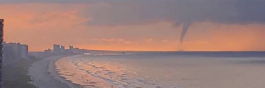
Ain’t it glorious! Another morning of soaking rain across the Grand Strand. Like yesterday, the wet weather comes to an end and we salvage a decent afternoon with some sun at times. #SCwx@wmbfnews
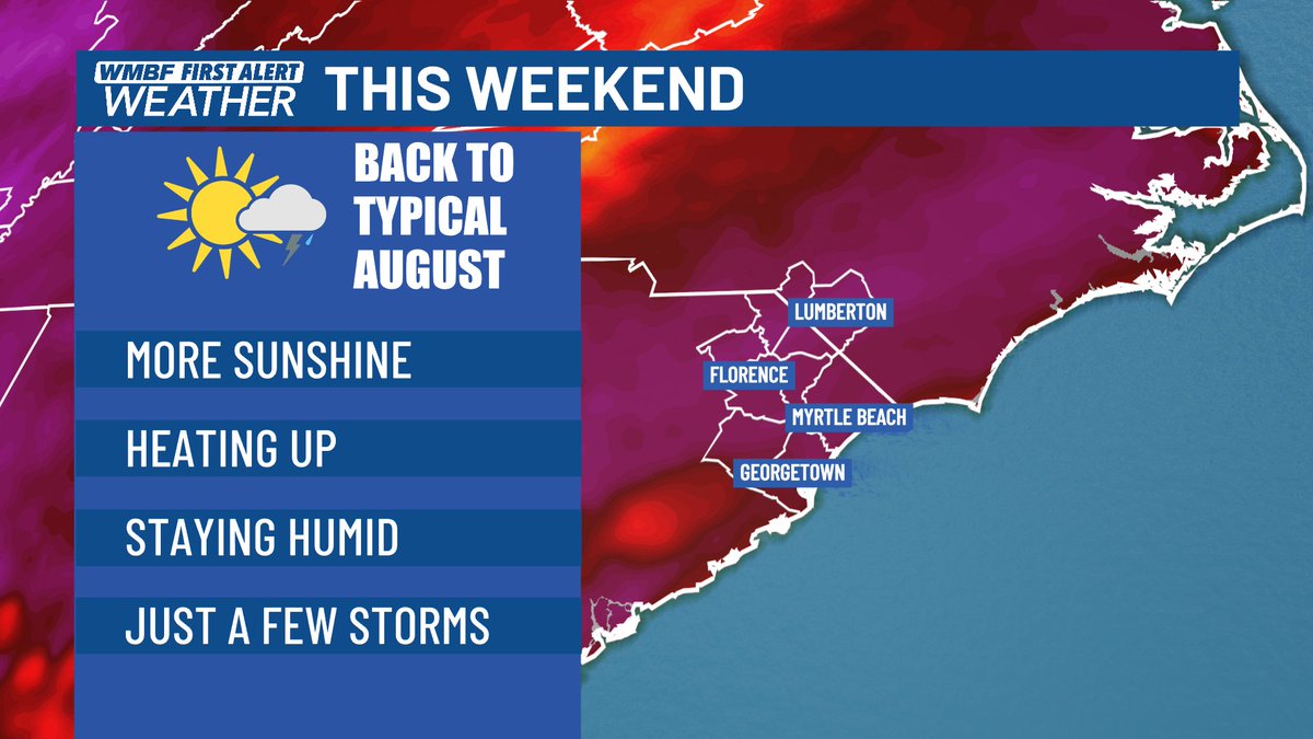
BACK TO REALITY - By this weekend, our current active and wet weather pattern will return to a more typical August pattern. YUCK. Hot and humid with the heat index over 100 and just a slim chance of a storm or two. #SCwx@wmbfnews
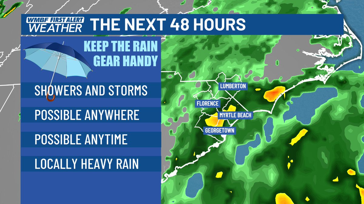
48 MORE HOURS - This active weather pattern will linger through Thursday with downpours possible anywhere and at anytime. Although there will be plenty of breaks in between and even some sunshine. #SCwx@wmbfnews
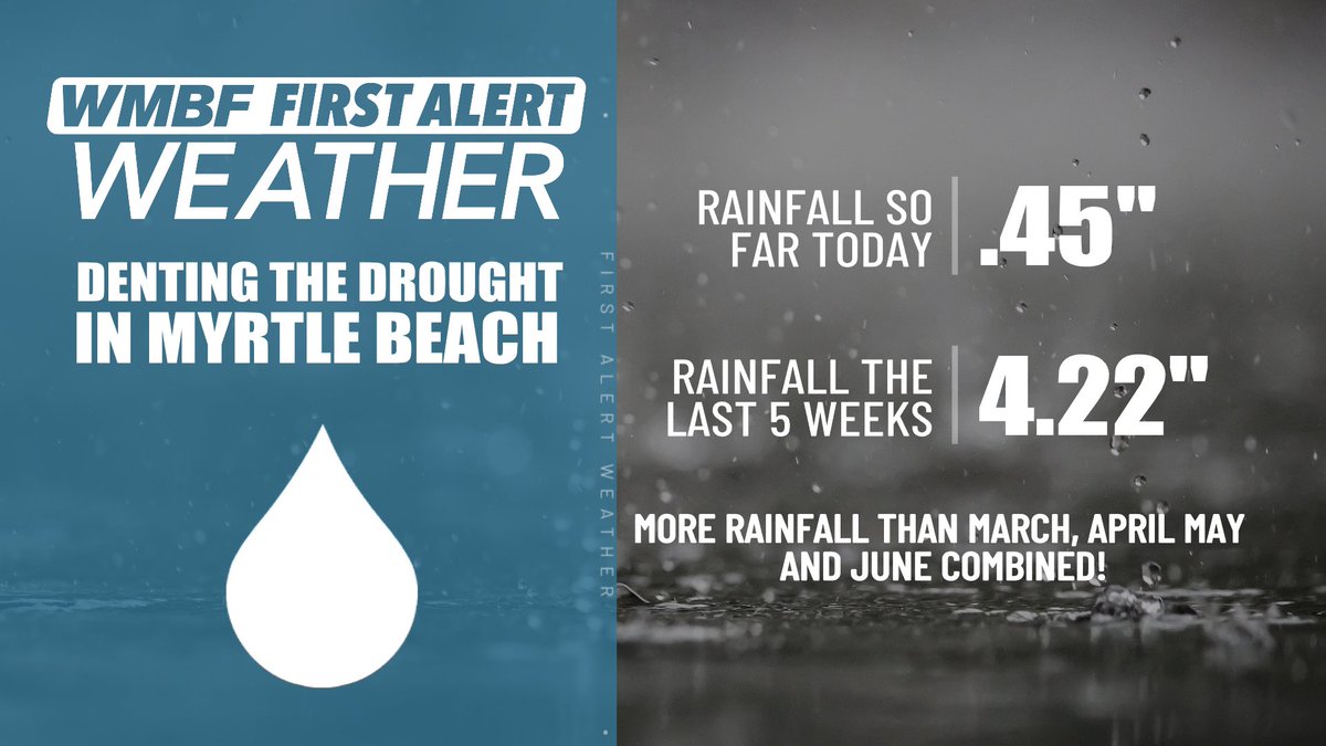
BABY STEPS to end the drought! With just under a half an inch so far today in Myrtle Beach, the rainfall total for the last 5 weeks is now over 4 inches. That is more than we saw in all of March, April, May and June COMBINED!! #SCwx@wmbfnews
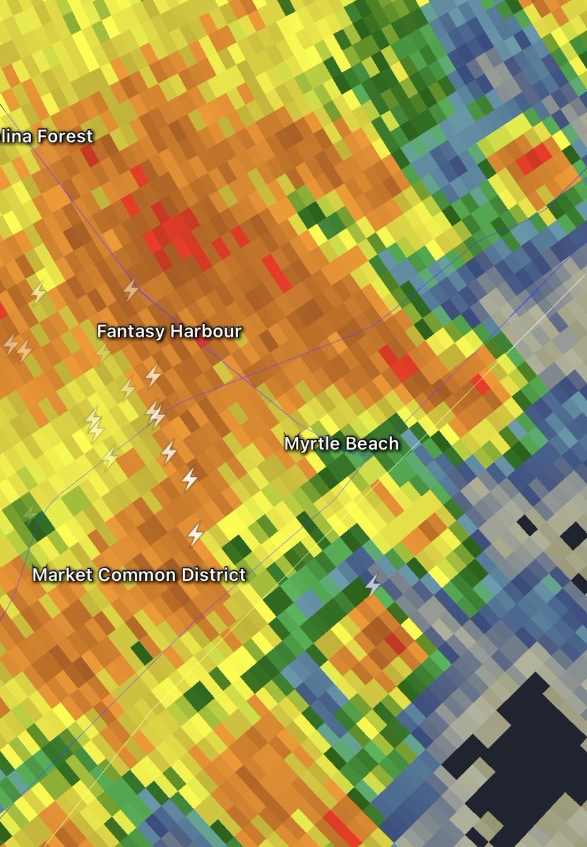
HEY, Momma Nature. Now listen. You gotta start acting right and remember how to rain right. This all or nothing is getting old! Rainfall rates in some of these storms are over 4 inches per hour. #SCwx@wmbfnews
5:35 PM MONDAY - HEY BEACHES! - Gonna try to get some big storms in here over the next 1-2 hours. These are not severe, but lightning and some locally very heavy rain will be possible in spots along the Grand Strand through 7:30 PM. #SCwx@wmbfnews
2:50 PM MONDAY - A pretty impressive cluster of rain and storms has developed across the Low Country and is pushing northward. It will arrive in our area through the evening commute with some locally heavy rain - especially inland. Most of the heaviest action will likely stay inland from the beaches. #SCwx @wmbfnews
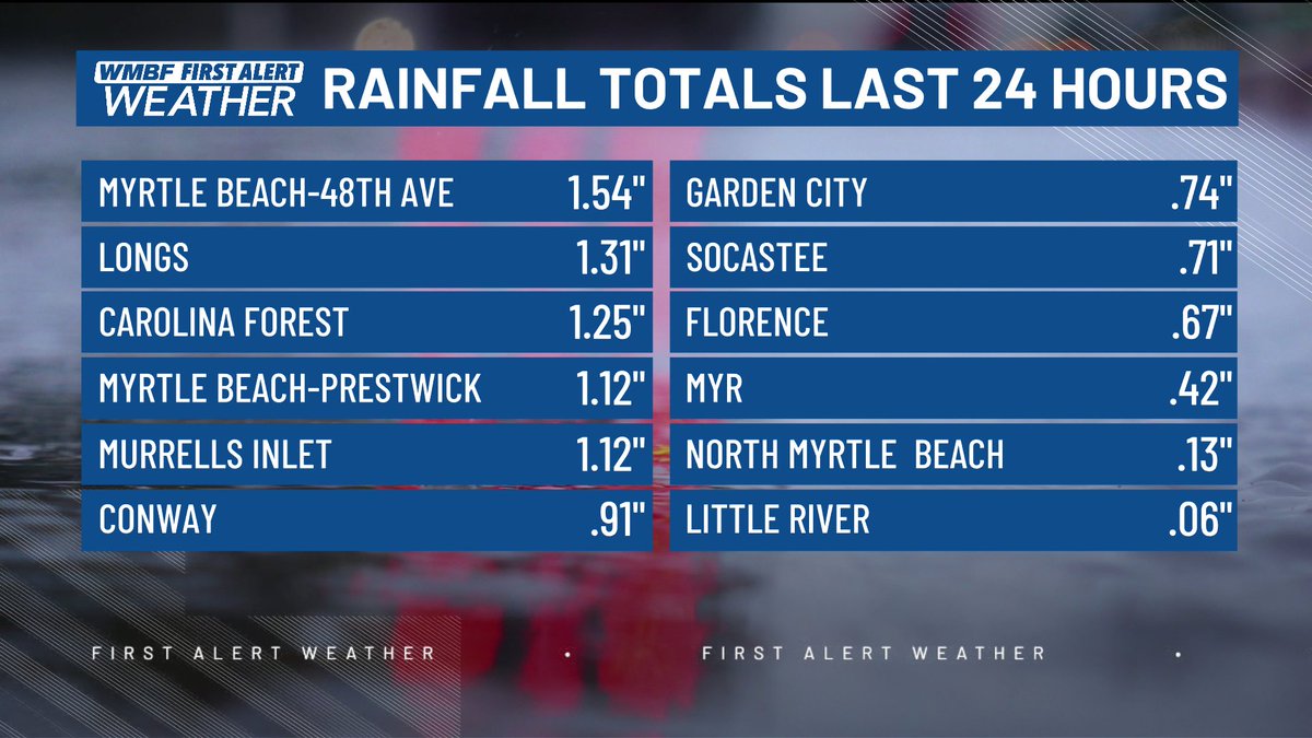
RAINFALL THE LAST 24 HOURS - Some good totals in some areas since Sunday while others missed out. Additional storms today and tonight can hopefully fill in the gaps. #SCwx@wmbfnews
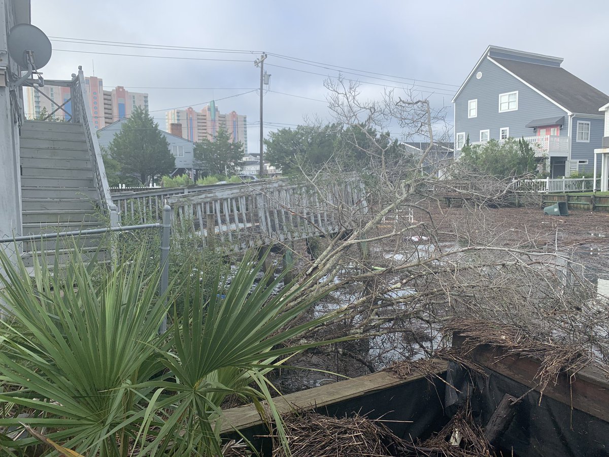
HURRICANE ISAIAS - 6 years ago today. Because 2020 wasn't crazy enough, we needed a hurricane with an impossible to pronounce name. Isaias made landfall at Ocean Isle Beach at 11:00 PM August 3rd, 2020 with winds of 90 mph. A damaging storm surge occurred along the Horry County coastline during the evening high tide on August 3. The middle portion of the Sea Cabin Pier at Cherry Grove was destroyed. Homes in low lying areas near the beach were flooded and dune erosion was severe. Main Street between Ocean Blvd and Hillside Drive was closed due to flooding. Sea Mountain Highway (SC Highway 9) was covered with 12 to 18 inches of water up to four blocks in from the beach. In North Myrtle Beach water up to one foot deep reached about a block inland. Ocean Blvd in Myrtle Beach was closed due to flooding for a time, and in Garden City North Waccamaw Drive was flooded and closed during high tide. The storm was also devastating to the sea turtle nests with many destroyed. 100 sea turtle hatchlings died in the surge in Cherry Grove. Despite the surge, peak winds in most of the Grand Strand only reached 40 to 60 mph as the core of the storm passed just off shore.
Damaging storm surge flooding continued northward along the south-facing coastline of Brunswick County including Holden Beach, Ocean Isle Beach, Oak Island, and Southport. In Southport, extensive damage occurred to a hundred or more boats moored at the town's marina. On Oak Island storm surge flooding damaged or destroyed an estimated 75-100 vehicles. Sand dunes were washed onto streets up to three blocks inland.
The storm surge moved up the tidal portion of the Cape Fear River into downtown Wilmington, causing significant street flooding and damaging some first-floor businesses along Water Street. The downtown river gauge reached its highest level in history at 9.03 feet, eclipsing the previous record of 8.28 feet set just two years earlier during Hurricane Florence.
I snapped these pictures the morning after in Cherry Grove.
#SCwx #NCwx @wmbfnews
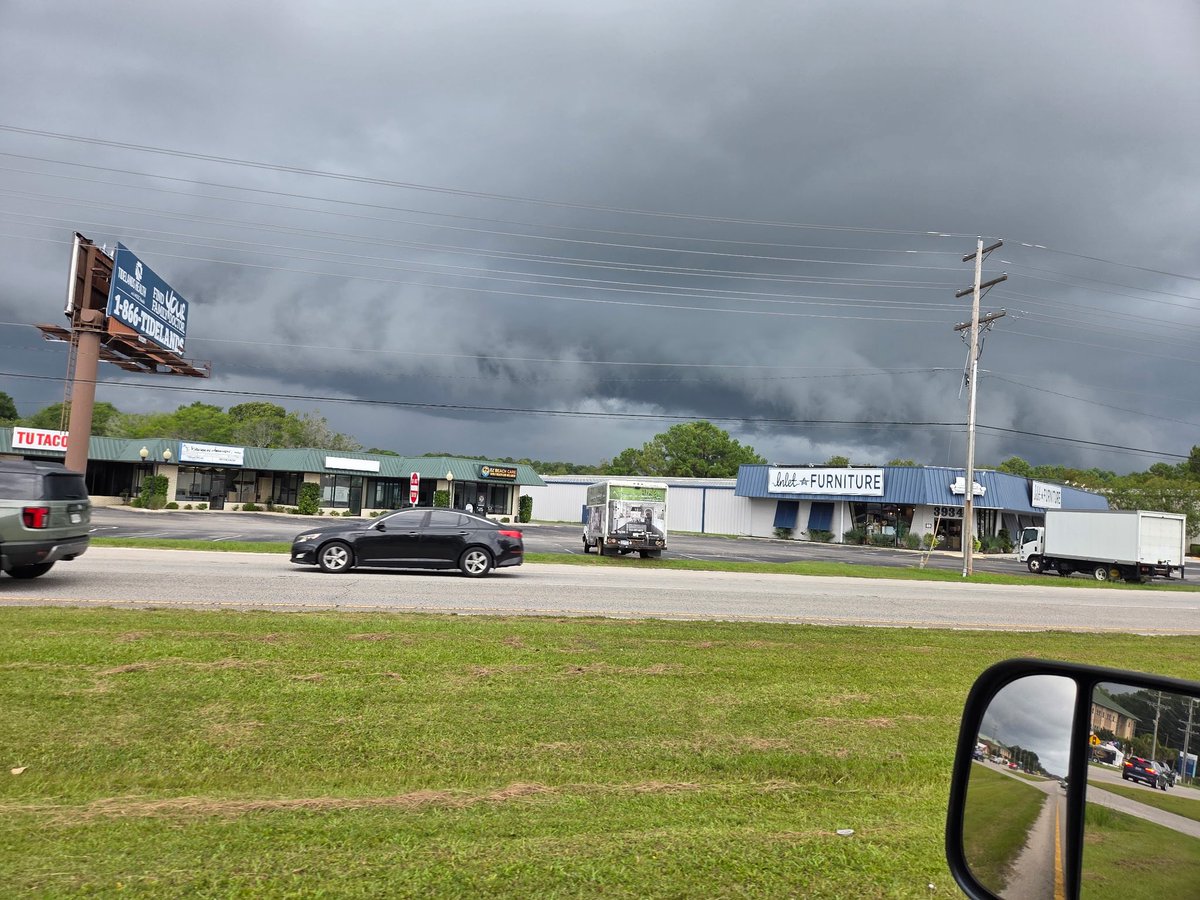
7:46 PM SUNDAY - Shelfie Alert. Check out this line of storms blasting northeast into the area. They’re not severe, but I’d be willing to bed there’s a heck of a shelf cloud out ahead of them. This like will move through over the next two hours. Show me those Shelfie. #SCwx@wmbfnews
Still a tremendous amount of research to be done about the evolving climate and hurricane frequency and intensity. Hurricanes and hurricane landfalls have always fluctuated over a well known decadal pattern. The 2010s and 1990s have been busy in the Carolinas, but nothing compares to the insanity of the 1950s. Those time frames have been bookended by long, quiet stretches.
HURRICANE WEEK - August storms. For our area, the most likely time for a tropical storm or hurricane hit is September through early October, but August storms are not uncommon. Most recently, Category 1 Charley brought a fast-hitting round of hurricane force wind gusts to the beaches in 2004. Isaias in 2020 made landfall just north of the border, but still resulted in significant storm surge and destroyed the Sea Cabin Pier. Just two years ago, Debby meandered around as a tropical storm for a few days with as much as 20 inches of rain in some areas. #SCwx @wmbfnews