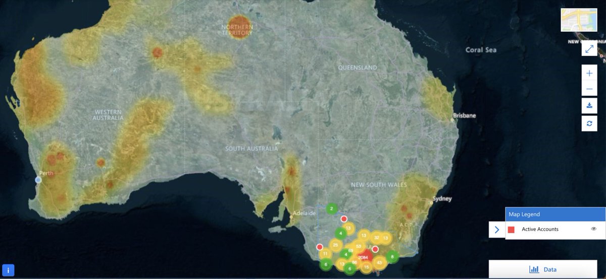
Maptaskr provides Government staff and the community, reliable and trustworthy coverage over any area of interest on Earth, ensuring safer communities, economic efficiency, a cleaner environment, and to detect changing conditions rapidly.
Read more here: https://t.co/BSjIjuyPlc
A huge thank you to Brian Galicia for inviting #Maptaskr to his #ISVConnectLive session at 11pm last night (AWST). It was great to discuss the integration of GIS and Dynamics, and our strong partnership with Microsoft and Esri.
View recorded session at: https://t.co/V1YT3xzY8P
Join our very own Ravi Nichani and Brian Ambrosius in a live online discussion with Brian Galicia from #Microsoft on Monday the 13th of September from 11:00-11:30pm AWST to learn about #Maptaskr.
https://t.co/jr962q5WvS
We are proud to announce that in partnership with @InsightEnt, NGIS, and @Microsoft, we are assisting in the development and implementation of 'Environment Online', a project led by the Department of Water and Environmental Regulation. #Insight#DWER#NGIS#DigitalTransformation
We at Maptaskr have thoroughly enjoyed the Microsoft Inspire 2021 sessions, and networking with @Microsoft and our Partners to unlock new opportunities. We are looking forward to helping mutual customers transform in this era.
#msinspire2021#mspartner#msdynamics365
Make the right decisions at the right time by combining your customer data with location data. Maptaskr enables you to overlay asset information like utilities, cadastral data (e.g., property boundaries), and more.
#maptaskr#crm#gis#locationdata#cadastraldata#cadastre
Did you know Maptaskr is a certified Microsoft ISV? We work with industry-leading technology Partners to deliver tight integrations with Maptaskr in geo-productivity and location intelligence opportunities. Email us at [email protected] or visit https://t.co/2f5sKiT4vc
How Esri contributes to—and advances—#science. Learn why for us, “The Science of Where” isn’t just a tagline. Article by Esri Chief Scientist Dr. Dawn Wright @deepseadawn. https://t.co/5tZXjW39Ri #TheScienceofWhere
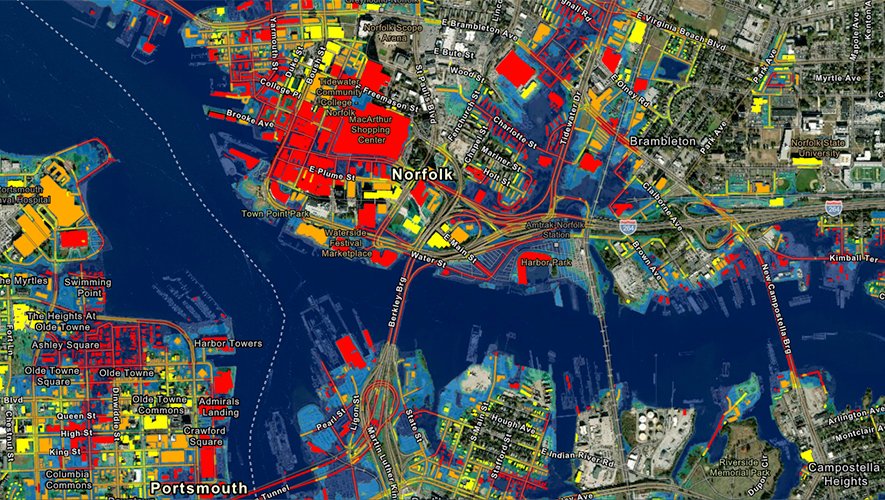
2080 sea level prediction model for Norfolk and Portsmouth, Virginia. This new dataset by @NOAA and @ODU will help coastal communities better understand and plan for sea level rise.
Learn more: https://t.co/RO3exKT0qW #Flooding#GIS
Going to create a site where the public can rate the core truth of any article & track the credibility score over time of each journalist, editor & publication. Thinking of calling it Pravda …
Interested in learning more about geospatial & location intelligence works within #dynamics365 then register for #365Saturday Sydney. https://t.co/XXYxyLHwQP