It's National Aviation Day! It may not seem like an obvious celebration for us, but we are the home of the National Geodetic Survey, which provides the highly accurate position, height, and orientation information needed for safe air navigation. More on how we work with the FAA on aeronautical surveys:
https://t.co/M4eqeInA0A
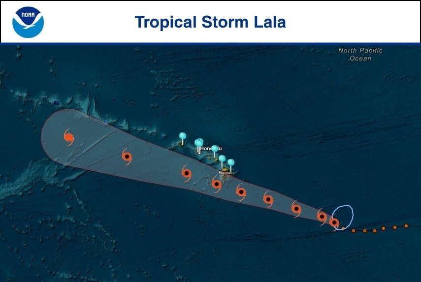
NOAA continues to monitor water levels and winds for Tropical Storm Lala as it approaches the Hawaiian Islands. View real-time water level and meteorological data: https://t.co/iSwTj32XCj
NOAA is monitoring water levels and winds for Tropical Storm Lala which is forecast to impact the Hawaiian Islands. View real-time water level and meteorological data: https://t.co/iSwTj32XCj
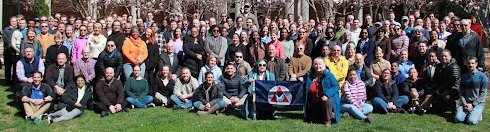
The oldest science agency in the U.S. government was founded as the Survey of the Coast in 1807, renamed Coast Survey in 1836, became the U.S. Coast and Geodetic Survey (USC&GS) in 1878 and joined NOAA: National Oceanic & Atmospheric Administration in 1970. On March 24, 1926, the staff of the USC&GS took a photo in front of their Capitol Hill headquarters. On March 24, 2026, the staff at NOAA who inherited the mission of the USC&GS took a photo at their headquarters in Silver Spring. More on the history of the Geodetic Survey: https://t.co/Cipl7xjEyb
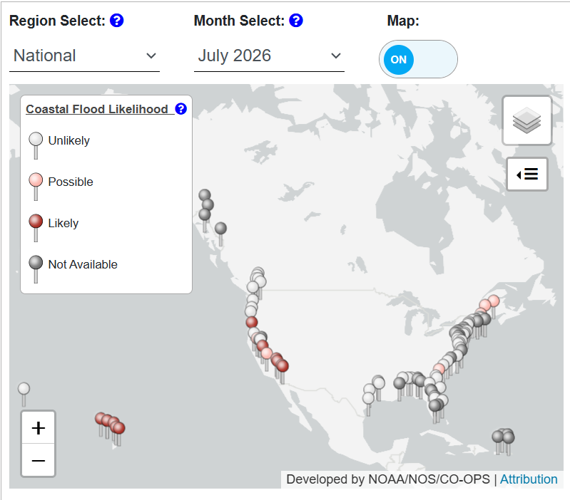
High tide flooding is possible in Southern California, Hawaii, and American Samoa on and around the new moon on the 12th. See the daily likelihood of high tide flooding in your area: https://t.co/Uy38uUy5mi
Just in: @NOAA and scientific partners find smaller-than-anticipated hypoxic 'dead zone' in Gulf of America
News release: https://t.co/TtsxVegJlY
via @noaaocean, @LSU, @LUMCONscience
A newly published study, led by @NOAASBNMS scientists, provides the first direct documentation of humpback #whales cooperatively hunting along the seafloor.
👉 Learn more in our latest webstory: https://t.co/apaJzOycH7.
📸: NOAA, under permit NMFS 18059
#NewResearch
Discover the story beneath the waves. 🌊⚓
In December 1862, the USS Monitor sank during a storm off Cape Hatteras, North Carolina. More than 160 years later, the wreck has become much more than a Civil War artifact, it is the nation's first national marine sanctuary, an artificial reef supporting a thriving marine ecosystem while preserving one of America's most iconic shipwrecks.
In the first of this two-part series, explore the history of the USS Monitor, its final voyage, and why its legacy continues to matter today: https://t.co/6Wf6fxykZ3.
#USSMonitor #MaritimeArchaeology #MaritimeHistory #NavalHistory
NOAA continues to monitor water levels and winds for Tropical Storm Bertha, which is affecting the northern Gulf coast. View real-time water level and meteorological data:
https://t.co/ghQW3Pfb0u
NOAA is monitoring water levels and winds for Tropical Storm Bertha, which is affecting the northern Gulf coast. View real-time water level and meteorological data: https://t.co/ghQW3Pfb0u
A partnership between @NOAA, William & Mary's VIMS & Batten School and the Virginia Institute of Marine Science, and Chesapeake Bay crabbers is transforming routine vessel activity, including crab trap removal efforts, into a new source of bathymetric data. The NOAA Marine Debris Program is supporting commercial crabbers with side-scan sonar technology to locate and remove lost and abandoned crab traps. Data collected during those recovery efforts is now helping researchers map and better understand the Chesapeake Bay. https://t.co/X7mZqD1b1P
@VIMS_News@NOAADebris
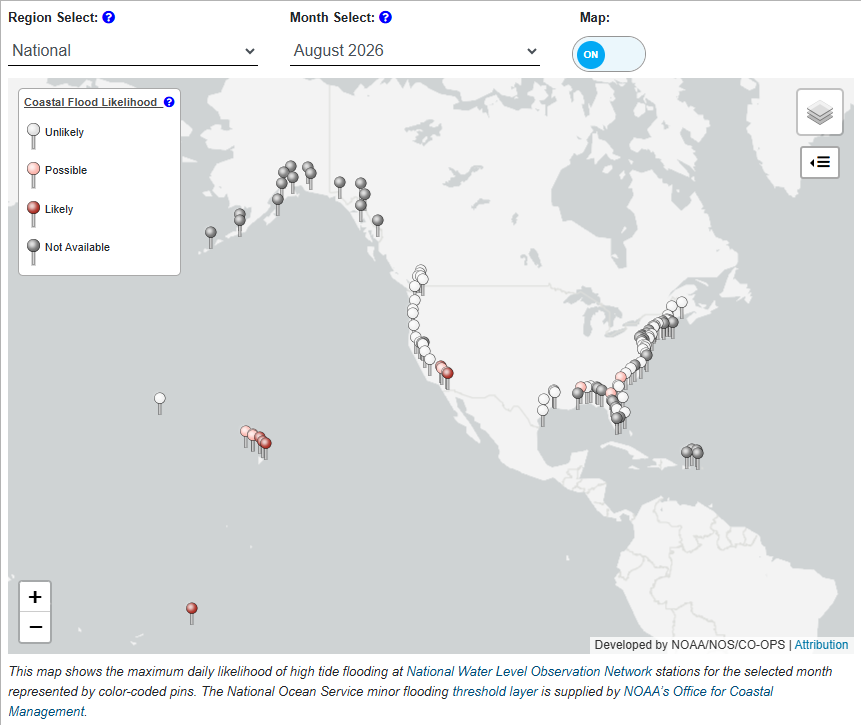
Many locations will experience higher than normal tides on and around the new moon on the 14th. See the daily likelihood of high tide flooding in your area: https://t.co/Uy38uUy5mi
We’re hiring 10 Natural Resource Specialists at locations across the country, spanning senior, early career, and recent graduate levels. Applications are due by 7/13/26. For more upcoming positions & tips for how to apply visit: https://t.co/8DZdtxxHYU
#WorkAtNOAAFisheries#NOAA
🌊 NCEI’s historical tsunami poster has been updated! The poster displays some of the critical information found in NCEI’s Global Historical Tsunami database, which aims to keep the public aware of tsunami trends. For more natural hazards posters, visit: https://t.co/8Yhzjaj8AE
NOAA and partners are forecasting a moderate #HarmfulAlgalBloom for western #LakeErie this summer. The 2026 summer bloom is expected to measure 3.5, with a potential range of 3 to 4.5 on the severity index. Learn more: https://t.co/rab3jRGwlr
All photos and preliminary seafloor mapping data are now available from NOAA’s survey in federal waters off American Samoa. See all data linked here: https://t.co/cE9SDMQ3M4
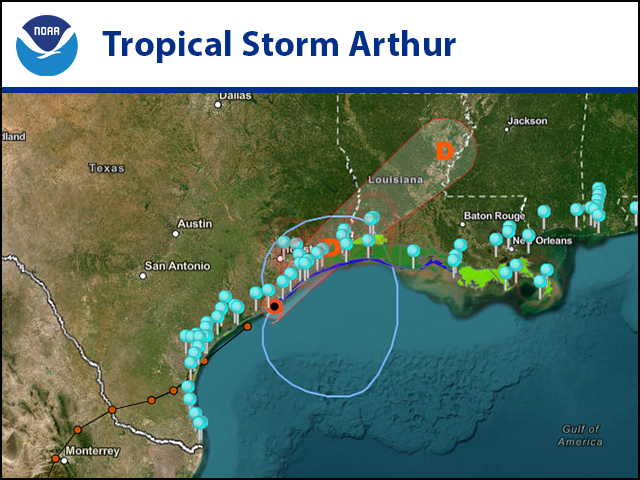
NOAA continues to monitor water levels and winds for Tropical Storm Arthur, which is expected to cause life-threatening flooding across portions of the Southeastern U.S. View real-time water level and meteorological data. https://t.co/xSlbXCdsA6
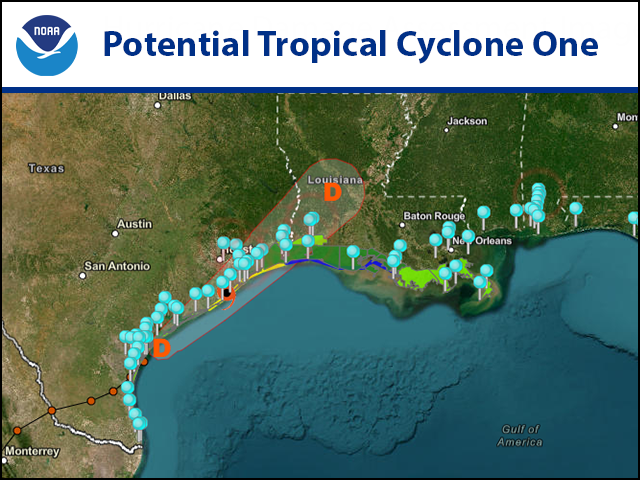
NOAA is monitoring water levels and winds for Potential Tropical Cyclone One, moving northeastward along the middle Texas coast. View real-time water level and meteorological data:
https://t.co/JVGliqJp4R
NOAA is forecasting this summer’s Gulf “dead zone” –an area of low to no oxygen that can kill fish and other marine life– to be approximately 7,027 square miles, larger than the long-term average measured size of 5,223 square miles. https://t.co/sdM5bBHJTz
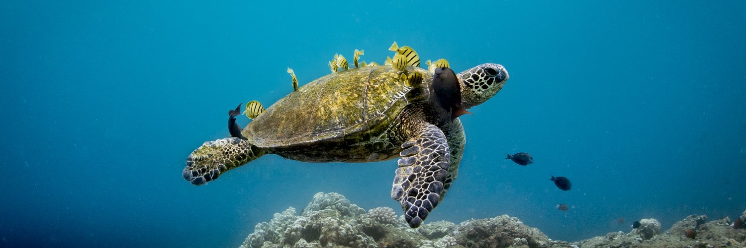
Sea turtle lovers, listen up! 📣This is your week! That’s because we’re celebrating the amazing reptiles who have been swimming in Earth’s oceans for tens of millions of years. Sea turtles migrate across oceans and survive for many decades at sea. 🐢🌊
https://t.co/uqf9xBcwmN