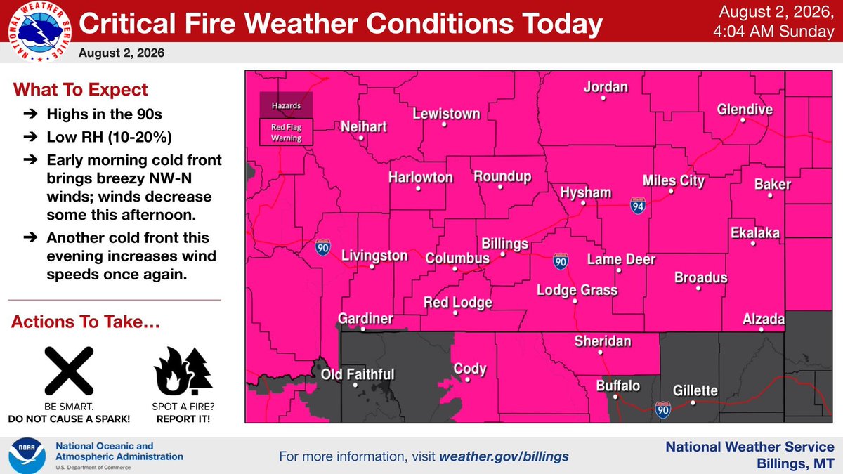
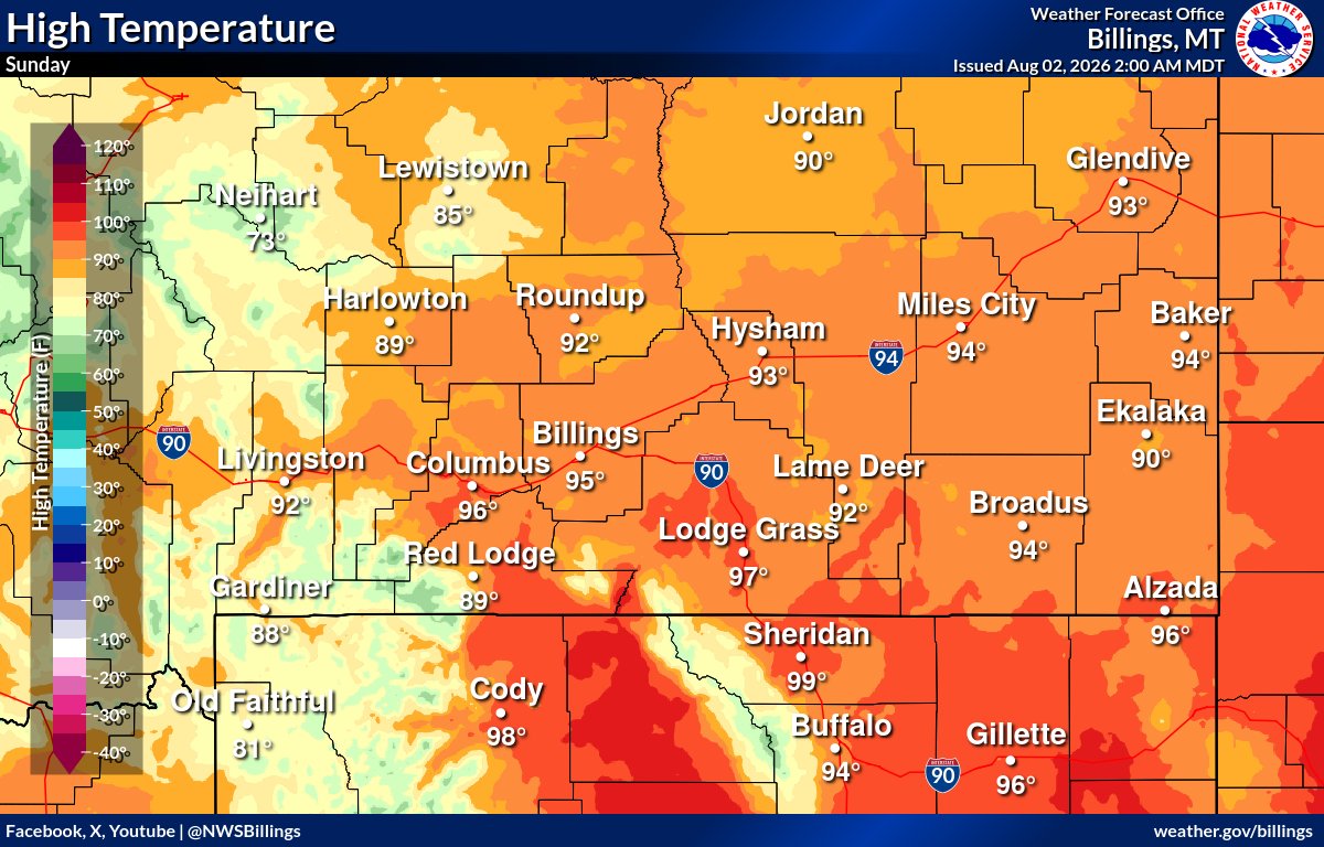
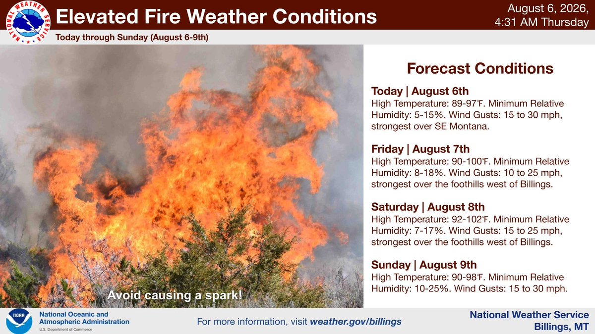
It's going to be a hot & dry weekend, with occasionally breezy conditions. Please avoid sparking a fire! Expect humidities to creep up next week, leading to increasing potential for thunderstorms. #mtwx#wywx
Livingston dropped to 41° this morning, breaking the old record of 43° set in 2018. Livingston has broken its daily record low for the 3rd straight day. Records at the airport go back to 1948. #mtwx
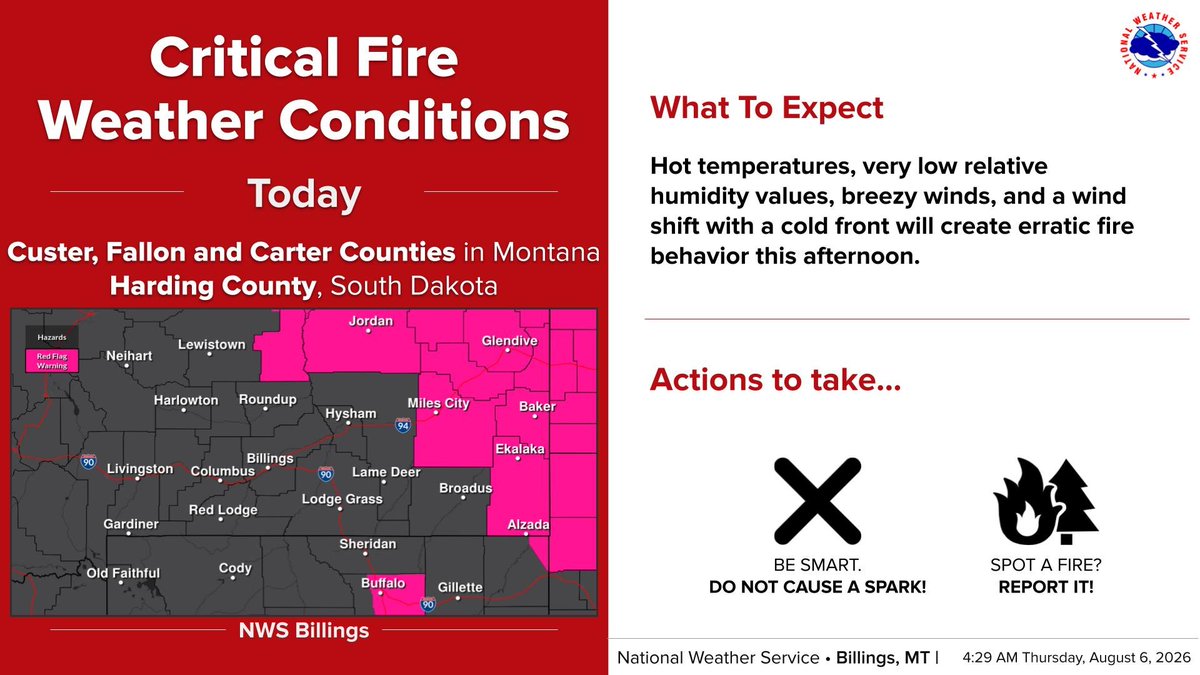
8/6 5am: Critical Fire Weather Conditions over SE Montana into the W Dakotas today. Elevated Fire Weather Conditions elsewhere today. Elevated conditions will continue through the weekend across the region. #MTwx#WYwx#WildfireDanger
A weak cold front moves through Thursday bringing increased wildfire smoke. Take precautions if you are sensitive to poor air quality. For the latest air quality visit https://t.co/p9ZFCXyFVM #mtwx#wywx
8/5 630am: Livingston has now broken daily low temperature records 2 nights in a row, dropping to 38 degrees so far this morning. The old record for today was 39 degrees from 1980.
Aug 5 545am: Not as cold as yesterday morning, but Livingston has tied a record low of 39 degrees, and Baker has set a new record low of 45 degrees, so far this morning. #MTwx#WYwx
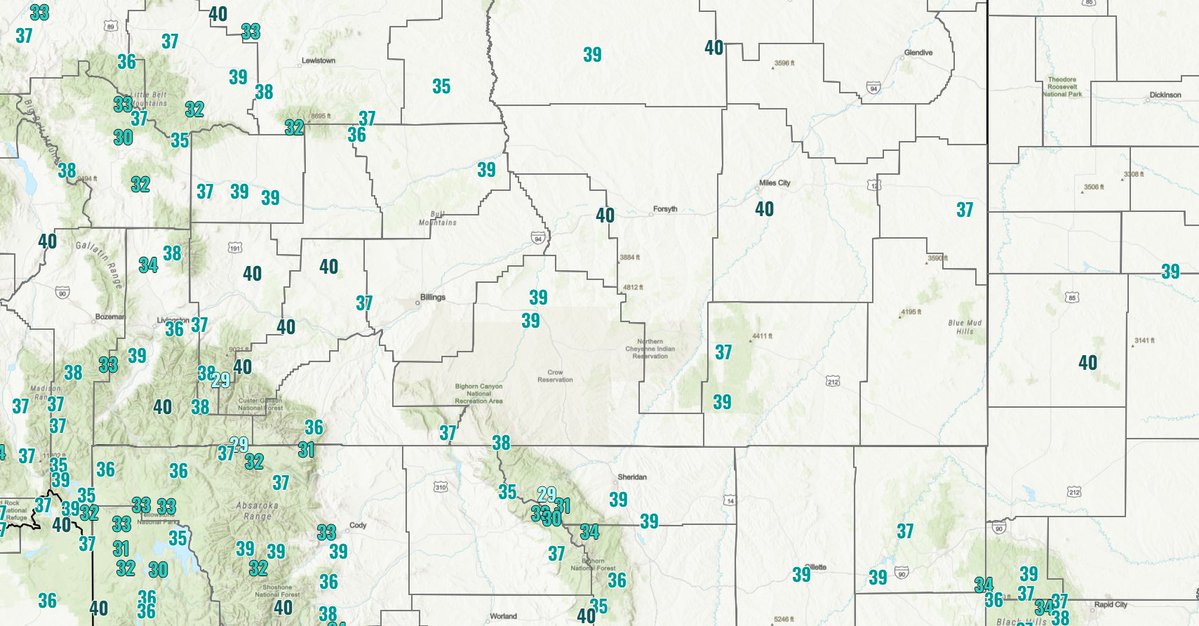
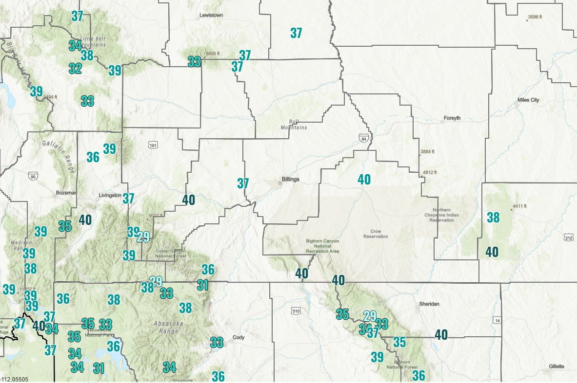
We set widespread daily record highs on Saturday and then roughly 60 hours later set daily record lows! Check out how much the temperature dropped across the region! #MTwx#WYwx
@danncianca The post we made earlier was from a real time, not quality controlled, preliminary, observation which rounds numbers. The 40°F actually reported accounts for the rounding errors and conversions between °C and °F.
3 of our climate sites (Livingston, Miles City, & Baker) hit daily record lows this AM. The coldest of which, Livingston, recorded a temperature of 34°F at 5:27am this morning! Sheridan and Billings were both within 2°F of their record lows but did not reach them. #MTwx#WYwx
8/4 545am: Low temperatures in the 30s are expanding coverage as the sun rises this morning. Hardin and Harlowton are now in the 30s. Baker has dropped 2 degrees in the past 15 minutes to 37 degrees. Bundle up this morning heading to work. #MTwx#WYwx
8/4 530 am: Preliminary daily low temperature records have been set at Livingston (36 deg), Miles City (43 deg) Baker (39 deg), and tied at Sheridan (39 deg). Billings is just 2 deg above the record low at this time. Still time to drop a few more deg this morning. #MTwx#Wywx
8/4 5am: Its a cold start to the morning in some areas. After triple digits on Saturday, temperatures are in the 30s (even in the lower elevations in some locations) this morning. 20s are showing up in the mountains. #MTwx#WYwx
8/3 4am: Much cooler and breezy conditions today. Critical Fire Weather Conditions continue over far SE MT/W Dakotas through this afternoon. Cool conditions with less wind expected tomorrow. #MTwx#WYwx
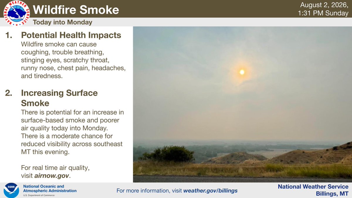
With an approaching cold front tonight, air quality will be reduced with wildfire smoke into Monday morning. Reductions to visibility are also likely. Take necessary precautions if vulnerable to reduced air quality. #mtwx#wywx
Smoke from wildfires across the Pacific northwest will continue to affect the area through at least Monday. Surface smoke may create minor reduced visibilities at times.
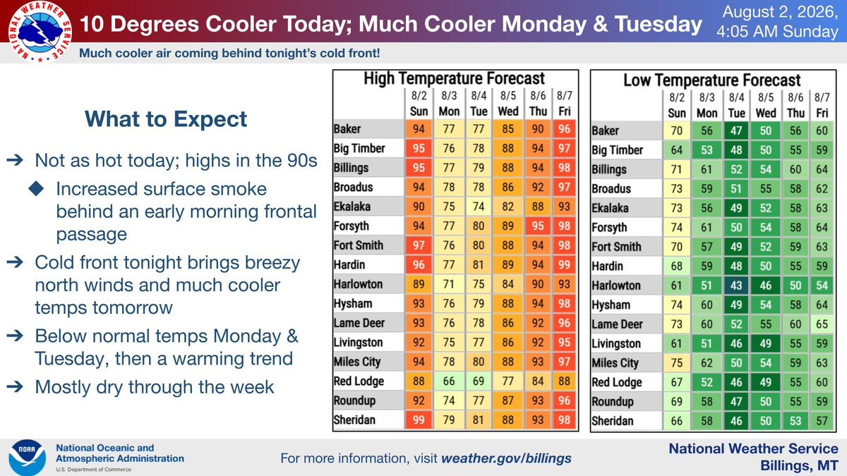
8/2 5am: Hot and dry again today, with a couple of cold fronts (this morning and evening) stirring up the winds at times. This will keep critical fire weather conditions going today. Tonight's cold front will usher in much cooler air for Monday/Tuesday. #MTwx#WYwx
8/2 430am: Two cold fronts (one this morning/one this evening) will bring higher smoke concentrations into the region over the next 24 hours. #MTwx#WYwx