The fate of D-Day and WWII came down to a controversial weather forecast ⛈️
This afternoon, join meteorologists and the director of the new film "PRESSURE" to discuss the science and stakes behind the historic story.
Tune in today at 2:00 PM ET: https://t.co/kacNBQNEu2
Call for Nominations: 2027 STAC Award in Probability & Statistics!
Categories:
• Early Career
• Distinguished Scientific/Technological Accomplishment
• Outstanding Service
Nominate a deserving colleague here: https://t.co/QLSHD0FmSy
📅 Deadline: June 12, 2026 (11:59 PM PDT)
🌟 ASBPA is proud to present the National Coastal Conference Centennial Celebration. #ASBPA100
ASBPA National Coastal Conference Centennial Celebration
📍 Atlantic City, NJ
📅 October 5-8, 2026
https://t.co/gRO7HntKjR
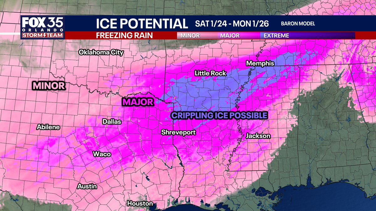
WINTER STORM UPDATE: ICE POTENTIAL
Going to break this up into several posts as there is way too much to put in one post. Will do a Facebook LIVE Thursday and Friday evenings. Regarding ICE, you will see on your TV and apps pink on the future radar. Pink is not created equal. Those are all cute and pretty for your short 3 minute TV forecast but misleading. Pink is either sleet or freezing rain, not both at the same time.
There will be a wild push of warm air aloft. Saturday night into Sunday morning, there will be places in NE TX, central AR, west KY, WV, and Virginia with air temps in the 10s, and heavy SLEET falling. And you will be probably shocked that is even possible.
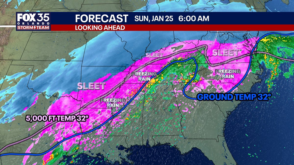
The storm will take several phases. The first radar image below is what I think should likely as of now be the furthest NORTH extent the sleet line makes it where the pink gets which will cut into snow totals.
The lines on the map are the temps of 32 degrees at 5,000 feet and the ground. From the PINK LINE north, any pink on the future radar would be falling as heavy SLEET, like so heavy it sounds like someone throwing rocks at your windows. BETWEEN the lines, most likely P TYPYE would be freezing rain.
Freezing rain = glazed donut
Sleet = sprinkles
Freezing rain takes down trees and your power for days to weeks.
Sleet bounces off everything, sounds crazy, is a pain in the rear, but doesn't take down power or trees.
The very specific line that things remain more freezing rain vs sleet will be fine tuned as the storm nears.
Where it stays mostly freezing rain, a crippling ice storm is possible in far NE Texas, southern Arkansas, SW Tennessee, and far NW Mississippi. Notice how places like northern Alabama get nearly 0 ice, but north Georgia may. That's "CAD" (cold air damming) where cold at the ground travels south in the valleys and around the mountains. Meaning, interior South Carolina gets hammered with freezing rain and interior North Carolina, while places north get more sleet.
The mix will come in waves starting Friday night and ending Sunday evening. Hopefully this post made sense.
Remember, sleet is NOT hail.
Hail forms going upwards in a thunderstorm.
Sleet forms from a melted snowflake (what goes from a snowflake to a raindrop) back into a ball of ice while falling in the sky. NOT hail. Sleet is much smaller and more uniform than hailstones.