Terra Drone Europe is a leading provider of geographic data acquisition, industrial inspections, and high-end aerial imagery using unmanned aircraft (UAVs).
Our blade inspections are carried out using the BladeInsight autonomous drone platform, custom-made for inspections of all edges of the blade. We provide safe, fast, high quality inspections with on average 8 minutes per blade and 0.4mm/pixel quality.
[email protected]
Terra Drone uses a LIDAR system, which produces highly accurate and dense geo-referenced point cloud data.
For more information contact [email protected]#drone#lidar#pointcloud#data
At TerraDrone we believe in training our people for all client’s needs; increasing our capabilities, for any work that needs to be completed.
For more information contact [email protected]
Terra Drone Europe acquires drone mapping data, using a combination of drones and manned aerial platforms using different techniques such as photogrammetry and LiDAR.
We have a team of qualified land surveyors and data processors to create accurate and high resolution datasets.
TeeraDrone Inspection solution, seamlessly integrates reliable & repeatable data collection with autonomous drone flight. We can reduce your downtime, give you 100 % blade coverage, with best-in-class quality.
We give you blade data & images that are automatically organised.
As Yuki Ueno, Director @TerraDrone_EU , puts it, "With the help of #drones, we want to solve serious problems in #logistics, such as carbon dioxide emissions. As deregulation progresses worldwide, #dronedelivery services will also increase."
https://t.co/CDTTi4Bwrd
#TerraDrone
Another way #drones are helping to fight the #coronavirusoutbreak in China. The high-tech monitoring devices can identify the person who has the highest body temperature in a crowd before reporting their condition to health officials. https://t.co/TpNBc7477P
One of the many benefits of being in a multinational org like #TerraDrone with vertical specializations is that you get to learn from the best. Here is Terra Inspectioneering, leaders in #droneinspection of #confinedspaces, providing training to two pilots from Terra Drone Europe
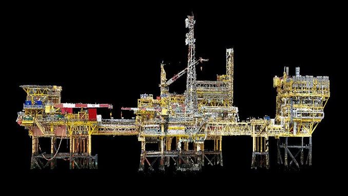
We provide a comprehensive package of inspection solutions tailored specifically to each client’s requirements utilising a range of ROV, UAV and Rope Access techniques which can be undertaken simultaneously. #ROV#OilandGas#RopeAccess#UAV#projecthighlight#TerraDroneEurope
80 sq km of Sahara desert mapped with BIRDIE UAV. Thank you, Terra Drone Europe for such a beautiful snapshot from your works!
#drones#uav#terradrone#Desert
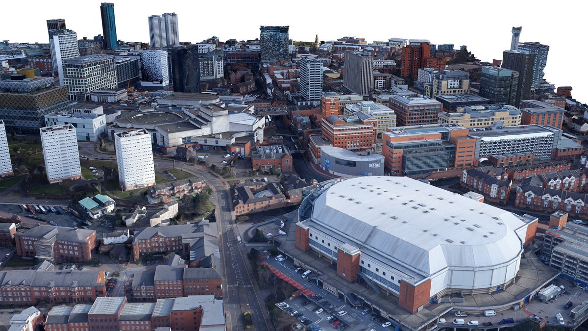
HQ Birmingham 3D city model.
Around 1100 images were captured with a dual camera system mounted under small Cessna plane.
Both nadir and oblique imagery were processed inside of RealityCapture.
Credits go to Jasper Mink and Terra Drone Europe.
Overall processing time was 17h.