FWIW: official USGS volcano information will always come from accounts that have the handles @USGSVolcanoes, @alaska_avo, & @USGS and are linked from our web pages.
Visit https://t.co/T7B6iv6eT0 for info.
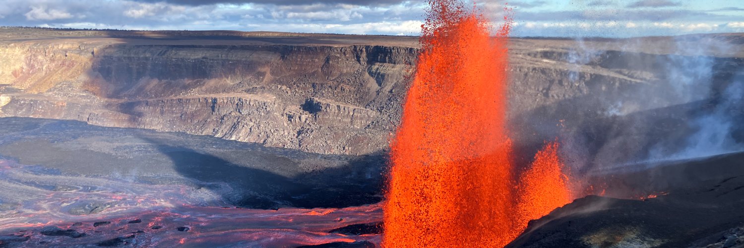
Kilauea Message 2026-09-07 19:28:19 HST. The fourth precursory flow that began at 5:52 pm ended at 7:20 pm HST with a vigorous drainback. The dome fountain feeding the flow reached about 35 feet (10 meters) high. Only a slight decrease in tilt during this event.
Kilauea Message 2026-09-07 18:03:30 HST. A fourth dome fountain and precursory overflow began around 5:52 pm HST based upon tremor and a brief glimpse on the V3 streaming camera. The thermal camera is obscured by weather.
Kilauea Message 2026-09-07 17:16:17 HST. The third precursory flow began just after 5:04 pm HST using tremor patterns and thermal camera images. It's occasionally visible through the rain squalls related to the passing of Hurricane Lowell to the west of the Island of Hawaiʻi.
Kilauea Message 2026-09-07 16:41:06 HST. The second precursory flow ended with a vigorous drainback beginning at 4:23 pm HST with tremor background jumping up at 4:24 pm HST. Gas pistoning continues with activity in the west and possibly south vents.
Kilauea Message 2026-09-07 16:23:57 HST. Low dome foutains feeding the second precursory overflow are gradually becoming more vigorous and are now 10-20 feet (3-6 meters) high. Tremor background remains low but with gas piston related spikes and UWD tilt remains relatively flat.
Kilauea Message 2026-09-07 15:29:09 HST. A second precursory lava flow began around 2:52 pm HST based upon tremor and thermal imagery. Glimpses via the V1 and V3 streaming cameras show a double dome fountain about 10 feet (3 meters) high feeding a lava flow on the crater floor.
Kilauea Message 2026-09-07 14:34:36 HST. There continues to be almost no visibility at the Kīlaueaʻs summit. The first precursory overflow appears to have ended at 2:10 pm HST based upon tremor and thermal camera images. The sluggish overflow last 1 hour and 25 minutes.
Kilauea Message 2026-09-07 13:50:04 HST. The north vent continues to passively overflow with almost no spattering or fountaining for the past hour. The summit continues to slowly inflate with the UWD tiltmeter recording a total of 13.2 microradians since the end of episode 54.
Kilauea Message 2026-09-07 12:58:49 HST. Sluggish overflow from the north vent with no fountaining began around 12:45 p.m. HST today. Overflow is continuing at this time. Winds are currently from the south and fume/steam frequently obscure the camera views.
Arizona hosts multiple volcanic fields, and new research suggests there may be more young volcanism in the state than previously thought. Yellowstone Caldera Chronicles heads to the Southwest this week to investigate!
https://t.co/1QnOnOw7VL
📷1: Looking northeast from the Green Mountain lookout at the Springerville volcanic field in eastern Arizona. All of the forested hills in the distance are cinder cones that mark eruptive vents of the field. USGS photo by Mike Poland, September 22, 2022.
📷2: USGS geologist Mark Stelten and San Jose State University student and USGS student contractor Darrian Ellis-Hardin collect a sample of an approximately 50,000 year old lava flow from the Springerville volcanic field. USGS photo by Dawnika Blatter, June 2025.
Kilauea Message 2026-09-06 20:49:16 HST. Bright glow from both the west and north vents. Summit inflation continues and UWD tilt has recovered 11.6 of the 12.7 microradians lost during episode 54. If inflation continues, precursory activity could begin in the next 12 hours.
@Pnwpeoplehelper Nearly all Rainier lahars are associated with eruptions (based on the geologic record) except the very large Electron Mudflow about 500 years ago, which started as a large avalanche. This is why lahar monitoring is independent of, but complementary with, volcano monitoring.
Could a lahar at Mount Rainier affect communities far downstream?
Recent deadly floods have prompted local news outlets, emergency managers, and the public to ask us a the Cascades Volcano Observatory (CVO) whether a similar event could occur at Mount Rainier during a lahar.
A lahar is a fast-moving mixture of water, mud, rock, and other debris from a volcano that can behave like wet concrete. These powerful volcanic flows can travel dozens of miles at high speeds, following river valleys into populated areas. They are the most dangerous volcanic hazard in the Cascade Range because of their reach and destructive force.
In mountainous regions, hazardous flows can move quickly and affect communities far downstream. We study these hazards before they happen so communities can prepare and people know what to do when a warning is issued. Nepal’s disaster was not a lahar, but the rapidly moving mixture of water, rock, ice, and sediment, and its downstream impacts, can help illustrate what a lahar could look and feel like.
Mount Rainier has produced at least 11 major lahars that reached the Puget Lowlands over the past 6,000 years. Today, more than 90,000 people live in lahar hazard zones around the volcano, with potential indirect impacts to millions more.
That’s why Mount Rainier has the Rainier Lahar Detection System, coupled with an alert and warning system managed by Pierce County and the Washington State Emergency Management Division. Community outreach is a critical part of preparedness—helping people understand what a lahar is, where it could occur, and what to do when a warning is issued.
The Cascades Volcano Observatory update for Friday, September 4, 2026: All volcanoes in the Cascade Range of Oregon and Washington were at normal background levels.
During the past week, small earthquakes were detected at Mount Rainier and Mount St. Helens. Earlier this week, field crews conducted site visits at Mount Adams.
📷: Lahars from the May 18, 1980 eruption of Mount St. Helens destroyed many homes, bridges and miles of road and rail. Sediment deposits continue to impact the local watershed even 46 years later. Credit: USGS
As the past year in Hawaii has shown, hurricanes, eruptions, earthquakes, flooding, and severe weather can occur with little or no warning and result in power outages, disrupted roadways, and other impacts.
September is National Preparedness Month. Steps you take to prepare in advance for any one emergency can help you and your family be better prepared overall.
Know your hazards, make a plan, build a go‑bag, and stay connected with your community.
One way to stay connected and aware of the volcanic hazards is to subscribe to the Volcano Notification Service.
Learn more: https://t.co/NT8e3ZVCbO
📷: Graphic showing the four-tiered USGS Volcanic Activity Alert-Notification System which uses Volcano Alert Level terms and Aviation Color Codes to inform people about a volcano's status.
#VolcanoWatch #Hazards #Preparedness
Before Yellowstone Caldera, volcanism in the region occurred from the Absaroka range and ultimately formed one of the densest concentrations of petrified wood on Earth! The Absarokas are the subject of the latest Yellowstone Volcano Observatory video update, along with seismic, deformation, and geyser activity from the month of August.
https://t.co/Krsw37UgPo
It’s National Preparedness Month, and USGS geologists are currently reassessing the list of young and threatening volcanoes in California and Nevada. The total is likely to drop - so what changed and why?
A key component of the California Volcano Observatory’s work is monitoring and studying young, threatening volcanoes in California and Nevada. When we say “threatening”, we consider not only the age of a volcano, but what kinds of hazards it produces and whether it can impact people and property. Knowing which volcanoes or volcanic fields in California and Nevada fit this description requires collaboration with state geologists, other government agencies, and academic colleagues. These groups use the most recent geologic evidence to figure out the age of each volcanic system and the types of eruptions they have had, to determine whether they should be considered threatening.
The last threat assessment for all U.S. volcanoes published by the USGS was done in 2018 and listed 13 threatening volcanoes in California and Nevada based on geologic evidence available at the time. However, research into these volcanic systems is still happening, and new data have provided reasons to make changes to this list. For example, the Golden Trout volcanic field, which consists of basalt cinder cones and lava flows about 16 miles (25 km) south of Mount Whitney in the Sierra Nevada mountains was on the list of young and threatening volcanoes in 2018. However, new research shows that the most recent eruption at the Golden Trout volcanic field was about 55,000 years ago and is likely not active today. In this case, USGS scientists are proposing the removal of the Golden Trout volcanic field from the list of young and threatening volcanoes because the field is not in fact young.
Other situations are not so simple. A good example of this is the Mono Lake Volcanic Field and the Mono-Inyo Chain, located on the eastern side of the Sierra Nevada mountains along US-395. The Mono-Inyo Chain consists of a 16-mile- (25-km-) long group of over 30 rhyolitic lava domes, lava flows, and tephra rings extending from Long Valley caldera to Mono Lake. The Mono Lake Volcanic Field consists of rhyodacite and basaltic volcanic vents within Mono Lake and on its north shore. In the past, geologists thought these areas had different magmatic systems because the chemical compositions of their lavas were different. However, radiometric dating has shown that both volcanic fields have been active over the past 20,000 years, often around the same time. Given the similar timing of eruptions and the fact that they are geographically adjacent, USGS scientists are proposing that these volcanic systems should be treated as a single, Mono-Inyo volcanic field. This better reflects the potentially linked magmatic systems beneath them and alerts geologists to the fact that activity could happen simultaneously in multiple parts of this volcanic region.
So don’t worry, California’s volcanoes aren’t going anywhere. As we learn more about the character of each volcano, we can categorize them better, and sometimes we learn that two volcanoes we thought were different may not be so different after all.
California Volcano Observatory Weekly Update for August 31, 2026: All volcanoes in California were at normal background levels of activity for the last week. Earthquakes >M1 were detected in the Clear Lake Volcanic Field and Coso Volcanic Field, with many of the earthquakes in the Coso Field being related to an ongoing swarm.
📷: Mono Lake’s volcanic features (Black Point, Paoha and Negit Islands) are all visible from this vantage point on the Mono Domes. USGS photo by G. Chiaro.
Yellowstone Volcano Observatory Monthly Update
September 1, 2026, 6:55 p.m. MDT
https://t.co/YgYlbUolVL
August summary:
▶️ background levels of activity
▶️ 61 located earthquakes (max=M2.0)
▶️ minor caldera uplift (about 1 cm, or a fraction of an inch, in 2026)
▶️ 2 eruptions of Giant Geyser (Upper Geyser Basin)
▶️ at Black Diamond Pool in Biscuit Basin, there were a few small eruptions and likely one large eruption (that occurred at night) in early-mid August
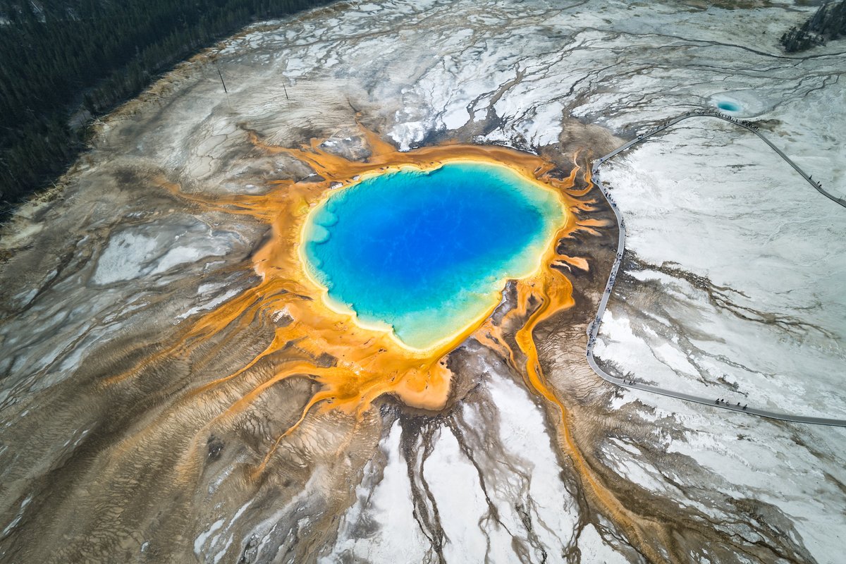
📷: Grand Prismatic Spring. Photo by Jake Frank, Yellowstone National Park, August 7, 2026.
Yellowstone was named for the color of the rocks along the Yellowstone River. But what causes these colors? Or the colors that make redstone red? Or greenstone green? Or blueschist blue? Today's Caldera Chronicles is very colorful!
https://t.co/PGnE8O1rzn
📷1: Large blueschist outcrop out along the east shore of Tomales Bay near Point Reyes National Seashore, California.
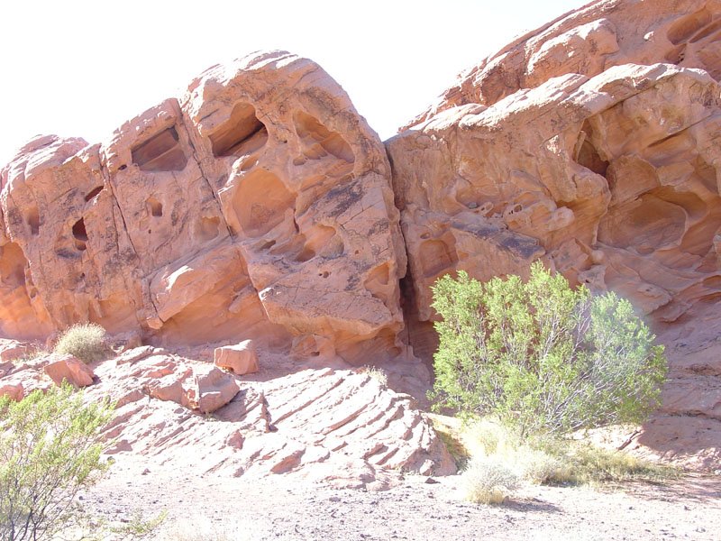
📷2: View of Artist's Palette in Death Valley, California. The colors result from different minerals weathering in this harsh desert environment. Iron minerals are red, pink, and yellow. Purple comes from manganese minerals. Green is weathered volcanic tuff.
📷3: Redstone along the north shore of Lake Mead, Nevada. The Redstone Area features massive, weathered outcrops of Early Jurassic-age Aztec Sandstone.