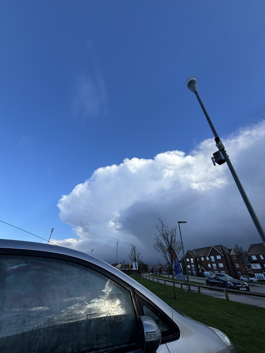
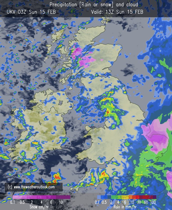
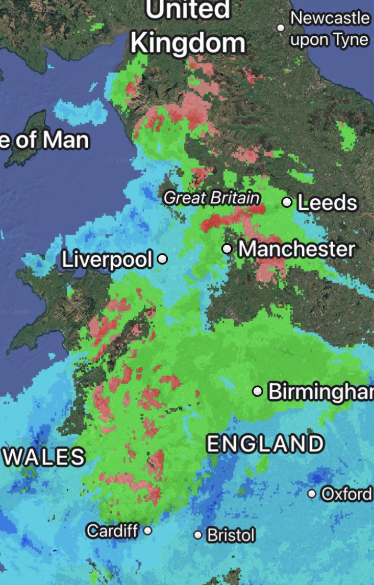
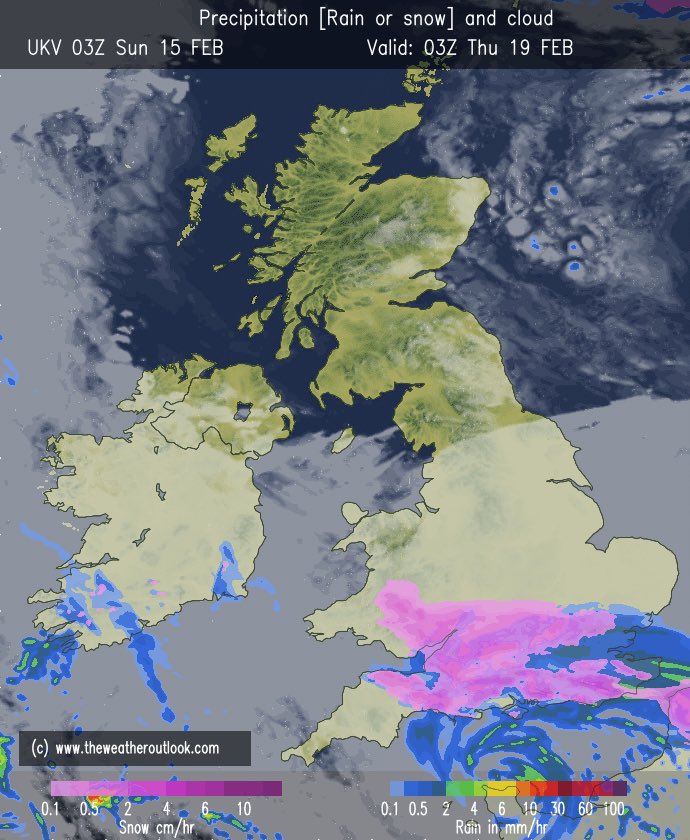
Very sleety mix it turned out to be, with snow restricted to higher elevations of around 180m^. Rain elsewhere…
This should all clear by tomorrow morning.
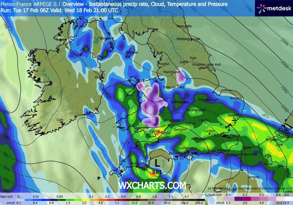
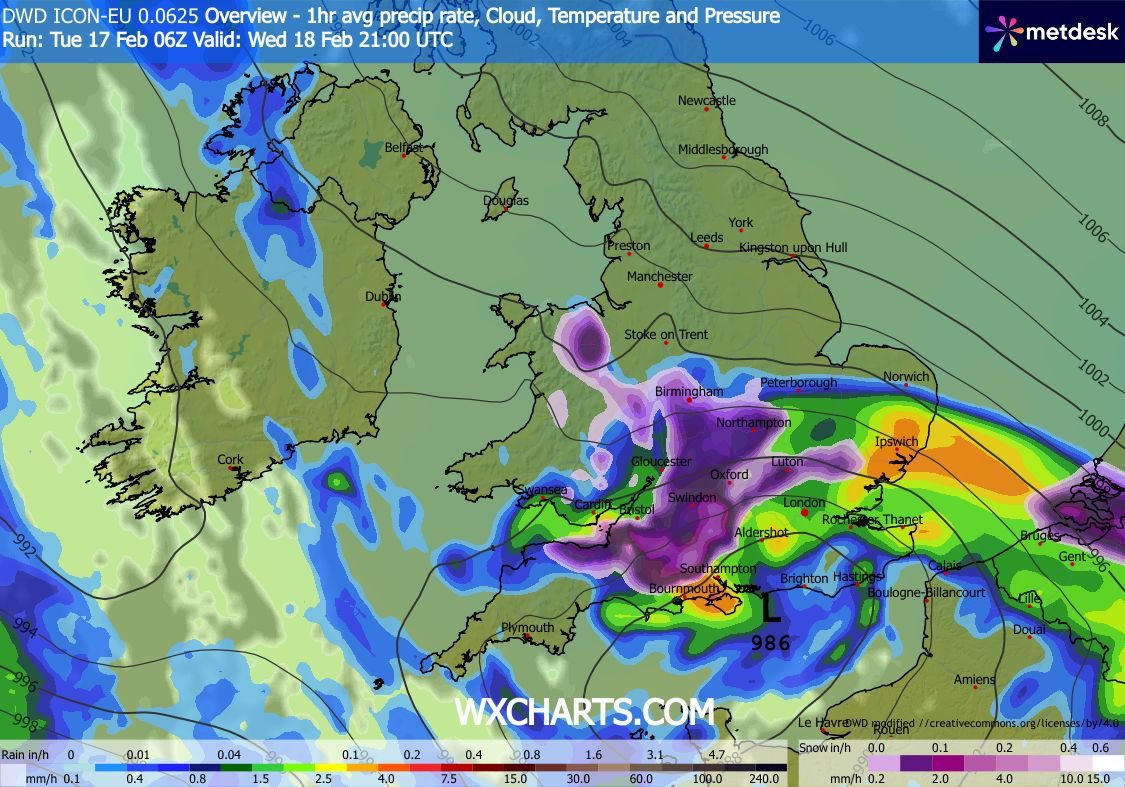
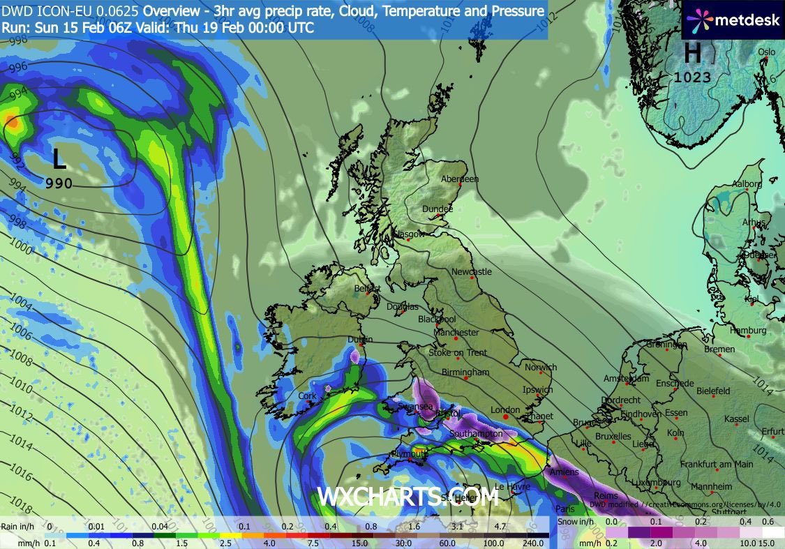
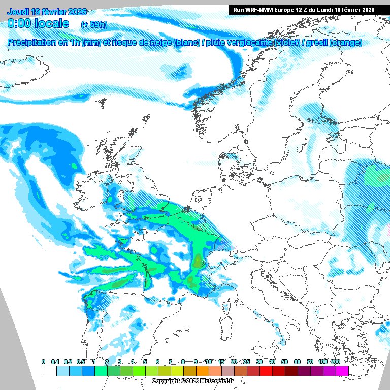
Snow risk now does look to be more towards wales / northern England. ICON being the furthest south with precipitation brining the snow risk all the way down to Dorset, although barely any support for such a southerly track.
Let’s see what models suggest this evening.
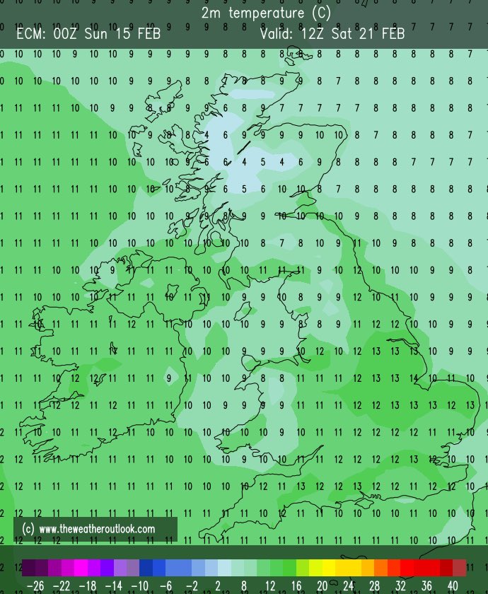
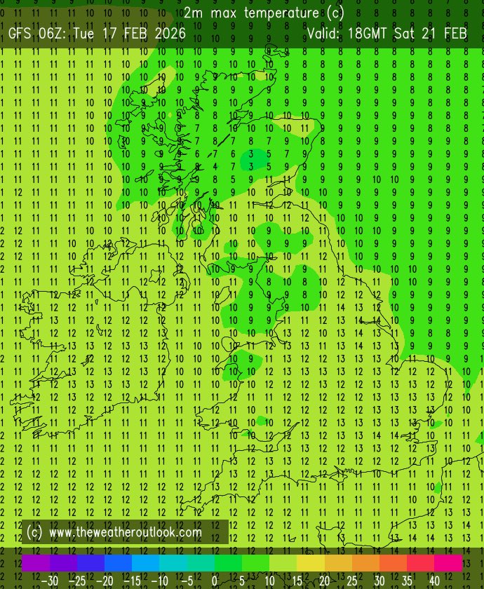
This weekend will bring a welcome change to temperatures with 13-14c possible, however it does look cloudy. Make the most of this as it looks to become wet again the following week.
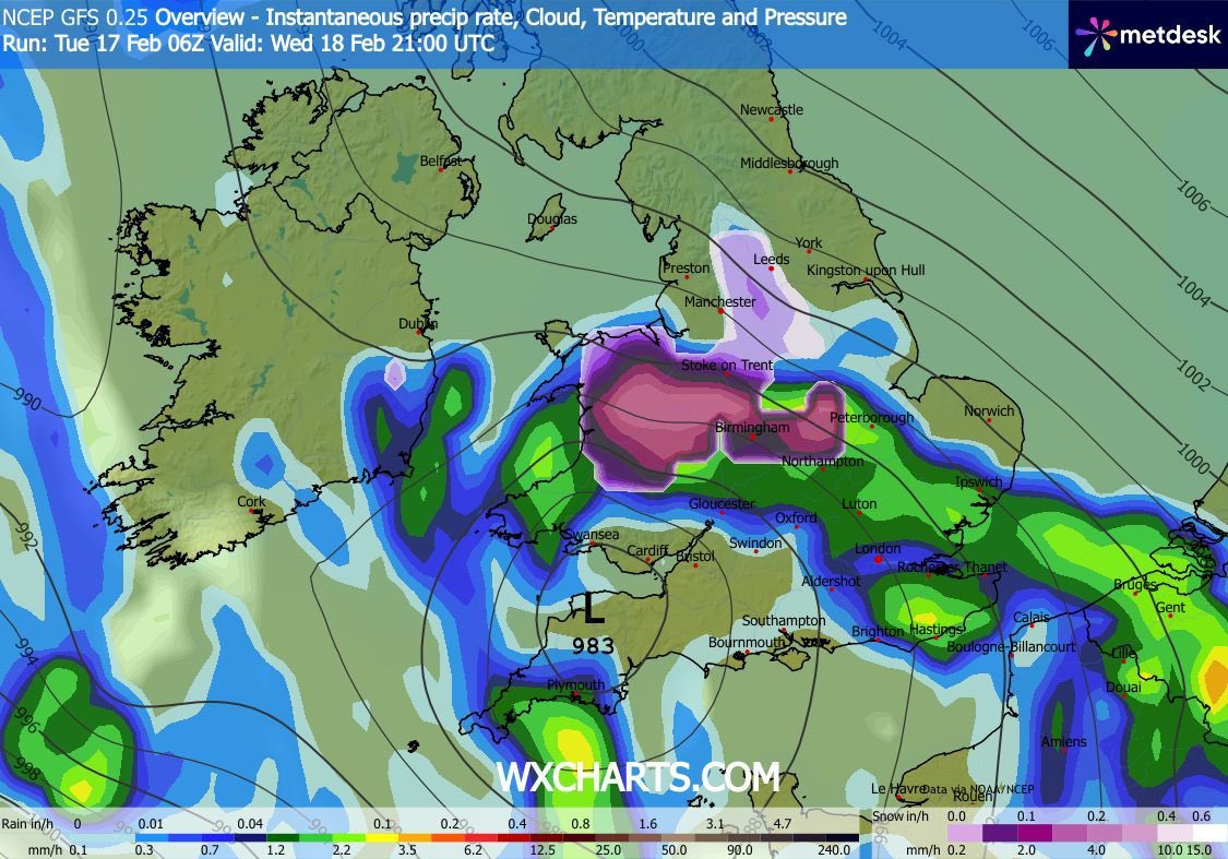
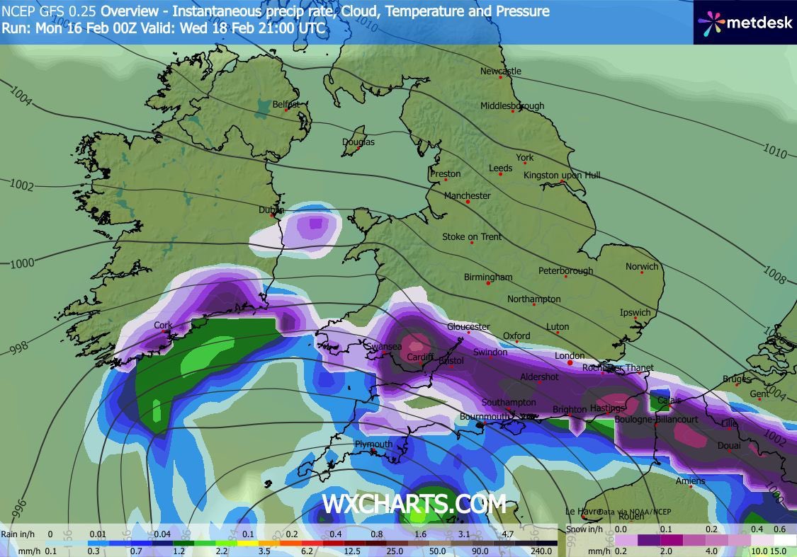
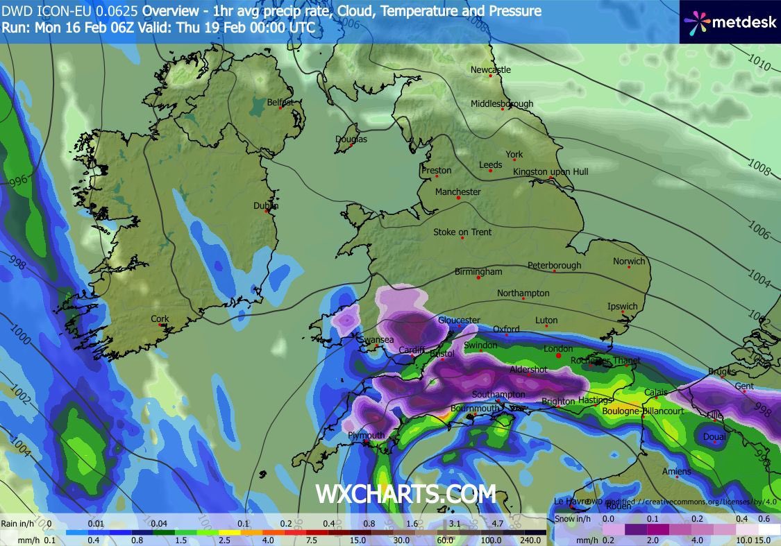
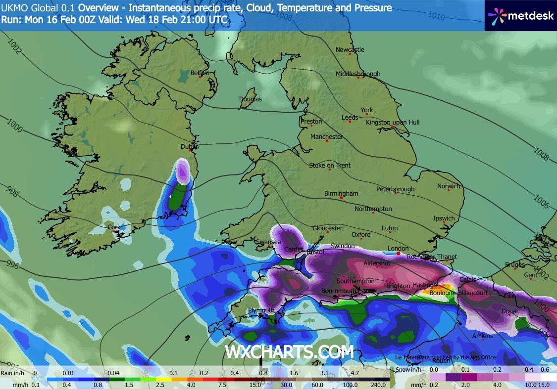
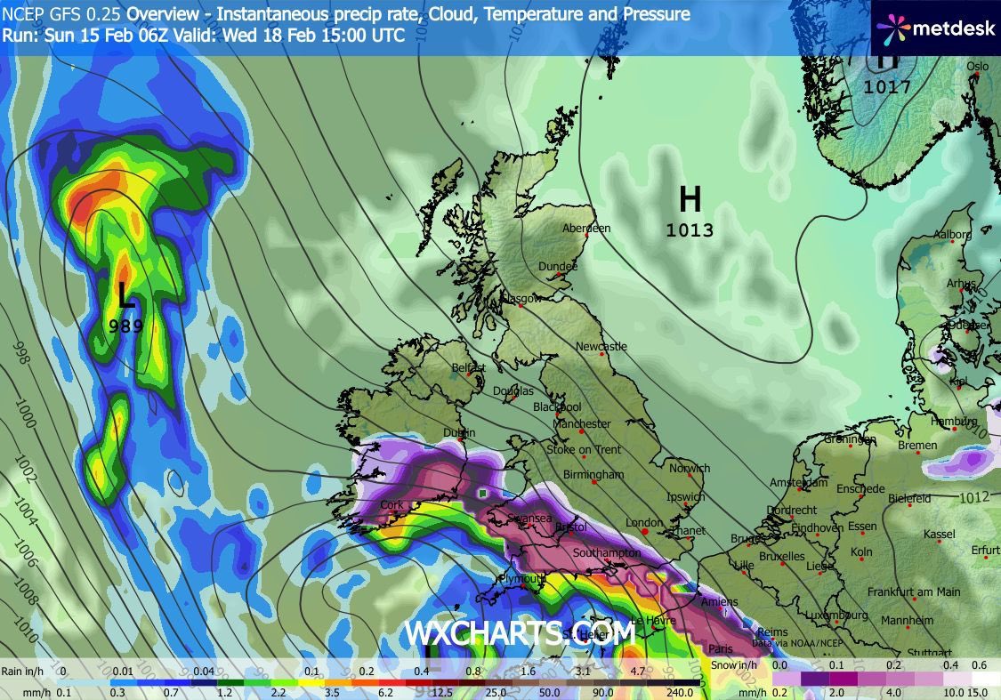
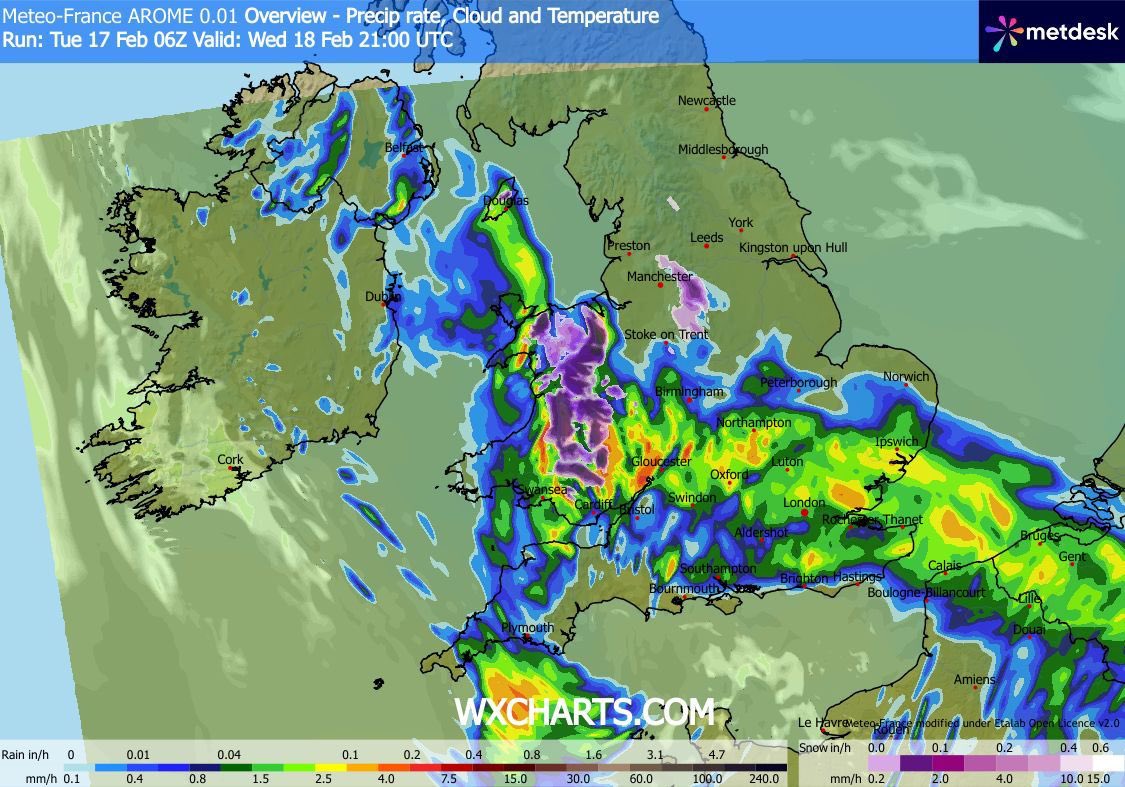
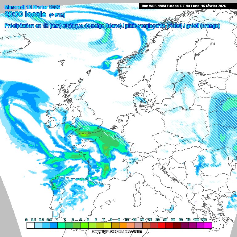
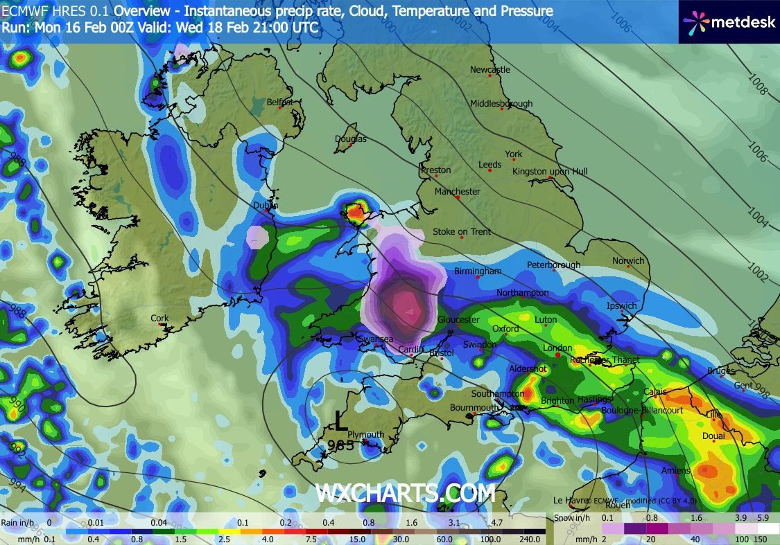
What looked like a possible snow event for southern England yesterday now looks like just rain. Totals off 20-30 mm expected for coastal areas, 10-20 mm elsewhere.
I wouldn’t discount a more northerly track to this low, bringing snowfall to Midlands and Wales and a lot of rain to the south. A slight shift north in model output today bringing the lows centre across the south coast of England.
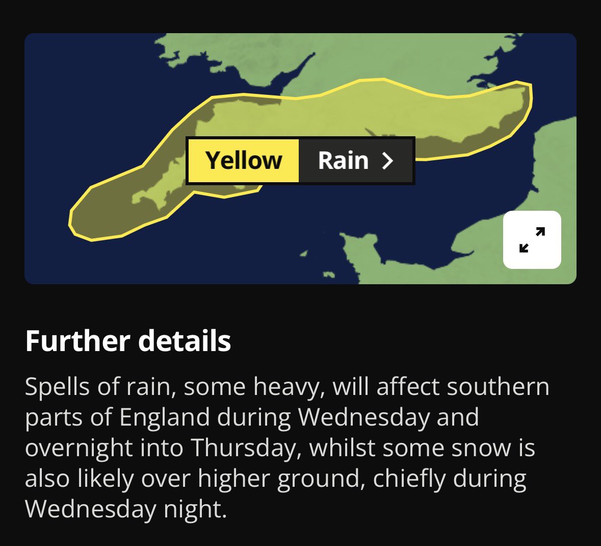
Looking at the higher res models, most are showing rain for southern counties with snow restricted to higher ground. Would bank on these for a more realistic forecast come Wednesday/Thursday.
Most models now indicating that this will affect the UK in some way, although cross model agreement on where snow will fall is still poor. GFS, UKMO, UKV, ICON showing more of an intense system allowing snow to fall more readily, while others show it more north or mostly rain.
Small chance at the moment of a low far enough north to bring snow to southern England next Wednesday/Thursday. Model agreement is poor with a 50/50 split of it going into France or not. From past experiences, it’s usually a France event.
Small chance at the moment of a low far enough north to bring snow to southern England next Wednesday/Thursday. Model agreement is poor with a 50/50 split of it going into France or not. From past experiences, it’s usually a France event.
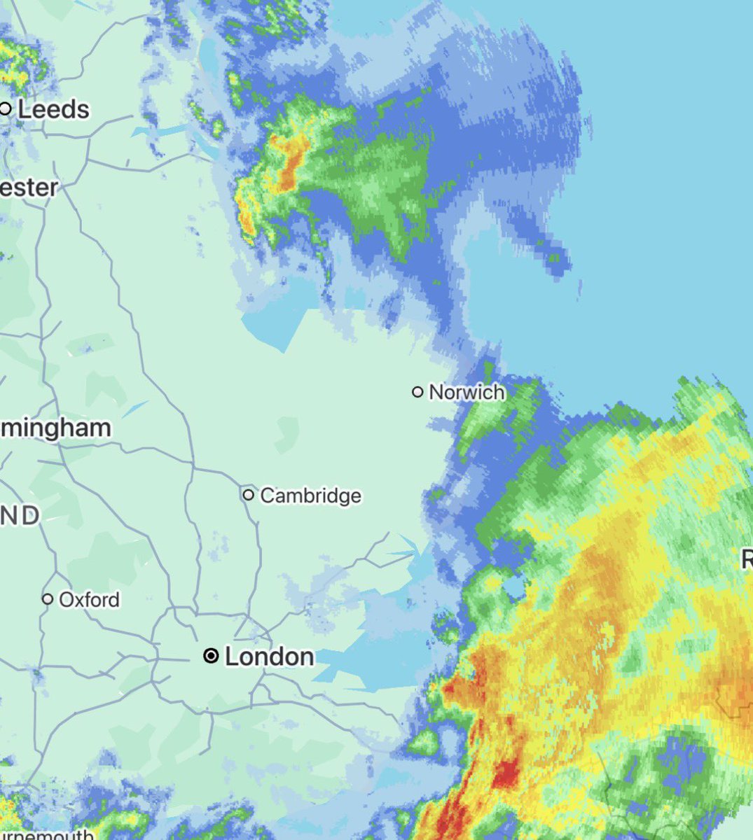
As rain clears east later today, it’s expected to turn into snow over East Anglia. Although ground is wet precipitation will be intense with the risk of a 1-3 cm in places.
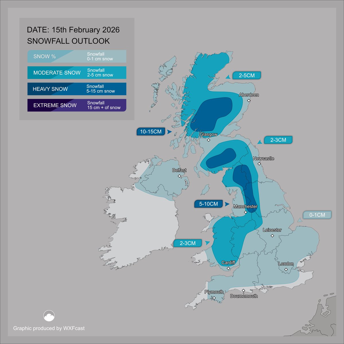
Snow Advisory 15th February 2026
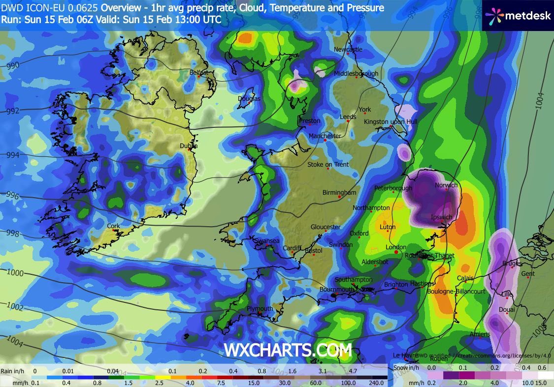
A band of precipitation off the Atlantic will collide with colder air over the UK throughout early hours of Sunday morning, although settling snowfall will be mainly restricted to higher ground 200m^. (1/2)
Risk of accumulations of 5-10cm over highest ground across northern England and Scotland. Small chance of settling snowfall to lower levels across areas precipitation is more intense. (2/2)