#WaterAccounting team @ihedelft applying WA+ (systematic framework for assessing current status & trends in water availability/consumption) using #remotesensing
Super nouvelle! Notre #MOOC 'Introduction to #WaPOR v3' est maintenant disponible en #français ! Venez découvrir le cours sur notre plateforme en suivant ce lien !
https://t.co/UYWNvK2mxo
Get an early bird discount by paying before tomorrow!
Diploma in Python for Water Resources, Nov 2024 - Feb 2025
Give it a like!
https://t.co/Rq9SWE7PzJ
Want to level up your #Python Dataviz skills? I am launching our Mapping and Data Visualization with Python course on YouTube and designed a free #PythonDatavizChallenge where you spend 30 mins a day for the next 30 days to learn a new skill. Start at https://t.co/9aTO7xIr6a
Recap: Remote Sensing for Agricultural Water Management
Participants in a recent course used a brand-new, innovative Python #WaPOR algorithm to generate detailed agricultural data. The pyWaPOR algorithm was developed by @FAOLandWater
💧Apply for March 25: https://t.co/4iYzkW9qys
Yasir Mohamed (IHE Delft) led the FAO’s 3-day WaPOR training in Pakistan last week. The training not only taught stakeholders how to use WaPOR & QGIS applications, but also how to adapt these tools to local contexts & the importance of forging partnerships for water cooperation.
Which is the best precipitation product to use in Africa?
The map below provides indications on that, and an integrated product would be the best choice.
Presented today @ESA_EO#EO4Africa conference
Live here: https://t.co/JHDc6izlyA
Last week, I was teaching participants of the course Remote Sensing for Agricultural Water Management at @ihedelft how to use NetCDF files in #QGIS. I've now bundled my course materials on mesh data in QGIS and made it freely available at @GISOCW: https://t.co/rRkYIt4EBN
If you're at the QGIS User Conference 2024 in Bratislava, join our team for a hands-on workshop on Waplugin!
It starts in 15min, B310
You can also follow the workshop online on @GISOCW : https://t.co/xYdE1RP18g
Happy learning #qgisuc2024
Productores del Magdalena y tomadores de decisiones se preparan para enfrentar desafíos en cambio climático capacitándose en el uso de #WaPOR y así hacer un uso eficiente del agua. @ihedelft, @FAOLandWater, @IWMI_, @Minagricultura. Conoce más en https://t.co/nypYESlLAf
Exciting opportunity for water professionals from MENA countries! The MENA Scholarship Programme (MSP) is now accepting applications! 📚
Application deadline: 15 October 2024
Learn more and apply: https://t.co/RDNNMdG404
#MENA#Scholarship
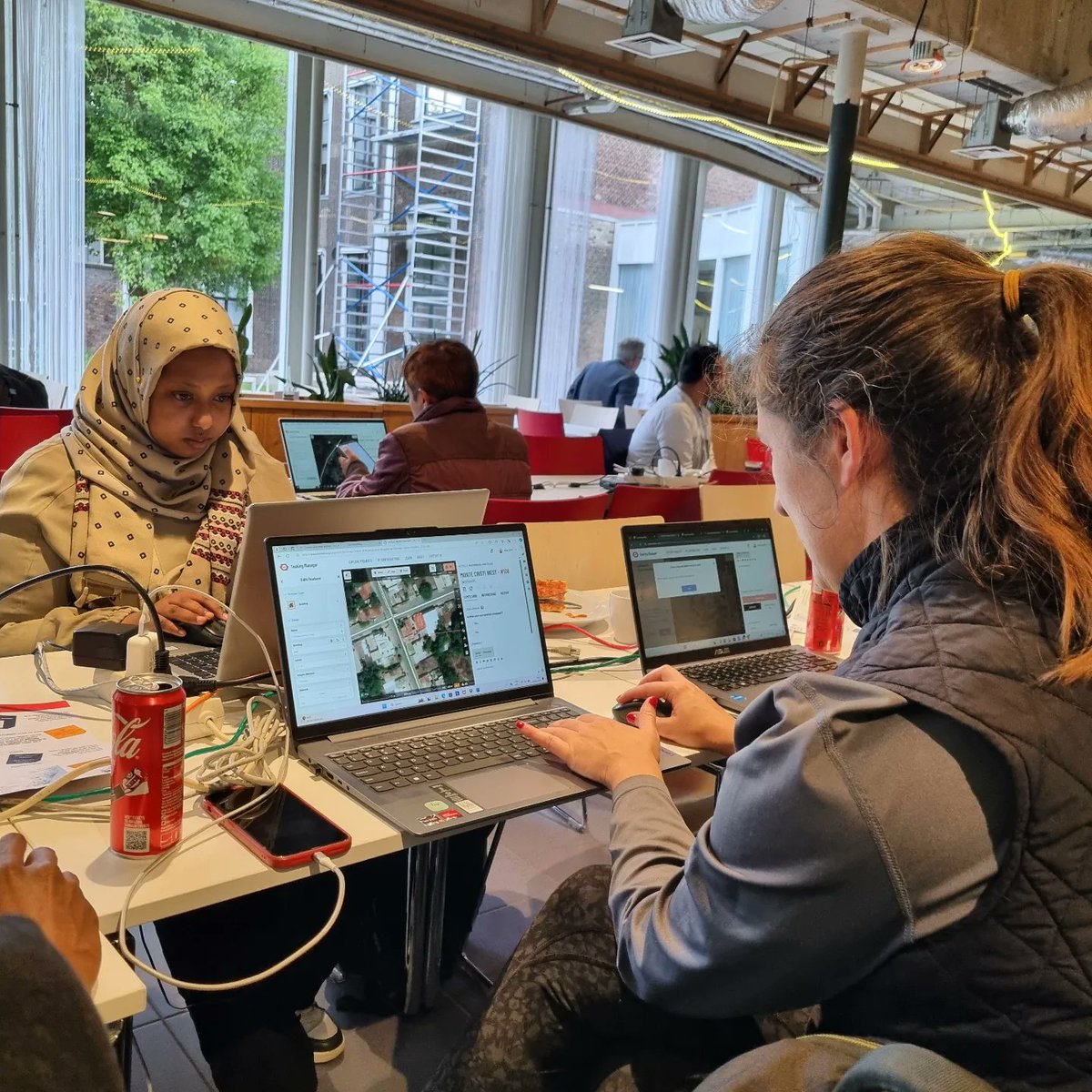
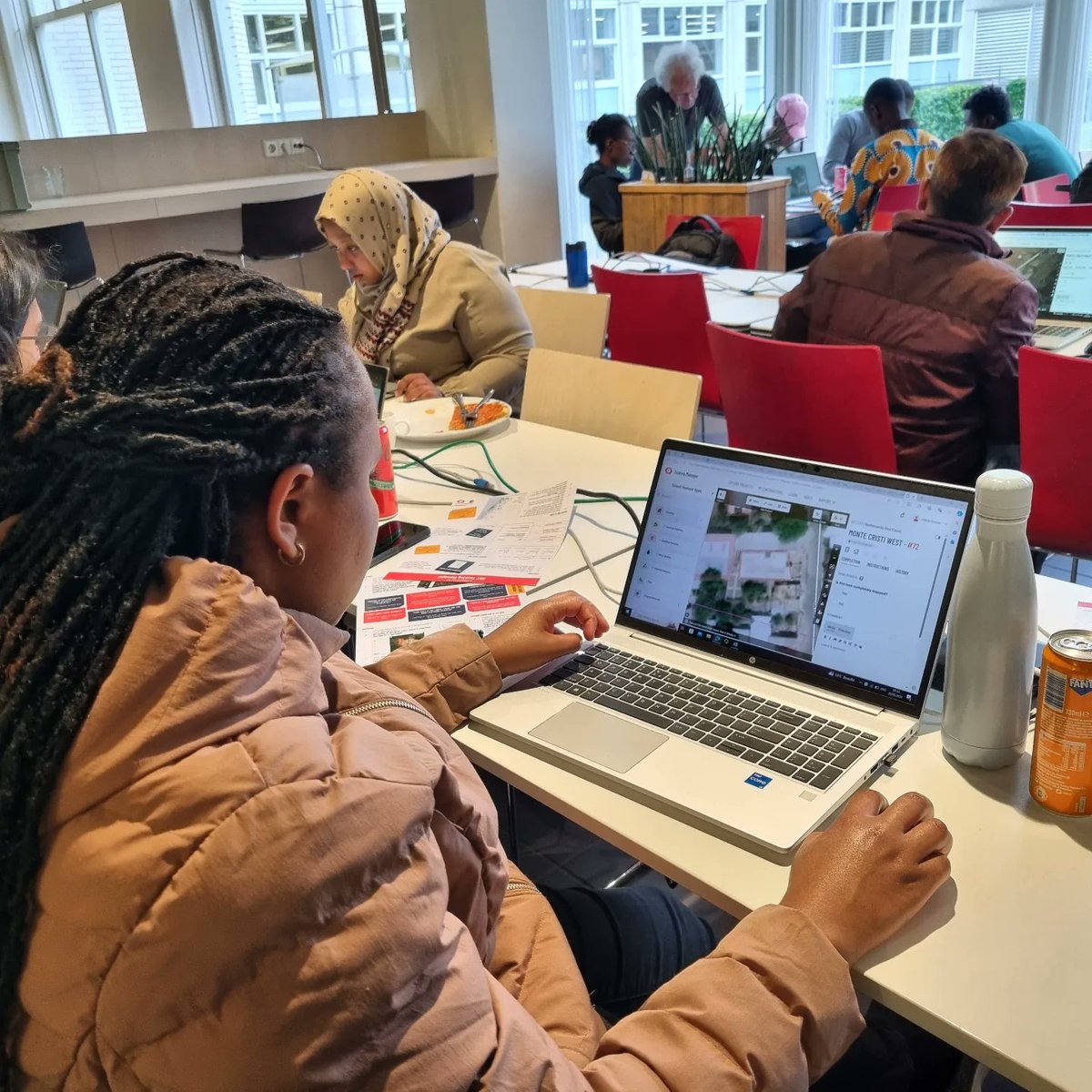
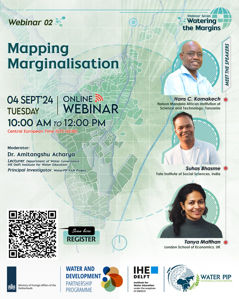
Join @WaterPIPproject for its upcoming webinar on mapping marginalisation in smallholder #irrigation, as part of the webinar series #WateringtheMargins. Register here➡️https://t.co/RUj8YTTYhI
Register now for our second #webinar : #Mapping Marginalisation of our Webinar Series: Watering the Margins
📢4 September 10:00 - 12:00 CEST
Registration here: https://t.co/snt1QrXUkR
New! Follow us now on linkedin: https://t.co/bMaeXjw4ZS
@ihedelft@IHEDelft_WDPP
Mark your calendar!
27 August 2024, 10:00–12:00 CEST
Five Sudanese IHE Delft alumni will present transformative visions for the Gezira Irrigation Scheme, in Sudan.
🔗To register or watch the livestream: https://t.co/Gz4wTCT33Q
Participant's testimonial: "This course provides state-of-the-art methods for agricultural water management using remote sensing". Do you also want to learn #pyWaPOR? Join us in March 2025:
https://t.co/cZoPt4Qa0Z
More info:
https://t.co/8c6QUjP1U8
@ihedelft@FAOLandWater
Recap: Remote Sensing for Agricultural Water Management
Participants in a recent course used a brand-new, innovative Python #WaPOR algorithm to generate detailed agricultural data. The pyWaPOR algorithm was developed by @FAOLandWater.
💧Apply for 2025: https://t.co/4iYzkW9qys
We are finishing the first week of the #shortcourse on #remotesensing for #agriculturalwatermanagement with 28 participants. Creating high resolution ET, NPP data using #pyWaPOR for 28 different case studies. Interested joining next year?
https://t.co/kHmB5kBlVd
New #WaPOR#MOOC available now! #Python for #geospatial analyses using WaPOR data.
For more information: https://t.co/KAGycuKKxK
Do you want to know more about WaPORv3 data? Start with the introduction course:
https://t.co/c6xBjn5aVg
@faolandwater@ihedelft