StormTeam 5 is watching a potential coastal storm late in the week. If this storm were to track close to New England, it could bring coastal flooding, beach erosion, gusty winds up to 50 mph and potentially several inches of rain.
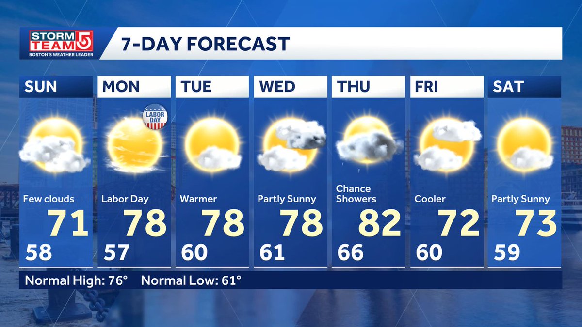
Quiet week up until about Thursday then we'll be watching the track of a potential coastal storm that could linger through the weekend before finally moving out.
Watching a potential Nor'easter heading our way late week. Still several days away so can't pin down details but if it does track toward a direct hit, this could be a multi-impact storm. Widespread rain along with coastal impacts and damaging wind.
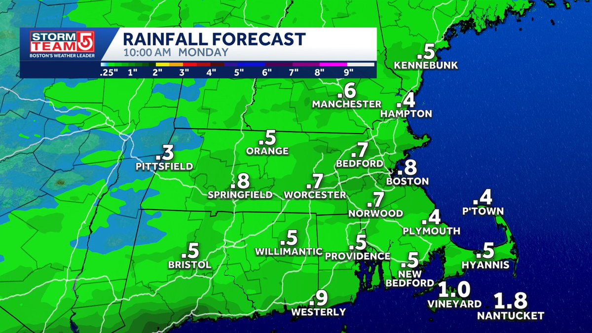
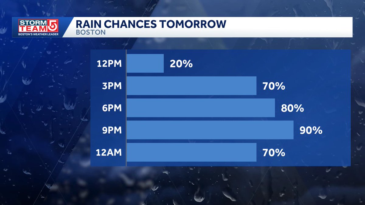
IMPACT WEATHER TOMORROW for light to steady rain starting late morning and not ending until Monday AM. Cooler than average conditions starting today all the way through next week.
WEATHER ALERT for Sunday as we track widespread rain arriving tomorrow morning. SE MA could receive 3"+ of rain in spots. Rain tapers off by mid-afternoon along with clearing skies. A few trailing showers early Monday morning, otherwise a quiet start to the work week
Waking up to a few showers and a few clouds. Clearing skies by the afternoon. Plenty of sunshine for Labor Day along with warmer temps. Next chance for rain arrives Wednesday night into Thursday.