Traffic Alert
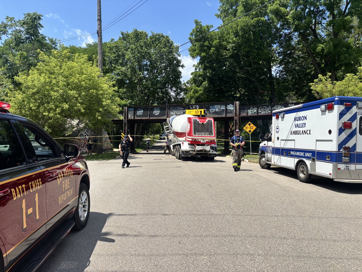
N. Ashley St. & Felch St. is currently closed after a cement truck struck an overpass. AAPD & AAFD are on scene. No injuries. Drivers should avoid the area.
Hot and humid conditions develop for much of next week. Most of Lower Michigan is within a Major risk of heat-related impacts. Plan to limit time outdoors and stay hydrated during the holiday week. #miwx
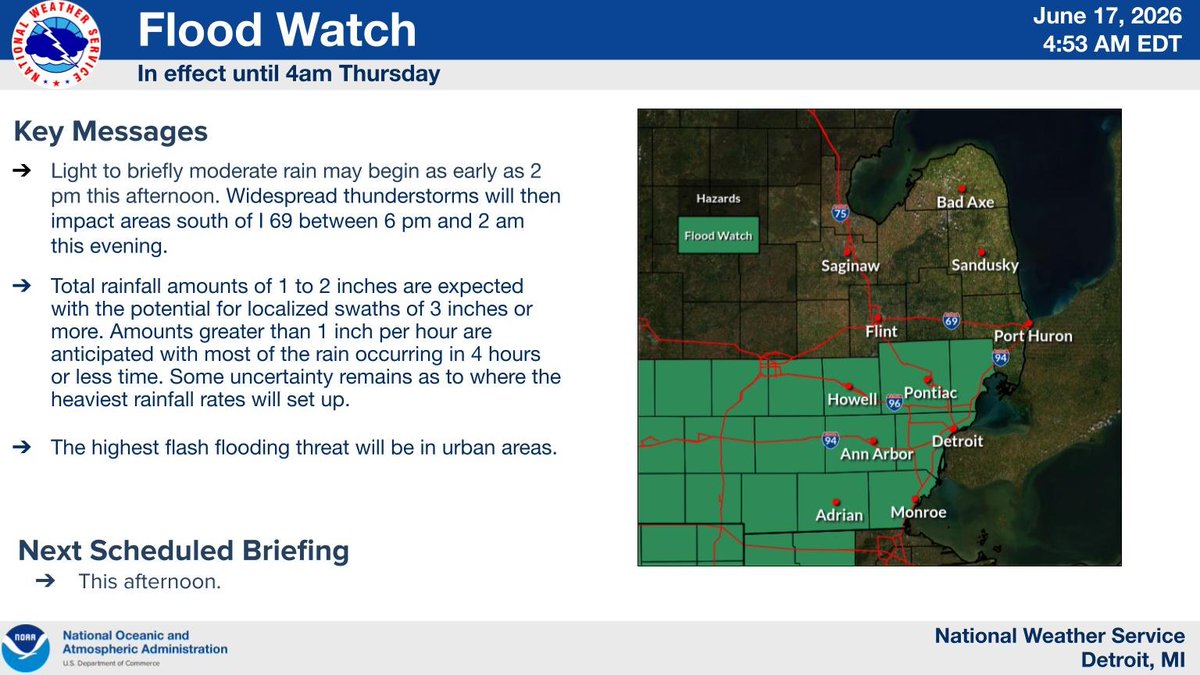
A Flood Watch is in effect for southern Lower MI through tonight. Heavy showers and thunderstorms will bring widespread rainfall totals of 1 to 2 inches with potential for localized swaths of 3 inches or more. The highest flash flooding threat will be in urban areas. #miwx
Scattered to numerous showers and thunderstorms will develop this afternoon and evening. Isolated strong to severe storms will be possible, with damaging wind gusts and large hail the main threats. #miwx
Traffic Alert: As you begin your commute this morning be advised that westbound I-94 at Jackson Rd, Washtenaw County is closed due to a semi-truck rollover. Troopers from the Brighton Post are working to get the area cleared up. Avoid the area and find another route.
The AAPD is looking for individuals to join our team as a Police Professional Assistant for our Records Department.
APPLY TODAY: https://t.co/aIRBeIqFdP
Full benefits package: https://t.co/nYHbpFmYJ5
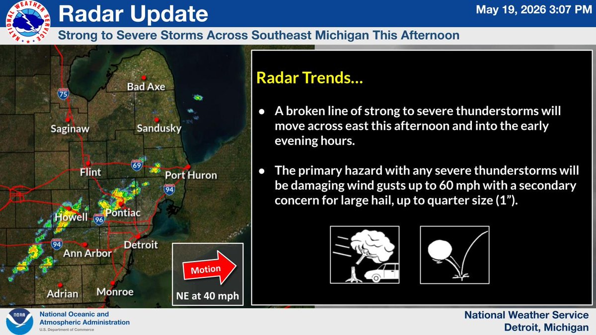
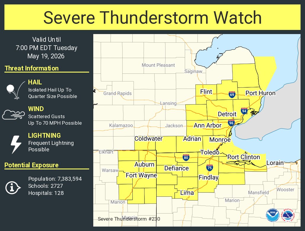
A line of thunderstorms to move through southern half of SE MI through the afternoon and early evening. These storms are capable of producing damaging winds up to 70 mph. Hail up to an inch will also be possible. #miwx
Coffee with a Cop is back TOMORROW, May 20th, at 9:30AM at Kerrytown Market & Shops. We welcome you to stop by for free coffee and an opportunity to meet your local officers.
We hope to see you there!
A Slight Risk again on Tuesday all of southeast Michigan. Potential exists for thunderstorms to develop during the afternoon and evening capable of producing damaging wind gusts, large hail, locally heavy rain, and/or isolated tornado #miwx