Severe Thunderstorm Watch for portions of Southern PA portions of Maryland Until 11PM EDT. Primary threats include... Scattered damaging wind gusts up to 70 mph possible Scattered large hail events to 2 inches in diameter likely. a tornado or two
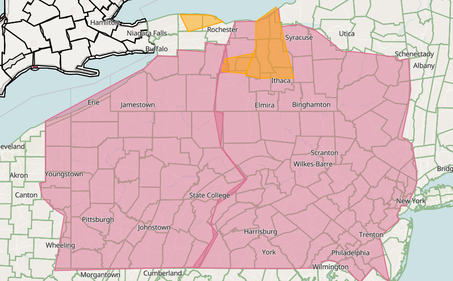
evere Thunderstorm Watch for portions of WNY portions of Pennsylvania Northern Ohio Until 9PM EDT. Primary threats include... Scattered damaging wind gusts up to 70 mph possible Scattered large hail events to 2 inches in diameter likely. a tornado or two
MCD: Pennsylvania and NY An line of strong to severe thunderstorms along a cold Front in SONT, with dew points in the upper 60s to 70s has yielded MLCAPE around 500-1000 J/kg. Low-level lapse rates are also steepening, with around 7-7.5 C/km analyzed in SPC Mesoanalysis...
Severe Thunderstorm Watch for portions of
central New York
portions of Pennsylvania
Until 9PM EDT.
Primary threats include...
Scattered damaging wind gusts up to 70 mph possible
Scattered large hail events to 2 inches in diameter likely.
a tornado or two
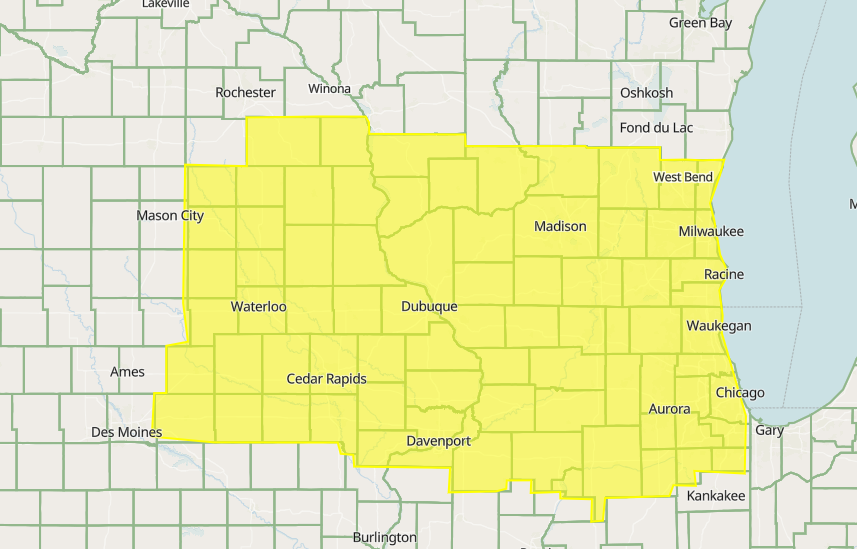
Tornado Watch for portions of South Eastern Iowa Northern Illinois Northern Missouri Southern Wisconsin Until 9pm CDT. Primary threats include... Several tornadoes and a couple intense tornadoes likely Widespread damaging winds and isolated significant gusts to 80mph likely
Severe Thunderstorm Watch for portions of
Southwest/central New York
Eastern Ohio
portions of Pennsylvania
Until 8pm EDT.
Primary threats include...
Scattered damaging wind gusts up to 70 mph possible
Scattered large hail events to 2 inches in diameter likely.
a tornado or two
MCD: Pennsylvania and NY a severe thunderstorm watch seems likely based on recent models runs and current obviations. Primary threats include thunderstorm winds and hail. thought a tornado cannot be ruled out. Pittsburgh sounding shows us a steep lapse rates...
PNS: ...Very volatile environment today... An high end severe episode is expected today with strong/intense tornados expected with severe winds and large hail. Our office in Des Moines are in some of the risk but the risk is east of the office. This could be tornado outbreak.
Tornado Watch for Extreme Portions of Minnesota South Wisconsin Eastern Iowa Northern Illinois Until 9pm CDT. Scattered damaging wind gusts up to 90 mph Scattered large hail events to 2.5 inches in diameter likely. A couple tornados likely and a few strong
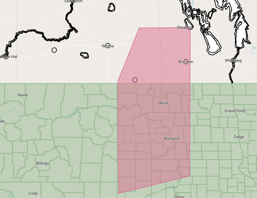
Tornado Watch for...
North Dakota Portions of South Dakota
North Western portions of Minnesota Extreme South Eastern portions of Alberta, south central Manitoba and Extreme Western portions of Ontario. View more here..https://t.co/KIevgL78Wd
Tornado Watch for..
Southern Central Nebraska
Northern Central Kansas
Until 9pm MDT. Primary threats include...
Scattered damaging wind gusts up to 80 mph possible
Scattered large hail and isolated very large hail events to 4inches in diameter likely A couple tornados
Severe Thunderstorm Watch for...Eastern North Dakota Western Minnesota and south central Manitoba Until 1 am CDT. ...THIS IS A PARTICULARLY DANGEROUS SITUATION...Primary threats include... Scattered damaging wind gusts up to 100mph possible Scattered large hail events to 2 inches
Severe Thunderstorm Watch for. Until 11 PM CDT. ...THIS IS A PARTICULARLY DANGEROUS SITUATION... Primary threats include... Scattered damaging wind gusts up to 100 mph possible Scattered large hail events to 3.5 inches in diameter possible A Intense tornado or two
Severe Thunderstorm Watch for. Until 11 PM CDT. ...THIS IS A PARTICULARLY DANGEROUS SITUATION... Primary threats include... Scattered damaging wind gusts up to 100 mph possible Scattered large hail events to 3.5 inches in diameter possible A Intense tornado or two