Field guides to the Ozarks : exploring karst, ore, trace fossils, and orogenesis / edited by Charles W. Rovey, Matthew P. McKay. The Geological Society of America, 2024. #geology#Missouri#ozarks#karst#paleontology
Laramide high angle fault crosscutting Permian and Triassic sediments, and unconformably overlain by the 1.3 My Bandelier tuff that formed Valles Caldera. New Mexico.
Mapa geológico generalizado del Departamento del Cauca : escala 1:350.000. República de Colombia, Ministerio de Minas y Energía, Instituto Nacional de Investigaciones Geológico-Mineras, Oficina Regional Popayan, 1979. 93 x 68 cm. #maps#cartography#cauca#colombia
Any geoscience/hydrology scientific illustrators out there? Might have funding to help me build educational content for the citizens of New Mexico all about water resources! DM me if interested!
Check out the hairpin turns in the Uraricoera and Takutu rivers in the northern Amazonian state of Roraima. These rivers formerly drained north into Guyana and now drain south into the Branco and then Negro rivers.
Pedro Val (@topoerosion) liked studying geology. But when he learned about how tectonic activity can change the flow of rivers, he “didn’t want to know about anything else.” @theAGU
https://t.co/g1UVQ2wwDI
Read more in our August career issue: https://t.co/YJ9MEw4g1k
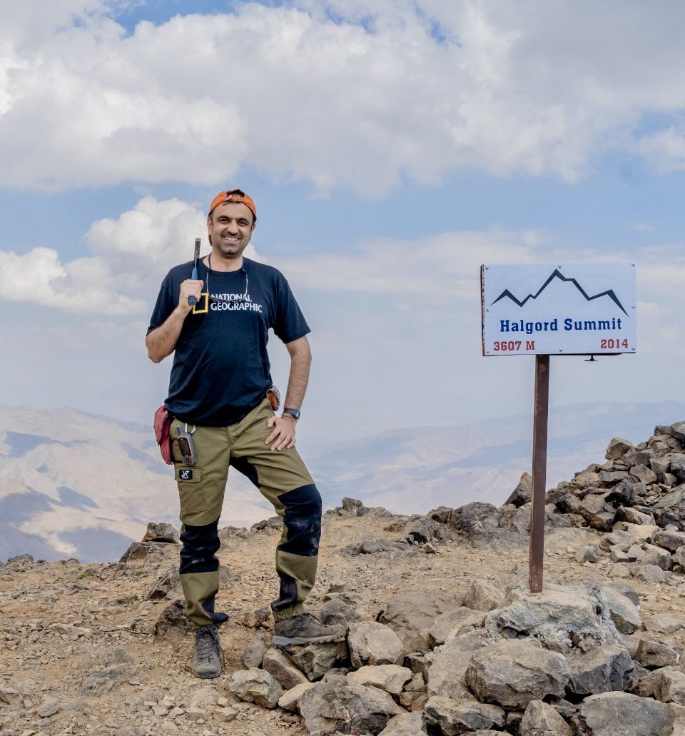
Halgurd mountain (3607 m; 11834 ft) a stacking pile of pillow lava basalts! Once upon a time a newly formed Neotethys oceanic crust between the Eurasian plate and the Arabian plate, now the highest peak of the Zagros mountain range in the Kurdistan region of Iraq! @InsideNatGeo
River drainage networks of England show the effects of both tectonics and erosion, with many smaller basins draining to the periphery, but the development of some larger interior basins by river capture, as in the Trent and Severn basins.
Also environmental conditions in the past. Nothing in the Amazon makes sense except in light of the Pebas megawetlands that covered over 1 million sq km from 22-10 million years ago.
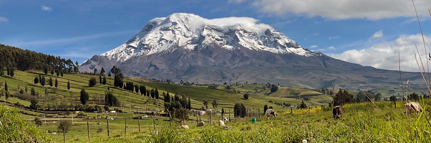
"Ecuadorians are strange and unique beings, they sleep peacefully amid smoking volcanos, they live in poverty amid incomparable wealth, and they cheer up with sad music." A. von Humboldt.
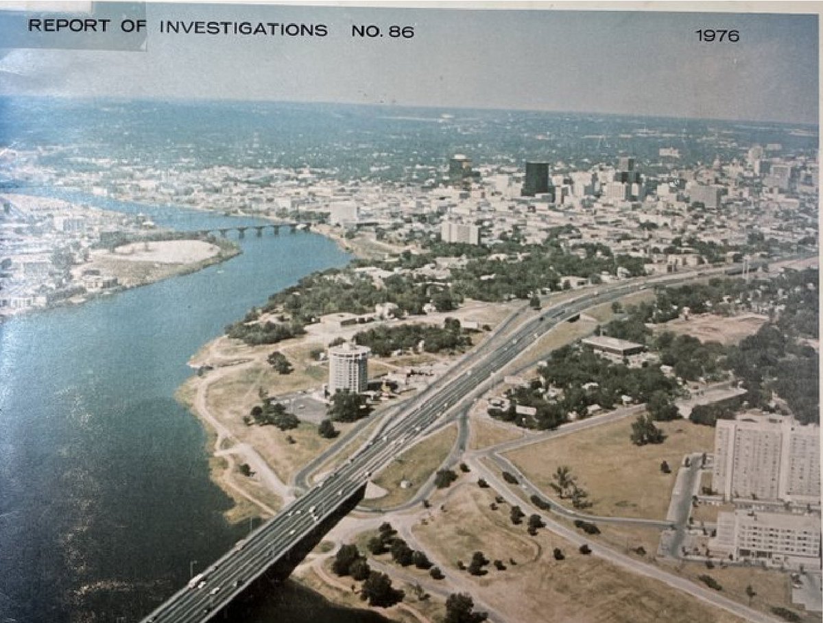
Growth of downtown Austin Texas over ~50 yrs: rough image comparison 1976 vs. 2023 (attempting to match bridges over Lady Bird (Town) Lake = the dammed TX Colorado River). Disclaimer: there is more I-35 traffic than depicted in GoogleEarth #austin#atx
https://t.co/DYKXyh9zVE
Meanwhile, in 1976... what a view!
Environmental geology of the Austin area : an aid to urban planning. L.E. Garner, K.P. Young. Bureau of Economic Geology University of Texas at Austin. 1976. #austin#urbanplanning#geology#atx#aerialphotography#1970s
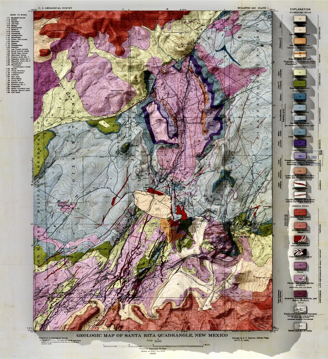
Nice example of Sub-Cretaceous (K) Unconformity in New Mexico: K Beartooth SS shows variable subcrop relationships, highlighting pre-K regional tilting & erosional beveling. S. Cather 2012 NM Geo Soc Guidebook https://t.co/oZEB3WlZDI