ARE's Safety Coordinator and UAS Pilot, Lindsey Mitchell, attended the @NUAIRAlliance 2019 New York UAS Symposium earlier this week. The symposium brought in over 300 participants giving the UAS community an opportunity to network with fellow UAS industry leaders.
#Drone#UAV
Check out our latest blog! In the UAS industry, when it comes to LiDAR and photogrammetry, it’s important to know the differences and utilization of both data collection methods.
https://t.co/ISnKMYGmG3
#datacollection#gis#civilengineering#engineering#drones#lidar
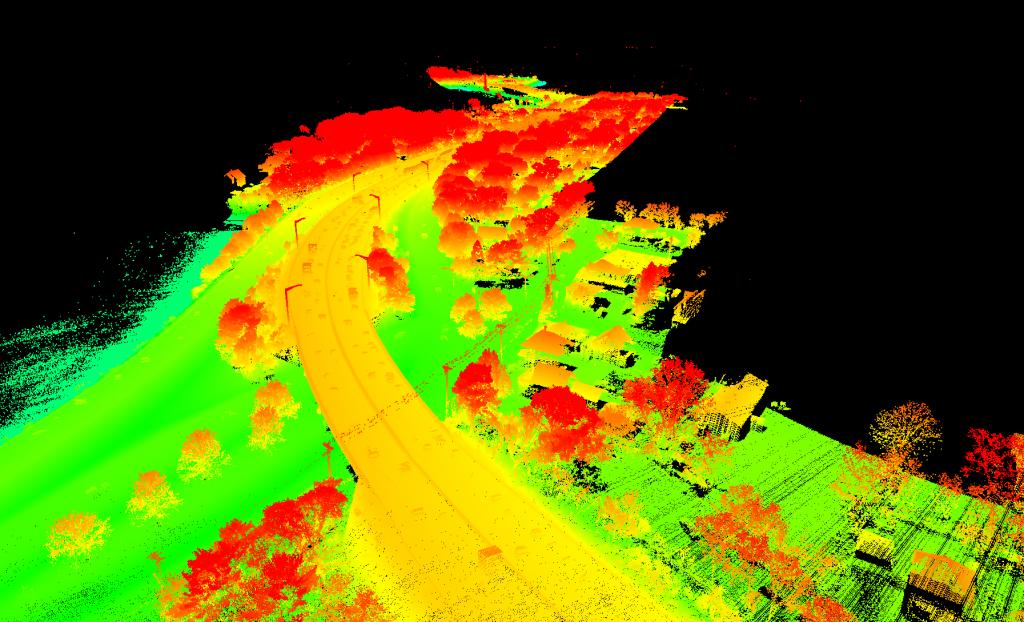
ARE delivers precise data with a quick turnaround time after data collection.
The colorized LiDAR point cloud below was processed and delivered within a week. The information was used by the campsite for design purposes.
https://t.co/yugDx95bnU
#Engineer#UAS#UAV#Drone
𝗖𝗢𝗠𝗘 𝗦𝗘𝗘 𝗧𝗛𝗘 𝗔𝗥𝗘-𝗔𝗜𝗥𝗦𝗛𝗔𝗥𝗞 𝗧𝗘𝗖𝗛𝗡𝗜𝗖𝗔𝗟 𝗣𝗥𝗘𝗦𝗘𝗡𝗧𝗔𝗧𝗜𝗢𝗡 𝗔𝗧 𝗔𝗥𝗘𝗠𝗔 𝗜𝗡 𝗠𝗜𝗡𝗡𝗘𝗔𝗣𝗢𝗟𝗜𝗦!!!
The presentation at @AREMArail is on Tuesday, September 24th at 4 pm.
#Bridge#UAS#AREMA#AREMA2019
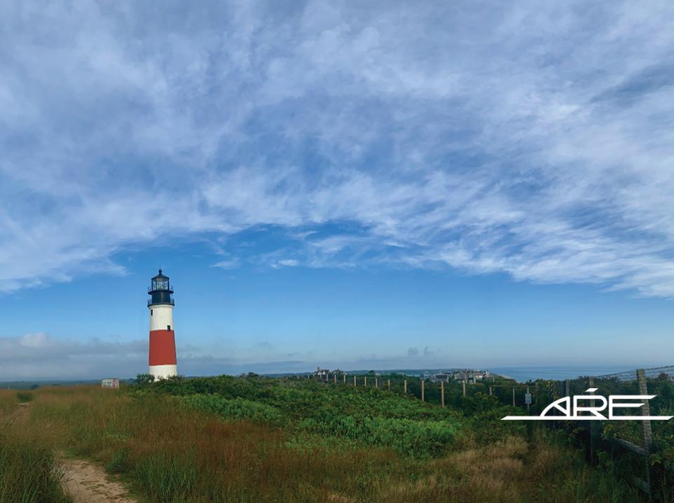
Our pilots are currently in Nantucket conducting a recurring beach erosion monitoring project, partnered with @WoodsHoleGroup, mapping 6 miles of coastline at Siasconset Beach to deliver a LiDAR scan, video and image documentation.
#monitoring#coastal#UAS
Dave Anderson, CEO of ARE Corporation: "I am proud of how ARE staff continually improves our processes to add value to our customers. This improvement comes from a culture that we collectively have developed that empowers ingenuity."
https://t.co/S8Zx1vSn6g
#CEO#datacollection
ARE provides UAS LiDAR data collection, processing, and customized deliverables for our clients. Watch the video of a classified drone LiDAR point cloud that ARE collected and processed for our utility client to help them better manage their inventories.
#classified#drone#UAS
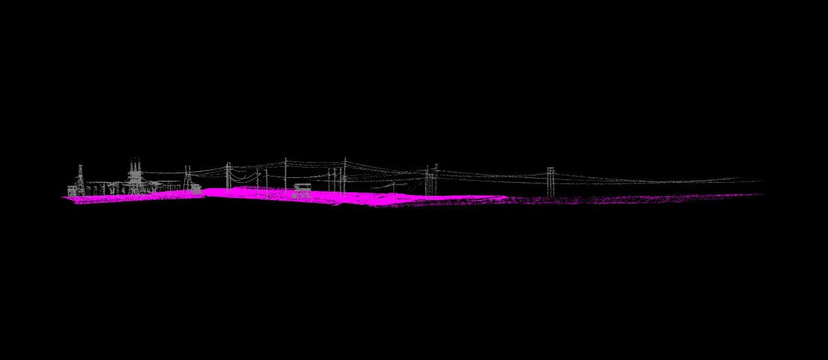
Recently, the ARE UAS flight team flew aerial LiDAR of a 12-mile transmission line ROW in Maine. Below is a classified point cloud generated from the project classifying the ground, transmission line, and substations to help the client manage their inventory.
#UAS#Classified
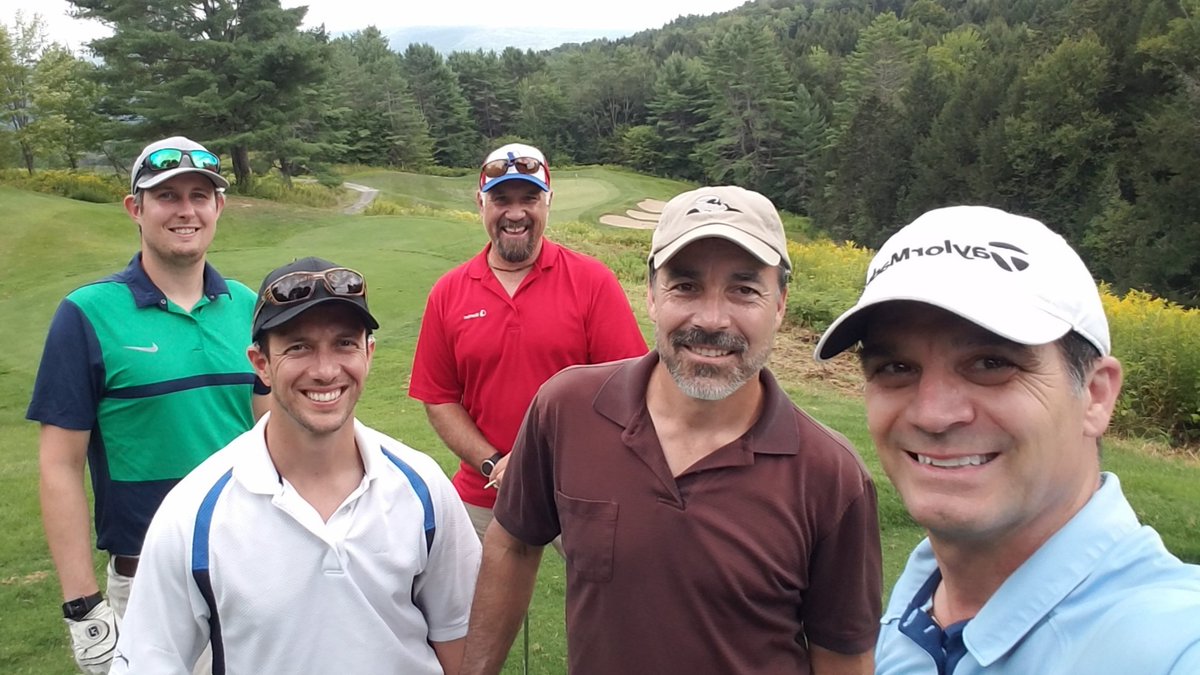
ARE was a Silver Sponsor at the 23rd Annual @fandoinc
Golf Tournament at the Pembroke Pines Golf Club in New Hampshire! Our EVP, Steven Youschak, and his team had a great time supporting this important client.
#drone#team#silversponsor#newhorizons#Engineering
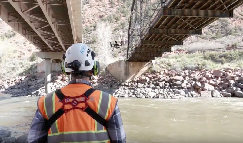
ARE engineers recently performed construction oversight at a railroad bridge pictured below. The project removed unwanted secondary stresses in the truss and floor system and alleviated the need to make track structure adjustments caused by the settlement.
https://t.co/bNlwnakkUz
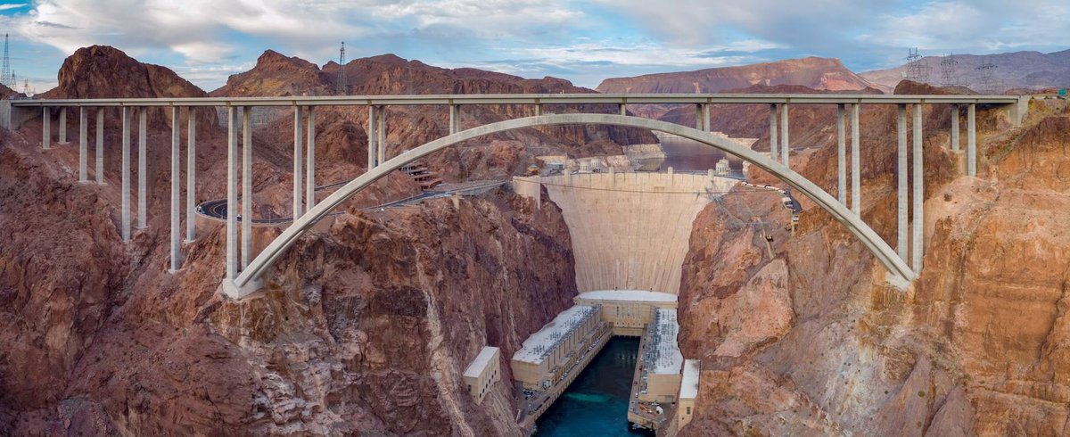
ARE UAS team recently assisted a bridge inspection of the Mike O'Callaghan–Pat Tillman Memorial Bridge, the world's highest concrete arch bridge standing at a height of 886 feet and a length of 1,900 feet with @Stantec.
https://t.co/1Ui49LEkXL…
#Engineer#UAS#UAV#Drone
We monitor high impact coastal zones on a biannual or yearly basis to provide stakeholders with up-to-date actionable information, digital terrain models, and contour maps to compare coastal change over time.
Read Case Study Here: https://t.co/OjF7wglr4P
#Engineer#UAS#Drone
ARE has provided UAS LiDAR scans, data processing, and point cloud classifying for: Utility Right-of-Way Planning, Vegetation Management, Environmental Monitoring, Site Planning and more.
https://t.co/3vpYamJ9Rx
#LiDAR#dronespace#dronenature#droneglobe#dronevideography#drone