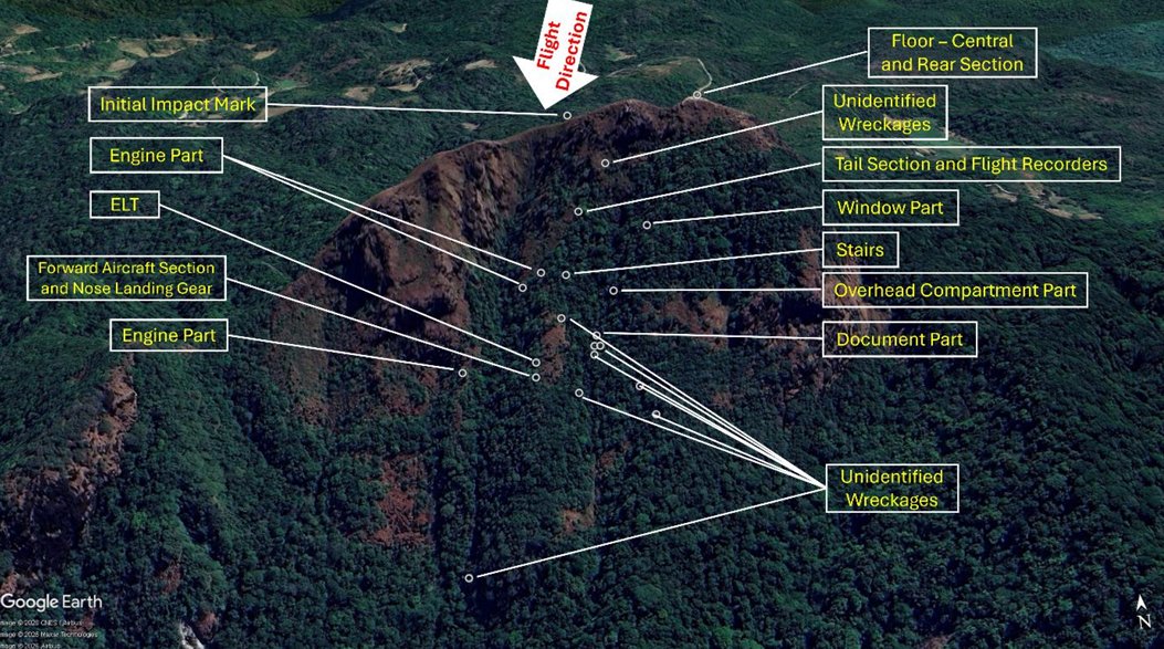
Report: The ATR 42-512 that crashed into terrain while on approach to Makassar-Sultan Hasanuddin International Airport in January flew with degraded GPS accuracy, a situation where the pilots should not have navigated the aircraft using the satellite system.
In the preliminary report published by Indonesian authorities, after engine start the FDR recorded the parameter of the GNSS HT1000 as "Degrade", which means that the GPS accuracy or integrity was compromised. A DGR amber alarm would have been displayed on the Electronic Horizontal Situation Indicator (EHSI) – a display in the cockpit that can be used by the pilot to indicate the aircraft position. As the flight continued to Makassar, the distance between the actual position of the aircraft and the one reported by the GPS increased to 15 NM.
The aircraft’s EGPWS generated aural alerts ���TERRAIN - TERRAIN” followed by “PULL UP” four times, moments before impacting the terrain. The CVR stopped recording soon after the EGPWS warnings.
The ATR FCOM requires pilots to perform several actions during cockpit preparations, including checking the aircraft GPS/GNSS. In the event that a DGR alarm display is identified the pilot must cross check the aircraft position using conventional means or revert to an alternative means of navigation.
@piokharisma#setorfoto
Kebetulan yang kebetulan, momen erupsi Gn. Lewotobi Laki-Laki 17 Juni 2025 dari bandara Frans Seda Maumere
Ditangkap dengan #withGalaxy S20 5G
I just obtained a new skin Symbol of Valor in Mobile Legends: Bang Bang! Let's face off against the world's best MOBA players together!
https://t.co/TyKPFmaNzI