🌊 AZ NavTeq launches Online Flood Maps of Pakistan 2025 🌍 Using hyperspectral & SAR satellite data, the app maps real-time & historical floods with Google Maps integration—supporting NGOs & govt in disaster response. 📩 [email protected]#FloodMapping
https://t.co/ZFwwbXtC5O
Are you a decision maker ready to solve big problems smarter? #Geo-intelligence is key to boosting productivity and tackling modern challenges. It's time to shift strategically and lead the change.
https://t.co/T8lmyeJQLG
Wishing you a joyous and blessed #Eid Al Adha from your trusted geospatial business partner, AZ NavTeq. May this special occasion bring you peace, happiness, and prosperity.
AZ NavTeq used Landsat 7, Sentinel-2 & Google Earth (1998–2020) to track erosion along Sindh Delta 🌍. Sea intrusion threatens centuries-old communities. Green areas show erosion! 📸 #GIS#RemoteSensing#CoastalErosion#SindhDelta#AZNavTeq
��� Turn your GIS data into instant insight with ArcGIS Dashboards.
AZ NavTeq builds custom dashboards to help you visualize & act—fast.
https://t.co/j4yUWGrRjq
#GIS #ArcGIS #AZNavTeq #DataViz
🚀 Are you getting the most out of your geospatial data? An experienced consulting firm like AZ NavTeq ensures accuracy, efficiency, and smarter decision-making. Discover why expertise matters in our latest blog! 🔗 [Read more](https://t.co/5xdesz8dCN) #Geospatial#DataDriven
🌐 Exciting News! 🌐 We’re thrilled to unveil AZNavTeq’s revamped website – https://t.co/hx6qDcMTeC! Experience an enhanced, user-centered interface with a clean design, mobile-friendly access, and clearer content on our GNSS & Geospatial services. #AZNavTeq#Innovation
Transform your projects with drone-based topographic surveys! AZ NavTeq delivers accurate, authentic data for construction, land development, and more. Trust us for precision! #AZNavTeq
https://t.co/Kf0D41fCiu
Transform complex data with #ArcGIS#Dashboards! 🌍📊 Make informed decisions in real-time. Learn more about our solutions with AZ NavTeq: https://t.co/54BGTaIm2m #GIS#DataVisualization
Wishing you a joyous and blessed Eid ul Adha from all of us at AZ NavTeq! May this festive season bring you and your loved ones peace, happiness, and prosperity. Eid Mubarak!
AZ NavTeq, your geospatial business partner.
Exciting news! 🌟 Learn how volume estimation is vital for cement industry asset management. Our latest blog covers accurate volume calculations on inclined base planes using dip-strike data from geologists.🏗️
https://t.co/PiLbxrKI1v
#CementIndustry#GIS#DroneTechnology
Drone-based geospatial mapping is revolutionizing site understanding. At AZ NavTeq, we create detailed 3D digital twins that allow clients to walk through sites virtually and make informed decisions. Connect at [email protected] for more details.
https://t.co/smNnReUbay
Eid Mubarak from AZ NavTeq! ✨
Wishing you & your loved ones a joyous Eid filled with peace & blessings. May your journeys be safe & guided by celebration.
#EidMubarak#AZNavTeq#EidAlFitr (238 characters)
From AZ NavTeq, we wish all our colleagues, clients, and partners a blessed Ramadan Mubarak! May this holy month bring you peace, prosperity, and spiritual reflection. #RamadanMubarak#AZNavTeq#GeospatialConsulting
AZ NavTeq joins ACEP, Pakistan's top consulting engineer association! This strengthens our commitment to excellence & innovation. We're excited to collaborate & deliver even more for our clients! #AZNavTeq#ACEP#Engineering
Boost your tax revenue with the power of maps! ️
Uncover hidden insights and optimize collection efforts with interactive GIS dashboards.
Watch our new video https://t.co/y2AoZ25zHj
➡️ Learn how to visualize key metrics, identify hotspots, and increase compliance.
#aznavteq
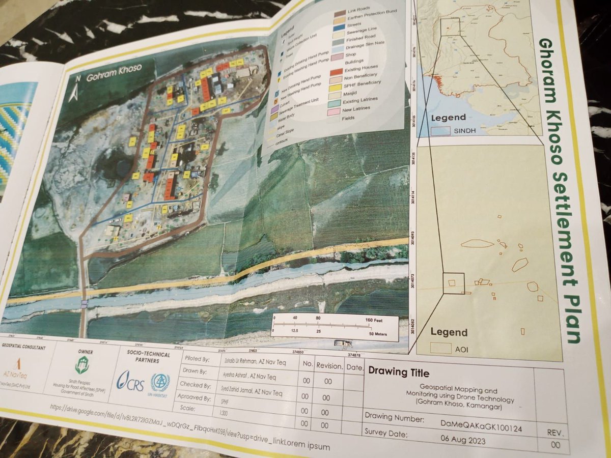
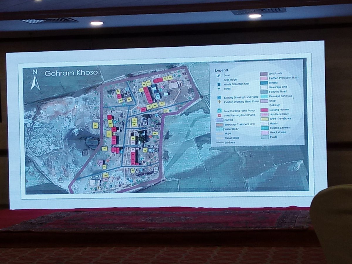
🌐 Proud to contribute to SHRRP's Climate-Resilient Settlement Plan post-2022 Sindh floods. AZ NavTeq integrates socio-economic data with GIS, ensuring precise insights for long-term resilience. Grateful for the opportunity to make a positive impact in Sindh. 🌍 #AZNavTeq
🌐 Explore the Evolution of Surveying & Mapping with Drone-Based Photogrammetry in our latest blog. From precision to reduced logistics, discover the transformative advantages. 🚀🗺️ Read now: https://t.co/CwoScJD3P3 #Surveying#Mapping#DroneTech#AZNavTeqInsights