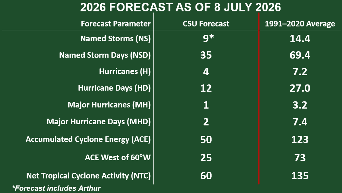
CSU reduces forecast for 2026 Atlantic #hurricane season and now calls for well below-normal activity: 9 named storms, 4 hurricanes & 1 major hurricane. High likelihood of strong #ElNino and associated increase in vertical wind shear the primary factor:
https://t.co/fAwk9hWVVK
@NTE_Ani_Info NTE Version 1.2 is now live~ Earn up to Annulith x940 by becoming an Eibon Partner! Visit the event page: https://t.co/LixwGSTCjH, enter invite code: BHYY283B5, and return to Hethereau today!
🌀 Over the next couple of weeks, the central Pacific may see an uptick in tropical activity, driven by El Niño and MJO forcing.
🌀 Models over the next 15 days depict an axis of anomalous vorticity (spin) south of #Hawaii as westerly surface wind anomalies envelope the deep tropics.
🌀 Concurrently, ridging near or northeast of Hawaii in Week 2 is expected to generate lower than average wind shear across much of the central Pacific, potentially lowering the shear curtain that so often suffocates tropical development in this part of the world.
The @NHC_Pacific is already monitoring one disturbance for possible development this week, and there will likely be others throughout mid to late July.
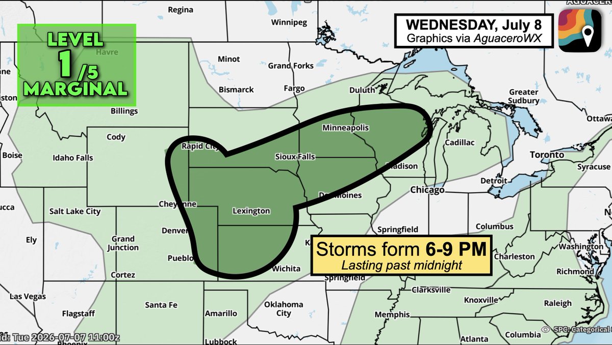
WEDNESDAY, July 8 will feature a risk zone for storms across parts of the Plains and Upper Midwest. Things look to get wet overnight, potentially lingering into Thursday morning.
A cold front will impinge upon a humid, moisture-rich airmass, causing scattered thunderstorms to form between 6 and 9 PM, coinciding with peak daytime heating.
Storms may eventually merge into a line. There's not much jet stream wind energy blowing overhead, keeping the severe weather risk marginal. Only scattered gusts of 50-60 mph are likely.
That said, locally heavy rainfall is probable. Storms will sag southward overnight before dissipating into Thursday morning.
@devouring_gods@Audjuice9989@Pirat_Nation Is a super easy topic to look for and not that deep to understand. I just said to inform yourself better and this is your response.
Because it seems to trigger you so well, here i'll go again: 🤓