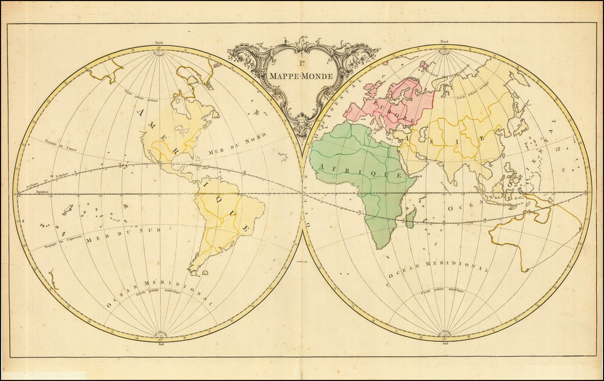
This world map is simple for a reason: it is made to teach geography, part of a series in Jean Palairet’s Atlas méthodique, composé pour l'usage de son altesse sérénissime Monseigneur le Prince d'Orange et de Nassau (1755).
Learn more here: https://t.co/QeEnGRWwim
#maps
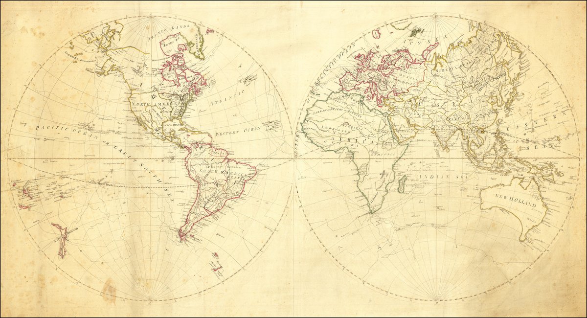
This is a hand-drawn world map, based on Samuel Dunn's ca. 1781 work, and was likely made as part of a geography lesson.
Learn more here: https://t.co/LNhlX6R7dZ
#maps#mapsbyhand
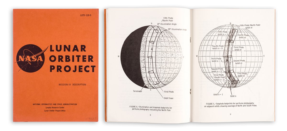
For some Friday fun, here is a fascinating booklet (1967) detailing the plans for Mission IV of the Lunar orbiter program, which sought to provide the most complete imaging of the moon to date.
Learn more here: https://t.co/iK5lJRQfRZ
#maps#moon#moonmaps
This is a rare, large sea chart of South East Asia by Jean-Baptiste-Nicolas-Denis d'Après de Mannevillette, with engraving by the master engraver Guillaume Dheulland.
Zoom in here: https://t.co/WLw71HhZ9P
#maps
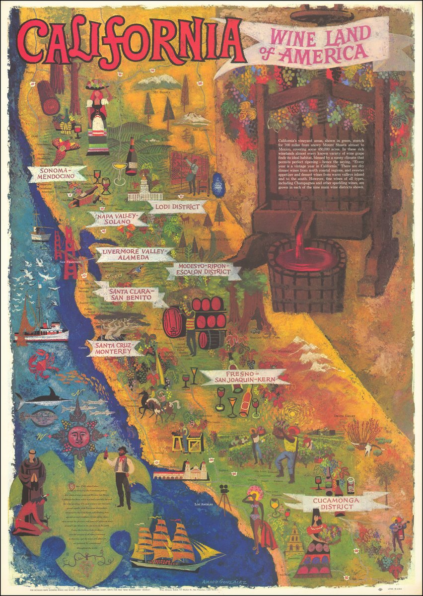
California wine, anyone? This is a promotional map made by Amado Gonzales on behalf of the Wine Advisory Board.
Zoom in on your favorite wine region here: https://t.co/paYOigLxj9
#maps#California#Californiawine
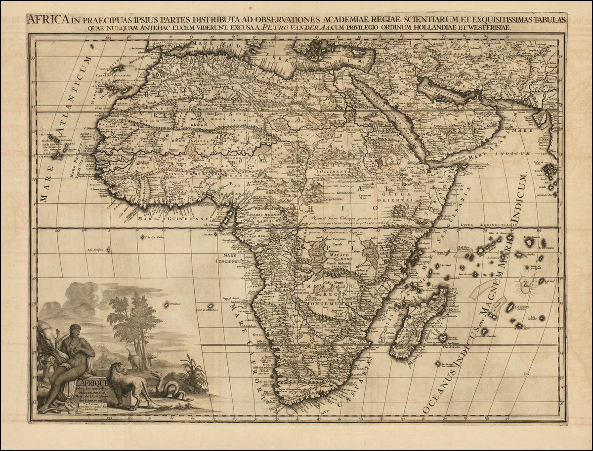
How to map Africa was an issue of enduring interest for European mapmakers. This is Peter van der Aa's attempt from 1713.
See more details here: https://t.co/efqcWx10XO
#Africa#maps
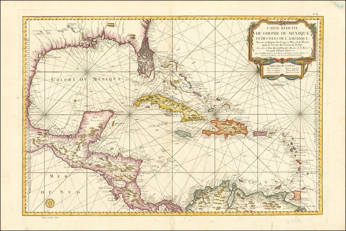
Florida as you've never seen it before! This is a Depot de la Marine chart of the Caribbean from ca. 1773.
Learn more here: https://t.co/28KU6jAcSL
#maps#Caribbean#Florida
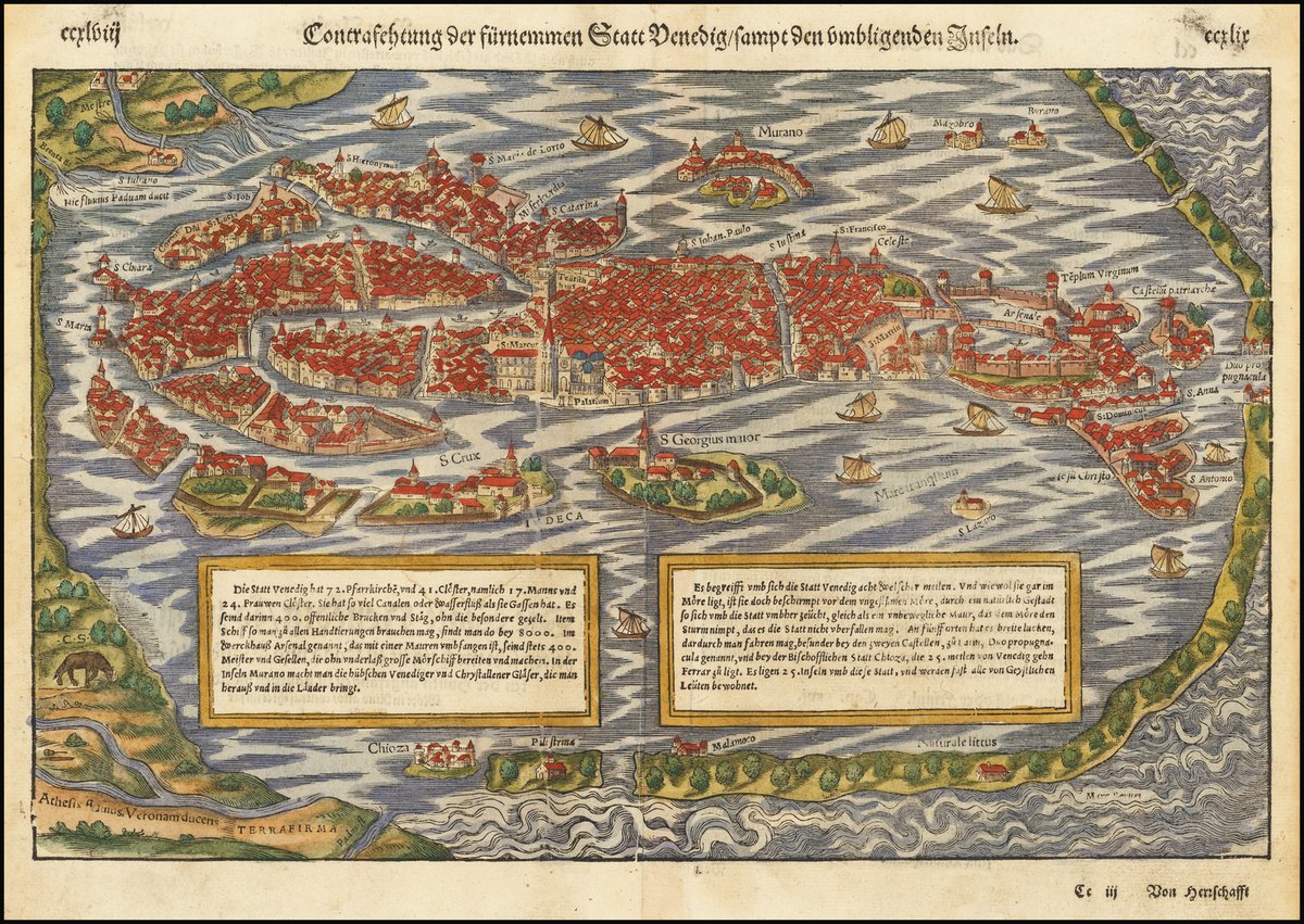
Venice always looks good, and this Munster view of the city (ca. 1550) is no exception!
Zoom in on each building here: https://t.co/YTSydeLrKT
#maps#Venice
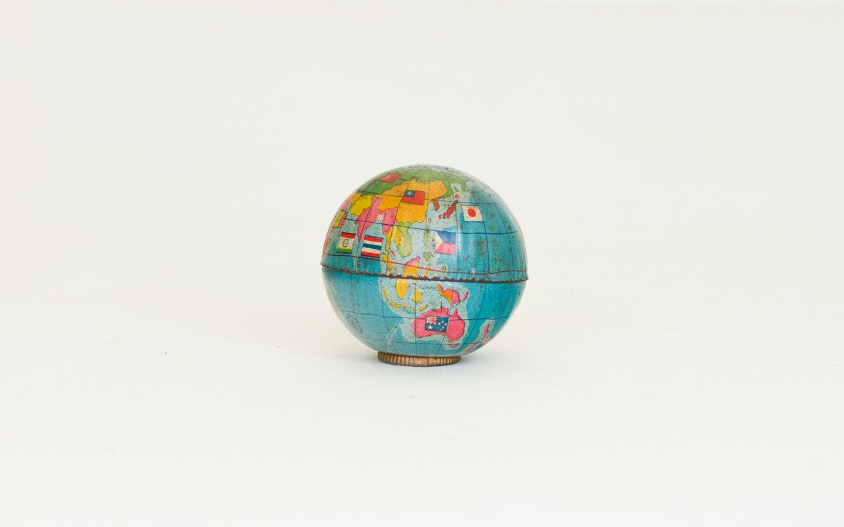
Something fun for your Friday! This is a globe pencil sharpener from Japan (ca. 1935).
See it in action here: https://t.co/OmIePBeter
#maps#globe#wholeworldinyourhand
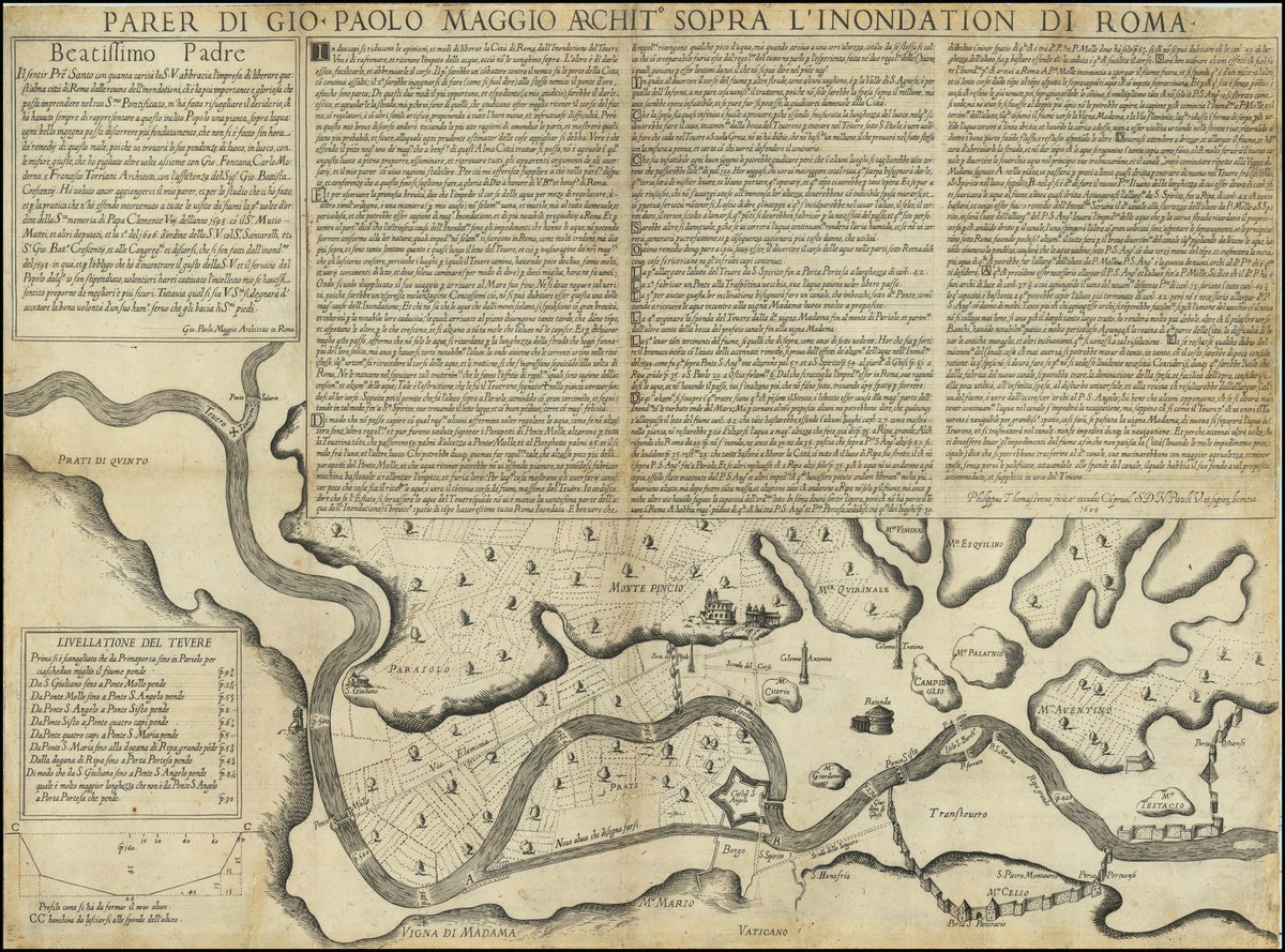
This is Giovanni Paolo Maggio's extremely rare map addressing the flood control problems faced by Rome and its environs (1608).
Find out more about flood prevention, and maps, here: https://t.co/oeuahrNnhL
#maps#floods#Rome
You can map all sorts of things. This map shows the ducks, eiders, and mergansers of North America (1937).
Find the locale of your favorite feathered friend here: https://t.co/NQsJWTb6XX
#maps#ducks#birdsofafeather
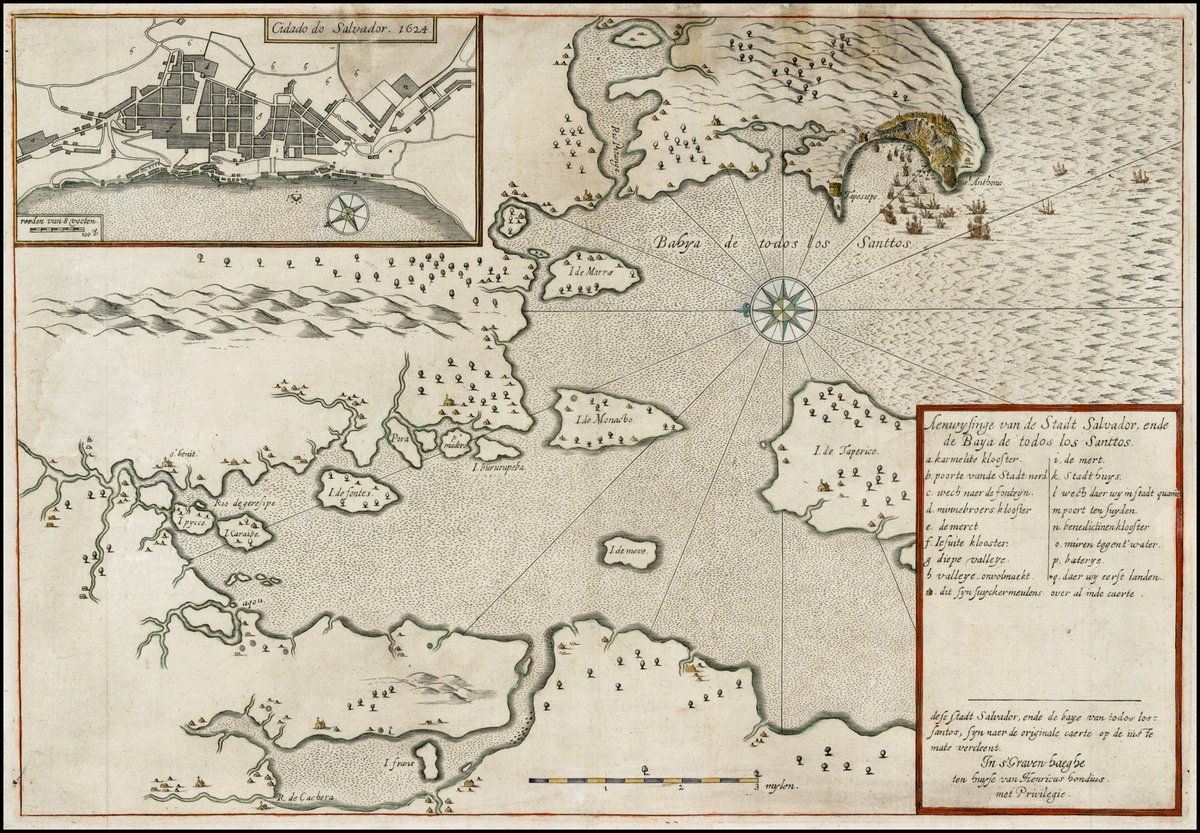
This Hondius map of Bahia de los Todos Santos, Brazil depicts the taking of Salvador by the Dutch in 1624.
Learn more here: https://t.co/vzwOl4ZLTU
#maps#Brazil
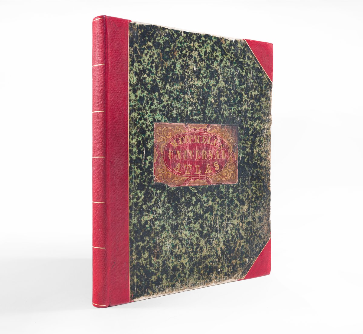
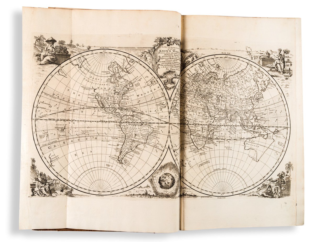
For Sunday, flip through the pages of Samuel August Mitchell's New Universal Atlas (1855).
Click here to access the contents: https://t.co/F2BYjVbolJ
#maps#atlas
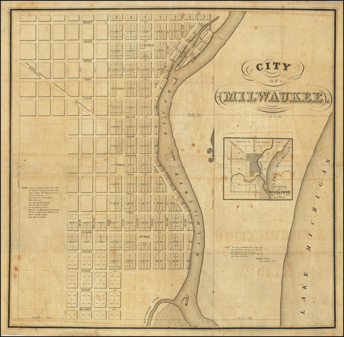
Enjoy the first printed map of Milwaukee, Wisconsin, executed by Increase Lapham and Byron Kilbourn in 1835-36, and engraved by W. Haviland in Cincinnati in 1836.
Learn more here: https://t.co/Jq8DUj298J
#maps#Milwaukee
Here's an atlas for your weekend, Bowen's massive Complete Geography (1747), to be exact.
Flip through a few pages here: https://t.co/wOOfQJwZNk
#maps#atlas
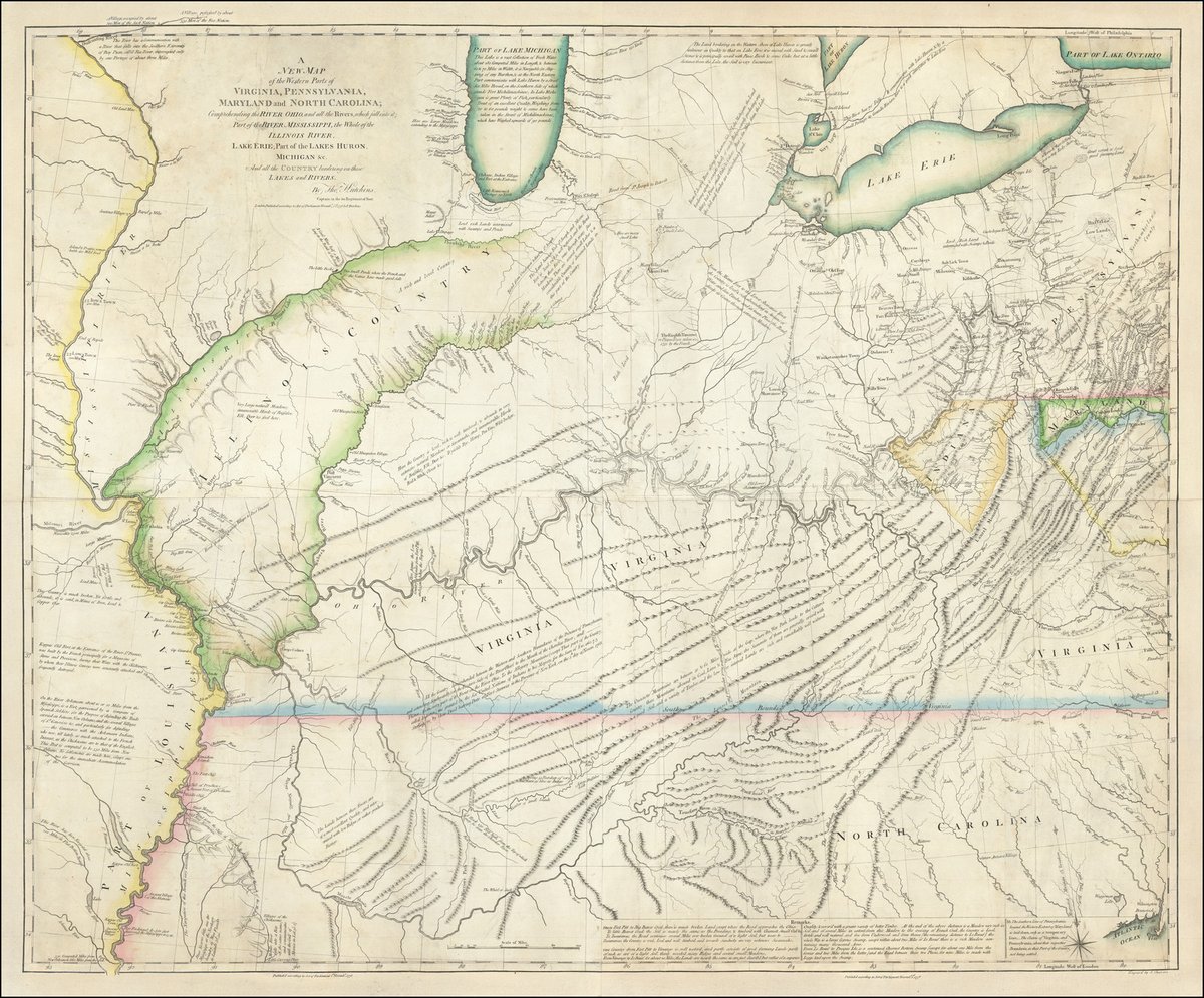
Hutchins' map (1778) of the area between the Appalachians and the Mississippi River was hugely important for American expansion westward.
Find out how here: https://t.co/28EpVO5bJl
#maps
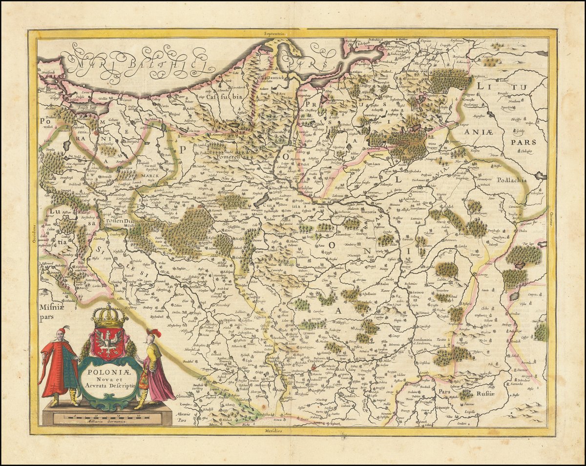
Oh hey, it's Poland. This is Jansson's map of Poland and parts of Lithuania, Pomerania and Prussia (ca. 1638).
Learn more here: https://t.co/VF7HJj5NF5
#maps#Poland
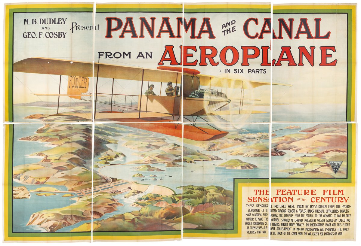
Take to the skies with this poster from the1914 silent film Panama and the Canal from an Aeroplane.
Learn more here: https://t.co/zemnwmY4AC
#morethanmaps#airplanehistory#filmhistory