If you're on the Wasatch Front, you probably noticed a large pryocumulus cloud develop over a prescribed fire! Here's a timelapse of the plume development and a display of the instability in place over northern Utah #utwx
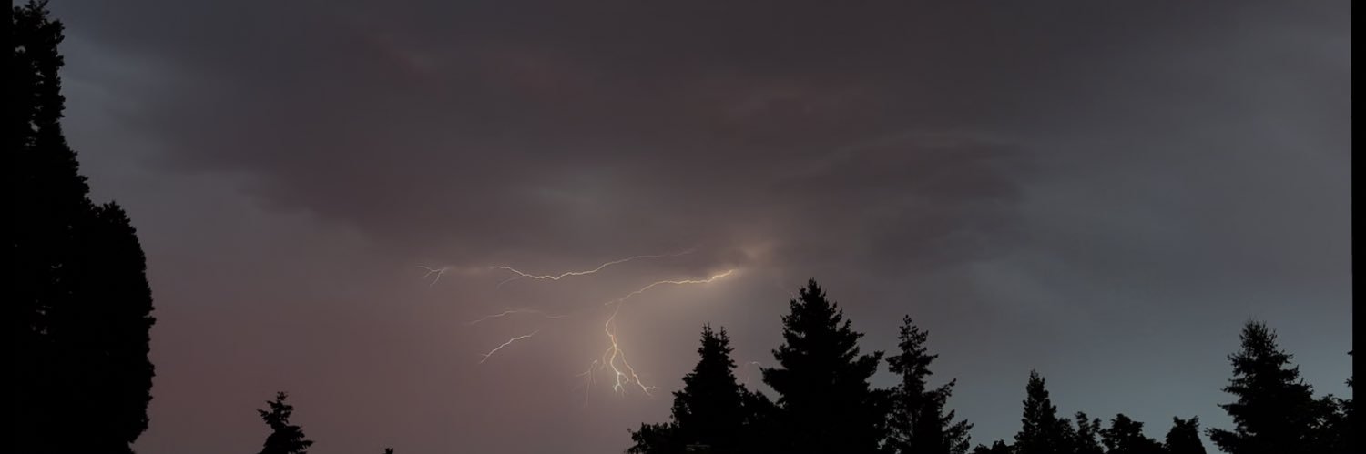
One of the most insane thunderstorm I’ve ever seen just rolled through Davis, California.
Local weather stations recorded nearly 0.50” of rain in 5 minutes. Temperature dropped over 20 degrees down from 70s to high 40s.
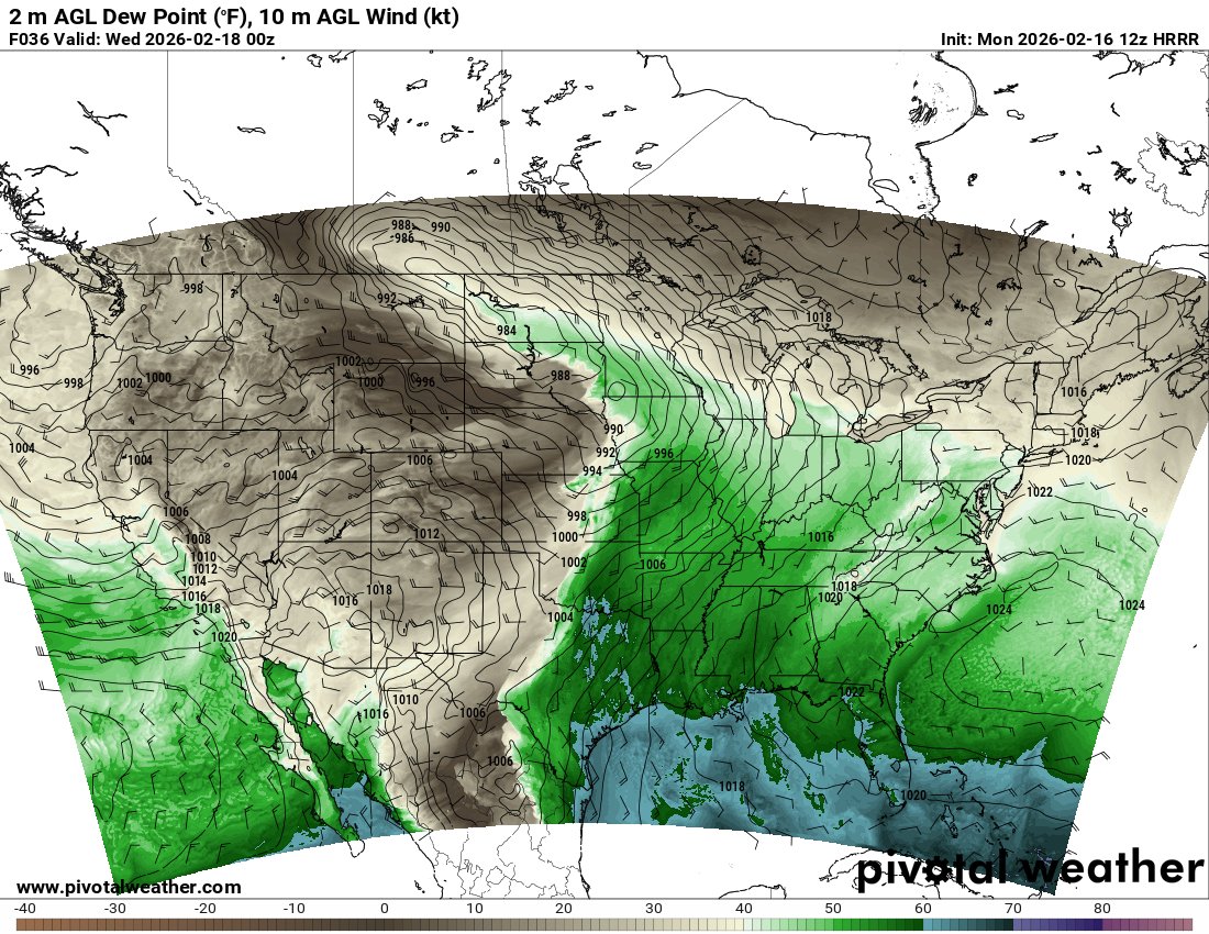
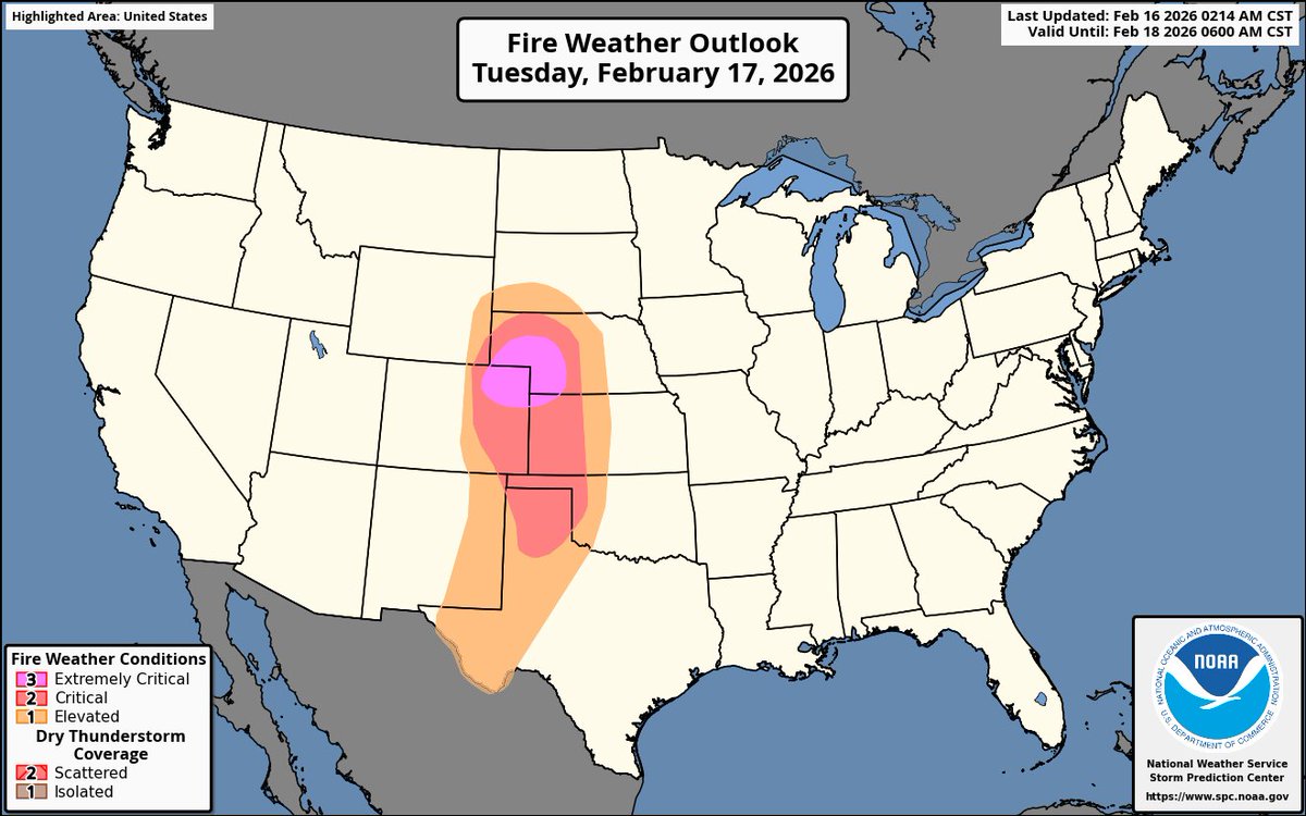
Extremely favorable fire conditions will exist in parts of CO, NE, and KS tomorrow. The SPC has issued an Extremely Critical fire risk tomorrow in these areas (pink) along with a wide area of Critical fire danger tomorrow. Very dry dewpoints with strong winds at the surface is a recipe for disaster.
Basic Weather Awareness should be mandatory teaching in every public school
We have kids memorizing the periodic table of elements while not knowing the effects of freezing rain
Unbelievable. This would be a terrible blow to American science, writ large. It would decimate not only climate research, but also the kind of weather, wildfire, & disaster research underpinning half a century of progress in prediction, early warning, & increased resilience.
Sacramento International Airport hasn’t risen above 46°F for more than 190 hours.
The last time the Sacramento area experienced a full week of daily max temperatures this low was over 30 years ago.
A seemingly endless stretch of low clouds and sunless days continues in California's Central Valley.