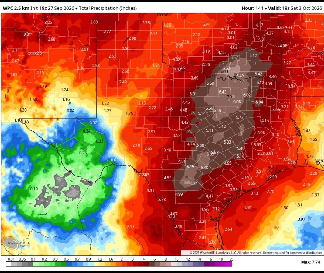
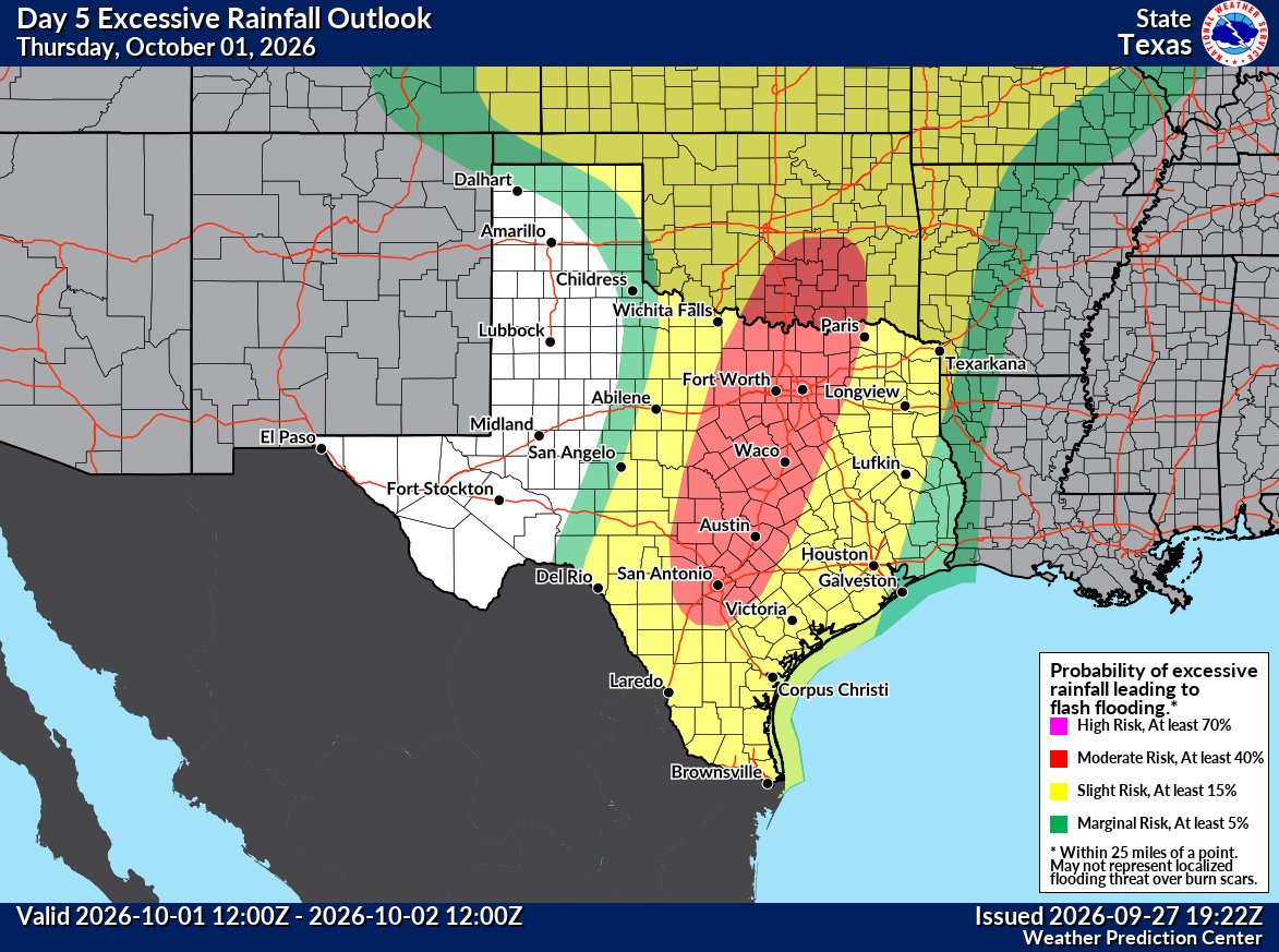
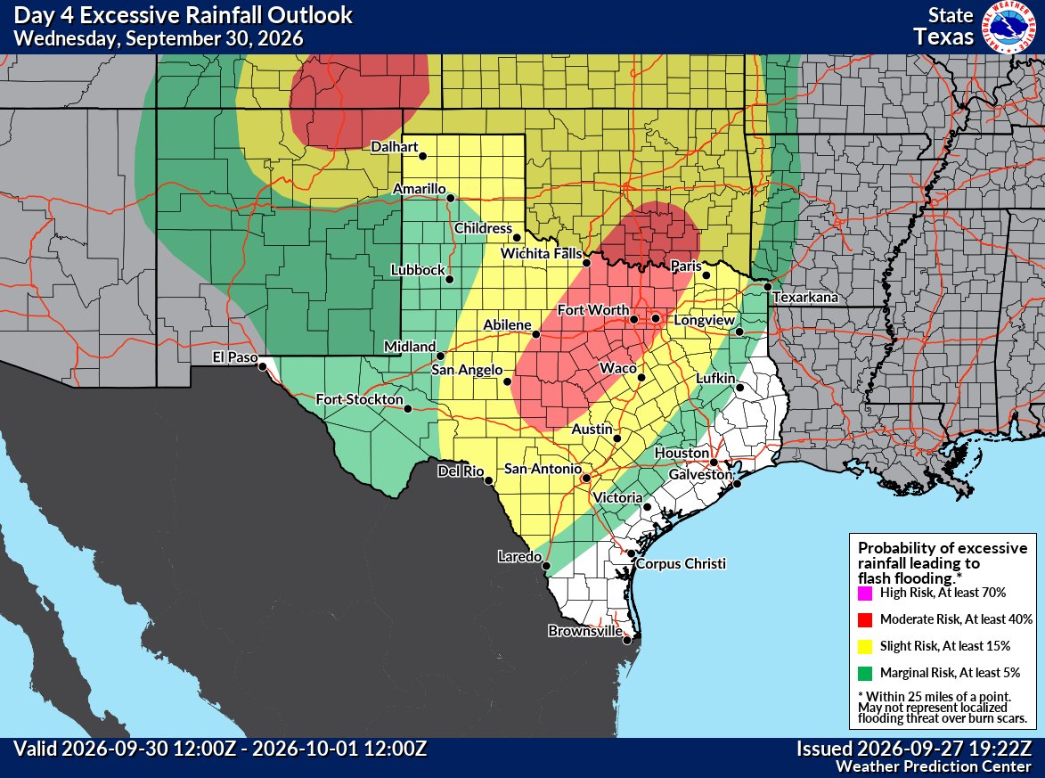
The WPC has upgraded parts of north and central Texas to a moderate risk for excessive rainfall on Wednesday and Thursday. This includes cities like Dallas-Fort Worth, Waco, Austin and San Antonio. Significant flooding is likely next week, start your preparations!
#txwx#dfwwx
@DFWStormChasing I don’t usually put BBQ sauce on it unless it’s dry. If anyone has had barbecue outside of Texas and thinks it’s real doesn’t know what real barbecue is
Here is the precipitable water % of normal animation for the next week. The higher the PWAT (precipitable water), the more moisture is present in the atmosphere to produce heavy amounts of rain. PWAT values greater than 150% of normal this time of year is indicative of a tropical airmass. Pushing PWAT values over 200% of normal means BIG rain potential will exist within the main plume. This is an impressive moisture signal, but the important details of how the main upper-level trough absorbs hurricane #Polo won't be determined for a bit... Just recognize the pattern and the potential, and pay attention https://t.co/OtoADNBm2S #desertfarmers #cowx #kswx #newx #okwx #txwx #nmwx
Okay so here's the overview- Front 1 (Oct 1) will be the remnants of Hurricane Polo, storms look likely and cools us down into the 80's.
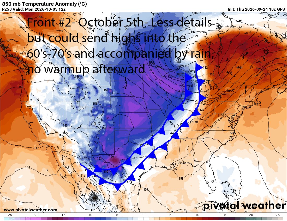
Front 2 (~Oct 5) Will be the big guns, it has the potential to send us into the 60-70's for highs and no warmup in sight AT ALL afterward!
A more active pattern will return to the Central and Southern Plains next week, bringing increasing chances that we'll see the season's first true cold front across the region. Stay up to date with the latest forecast at https://t.co/s9JpN9yVKL. #txwx#dfwwx#ctxwx#texomawx
@scr0sX@EjHass Honestly atp I kind of want it to keep going just to see how long it can go on for. The DFW measurements also don’t account for everyone in the metro. I think the last time I truly got rain was almost 30 days ago