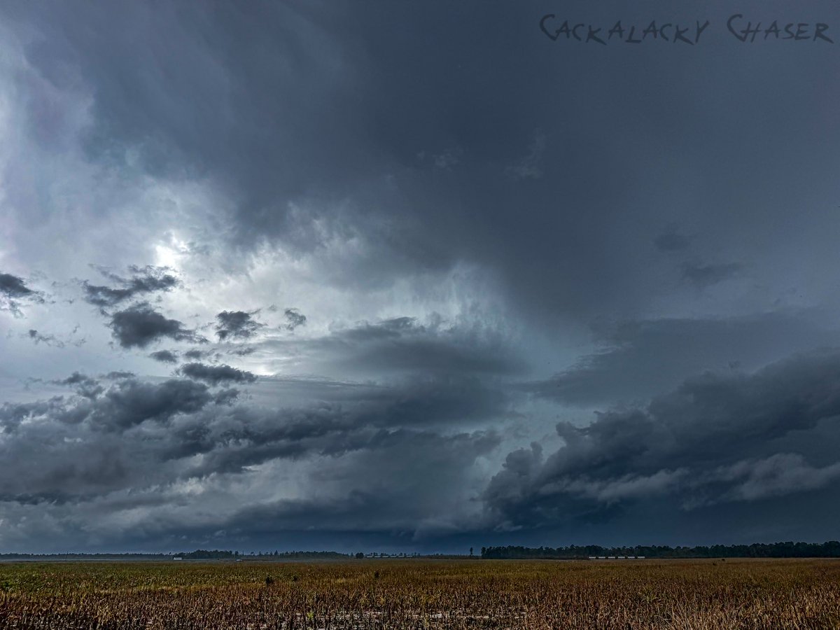
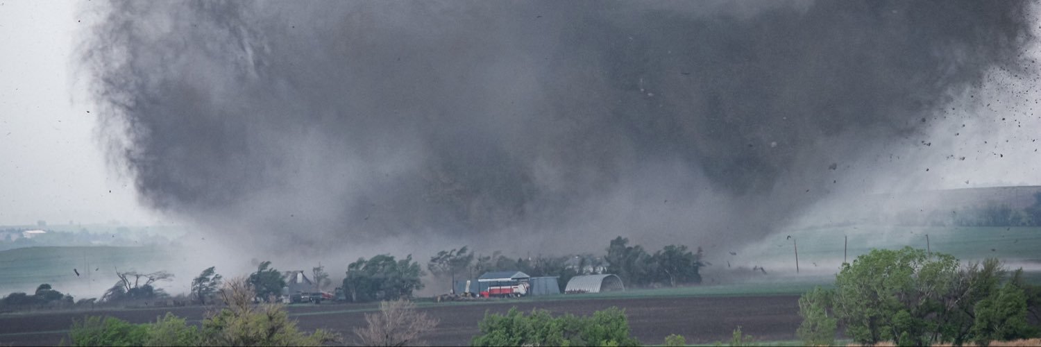
A vintage #tornado photo from the 4-14-12 high risk chase. This was the Rice-Ellsworth-Saline EF4. We were just under a mile away. On map, red line is tornado path, blue arrow is the direction the camera was looking at the time of the picture.
/w @KevinSmithWx#WXtwitter#KSwx
Today we mourn the loss of Nolan Doesken, the founder of @CoCoRaHS. Nolan founded CoCoRaHS in 1998 as a non-profit, community-based network of volunteers working together to measure and map precipitation totals. To learn more visit https://t.co/xjIth9xYKO
#CoCoRaHS#ncwx
🚨 Updated tornado summary for October 11th, 2026.
We have confirmed 10 tornadoes occurred between 10:14 AM and 1:47 PM and caused nearly 21 miles of significant damage. However, and most importantly, these tornadoes did not result in any fatalities. #NCwx
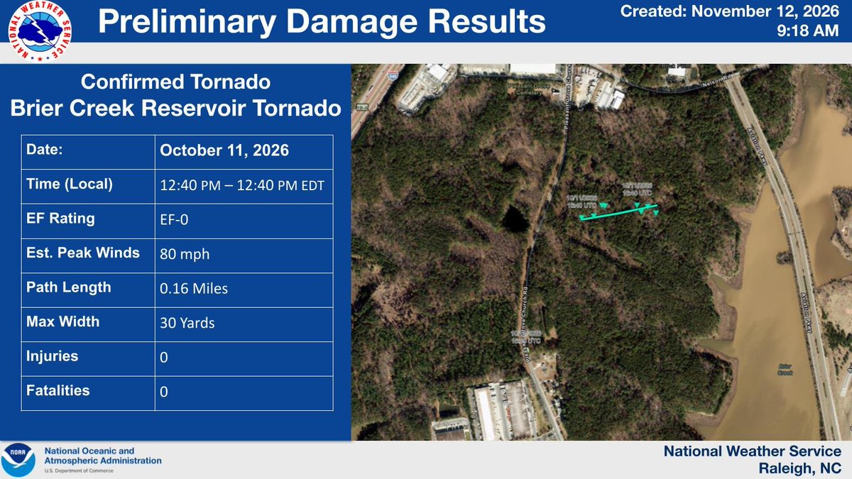
🚨 New Confirmed Tornado from the 10/11/26 Tornado Outbreak!
After 1-month of analyzing data, we confirmed a tornado near the Brier Creek Reservoir. This brings the final number to 10, making 10/11/26 the day with the most confirmed tornadoes in central NC history! #NCwx
🚨 Maximum width of the Jordan Lake tornado, which occurred on 10/11/2026, has been increased.
After analyzing post-event satellite imagery, additional tree damage on the left side of the track was found. This gives us confidence to increase the path width to 150 yards. #NCwx
THANK YOU to all who served, especially to my Uncle Tommy (pictured with me) who served 8 years in the U.S. Coast Guard and performed the recovery efforts for the families of TWA Flight 800 in 1996. I appreciate his service and all else who served!
Here's a timelapse (~25x) drone video synced with KLTX Super Res reflectivity & velocity, with drone telemetry in the corner. This is the storm that was tornado warned storm in southeastern NC on 11/6/26 (last Friday). My position on the radar is the orange SKYWARN icon.
What I saw early on was a hook on reflectivity, a striated updraft base, and a lowered flat looking base with a curling tail that may be low-level rotation. By about 1:17 to 1:26 PM the cold pool takes over, the gust front races ahead (the dust seen towards the end), and a shelf cloud rolls in overhead.
My read is it was a short lived (transient) supercell that went outflow dominant. I think I caught it past its peak, as it was ramping down. I positioned myself so the drone wouldn’t get soaked and I could fly for more than 5 minutes, so it looks as if I passed the storm while coming in from the northwest.
No tornado was observed in this video. KLTX was ~40 miles away, putting the beam around ~2,700 ft, so low-level rotation could have been partly missed. I chose this editing style so y’all can help me if I misidentify or missed anything. If you find it useful for radar training, education, research, or school projects, please reach out. I’m happy to help.
Full real-time video in 4K on YouTube: https://t.co/6maB1jmuym
#NCwx #wxtwitter #StormChasing #Supercell #SKYWARN
@NWSRaleigh@NWSWilmingtonNC
Here’s a ~2 minute timelapse of the rotation from that tornado-warned storm west of Ivanhoe, NC around 1:20pm. I have a wider shot of the Meso I'm going to look at when I get home.
#NCwx
UPDATE: The good news is we got the Twistex Memorial site on Google Maps all cleaned up. The not so good news is, as you can see, two spammers have already posted in the past 4 hours. I’ll figure out how automated with an AI agent. Thanks @DFWStormChasing for bringing to my attention.
NEED YOUR #wxtwitter HELP:
To stop the mass spam flooding the TWISTEX Memorial on Google Maps, I built a master list of the offending accounts (see tech summary below) and submitted an escalation request to Google’s Product Experts for a bulk purge.
I NEED YOU to open my Google Help post (https://t.co/vyJAXMSPoy), scroll to the bottom, and click the "I have the same question" button. Every click upranks the ticket and pushes it to the top of the queue for immediate action. IF someone knows someone at Google and can nudge them, that'd be cool, too.
The full spreadsheet of offenders is linked at the bottom if you'd like to review or report them directly. Thanks, R.I.P. TWISTEX, and never stop chasing the spammers!
TECH SUMMARY
I captured the Google Maps photometa/v1 Fetch/XHR responses while viewing the TWISTEX Memorial photo grid, aggregated all responses, and exported them as a HAR file. The HAR was then parsed to extract contributor display name, contributor ID (and profile URL), raw photo counts per contributor, and the image URLs for each photo posted to the TWISTEX Google Maps site, producing a CSV of all 118 contributors. I then manually reviewed each photo per contributor and flagged those accounts that posted at least one image unrelated to the memorial site under Google’s guidelines; of the 118 contributors reviewed, 106 were flagged as irrelevant offenders. Link to final output for purging is below.
Spammer List: https://t.co/VCQy5nBNWx
We caught a nice funnel cloud in Person County, NC, the next day with that system! There were a lot of dead zones in cell coverage back then, so we had to chase using 20-minute-old radar data, whatever info we could get from a radio simulcast, and visual tracking—which wasn't easy in the Carolina "jungle" with no drone to pop over the treeline!
https://t.co/2unv8MPzA2
NEED YOUR #wxtwitter HELP:
To stop the mass spam flooding the TWISTEX Memorial on Google Maps, I built a master list of the offending accounts (see tech summary below) and submitted an escalation request to Google’s Product Experts for a bulk purge.
I NEED YOU to open my Google Help post (https://t.co/vyJAXMSPoy), scroll to the bottom, and click the "I have the same question" button. Every click upranks the ticket and pushes it to the top of the queue for immediate action. IF someone knows someone at Google and can nudge them, that'd be cool, too.
The full spreadsheet of offenders is linked at the bottom if you'd like to review or report them directly. Thanks, R.I.P. TWISTEX, and never stop chasing the spammers!
TECH SUMMARY
I captured the Google Maps photometa/v1 Fetch/XHR responses while viewing the TWISTEX Memorial photo grid, aggregated all responses, and exported them as a HAR file. The HAR was then parsed to extract contributor display name, contributor ID (and profile URL), raw photo counts per contributor, and the image URLs for each photo posted to the TWISTEX Google Maps site, producing a CSV of all 118 contributors. I then manually reviewed each photo per contributor and flagged those accounts that posted at least one image unrelated to the memorial site under Google’s guidelines; of the 118 contributors reviewed, 106 were flagged as irrelevant offenders. Link to final output for purging is below.
Spammer List: https://t.co/VCQy5nBNWx
Hey folks.
The Twistex memorial on google maps has been completed overrun with AI slop, Roblox videos, random memes, and fancams(?).
Please do me a favor and report any photos that aren't actually of the memorial.
Thank y'all ❤️
https://t.co/w8QoEBM64K
Hey folks.
The Twistex memorial on google maps has been completed overrun with AI slop, Roblox videos, random memes, and fancams(?).
Please do me a favor and report any photos that aren't actually of the memorial.
Thank y'all ❤️
https://t.co/w8QoEBM64K
I think knowing particular AIs’ failure modes is important and aligns with needing scientists to validate or diagnose. Although Gemini and WeatherNext are two completely different AI models, Gemini’s hallucinations show the need for human validation, as LLMs will lie until checked. The example below demonstrates this while red teaming sycophantic behaviors. Another real life examples are all those lawyers that presented fictitious case law in court after retrieving them from LLMs without validating.
🧵 of my opinions on AI in meteorology.
There are many, many ways this could be good for operations. I worry it might not be as good for science. I think of it as detection vs. diagnosis. AI can be trained to detect anything, but only we as scientists can make the diagnosis.
Good breakdown! You're right about the half-billion low-end estimate in the 2000s, and NCDOT's top-end then was $1.7B. WRAL very recently reported a long bridge topping $1B, which is where I sourced from.
Whether half a billion, a billion, or anywhere in between; the state should make a long-term investment instead of temporary fixes (especially those not covered by state of emergency declarations). If it's still a "no money" issue, NCDOT should propose a toll road, as they tried for northeastern Wake and Franklin counties citing "no money"—though we quickly rejected it.
https://t.co/tSwLXyqPDe
@GMengel Yes! I remember waking up to significant snow drifts in eastern Wake County! Everything was SHUT DOWN for about a week, and the news asked folks with four-wheel drive to volunteer giving hospital personnel rides to work. Craziest snow event in all my 36 years living in NC!
@NC_Governor@NCDOT_NC12 NCDOT will drop endless millions shoveling sand back onto NC 12, but leaves Wake Forest stranded in the Capital Blvd parking lot every day. Can us north-eastern Wake county folks get some of that urgency too? j/s