Thursday storm timeline - storms likely start up after 6pm along I-35 and north of I-20. Highest threat for large hail and strong winds (and low tornado threat) will be north of the metroplex. Storms quickly move east through the evening.
#wfaaweather
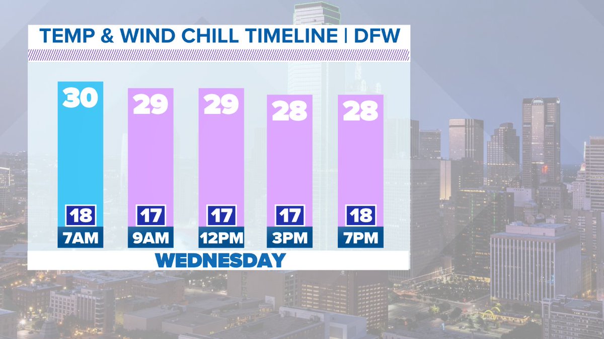
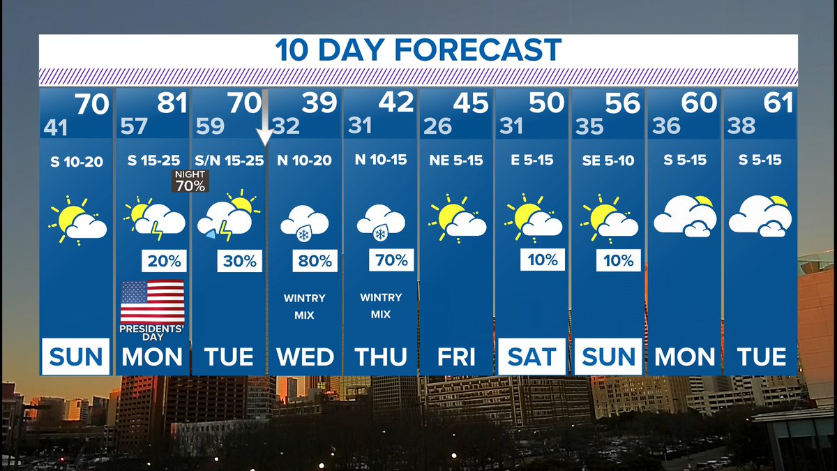
Here's why I'm concerned with freezing rain and sleet Wednesday, not just rain. Temps will fall to at or below freezing late tonight with freezing temps when you wake up in the morning. Then temps will hold steady or even fall a bit heading thru the day staying below freezing.