"Utilizing the highest accuracy data of the #NEXTMap's ultra-high-resolution digital #elevation models, the NEXTMap #Link#Planning is the best resource for point-to-point #microwave and millimeter-wave wireless #telecom connectivity" - https://t.co/UG7ESl75eO
🌋 #timelapse of Hunga Tonga-Hunga Haʻapai landform evolution, starting from the previous volcanic eruption in 2015, assisting in the better understanding of the phenomenon thanks to #googleearth@planet@sentinel_hub@CopernicusEU
Our brand new #marketplace is here 🎉 !! Fresh design, easy-to-use, and quick navigation to high-quality #geospatial data and software from industry leaders worldwide!! Find the solution you need ➡️ https://t.co/E2sMFvPbXK
Day 3 in #IAC2021! Come meet us at Hall 8/14D, and find out how you can take advantage of our geo market platform, currently offering more than 120 products for the #geospatial and #space industry, from more than 40 partners worldwide!
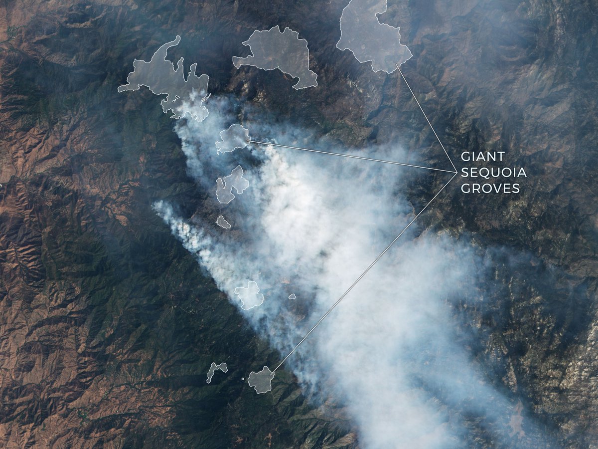
The Windy Fire rushed across one of the enormous sequoia groves strewn throughout the western slopes of the Sierra on September 19, 2021, as seen in a PlanetScope image taken on September 19, 2021.
Read More: https://t.co/mCnc0M2pa7
#satelliteimagery#wildfire#GIS#geospatial
Elevation30 is a unique worldwide 3D geographic reference database with a vertical accuracy down to 6m at 30m grid spacing specifically designed for large area coverage, addressing mapping, GIS, and military needs.
Read More: https://t.co/Fi8lFj8hkR
The images were collected at two different times in the growing season in Brazil, September 27, 2020, and February 7, 2021.
Planet Monitoring provides access to the most recent images of your areas of interest.
Read More: https://t.co/mCnc0M2pa7
#satelliteimagery#geospatial
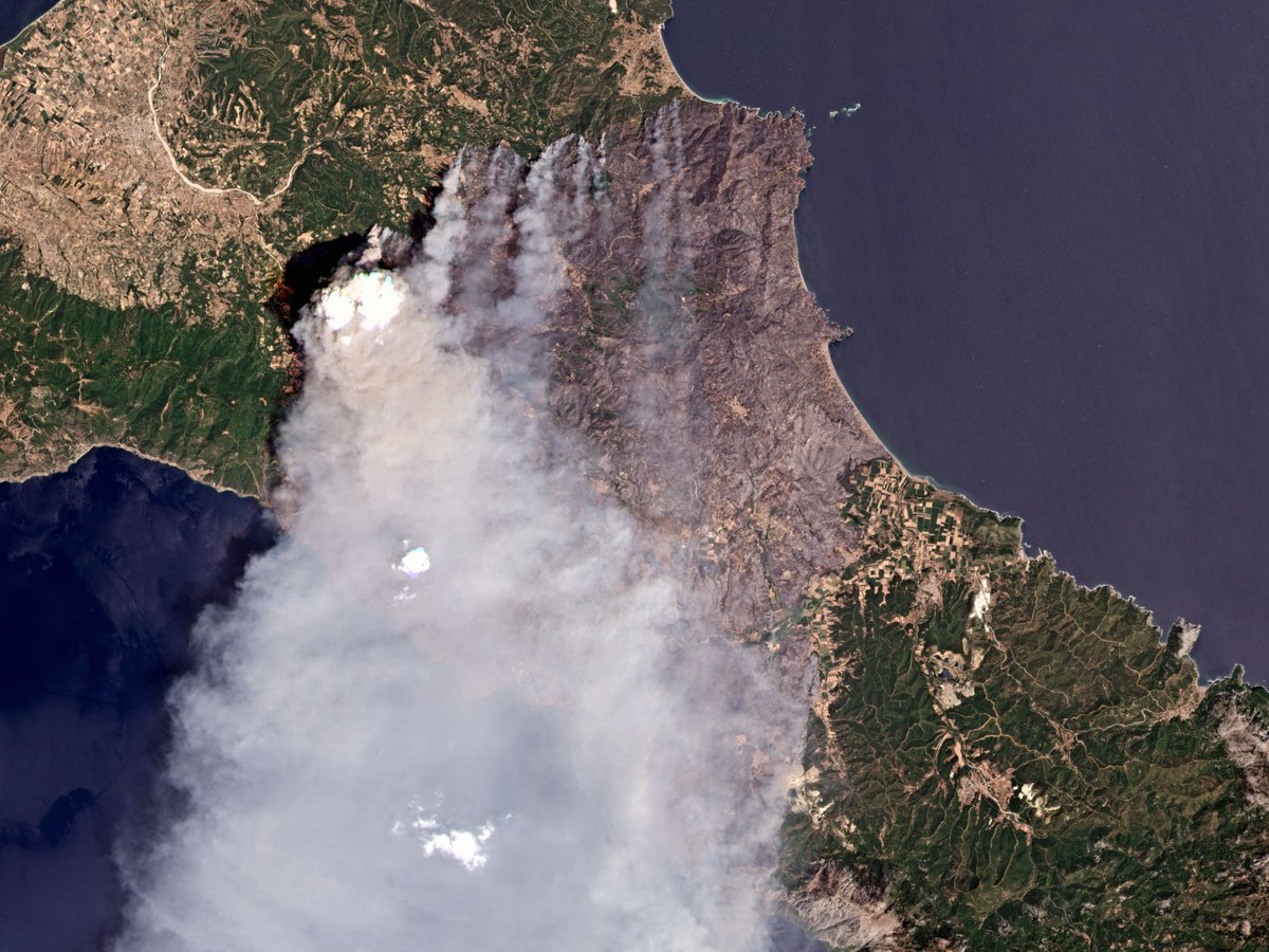
Fires swept across the Greek island of Evia in early August of 2021.
Explore more Real-Time Satellite Monitoring with PlanetScope Monitoring from cloudeo marketplace
Read More: https://t.co/mCnc0M2pa7
#satelliteimagery#climatechange#remotesensing#geospatial#gismapping
Monitor geographic areas of interest, uncovering trends, tracking infrastructure, and detecting changes as they occur with Planet scope monitoring.
Real-Time Satellite Imagery Monitoring.
Read more at cloudeo Marketplace: https://t.co/mCnc0M2pa7
#satelliteimagery
Power your applications and analytics with seamless Basemaps built from the most recent imagery over broad areas, With daily, global imaging.
Read More:https://t.co/kVZfD7TTRg
#satelliteimagery#earthobservation#GIS#geospatial#planet