DEMHS' mission is to direct and coordinate all available resources to protect the life and property of the citizens of Connecticut in the event of an emergency.
Warmest day of the year so far today ☀️
Temperatures this afternoon top out in the 70s and 80s for most, or about 20 degrees above normal for mid-April.
⚠️ Early-season heat can catch people off guard—stay hydrated, take breaks, and never leave kids or pets in cars!
911 Outage for Southeastern Connecticut Resolved
March 11, 2026 3pm update:
All affected Southeastern Connecticut Public Safety Answering Points (PSAP) outages have been resolved, with all PSAPs back online and reroutes lifted.
The cause for the rerouting was determined to be a faulty router in Southeastern Connecticut and not a cyber-related incident.
Should residents or visitors have any further problems related to 911, please contact the Network Control Center (NCC) at 860-685-8525.
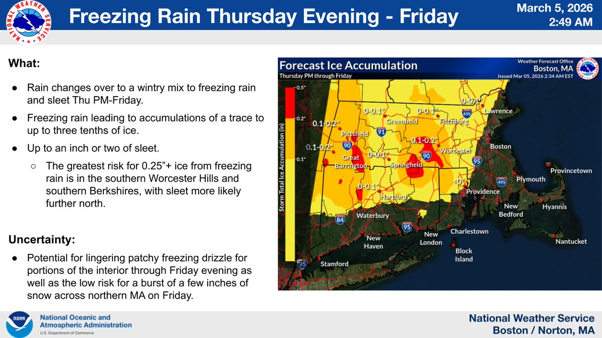
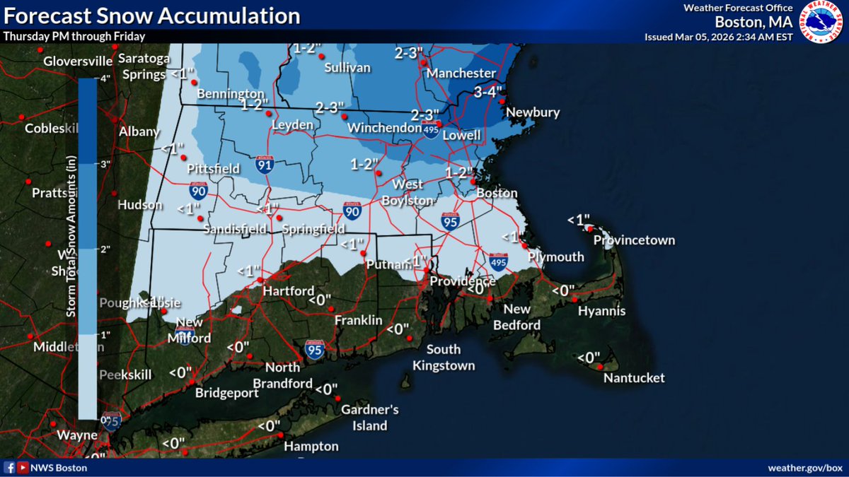
Rain changes over to a wintry mix to freezing rain/sleet Thu PM-Fri. The greatest risk for ice is in the S. Worcester Hills and S Berkshires, with significant sleet more likely further north. There is also a low risk for a burst of a few inches of snow across northern MA on Fri.
A Special Weather Statement has been issued across the interior. Localized slippery conditions are possible this morning due to black ice, especially on untreated surfaces. Exercise extra caution if traveling this morning!
#NYwx#CTwx
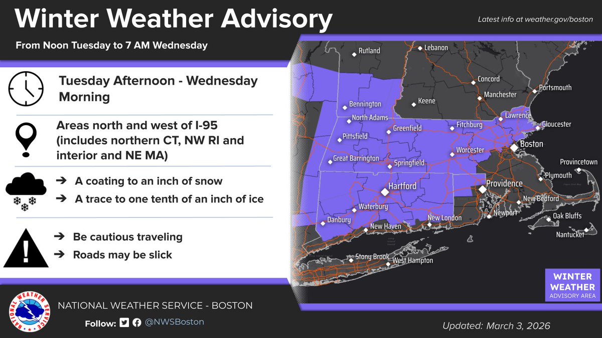
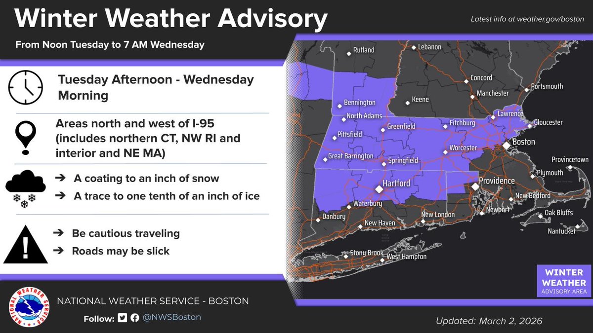
A wintry mix of snow, freezing rain, and rain will arrive this afternoon and come to an end before sunrise on Wednesday. This may make for a slippery commute Tuesday evening and even Wednesday morning thanks to lingering black ice.
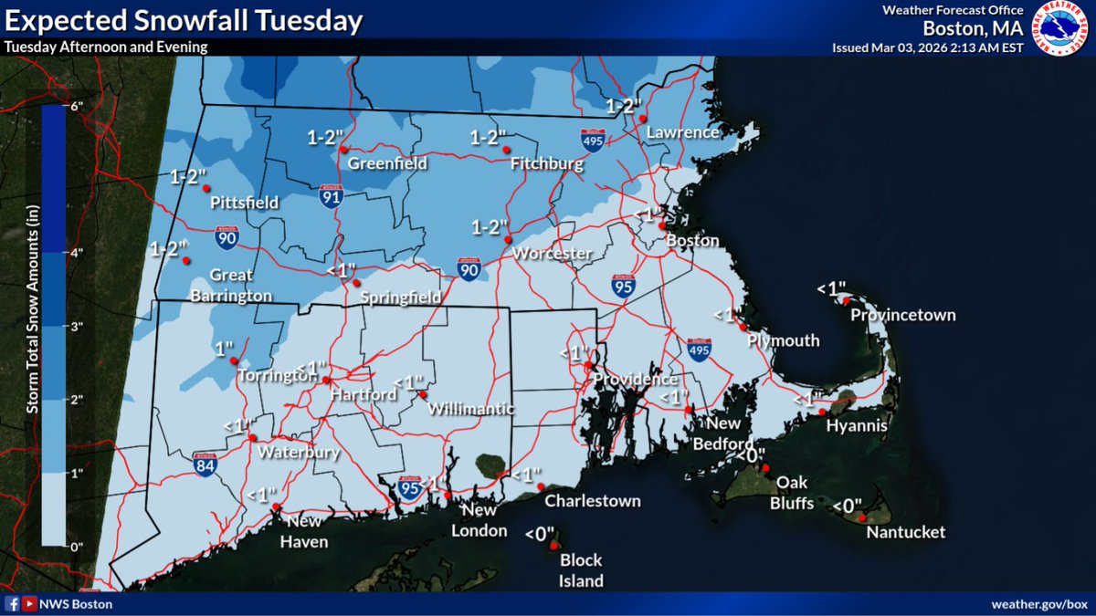
Snow develops Tuesday afternoon in the interior then changes to rain and freezing rain Tuesday night. A coating to an inch of snow is possible followed by a trace to one tenth of an inch of ice, especially over higher elevations. Untreated roads may become slippery.
CT, we are looking at mixed precipitation starting mid-day tomorrow, making for slippery conditions. Luckily, things warm up a bit with possible temps in the 60s next week!
High pressure over the area today will give way to a series of frontal systems bringing rain chances much of this week. A wintry mix may begin early Tuesday morning, likely quickly becoming all rain. A much-welcomed warm up is expected later this week.
High pressure over the area today will give way to a series of frontal systems bringing rain chances much of this week. A wintry mix may begin early Tuesday morning, likely quickly becoming all rain. A much-welcomed warm up is expected later this week.
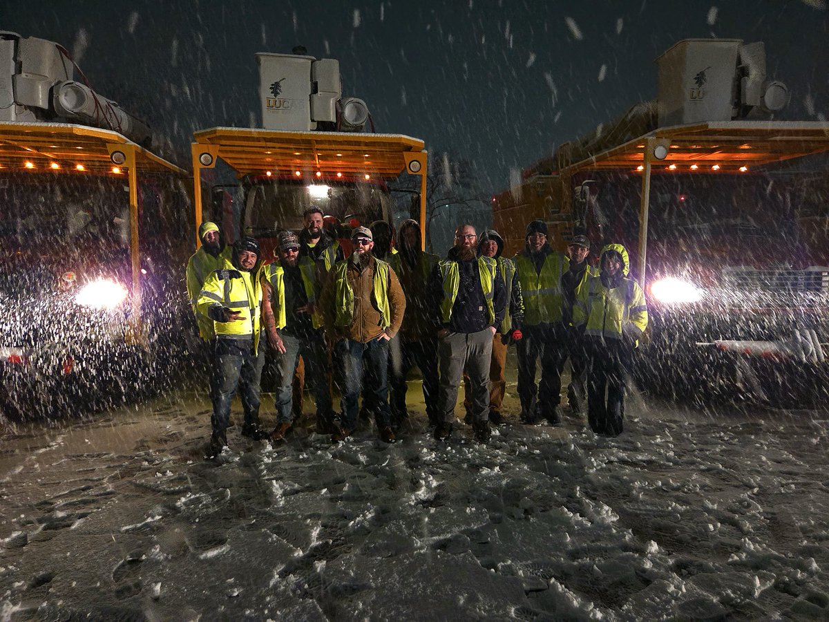
We’re sending @CTDOTOfficial crews to support @MassGovernor and @GovDanMcKee as they recover from this historic storm. We’ve been in their shoes before and we’ll always answer the call to help our neighbors .
New England shows up for each other when it matters most.
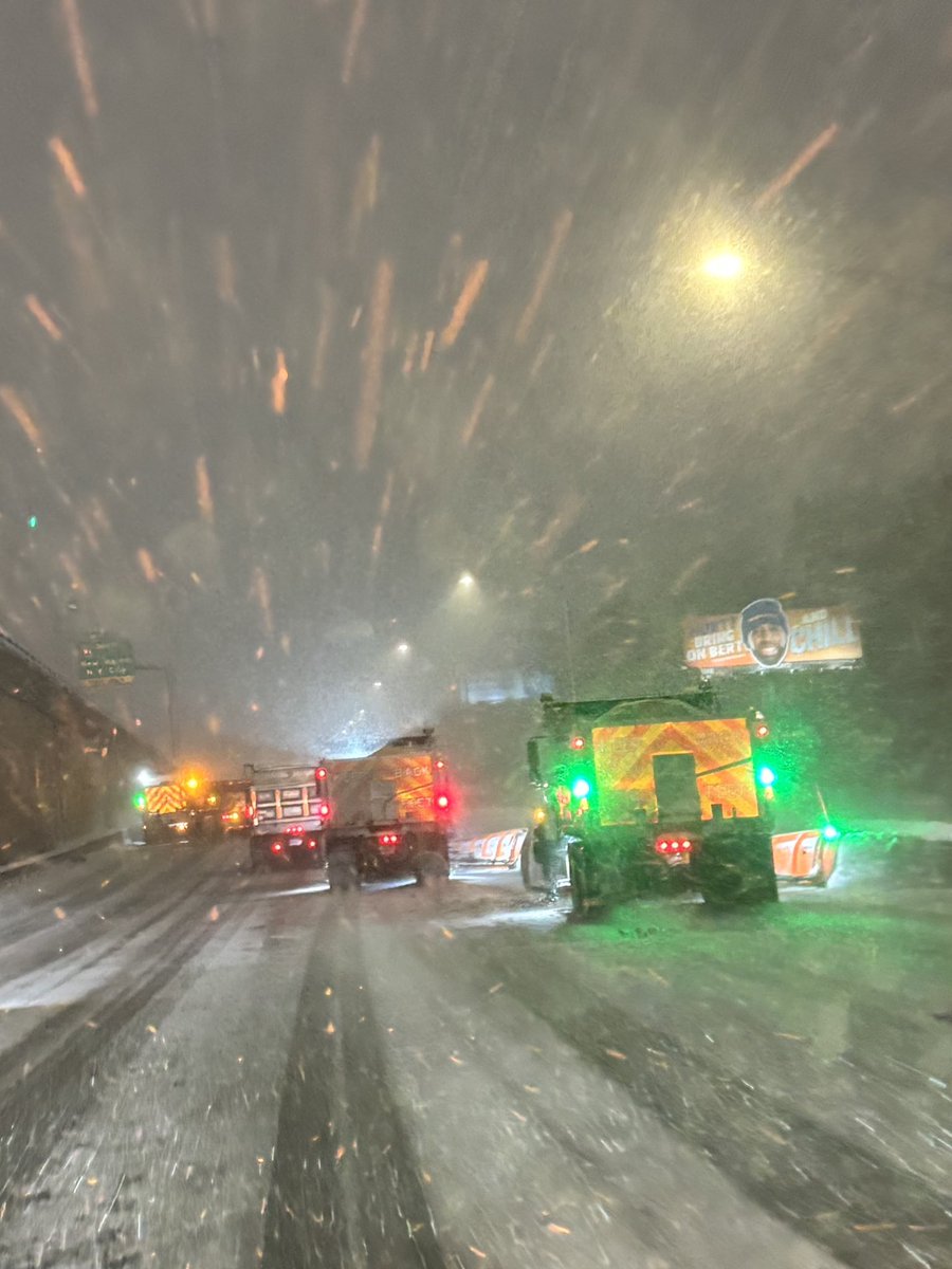
When our neighbors call, we roll out! 💪 CTDOT left at 4 a.m. with crews heading to Massachusetts and Rhode Island to clear snow following the historic blizzard. We're so proud of this team and thankful for their service! #CTDOT#Winter#Weather#Blizzard
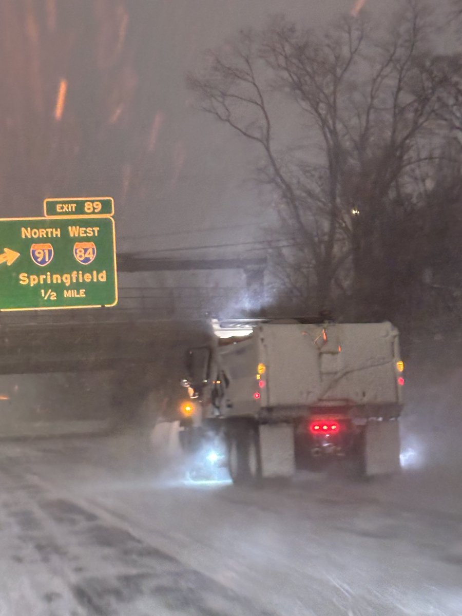
Our crews were out all night clearing the roads, and they’re still out there now. The #blizzard continues and travel remains difficult, so if you don’t absolutely have to drive, STAY OFF THE ROADS! Give our crews the space and time they need to do their jobs. #CTDOT#Snow
As the 2026 Blizzard continues to move over Connecticut, we urge residents to remain to indoors and off the roads so that emergency workers and DOT can get around with minimal hazards.
[Potentially Historic/Destructive Storm southeast of the BOS-PVD corridor] We are very concerned for areas southeast of the Boston-Providence corridor where wet snow combines with northeast wind gusts of 60-70 mph. Power outages & tree damage. Worst conditions Mon 4 am to noon.
[1/3]❄️High-impact winter storm expected to hit southern New England Sun evening-Mon night bringing strong winds and heavy snow. Blizzard conditions likely in east MA & RI. Hazardous travel expected. Increased risk for tree damage/power outages in east MA/RI. #MAwx#RIwx#CTwx
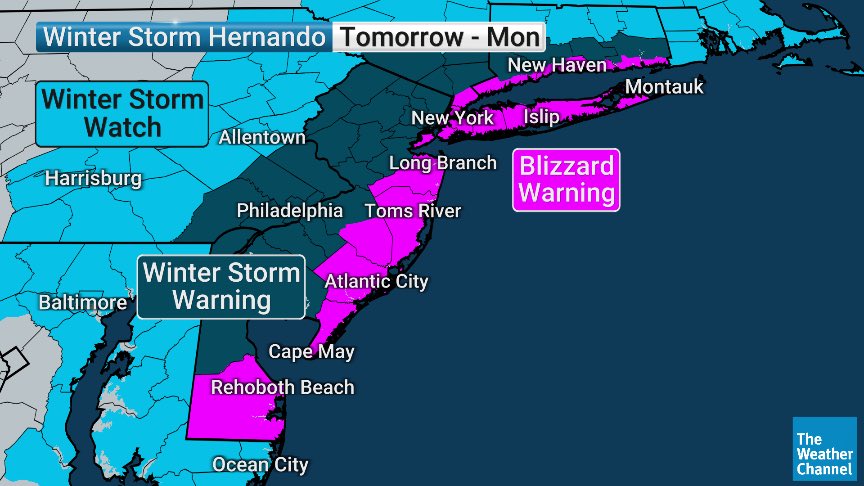
With blizzard warnings now in effect for the entire coast, including the NYC metro, it is time to review blizzard conditions.
The image here details the criteria for blizzard conditions to be met.
#nycwx#nywx#liwx#ctwx#hvwx#njwx
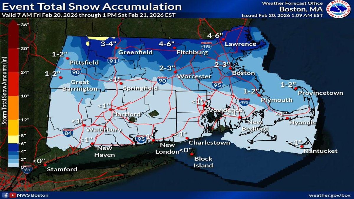
A winter storm will bring a mix of snow, rain, and freezing rain to southern New England today into Saturday morning. Here's a look at what to expect for snow totals.


![NWSBoston's tweet photo. [1/3]❄️High-impact winter storm expected to hit southern New England Sun evening-Mon night bringing strong winds and heavy snow. Blizzard conditions likely in east MA & RI. Hazardous travel expected. Increased risk for tree damage/power outages in east MA/RI. #MAwx #RIwx #CTwx https://t.co/3Wp3Ydgc3E](https://pbs.twimg.com/media/HBtTZjOWkAA4V7n.jpg)
![NWSBoston's tweet photo. [1/3]❄️High-impact winter storm expected to hit southern New England Sun evening-Mon night bringing strong winds and heavy snow. Blizzard conditions likely in east MA & RI. Hazardous travel expected. Increased risk for tree damage/power outages in east MA/RI. #MAwx #RIwx #CTwx https://t.co/3Wp3Ydgc3E](https://pbs.twimg.com/media/HBtS7AKWYAAjgGB.jpg)


![NWSBoston's tweet photo. [Potentially Historic/Destructive Storm southeast of the BOS-PVD corridor] We are very concerned for areas southeast of the Boston-Providence corridor where wet snow combines with northeast wind gusts of 60-70 mph. Power outages & tree damage. Worst conditions Mon 4 am to noon. https://t.co/8NHt3mkDIP](https://pbs.twimg.com/media/HBxN0EMXkAA_q-c.jpg)