Custer County EMS helps the citizens of Custer County SD and surrounding areas prepare for, respond to, recover from and mitigate against all types of disasters
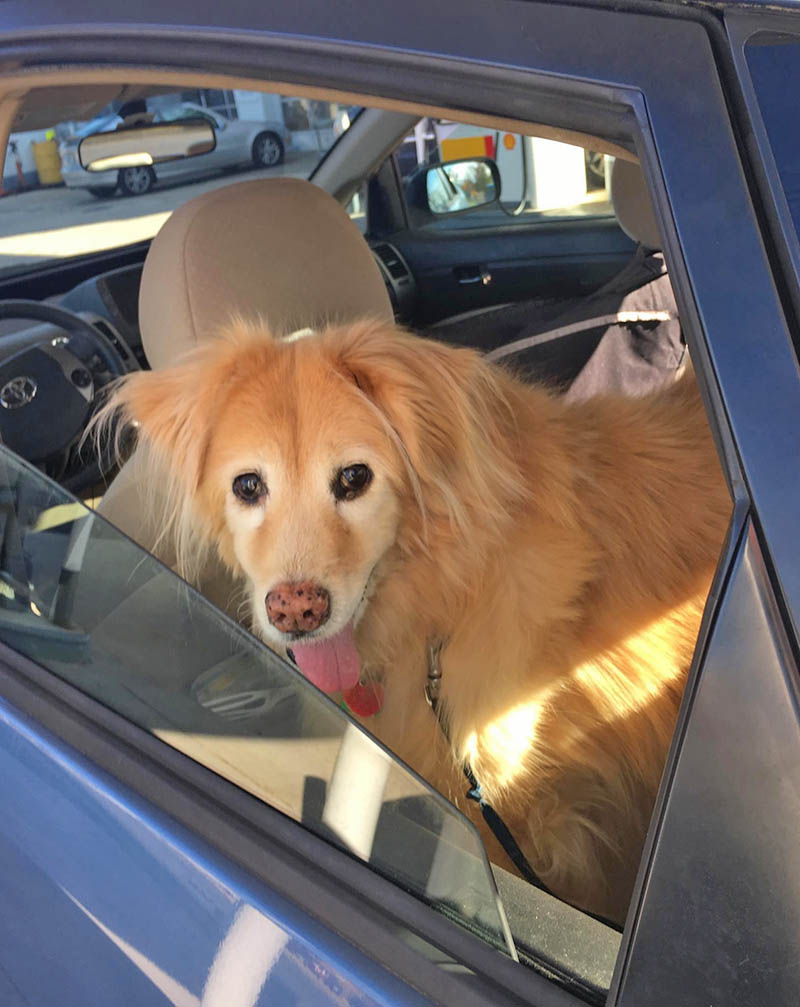
This #NationalPetDay, set some time aside to make sure your furry friends have everything they need in their emergency bags.
Remember, if you need a plan, so do they!
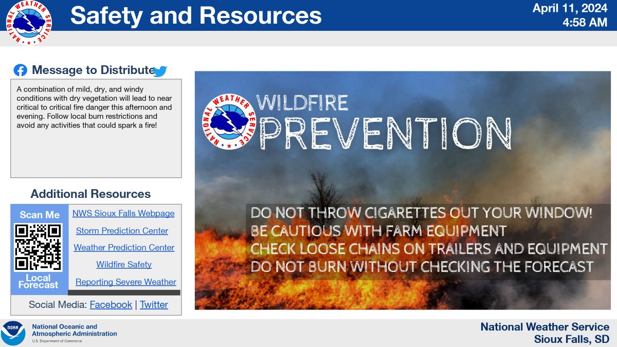
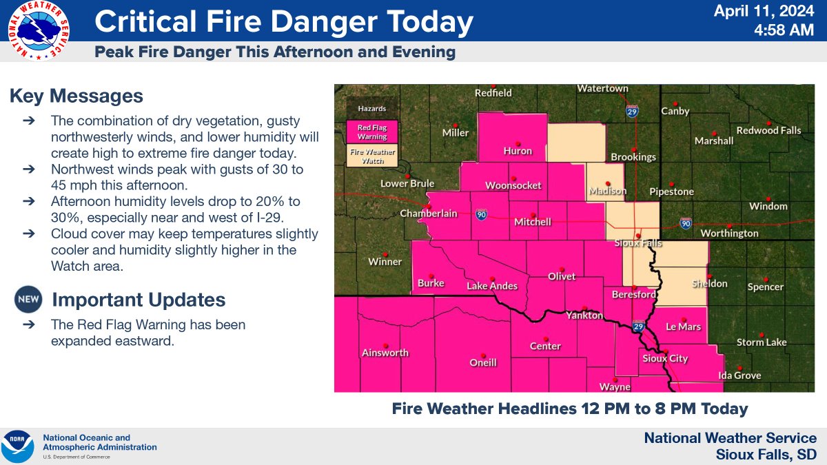
A RED FLAG WARNING has been issued for portions of southeastern SD today. Warm temperatures combined with dry vegetation, gusty winds and lower humidity pose a significant risk for wildfires. Be careful and help #KeepSDsafe
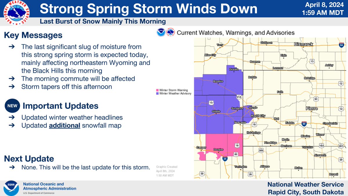
4/8/2024: Our strong spring storm will wind down today. This morning, one last burst of snow will move through the area, especially for northeastern Wyoming and the northern Black Hills. The morning commute will be affected. The storm will wind down this afternoon. #SDwx#WYwx
SDWF is thankful to be among those called to the Pine Ridge reservation Fri/Sat to support BIA firefighters and OST EM with the wildland fire near Wounded Knee and Manderson, SD.
Great example of teamwork paying off!
#keepSDsafe
South Dakota Severe Weather Preparedness Week is April 8-12, 2024: Are you prepared for large hail? Lightning? Are you prepared for damaging wind? Flooding? Tornadoes? South Dakota Severe Weather Preparedness Week is April 8-12, 2024. Stay tuned for safety topics each day. #SDwx
Safe2Say provides students a confidential way to share sensitive information about potentially risky or threatening events. Taking action early helps prevent harm to others and may even save lives. Go to https://t.co/cjxO35TQDH for more information and FREE resources.
Permits for open burning in the Black Hills Forest Fire Protection District expire Sunday March 31.
Be sure all burn piles are completely extinguished by that date.
For more information visit: https://t.co/PuVrPTkLpP.
Wintry mix possible tonight across NW SD. Breezy Friday. Rain and snow likely Easter weekend. Snow amounts will depend greatly on temperature. #sdwx#wywx
Mild weather is expected today, with highs generally in the 50s-mid 60s. A fast-moving disturbance and cold front tonight will bring light rain and freezing rain to NW SD. Very light ice accumulation is possible. A storm system this weekend will bring rain/snow. #sdwx#wywx
Did you know 1 in 10 people will have a seizure at some point in their life? If someone around you is having a seizure, are you prepared to help? Learn how to provide first aid for any type of seizure & get certified: https://t.co/PRpxd85fek #SeizureAwareness #EpilepsyAwarenesDid you know 1 in 10 people will have a seizure at some point in their life? If someone around you is having a seizure, are you prepared to help? Learn how to provide first aid for any type of seizure & get certified: https://t.co/PRpxd85fek #SeizureAwareness #EpilepsyAwarenesDid you know 1 in 10 people will have a seizure at some point in their life? If someone around you is having a seizure, are you prepared to help? Learn how to provide first aid for any type of seizure & get certified: https://t.co/PRpxd85fek #SeizureAwareness #EpilepsyAwarenesDid you know 1 in 10 people will have a seizure at some point in their life? If someone around you is having a seizure, are you prepared to help? Learn how to provide first aid for any type of seizure & get certified: https://t.co/PRpxd85fek #SeizureAwareness#EpilepsyAwareness
The combination of accumulated snow, precipitation refreezing on roadways, and strong winds is causing snow-packed and ice-covered roads along Interstates 90 and 29 throughout South Dakota this morning, Tuesday, March 26, 2024.
https://t.co/jAj5PbAmq4
#SDDOT#SD511
Two rounds of winter weather will impact the region tonight through Monday. Round 1 will move through tonight with rain/snow over most of western SD & NE WY and freezing rain over south central SD. Most areas will see minor accumulations but south central could pick up 0.1-0.2"
A Winter Storm Watch will cover most of SD. Stay current with weather forecasts from a trusted source. There are two weather systems to watch for. You may need to change travel plans. Road conditions can be found at SD DOT’s free app SD511 or by calling 511. #keepSDsafe
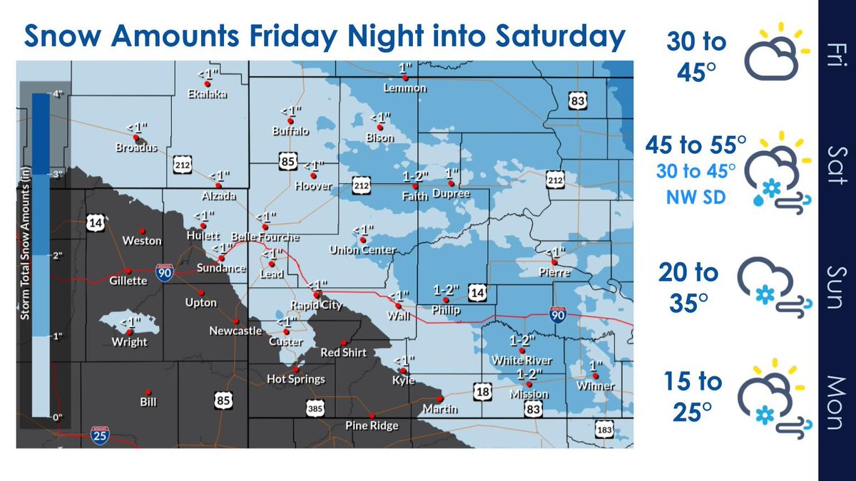
Light snow late Friday, and then a bigger system will bring rain, snow, wind, and colder temperatures to the area this weekend. Most likely place for heavy snow in our area will be NW and central SD. #sdwx#wywx
If local officials ask you to evacuate, that means your pet should evacuate too.
Make a plan! Many public shelters & hotels do not allow pets inside.
Know a safe place where you can take your pets, then practice evacuating with them to reduce stress & worry during an emergency.
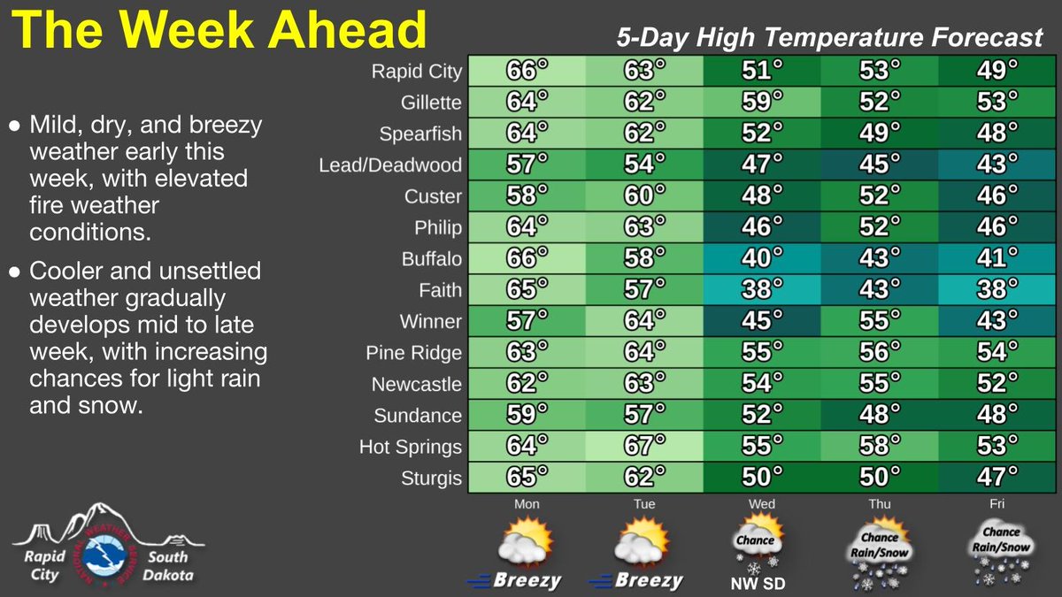
Mostly sunny and mild today and Tuesday. Breezy winds today will help to produce elevated fire weather conditions. Cooler air builds into the region mid to late week, with increasing chances for light rain and snow. #wywx#sdwx
Get the whole family involved in preparedness! Kids need to be included.
We have games and books you can use to practice preparing for a disaster on Ready Kids.
👉 https://t.co/TyxjuHMZWz
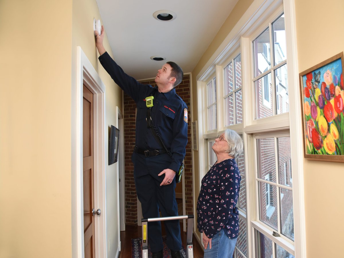
By now you likely changed your clocks, but have you tested your smoke alarms? 🤔
#PushTheButton, not your luck! 🍀
Make sure your smoke alarms work — check the sound. If you don't hear anything, you may need to replace the batteries.
#ItsNotLuck