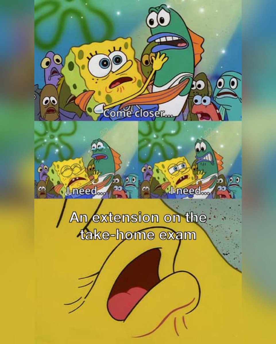
Happy #MemeMonday 💯 I hope everyone is having a great Wellness Day ❤️🩹 Today’s meme features a student’s desperate plea that is sometimes met with disappointment 🥲
We made it to Friday! Enjoy this lovely cloud photo taken by our very own club member Theo, a runner-up of our Cloud Photo Contest ⛅️ [Photo taken at Lake Tahoe, CA]
Happy Friday! Here’s a beautiful cloud photo to brighten up your day ☁️ This photo was taken by our very own club member Ethan, the winner of our first ever Cloud Photo Contest 👏 Congratulations 🎉 [Photo taken near Saint Helena, Nebraska on May 24, 2026]
Welcome to the recently *revamped* DAPS Graduate Students X page 🎉 Hopefully you’re having a relaxing Labor Day! It IS a Monday, so let’s kick everything off with our first post, a #MemeMonday 😎☁️
The image on the right shows the Aerosol Optical Thickness product, which is a measure of how many aerosols (or in this case how much smoke) are present. The red values represent high amounts of aerosols, which we can see reflected in air quality measurements today.
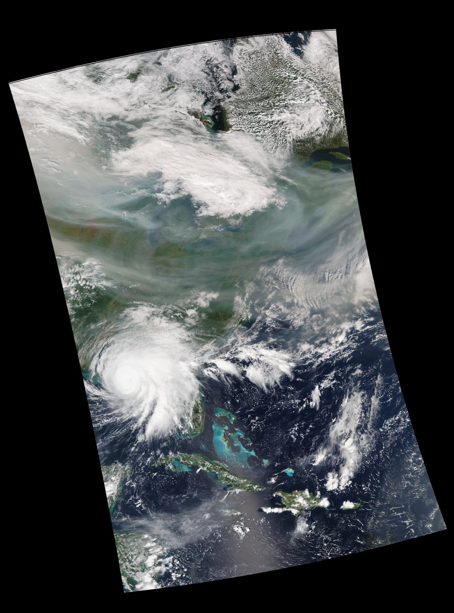
Some pretty cool images coming through today on the @CARE_HamptonU DBS thanks to #VIIRS! Wildfires out in the western US are making enough smoke that it has made its way to the east coast, blanketing most of the US! These VIIRS images show just how much there is!
The image on the left shows the S-NPP VIIRS true-color composite for this afternoon. It's easy to see the grayish colored smoke in between the clouds. The smoke can be seen blanketing the US fully from the left side to the right side of the image
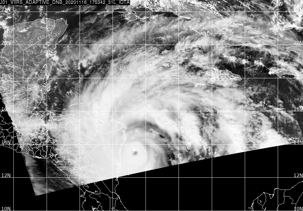
Record breaking hurricane Iota is only the second category 5 storm to form in November (the other was in Cuba in 1932). Here it is seen at night by the VIIRS instrument on board the JPSS-01 satellite, captured by the @CARE_HamptonU DBS shortly before making landfall in Nicaragua.
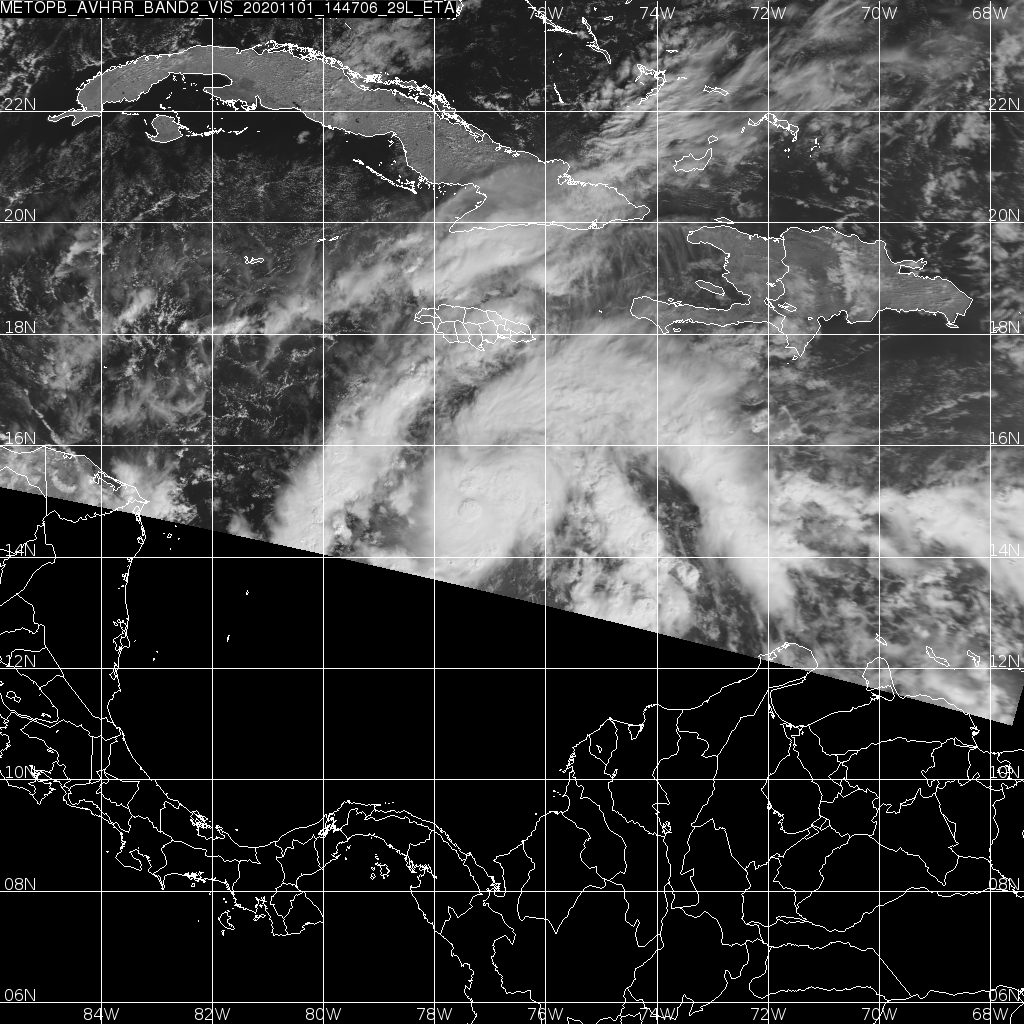
This image is from the AVHRR instrument on the European METOP-B satellite. We'll keep an eye on the DBS for any more interesting images of Eta as it moves closer to the coast!
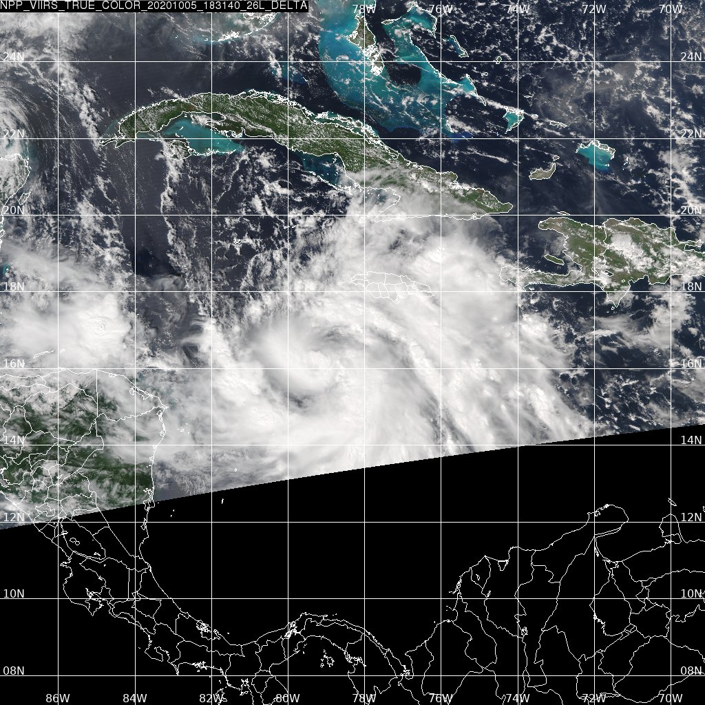
Tropical storm and soon to be hurricane #Eta has formed at the edge of the @CARE_HamptonU Direct Broadcast System reception range. With 28 named storms, the 2020 season ties 2005 for the most active season in the satellite era, and there is still a month yet to go.
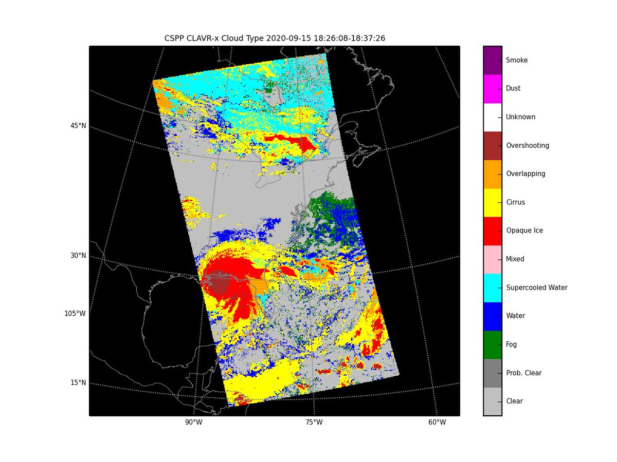
The last image is another composite product, this time a Cloud Type product. This helps indicate what kinds of clouds exist in the images we collect. Interesting to note here that the smoke is not showing up in the product, but #HurricaneSally can be seen very clearly in the gulf
The @CARE_HamptonU DBS received some incredible looking images and products this afternoon! The first image is a #VIIRS true-color image and clearly shows the #smoke that our region has been dealing with today, as well as a great look at #HurricaneSally!
The red coloring over most of the image indicates a high level of aerosols, indicating that what we're seeing is in fact smoke. For contrast, a more "normal" value can be seen over most of the Atlantic, where the colors are mostly dark blue.
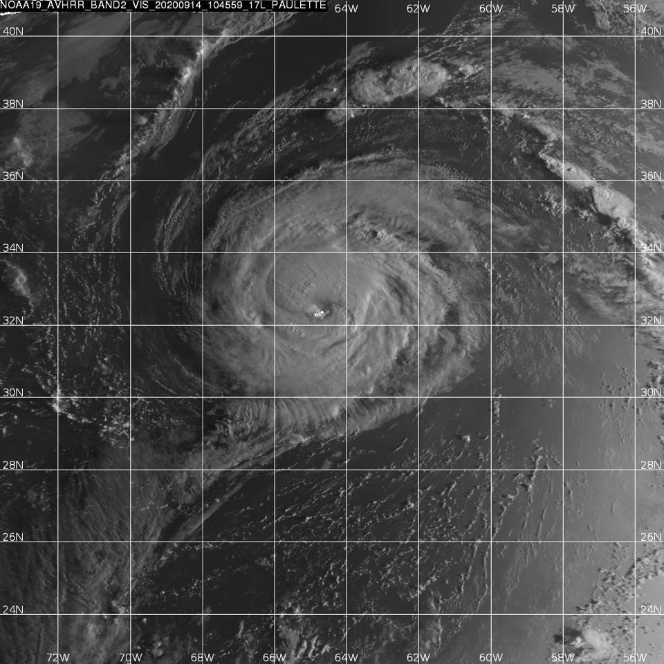
Here's a great image of Hurricane #Paulette that our @CARE_HamptonU DBS received from this morning's overpass of @NOAASatellites NOAA-19! This image is a visible image from AVHRR and shows Paulette directly over #Bermuda




![DAPS_Grad's tweet photo. We made it to Friday! Enjoy this lovely cloud photo taken by our very own club member Theo, a runner-up of our Cloud Photo Contest ⛅️ [Photo taken at Lake Tahoe, CA] https://t.co/geuF9vCO1d](https://pbs.twimg.com/media/HTph9yMW8AAitPG.jpg)

![DAPS_Grad's tweet photo. Happy Friday! Here’s a beautiful cloud photo to brighten up your day ☁️ This photo was taken by our very own club member Ethan, the winner of our first ever Cloud Photo Contest 👏 Congratulations 🎉 [Photo taken near Saint Helena, Nebraska on May 24, 2026] https://t.co/5qzQBzICOo](https://pbs.twimg.com/media/HTE60nMW0AAVGfB.jpg)