445pm update on the cell near the US/Mexico border that we’re chasing. Storm is becoming more linear and looks to be cycling. Good stricture and lots of cloud to ground lightning though.
Our chasing day has come to an end. The storms we were following began moving at 75 mph to the east! It was a fun chase day today, and we can’t wait for the next one!
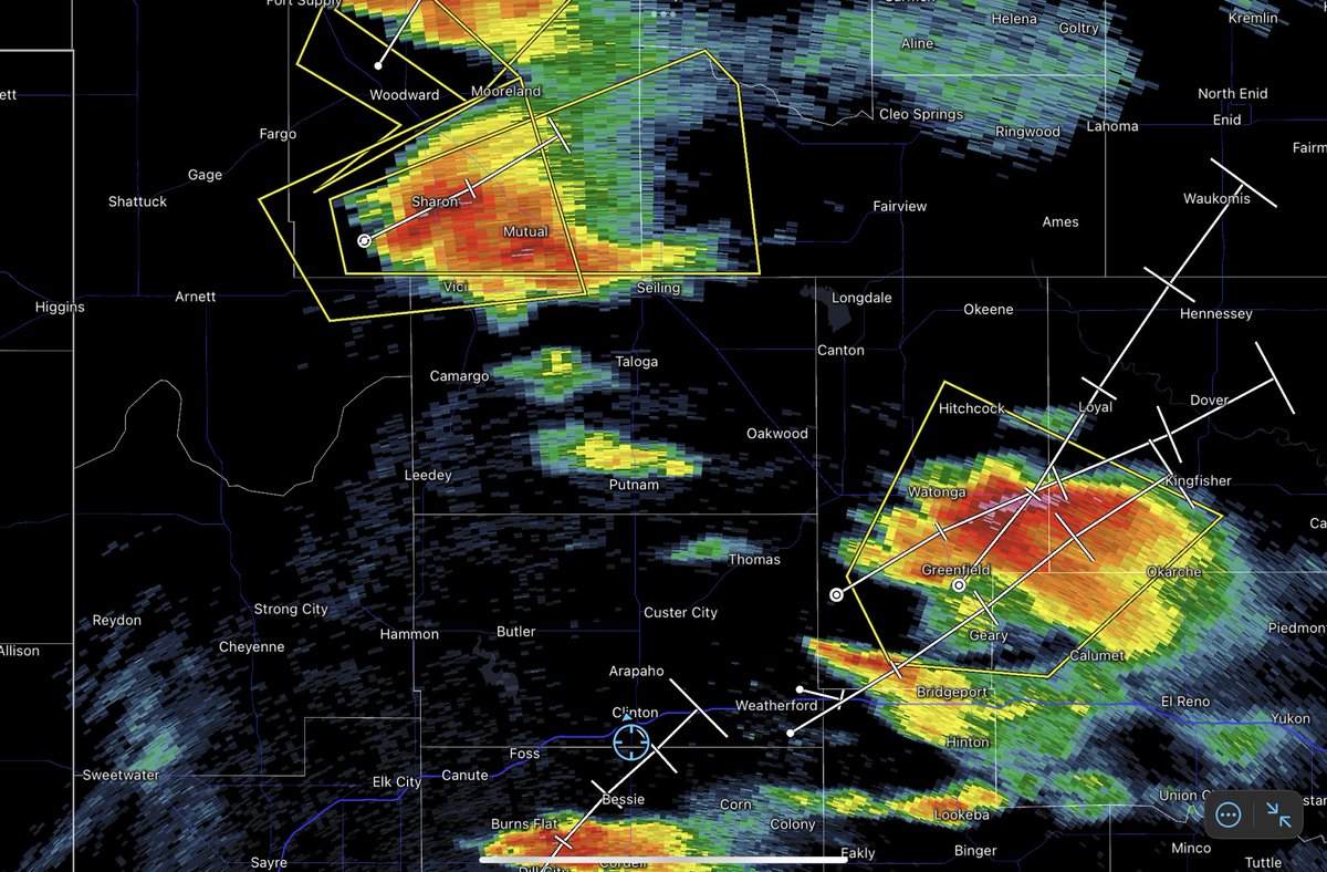
We are approaching the cells over Cleo Springs! With multiple strong hail cores and 60 mph winds, these thunderstorms were already threatening. A Flash Flood Warning has also been issued for the area, along with 3 separate Tornado Warnings
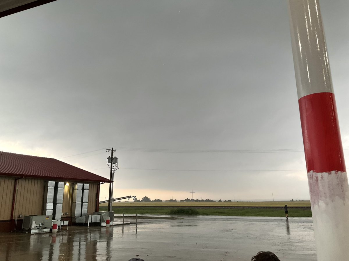
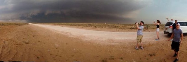
Beautiful cloud structure to our west! This is a picture of the thunderstorms near Greenfield right now. They are visible to us as we head north towards the cells near Sharon, Oklahoma.
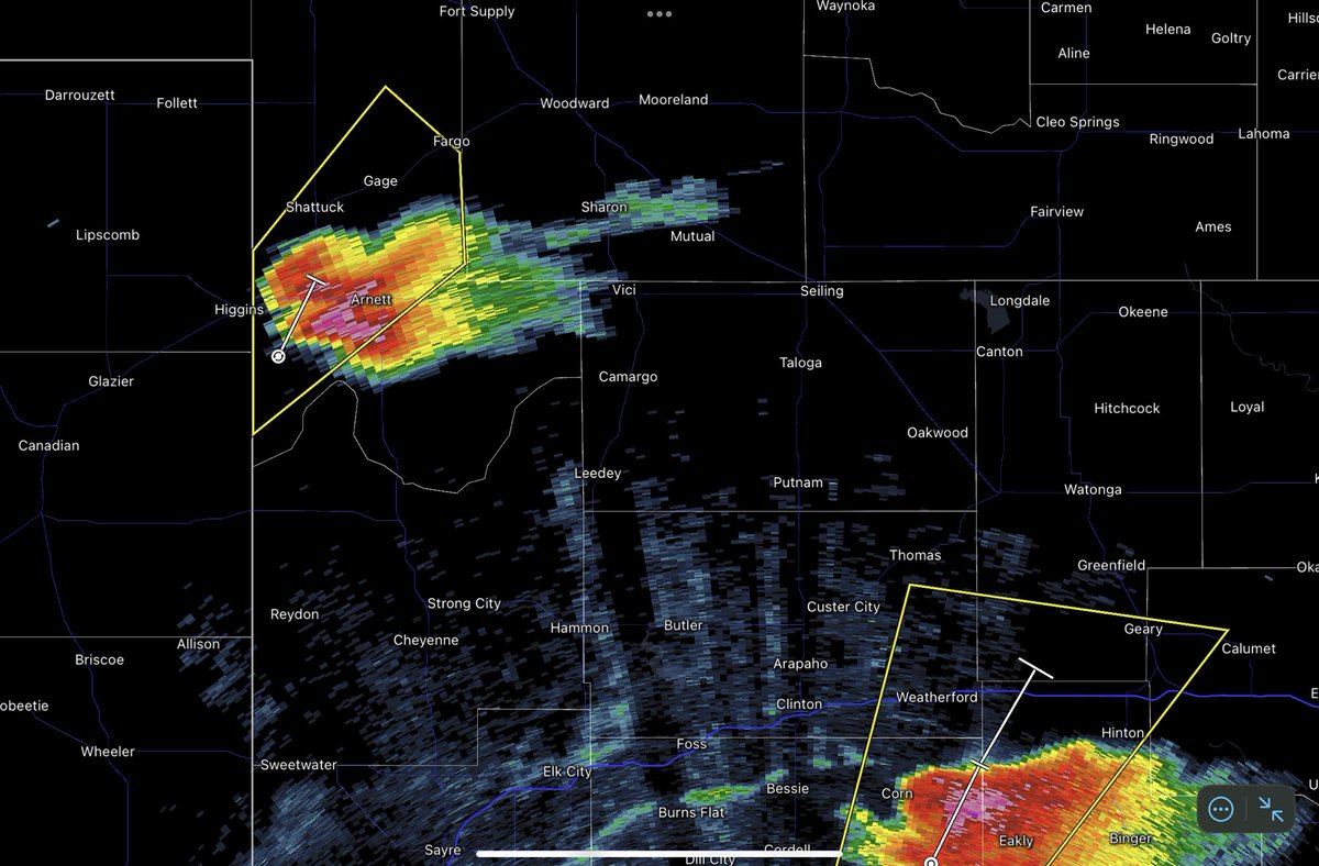
Our chase group is headed towards this cell outside of Arnett, Oklahoma! With high CAPE near the dry line and a potentially dangerous situation being issued in the state, our day is far from over!
At the park, we ran into the storm chasers from Mississippi State, and got snow cones! It was awesome to meet another group of chasers who love meteorology!
Cells have begun to form around Blackwell, Texas! This is caused by convection on the dry line in western Texas right now. Expect severe weather early this evening, with more scattered showers before then.
Our chasers have stopped for lunch in Lawton, Oklahoma! Initiation of storms still looks to be a few hours out, and we will be ready after a nice lunch