Here's a look at 24 hour rainfall totals across the area. Certainly highlights the swath of heavy rain that was seen yesterday from western Lunenburg through Chesterfield and across to the Williamsburg/Hampton Roads area and Middle Peninsula. What did your gauge record? #vawx
Here is my snowfall forecast for Sunday into Monday AM. I think there will be many disappointed folks… if they choose to believe in fear mongering forecast that are painting 6+ inches of snow for the metro area. I just don’t see it… #vawx#dcwx#mdwx#snow#rain#weather
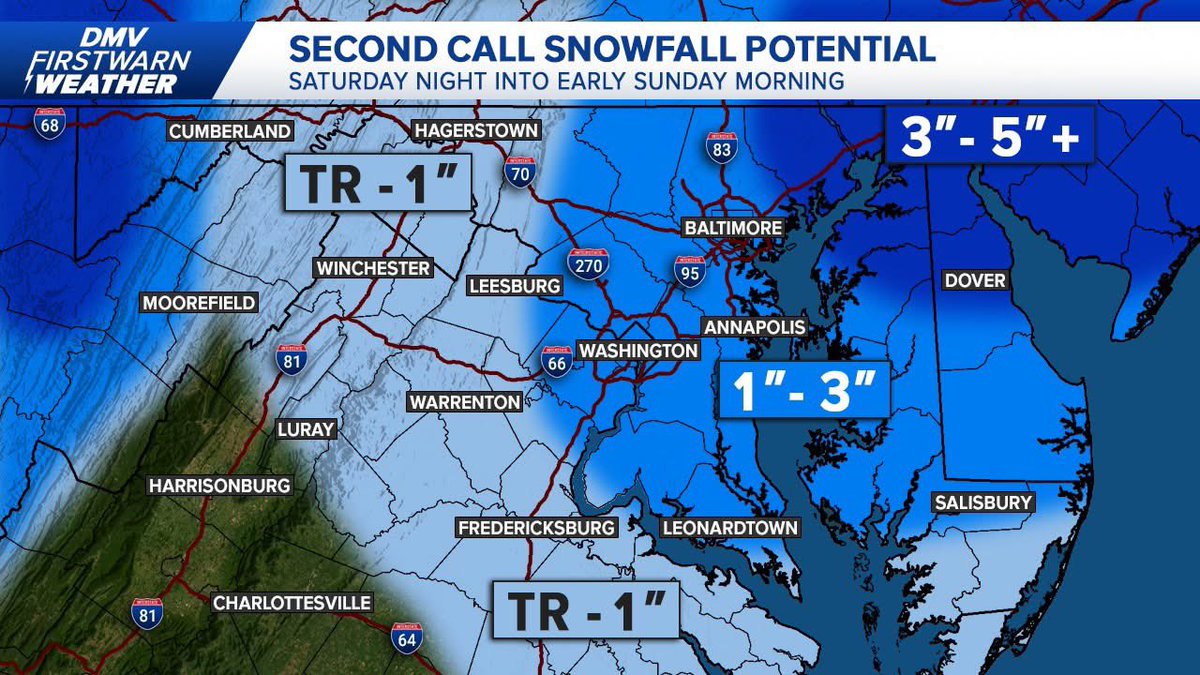
Here is my second call map as well as an ice map since freezing rain has crept more north since yesterday. Minor tweaks to my first call as sleet may move earlier but still relaying the same risk... #vawx#dcwx#mdwx#snow#sleet#ice#winter#storm#WeatherAlert#weather
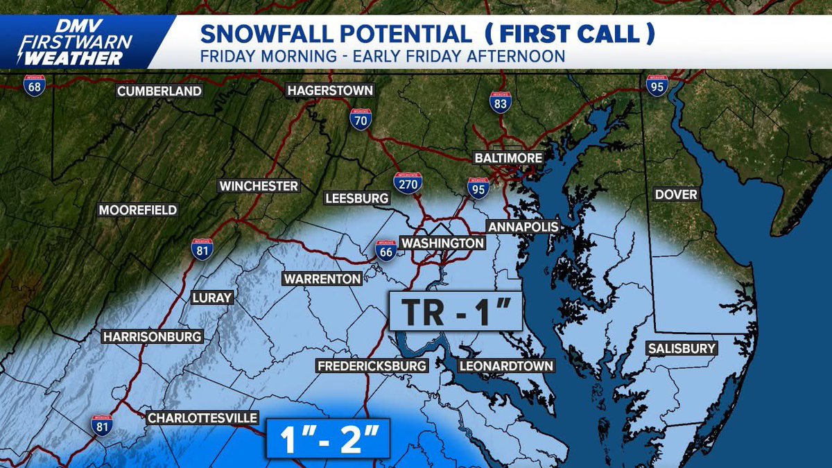
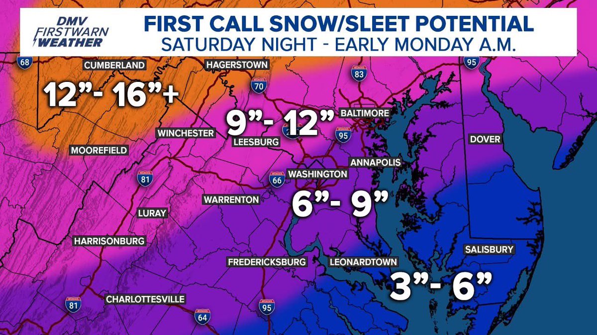
Good afternoon. Here is my first call snow/sleet map for our weekend storm and especially for those north and west of D.C. it's looking like a doozy in terms of impacts. Less south and east. #vawx#dcwx#mdwx#snow#winterweather#storm#WeatherAlert#weather
Here is your Thursday morning headlines ahead of what will be busy few days leading up to the start of our major winter storm. Now's the time to start getting ready if you haven't already... #vawx#dcwx#mdwx#winter#storm#snow#sleet#WeatherAlert#weather
SchoolCast for Friday: With this weak system moving in during the morning commute & temperatures in the 20s areawide, untreated surfaces will become slick so for that reason, I think a fair amount of schools in our southern zones have at least the chance for delays & closings.
Good morning, everyone. Wintry weather is moving in on this #WeatherAlert day, and things will get messy over the next 2-3 hours. Many schools have chosen to delay in our western zones to allow more time for things to warm up #vawx#dcwx#mdwx#snow#rain#wintry#weather
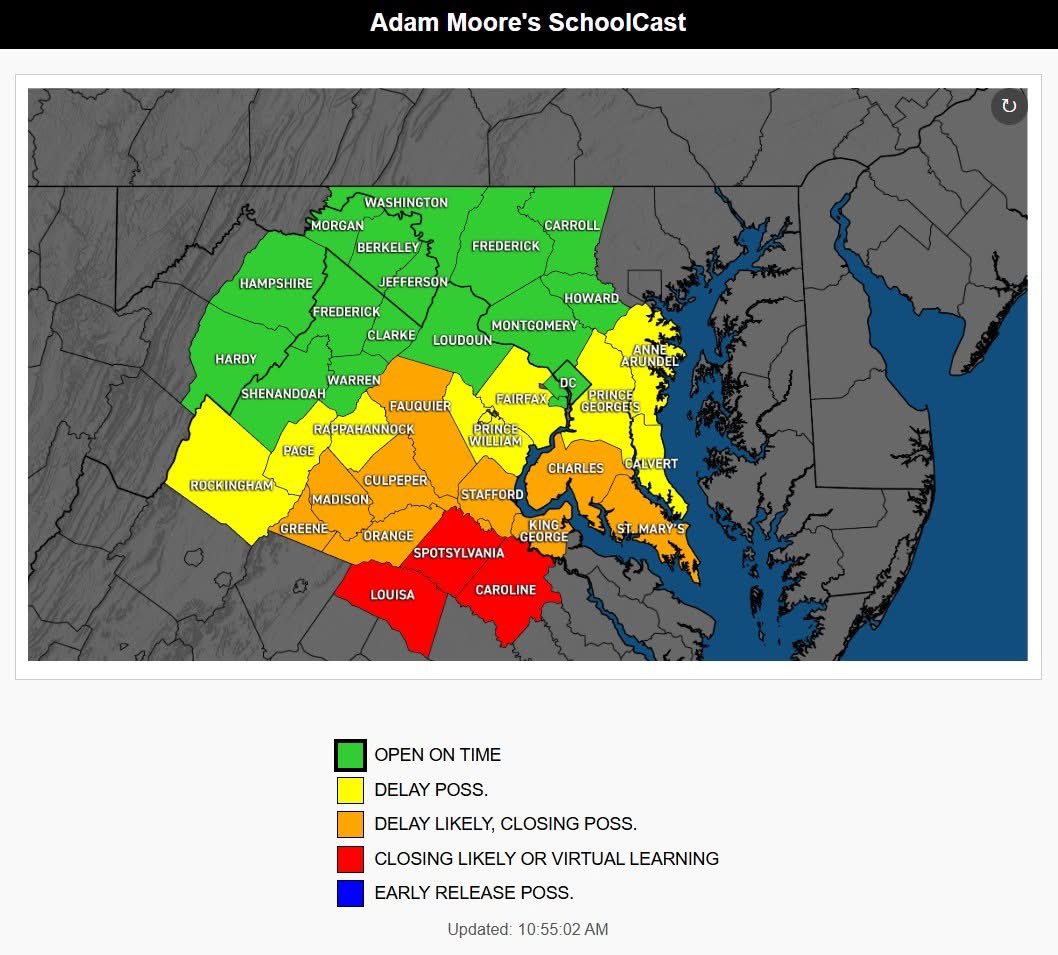
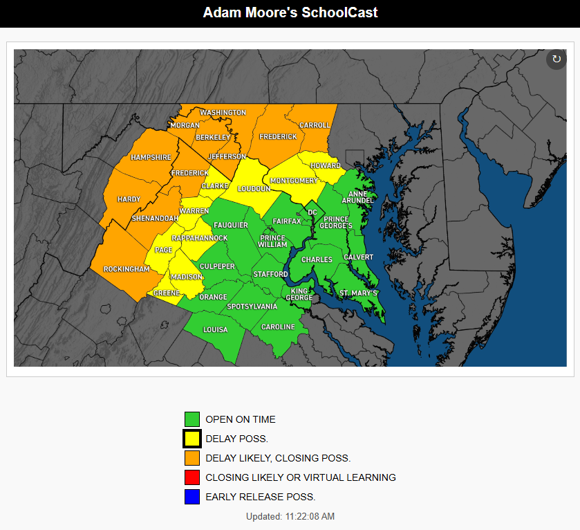
12/2/25 SCHOOLCAST: Tomorrow is a tricky one in terms of school decisions, due to the window of when wintry precip. affect our region. Those in northern MD, as well as the I-81 corridor, have the chance of a delay, but areas south & east of DC will likely remain open on time.
Clouds and sun will stick around for the rest of the day, with a possible isolated shower this afternoon. Expect unseasonably warm temps, with highs mainly in the 60s. With the passing cold front, tonight will become breezy and colder, with increasing clouds. #MDwx#VAwx
Overcast skies today with highs in the mid 50s. Rain chances return late tonight & a few spots may see showers before the day ends. Widespread rain continues overnight & ends Saturday AM. Conditions will dry out by Saturday afternoon & through the rest of the weekend. #MDwx#VAwx
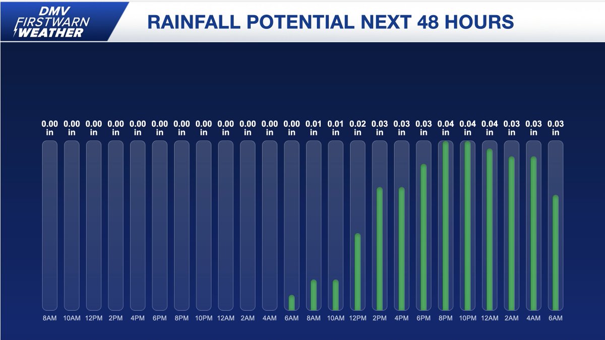
Today will be mostly cloudy and dry, with highs mainly in the upper 40s. Friday will be milder, with increasing chances of rain. The heaviest and most widespread light showers are expected Friday night, with rainfall totals of 0.10" to 0.25" possible. #MDwx#VAwx
Today will be mostly cloudy with cool and damp conditions. Because of the cloud cover, highs will only reach the upper 40s to low 50s. Cloudy skies will stick around for the rest of the work week. Rain is expected to return on Friday and continue into the weekend. #MDwx#VAwx
Here it is, our 2025-2026 Winter Forecast for the DMV! I am forecasting a weak La Niña for the upcoming winter, as well as average - above average snowfall, so get your snow shovels ready. The full write-up of my analysis is available on Facebook. #vawx#dcwx#mdwx#snow#weather
Mostly sunny & seasonably cool this morning. Clouds will increase through the day, with highs mainly in the 50s to near 60. Tomorrow will be mostly cloudy & warmer, with some areas reaching well into the 60s. Showers are likely late tomorrow night into the overnight. #MDwx#VAwx