INSANE video of a tornado (No, this is NOT A.I.) moving within just yards of people outside in Trappe, MD as it destroys a roof off a building!!! This is one of two confirmed tornadoes to hit the county yesterday.
@FOXBaltimore#wxtwitter#mdwx
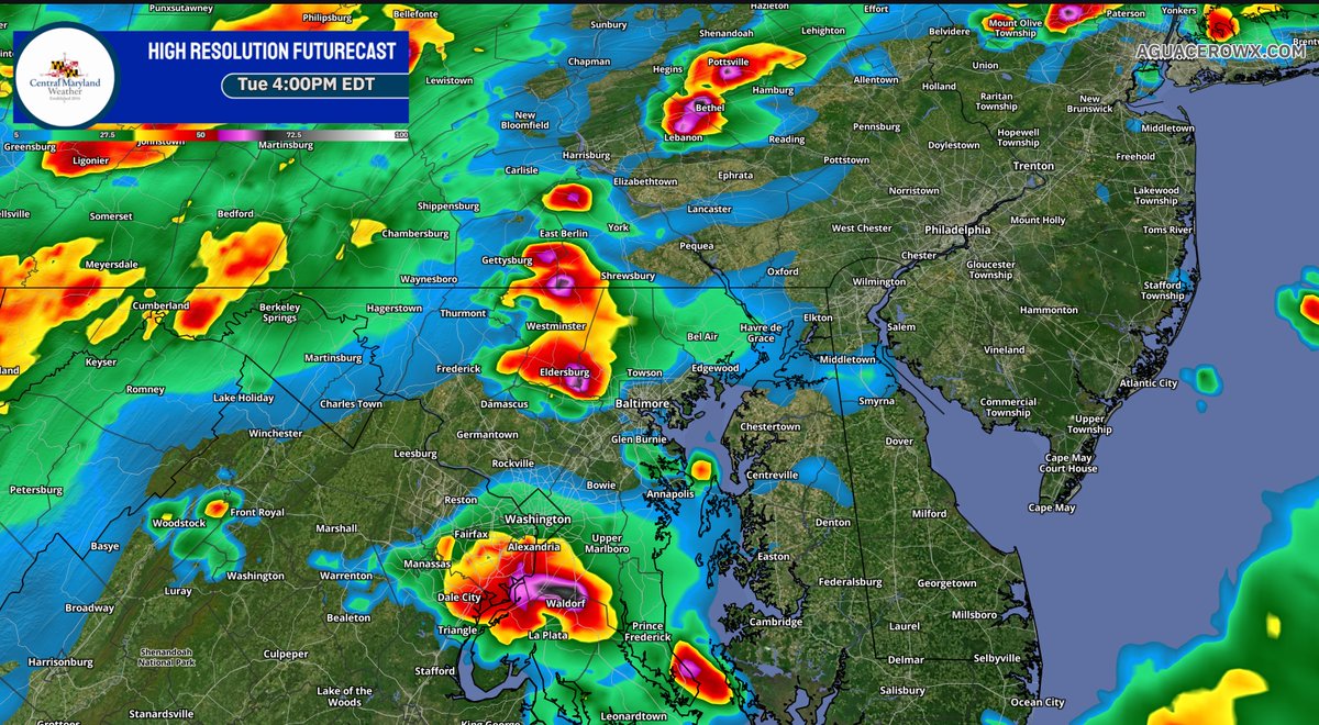
0z HRRR coming in and the trend has been towards more of a supercellular storm mode. Yes, low level shear is weak, but bulk shear has trended stronger once again. So, with very unstable and strongly sheared airmass, widespread damaging winds are possible, as is a tornado threat.
Enhanced risk expanded to include most of the DC region for Tuesday afternoon.
Wind threat is the highest, with tornado threat sitting around 5% though northern zones up through PA seems to have the best forcing for rotation as that’s where the warm front will likely be.
Still, available moisture does look rather high. Available moisture (PWATs) approaching 2” means heavy downpours and localized flash flooding risks look possible as well.
I'd say this is the best video I've seen so far during yesterday's tornado event. No scream, no shouting, steady https://t.co/ulUHw3BjQh makes the best illustration of how terrifying a nighttime monster could be....
Complete devastation near a construction site in Huanggang, Hubei Province. Houses completely demolished, iron beams thrown long distance, trucks tossed&severely mangled. Can't imagine how tragic when dawn breaks, unconfirmed sources list already 11 fatalities, a truly nightmare.
This is ~40 inches of rain in 12 hours… I’d like to see some verified readings for this but China is known to have some pretty insane rainfall rates especially in the summer when tropical cyclones influence weather patterns.
Affected by Typhoon Maysak, Fangchenggang in Guangxi was hit by extreme rainstorms, with 997.1 mm of rainfall in 12 hours, causing local river levels to exceed historical records and almost the entire urban area to be flooded.
#WPC_MD 0619 affecting Central to Northeast MD...Central and Eastern PA...Central and Northern NJ...Southeast NY/Long Island...Southwest CT, #nywx#ctwx#njwx#pawx#dewx#mdwx#dcwx#vawx#wvwx, https://t.co/oyYVub9iSS
High heat/humidity will lead to plenty of storm fuel. This evening's 00z July 4th KIAD sounding coincidentally shows 1776 J/kg of DCAPE signifying plenty of wind energy to work with. Similar values are expected Sat leading to severe storms capable of wind gusts of 60-80 mph.
Temp went down 4°F from 92°F to 88°F between 10-11pm tonight...but the dew point rose from 72°F to 77°F...so despite getting cooler, the heat index went up 1°F...from 99°F to 100°F at 11pm.
Gotta love summer...
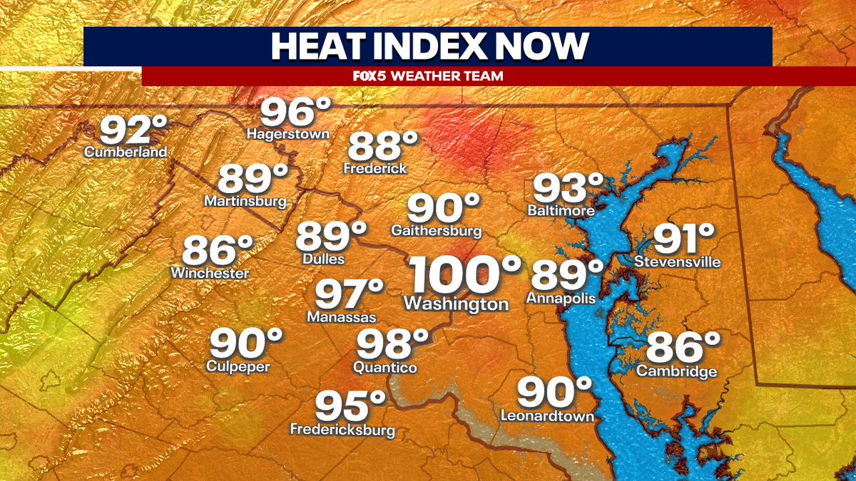
@MikeTFox5 Yeah I’m thinking heat index when I put those numbers out. I’d be surprised if we hit the 105 actual high the NWS forecasted a couple days ago but you never know. If dew points are up over 75 during the hotter parts of the day could see those heat indexes verifying.
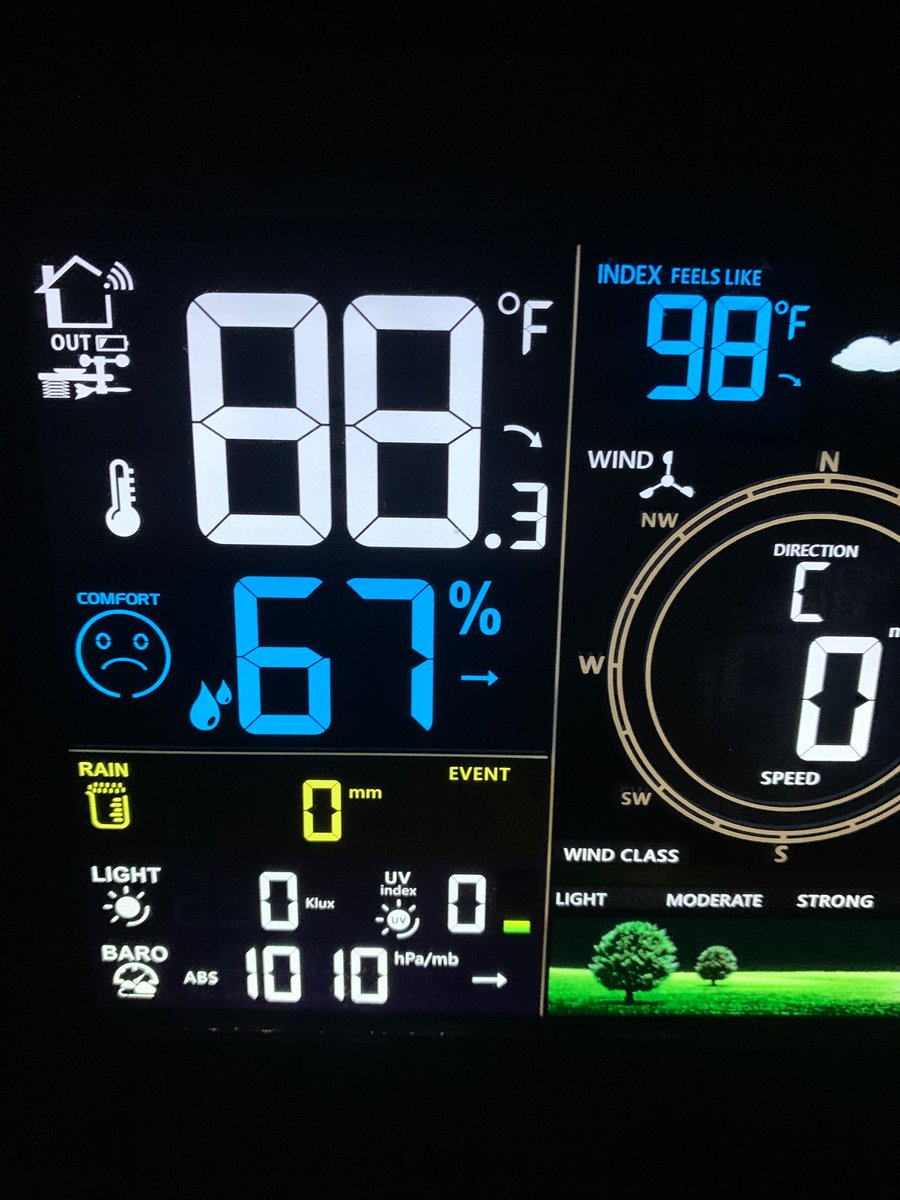
DCA still feeling like 98 at midnight, and my station has the same reading. It will be very, very hot tomorrow. I wouldn’t be surprised to see a couple heat indexes in the region hitting 120 where the dew points are high… Stay cool! #dcwx#mdwx#vawx
88 with a heat index of 98 at 11:40. Yeah that’s uncomfortable to say the least. DCA also reading the same at 11:30. Next couple days will be worse. @capitalweather#dcwx#mdwx#vawx
PUNISHING heat wave Wednesday through July 4 in DC.
NWS now forecasting highs of 104 Thursday, 105 Friday and 102 on July 4 -- all record highs.
Heat indexes 5-8 degrees higher.
Forecast update: https://t.co/epWSoxksz8
Heat index for Thursday. NWS going 110-120 along/east of I-95 and 105-110 west and I agree. These are life threatening temperatures with heat stroke LIKELY if precautions aren’t taken.
Yes, that’s 121 degrees in northeastern AACO….