One photo doesn't capture a project. Consistent documentation does.
DesCor Builders captured every phase of this school campus expansion with DroneDeploy – so when questions came up, the record was already there.
#Construction#SiteDocumentation#EducationConstruction
Big changes are coming to DroneDeploy Ground. We're not ready to spill everything yet – but stay tuned.
See what Ground can do today: https://t.co/1hm3gJjH0B
#construction#constructiontech
One photo doesn't capture a project. Consistent documentation does.
DesCor Builders captured every phase of this school campus expansion with DroneDeploy – so when questions came up, the record was already there.
#Construction#SiteDocumentation#EducationConstruction
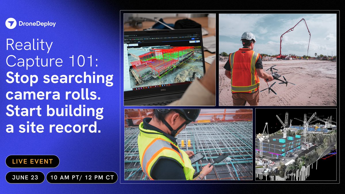
A utility line strike costs $100K on average. Most are preventable with documentation taken before excavation starts.
We're covering underground workflows – and a lot more – in our Reality Capture 101 webinar. June 23, 12pm Central.
Register → https://t.co/K9IBVTcq0u
AI is creating one of the largest infrastructure investment cycles of our lifetimes.
Our new roadmap covers six areas of enabling technology in the data center stack that address the interconnected challenges in AI’s energy layer:
🔹 Permitting & site selection
🔹 Power generation
🔹 Transmission & power conversion
🔹 Software and orchestration
🔹 Construction, maintenance, & labor
🔹 Cooling technologies
Learn our view of the current landscape + the leaders we’ve backed 👉 https://t.co/2hpqICHk4g
Your crew walks the floor before close-up anyway. DroneDeploy Ground maps that walk to the floor plan at 2 photos/sec and stacks every new walk against the last one. Same effort. Permanent record.
#construction#realitycapture
.When you have 1,200 workers on site, "I think it looked like that" isn't good enough.
@McCarthyBuild documents every room from steel to paint — every week — so the record exists before anyone has to ask for it.
More stories like this one: https://t.co/aI4r0wRLga
Join us June 23 at 10 AM PT for Reality Capture 101 – what structured jobsite documentation actually looks like in practice.
Register here: https://t.co/mSRgAQP7Y0
#webinar#constructiontech
A plane ticket to a remote site costs more than a DroneDeploy flight.
Trained pilots. Flat-rate pricing. Maps, photos, videos and panel data – no travel required.
Try Data On-Demand on your next project → https://t.co/DWuZHdtUZ9
#construction@LaytonConstruct
One year of construction at Adolfson & Peterson Construction. 1,800 students. The last school in a community bond initiative – documented from the air.
Rocky Vista High School, 27J Schools. Progress captured with DroneDeploy.
#construction#constructiontech#timelapse
Consistency at scale matters. ✅
Across North America, PCL Construction is expanding its partnership with @DroneDeploy to standardize reality capture across 1,000+ active projects. 📸
Since adoption, our teams have processed more than 45M images. ⏬
https://t.co/yxDIioaUmy
A folder labeled "photos" will only get you so far.
@JoerisGC flies weekly, uploads hundreds of photos in under two hours, verifies sub payments from the air and pulls up any phase of their build in 3D.
Cost: 30 minutes a week.
#constructiontech
🚁 AI-powered drones, 360 cameras & 3D scanning are transforming #construction jobsites. PCL Construction and DroneDeploy are leading the shift toward smarter, data-driven project delivery. 🏗️📊 #ConstructionTech - Read all about it 👉 https://t.co/ZddICledIM
Scaling construction technology takes more than new tools. It takes the right partnerships. 🤝
For more than a decade, PCL Construction has worked with @DroneDeploy to turn early trials into scalable, enterprise capabilities as AI continues to mature. 💻
https://t.co/0HbFEwYeUQ
One year of construction at Adolfson & Peterson Construction. 1,800 students. The last school in a community bond initiative – documented from the air.
Rocky Vista High School, 27J Schools. Progress captured with DroneDeploy.
#construction#constructiontech#timelapse
Monitoring and inspection are one area where robots are working well today.
DroneDeploy just crossed 20 trillion square feet of visual site data, with missions up 160% YoY, spanning autonomous capture from docked drones to ground robots.