@NWSCharlestonSC Do you think the enhanced risk could be extended southward over the rest of the forecast area? Particularly, Hinesville, Richmond Hill, Savannah area? Thank you for the updates!
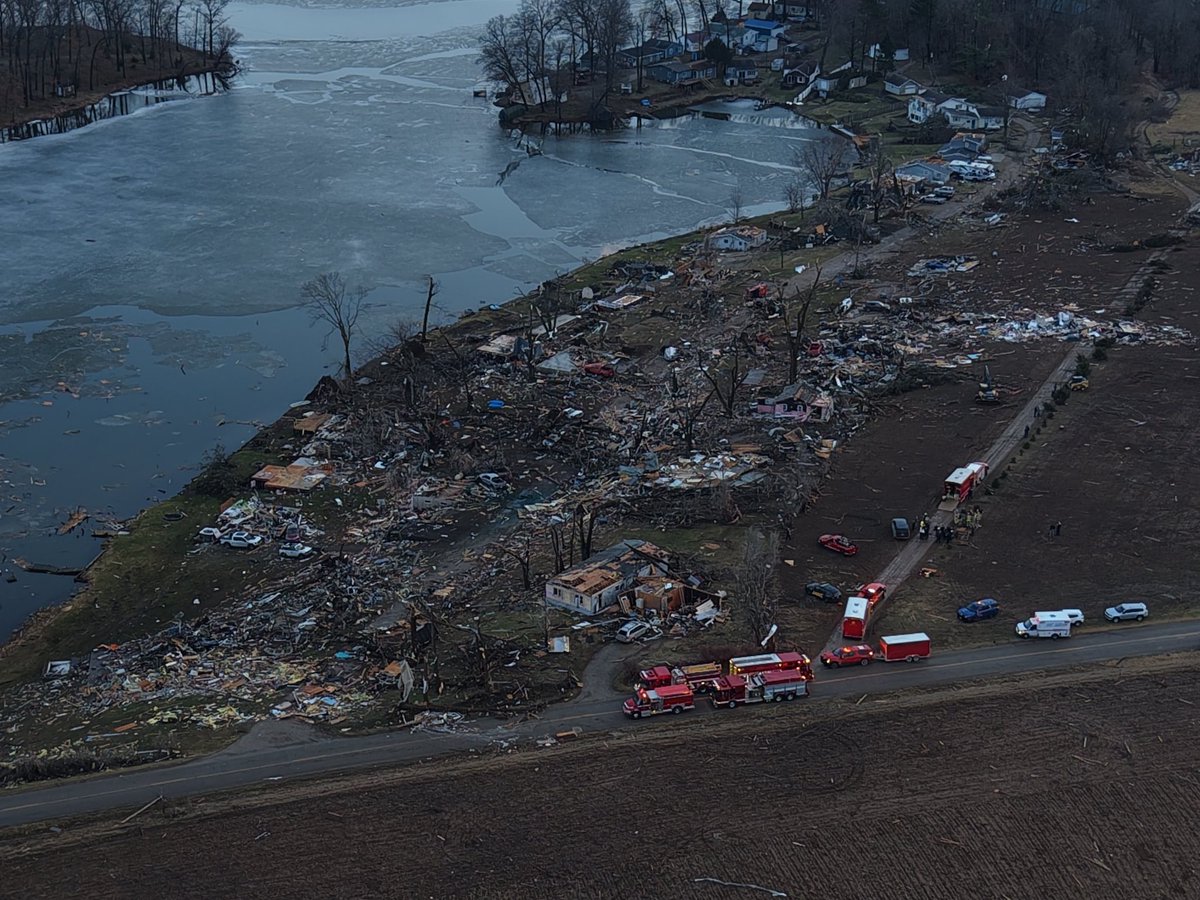
This neighborhood in Union City, MI was decimated by the tornado today.
This is devastating and EF4-level winds were almost certainly present.
Whether it gets the rating is different but this is the worst tornado damage Michigan has seen in decades.
https://t.co/l3N8eejuLq
This is the moment 2 homes are fully rolled/vaulted and disintegrated by the Union City, MI tornado. Unanchored residences and mobile homes are commonly thrown like this in intense/violent tornadoes.
Cuba 🇨🇺 has just recorded its lowest temperature on record this morning, with 0.0°C (32°F) at Indio Hatuey. This marks the first time in recorded history that the country has officially reached the freezing point.
This will be an event to tell the kids one day. I lived in Redfield and to say there was a lot of snow is an understatement! School was closed practically all week. Snow buried road signs, homes, even the bottom of some billboards per reports. An event I’ll never forget!
February 3-12, 2007:
A substantial lake-effect snow event impacted western New York. Long-lived bands sat over the Tug Hill Plateau, and by the 12th, portions of Oswego, Oneida, and Lewis counties measured accumulations of over 120 inches (Redfield peaked at 141").
#wxhistory
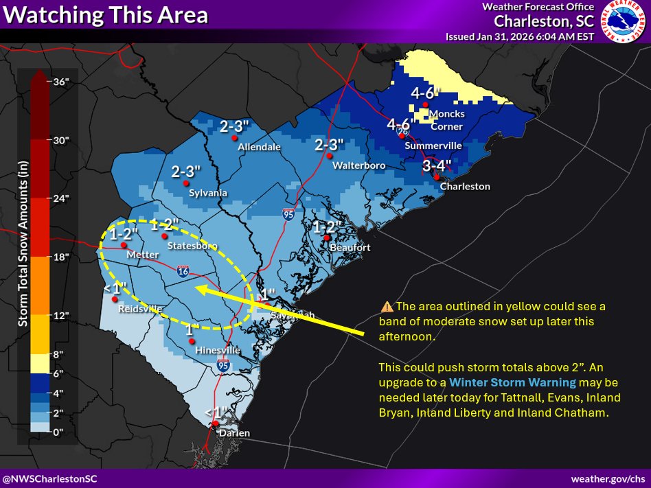
We are monitoring the area from roughly Metter to Savannah for a possible band of moderate snow setting up late this afternoon. This could push snow totals above 2". An upgrade to a Winter Storm Warning may be needed Tattnall to Chatham Counties later this morning. #gawx#savwx
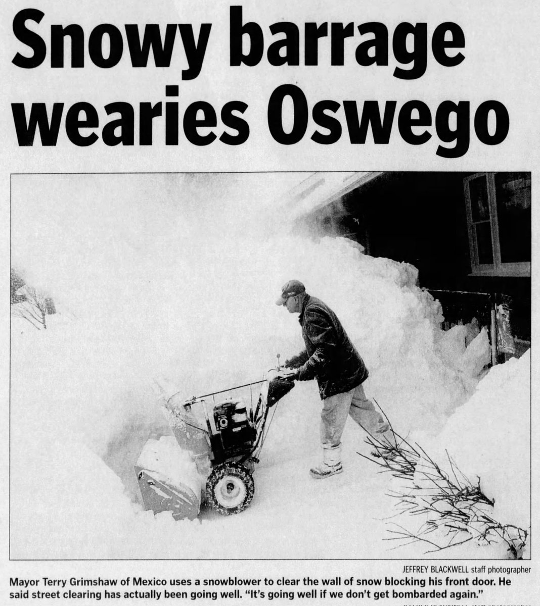
You asked. We listened. More massive snowblowers, right here!
After this weekend’s statewide snowstorm, crews are using these massive machines to remove towering snowbanks crowding roads and blocking visibility. Cleanup continues. Please slow down and give crews space.
Watertown Airport in Northern NY clocking in with a low temperature of -33°F this morning!! They are in a "bowl" where the Black River Valley drains the Western Adirondacks and this is not that rare. Still, it's FRIGID!! @NWSBUFFALO
From a snow enthusiast back home! The Eastern Lake Ontario region has been getting PUMMELED this month. I am sure somewhere on the Tug Hill will top out over 300" this season.
@Brady_Wx Do you think the NWS in Charleston held off on watches for the Savannah area because they are seeing if this is a trend, or do you think they believe the Savannah area won't see warning criteria snow?
@SCweather_wx I wonder why they failed to add Savannah and points south. Maybe they don’t see as much coming here? Lowkey surprised but I’m not the expert..