A new VC in UNN was inaugurated, and it's not even up to one year of his administration, we are seeing a hike in school fees, including the acceptance fee. Parents no dey shit money o!
We say No!
#NoToFeeHike#UNNFeeIncrement#UNNStudentsSpeak
✊🏿WE SAY NO TO SCHOOL FEES HIKE✊🏿
We, the students of the University of Nigeria, are saying no to any form of school fee hike. The school management increased our fees—by as much as 100%—without clear communication or explanation.
#UNNFeeIncrement#UNNStudentsSpeak#fyp#vdm
😪
This decision will only bring frustration and hardship to families. Education shouldn't be a privilege reserved for the rich; it should be a source of hope for everyone, including the poor.
We deserve clarity
We deserve proper communication #SuspendUNNFeeHike#UNNStudentsSpeak
✊🏿WE SAY NO TO SCHOOL FEES HIKE✊🏿
We, the students of the University of Nigeria, are saying no to any form of school fee hike. The school management increased our fees by as much as 100% without clear report
This is Pressure😭
#jNoToFeeHike#SuspendUNNFeeHike#UNNStudentsSpeak
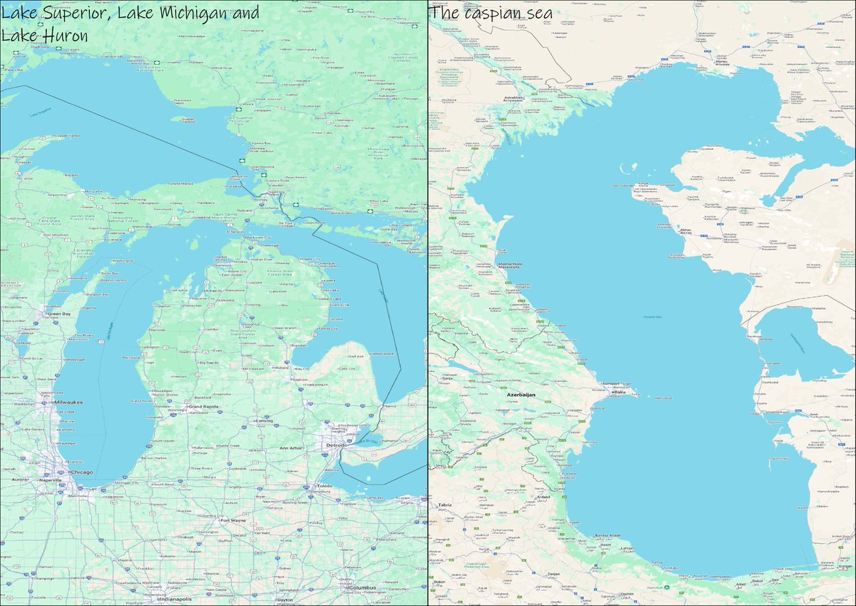
💧 Day 20 – Water #30DayMapChallenge
Compared the Caspian Sea and Lake Superior today.
They look similar in size, but geographers know the difference:
Caspian = huge inland lake
Superior = largest freshwater lake
#GIS#Mapping#Geography#DataViz
🗺️ Day 19 – Projection (GIS Day)#30DayMapChallengeFocused on map projections today! Used four styles: • World From Space • Peirce Quincuncial • Equal Earth (Asia-Pacific) • Robinson Cool to see how each one reshapes the world differently. 📷#GIS#GISDay#Mapping
🗺️ Day 17 – A New Tool #30DayMapChallenge
Tried a new mapping tool today — https://t.co/8hJTsITClx. UI felt a bit tricky at first, but I got the hang of it. Definitely a different experience from QGIS!
#GIS#Mapping#DataViz#Geospatial#AtlaCo
🗺️ Day 16 – Cells #30DayMapChallenge
Made a hotspot map of food joints in London, using cell-based analysis to show the busiest areas 🍽️🔥
Shout-out to Alasdair Rae for the data + inspiration!
#GIS#Mapping#DataViz
🌍 Day 14 – OpenStreetMap #30DayMapChallenge
Mapped a 10km buffer around Old Trafford using OpenStreetMap data, showing all road networks within the range.
A simple look at how connected the area is. 🛣️⚽
#GIS#OSM#Mapping#OldTrafford