CHELCO is working to restore power to the area. Almost the entire electric system was down after Hurricane Isaias blew through. https://t.co/rck5PJd5c6
Okaloosa County will open a hurricane relief supply distribution point with water, tarps and MREs at the public library from 1-5 p.m. today. https://t.co/3jmimjbOrS
Oct. 11: Calm after the storm. The forecast for the upcoming week is pretty simple: Sunny with highs of 90° and lows between 60-64° through Friday. 85° today, 89° tomorrow/Columbus Day. Lows of 61° both nights.
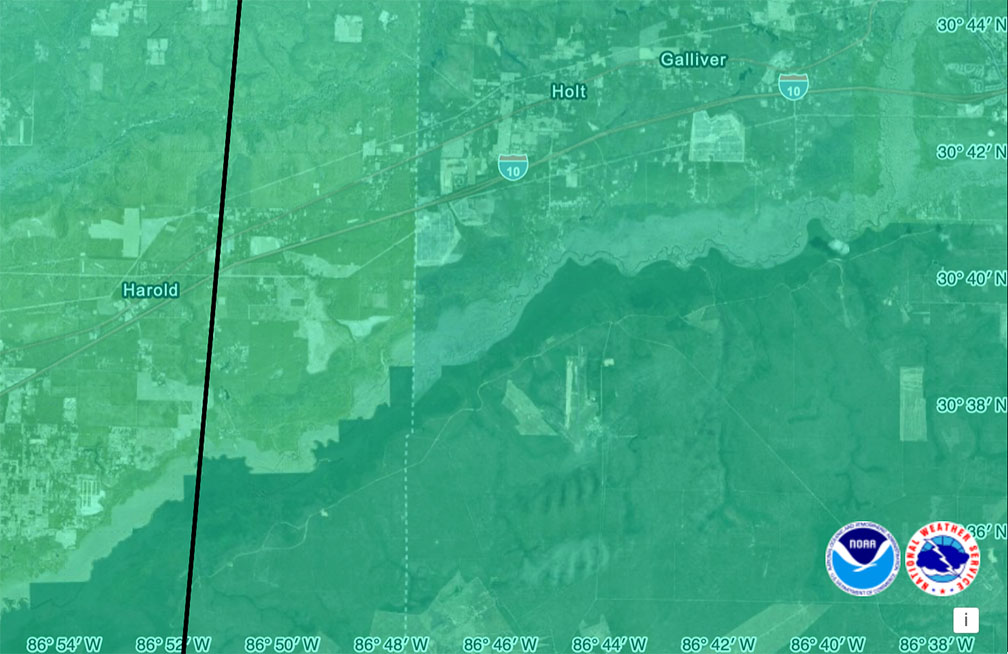
Holt hurricane recovery is underway. Lots of downed trees & power lines. And it was a busy 24 hours for Holt Fire District. https://t.co/ujcqAa644Z
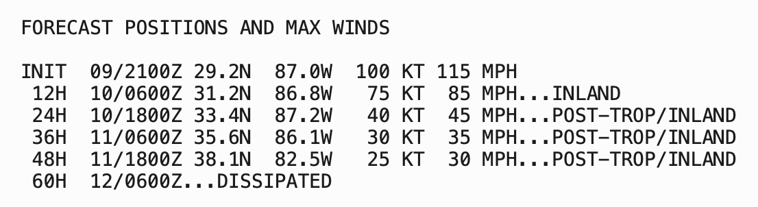
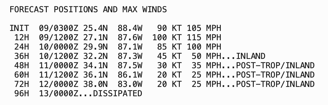
Oct. 9 Isaias 4 p.m. update: Isaias has turned north toward us, moving at 17 mph. This is a fast-moving storm with “extremely dangerous and damaging hurricane-force winds.” Max winds are at 115 mph, Cat 3. NHC says little change is expected before landfall.
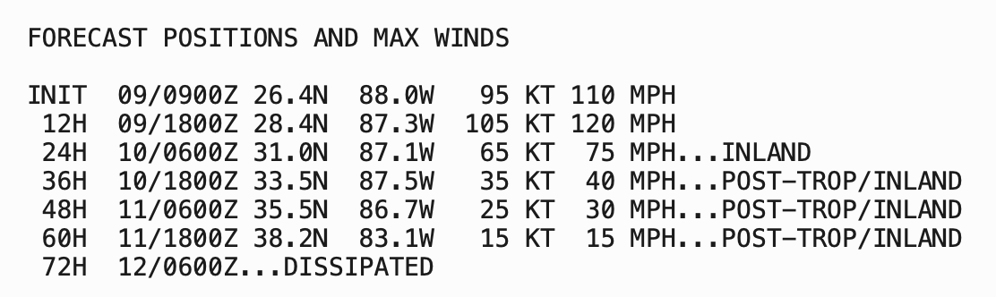
10/9 4AM: Isaias is intensifying to be a Cat 3 storm. The NHC is forecasting some wind shear prior to landing to knock it down to a Cat 2, but it will be a dangerous storm w/damaging winds, heavy rain & tornados. Expect power outages. Landfall tonight/earlytomorrow.
10/8 10PM update: Isaias is a Cat 2 storm w/wind speeds near 105 mph. It is forecast to briefly become a major hurricane, Cat 3, w/115 mph winds within the next 24 hours; however, wind shear will cause some weakening before landfall sometime tomorrow night or early Saturday.
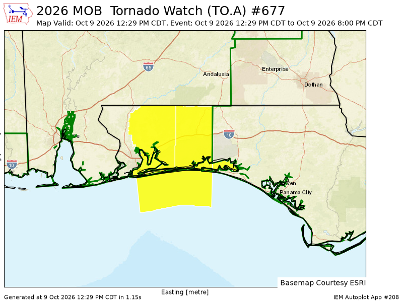
10-8, 1PM storm impacts update: We have a Level 2 tornado risk tomorrow as Isaias makes it way here. The tornado threat can happen well before the hurricane arrives. EF2+ tornadoes that may stay on the ground for a bit are possible. 3-7" of rain, up to 10" possible.
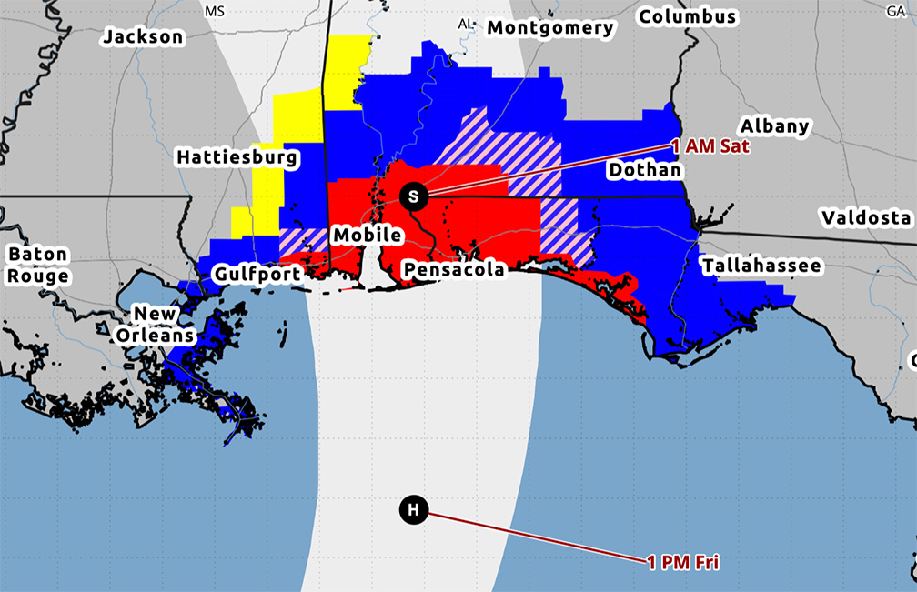
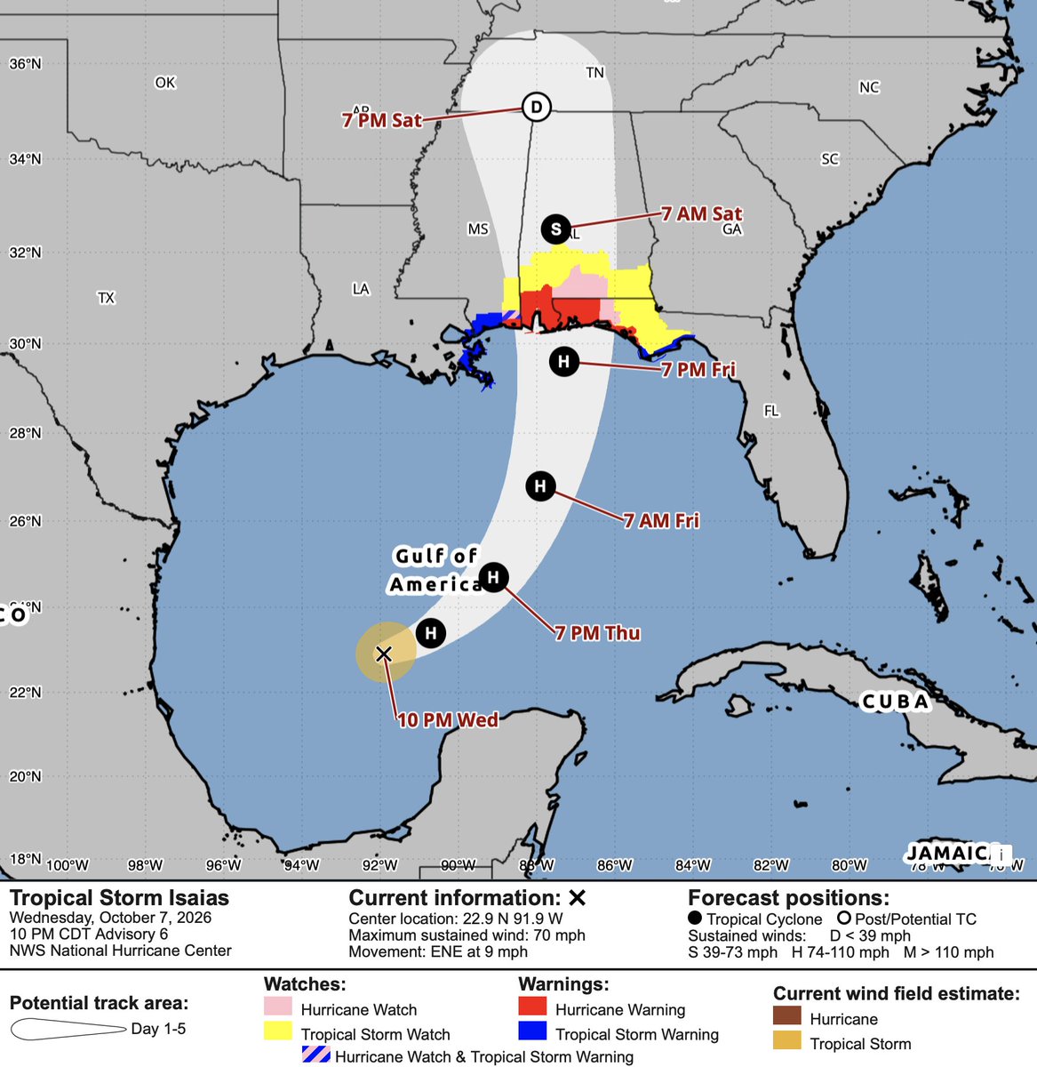
10/8 7 a.m. map update: Isaias is still traveling E-NE but is expected to make a turn toward the NE today followed by a turn north tomorrow. Strengthening to a Cat 2. NWS-Mob is forecasting landfall tomorrow night. We'll be under a Level 2 (out of 5) tornado risk Fri & Sat.
10-7 10 p.m. NHC update: Isaias is nearing hurricane strength—will be one soon. We’re now under a hurricane warning. The system is expected to remain a dangerous Cat 2 hurricane through landfall. Track keeps ticking east, closer to us with each update. Next update is at 4 a.m.
Okaloosa County has issued a county-wide state of emergency. Included in this article is information on evacuations, shelters, and more. https://t.co/KUKqqXj1zN
4 p.m. NHC update: TS Isaias is quickly intensifying and is expected to be a hurricane by tomorrow morning with further strengthening through Friday morning. It is forecast to make landfall late Friday or early Saturday.
Okaloosa County schools will be closed tomorrow and Friday. County officials are expecting high winds, storm surge, flash flooding and the potential for tornadoes beginning as early as Friday mid-day. As a reminder, Monday is a scheduled teacher workday. Classes resume Tuesday.