Interested in using GIS to do 2D and 3D analysis to understand the environmental, social, and economic impacts of your design? Langan can help, swing by our booth (401) at IMGIS.
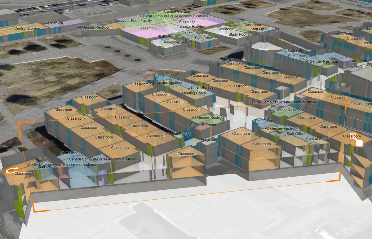
Swing by the Langan booth (401) at IMGIS to learn more about taking your campus or facility 3D for asset, space, and emergency management. Here is an example of a K-12 campus we've 3D enabled in ArcGIS Indoors.
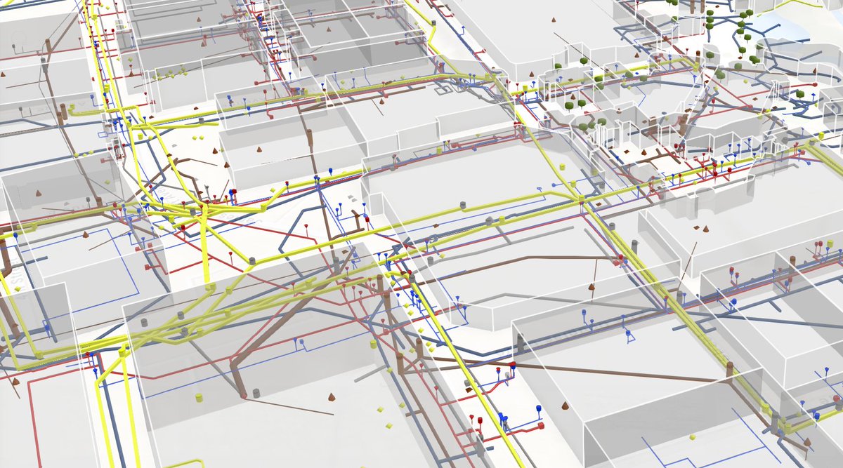
@X Excited to be at the Esri IMGIS conference this year. I've been working with the NBC team to build a 3D subsurface utility network. If you'd like to learn more, watch the IMGIS Plenary or swing by Langan's booth 401.
@PetrickVicki Let us set the way back machine to ‘98, when a beautiful doctoral student conceded to let a young man who was enamored with her love of art take her to dinner in Paris. ;)
CityEngine continues to drive how content is created in the entertainment world. Besides Zootopia, Incredibles 2, Blade Runner 2049, it's no surprise the hit TV show, The Witcher, rolls with CityEngine as well! Check it out: https://t.co/IRDZPV6xPF
#3D#GIS#CityEngine
You can now use #ArcGISUrban to create land use plans based on existing and #future land use boundaries. Additionally, you can validate #zoning scenarios against future and existing land use to ensure feasibility. Check out the other new capabilities here. https://t.co/Mn0uS5dKVL
Join us for a webinar on Wednesday, July 1st @ 9-10am PST to discover how cities can transform and better plan for the future with #ArcGISUrban. To see some exciting new enhancements that are set to release soon, sign up here! https://t.co/jNdy3hZY9T
#smartcities#BIM#AEC
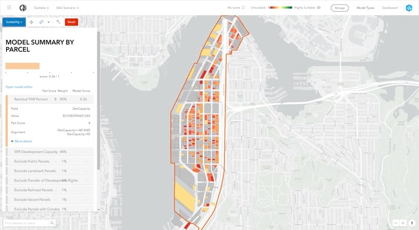
Check this out! The City Council of Honolulu uses #ArcGISUrban to address the housing affordability crisis by visualizing proposed #zoning changes against current #housing patterns, to gauge impact. Read the blog to learn more! 🌴🏙️ https://t.co/Au3kCeohfw
#smartcities#3DGIS
Learn how #ArcGISUrban helped the fastest growing city in Switzerland improve its existing #urbanplanning workflows without the additional overhead of #data preparation and customization. Read the blog here!
https://t.co/jVGaOawNpq
#smartcities#3DGIS
Preparing plans for your community? With #ArcGISUrban create specific area plans quickly and evaluate key indicators for your #planning scenarios on the fly easily. Reduce time it takes to evaluate zoning changes and schedule a demo!
https://t.co/3VUTLFPhHz
#smartcities#3DGIS
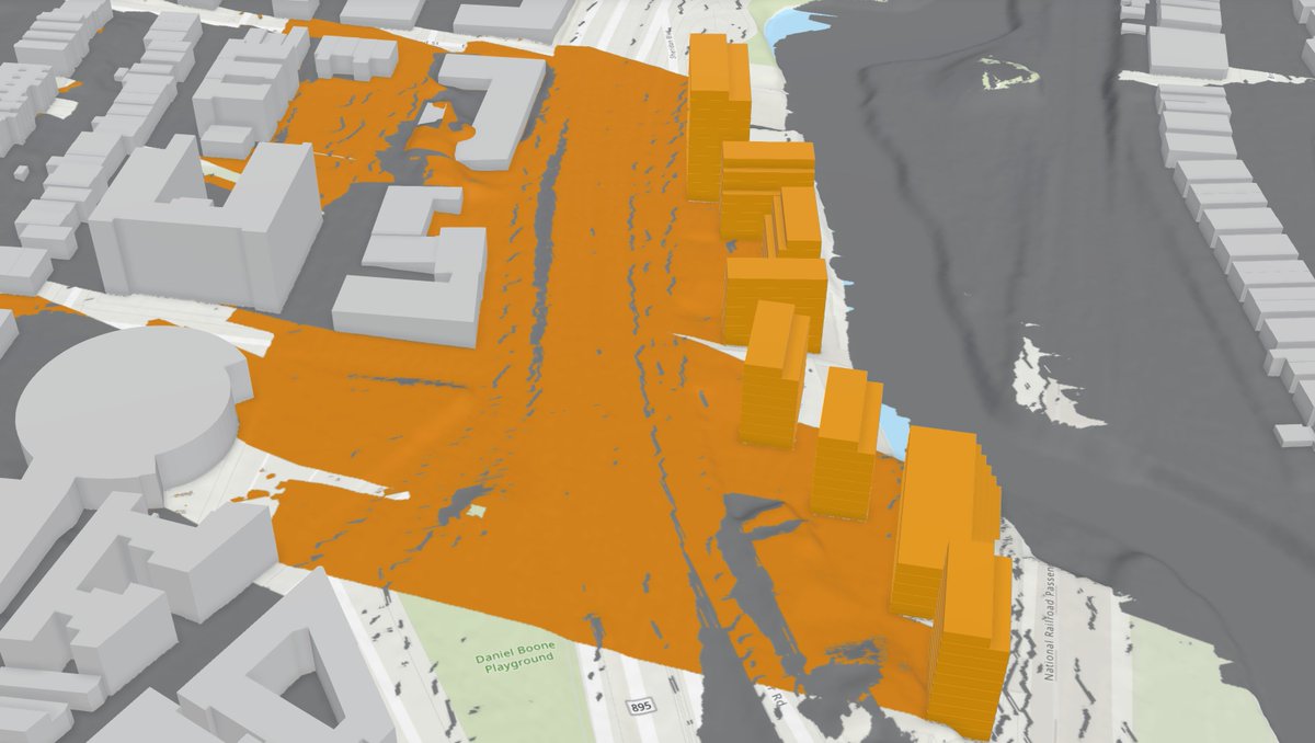
Seattle, the decade’s fastest-growing US city, dives deep into #spatial analytics to manage dramatic growth, assess buildable lands, and fine-tune #zoning to make way for more residents. Check out the blog here!
#smartcities#3DGIS
https://t.co/cA7DFHsQ2A
An Argis Lens client success story-- read how a commercial/residential mobile home park in El Jebel, CO is leveraging the #argislens, improving safety, saving time, and refining their #GIS data: https://t.co/PfNXCi3rrS #AR#ArcGIS#geospatial#excavation