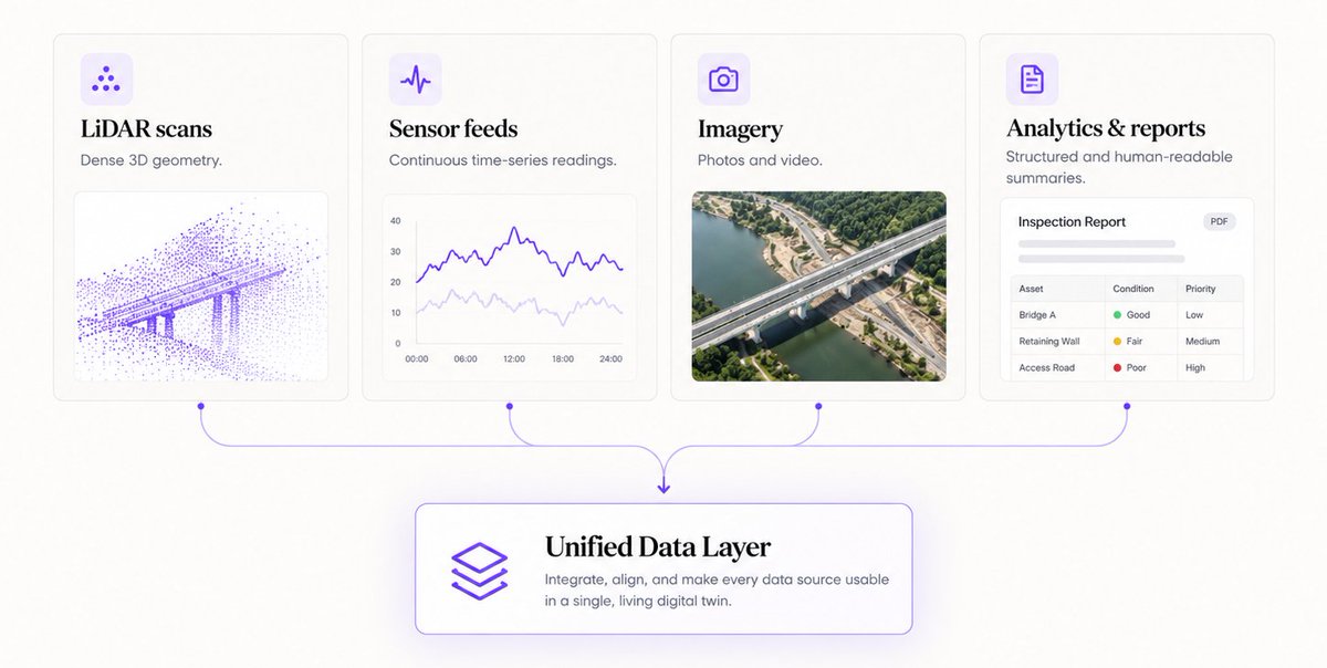
The hardest part of a digital twin isn’t the visualization.
It’s getting LiDAR, sensors, imagery, and reports to agree on where, when, and what.
Read the article: https://t.co/UBMD9eYJiH
#DigitalTwins#Geospatial#LiDAR#DataIntegration
We wrote up how a levee becomes a digital twin.
Aerial imagery, LiDAR, subsurface surveys, boreholes, live sensors — all scattered across incompatible tools, brought into one browser-based model.
Full case study → https://t.co/BNBzgywJgt
#DigitalTwin#Infrastructure#CaseStudy
"Digital twin" gets used a lot. The workflow behind one gets explained far less.
We broke it down — step by step, from drone survey to live dashboard.
Full article → https://t.co/OeudzChXXI
#DigitalTwins#Infrastructure#RealityCapture
Infrastructure data is scattered across scans, sensors, and inspection notes. EZ Digital Twins brings it all into one live 3D platform—helping teams visualize assets, share insights, and predict issues before they escalate.
https://t.co/lIEmtPoE49
#DigitalTwin#Infrastructure
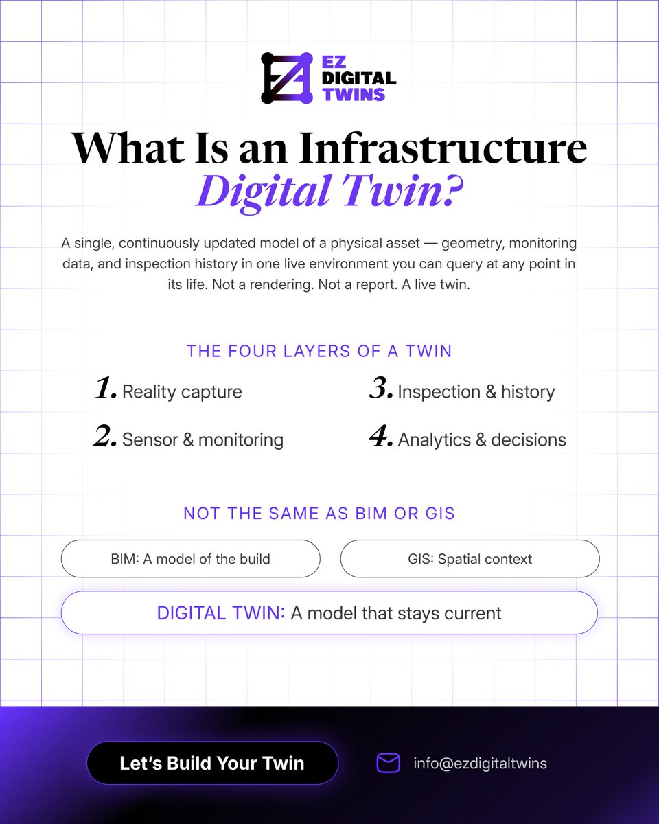
What Is an Infrastructure Digital Twin? Not a rendering. Not a report. Not BIM. Not GIS. A live model of your asset that stays current: geometry, sensors, and inspection history in one place.
Read the breakdown: https://t.co/93038NdISK
#DigitalTwin#AssetManagement#Engineering
Take a walkthrough of the Levee Digital Twin platform, developed by EZ Digital Twins. See how levee infrastructure can be explored and understood in an interactive digital environment.
▶️ https://t.co/8cj0M5BMFK
Today, we are launching EZ Digital Twins, a platform that brings infrastructure assets into a single, live, and intelligent digital environment. Built by engineers, accessible to all. Read the full announcement → https://t.co/Avrp33Lujf
#DigitalTwins#Infrastructure
The Levee Digital Twin Platform is live and we powered it.
Built by @UCBerkeley, founded by @YubaWater. 2 field seasons. 8 data layers. LiDAR, thermal IR & multispectral imagery for the Yuba River Corridor.
https://t.co/KzAd3JrH4g
#DigitalTwins#LeveeMonitoring#LiDAR