Thanks, Flathead Avalanche forecast team!
Your forecasts and videos are the visible products of your dedication, teamwork, wise-decisions, deep expertise, and experience. You bring unique talents and styles to our work, but you all work together. Thank you.
📷 austin seback.
We are in the midst of a wet loose avalanche cycle that may become more widespread today. The snow surface on slopes unaffected by yesterday's heat will become more dangerous as the day warms.
📸 1 - Wet loose slides witnessed at 1700 yesterday.
Expect wet snow avalanches to develop as sunshine and warming temperatures melt the snow surface. Pay attention to changing conditions and move to a different aspect or lower-angle slope if you find yourself sinking into mushy snow.
Even the snow is thinking about waves and beaches.
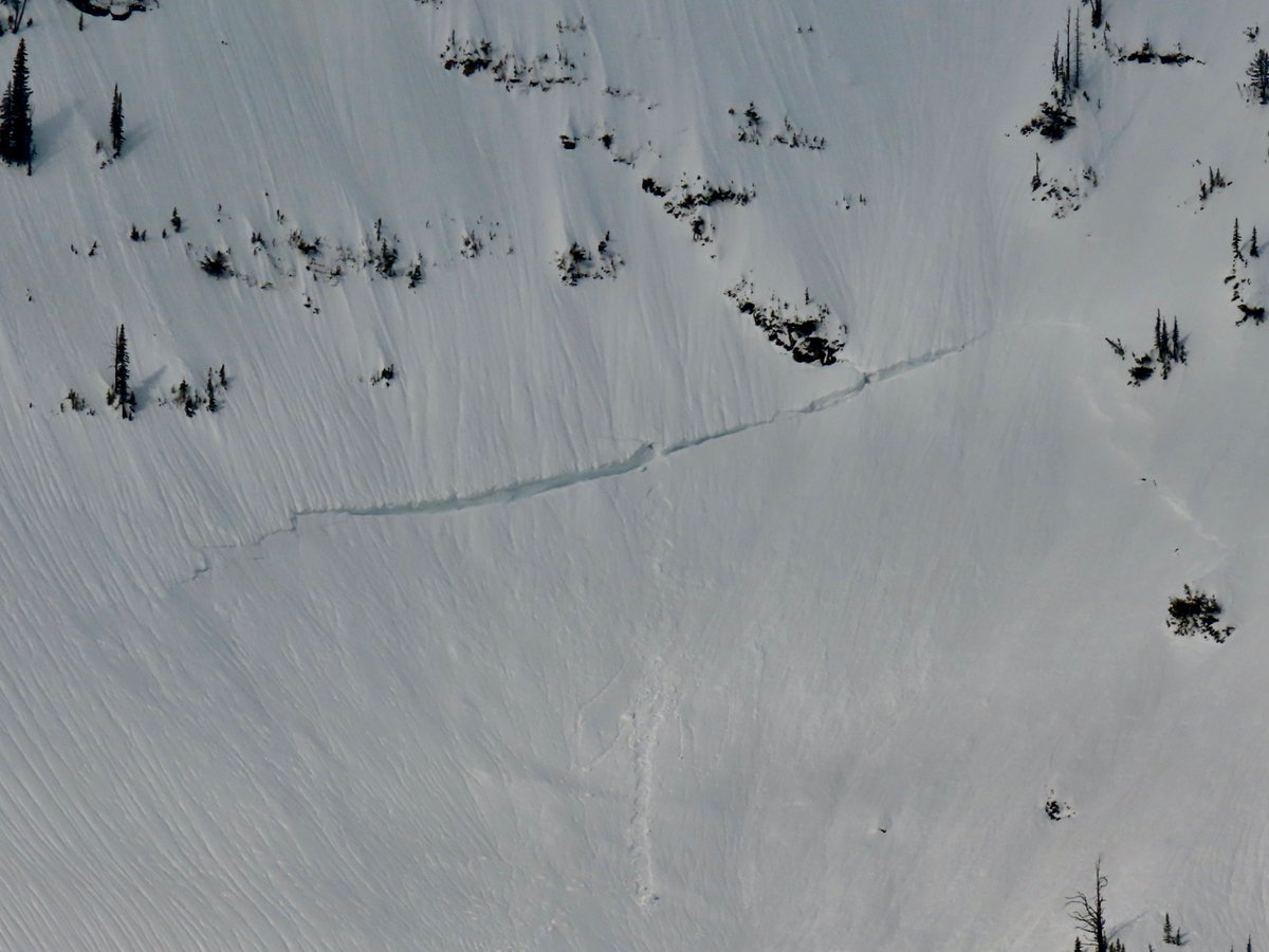
Recent observations are finding few signs of unstable snow. The only reported slab avalanche is of image 2 in extreme terrain. Other avalanche activity includes small dry loose avalanches.
The Flathead Avalanche forecast team thanks Jenny Cloutier and Corrie Holloway for their work this winter.
Jenny - FOFAC's ExecDirector - makes things happen for Flathead Avalanche. Corrie - FOFAC's Communications Manager - spreads the word about the happenings!
New snow problems are on the menu. Wind slabs will be at the top. Whether you deal with a loose dry problem or a storm slab problem will depend on how much snow fell in the area you are traveling. Head over to https://t.co/RXISQ3Bz0N for more information.
Small wet slides and tumbling cornice are the most likely triggers for large avalanches on buried weak layers. Riders can still trigger a slab on rocky slopes where the snowpack is thin. Full forecast at https://t.co/RXISQ3Bz0N
📷 Sluffs and slabs above Marion Lake
Steep, rocky slopes with overhanging cornice: This is where you can still tangle with large avalanches on buried weak layers. Opt for slopes with a supportable surface away from overhead hazards. https://t.co/RXISQ3Bz0N
📷 Mount Liebig
📷 Old hard slabs on a rocky slope
Upper elevation ridgelines may be viciously windy today. Identify and avoid areas where you see active wind loading, or previous wind loading. Your safest and best riding conditions will be on lower angled slopes sheltered from south and west wind.
Dangerous conditions may develop this afternoon as heavy rain increases the likelihood of wet snow avalanches at upper elevations. Plan to be off of and out from under steep start zones with more than a few inches of recent snow by about midday.
The late March sun may pack a punch this afternoon. Time your exposure to steep terrain based on surface conditions. If a strong and supportable crust exists at the surface, expect generally stable avalanche conditions. Once that crust breaks down, move to lower angled slopes.
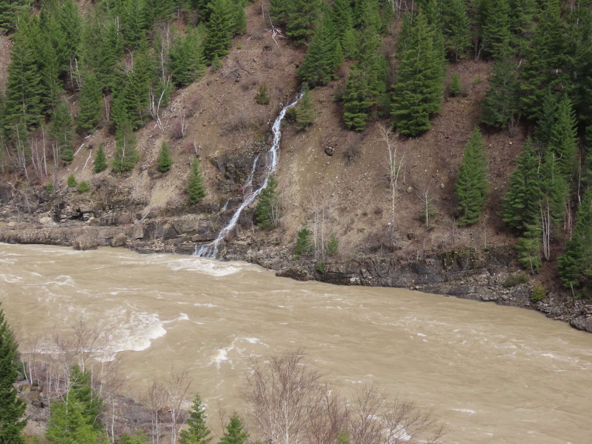
Enjoy today's clear skies and much needed cooler temperatures. Lots of snowmelt this week filled area creeks and rivers to the brim while rising the danger of natural and human-triggered slides on a buried weak layer. Follow along at https://t.co/RXISQ3Bz0N
Warm weather and rain has lead to rising creeks and the Middle Fork River cresting above 13000 cfs! Follow along at https://t.co/RXISQ3Bz0N for snowpack, weather, and avalanche information.
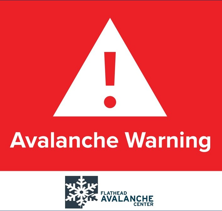
The snow is still wet, avalanches are still occurring, the danger is still HIGH, and the Avalanche Warning is still in effect! Travel near steep slopes is not recommended.
📷 1+2: Crowns on Mount Grant.
📷 3: Very Large avalanche on Sixmile, Chris Gotschalk
We’ve extended the Avalanche Warning to Saturday morning. Exceptionally warm temperatures and rain are causing very dangerous avalanche conditions. Avoid traveling on or underneath any steep slope.
An Avalanche Warning is in effect. Very dangerous avalanche conditions exist. Rain on snow and rising freezing levels are causing widespread areas of unstable snow. The travel advice is simple - stay far away from steep terrain.
Avalanche Watch
3/16 at 4:00 PM – 3/17 at 4:00 PM
Rising freezing levels and rain on snow may rapidly destabilize the snowpack. Avalanche danger may rise to High (Level 4 of 5).
Very dangerous avalanche conditions may develop. Travel in avalanche terrain is not recommended.
What these images share - besides being shot from far away - are remarkably wide, thick crown faces. The D3 avalanches released when this week's storms loaded leeward slopes where the January Drought Layer remains a threat. 📷 Kniveton, Reavis x2, Millspaugh
FAC staff visited Noisy Basin and the Aeneas Ridge weather station on Saturday, March 14. Follow along at https://t.co/RXISQ3Bz0N for snowpack, weather, and avalanche updates.