Technical Data Strategy Lead by day 💼 Geospatial analytics side hustle (advanced stats & over-engineered R workflows) 🌍📈 Public health research for fun 🤓
1/12 Our book, ‘Social Murder? Austerity and life expectancy in the UK’, by David Walsh and I, is out today. It details how mortality stopped improving in the UK and other countries as a result of austerity policies damaging the building blocks of health. Here’s a brief summary:
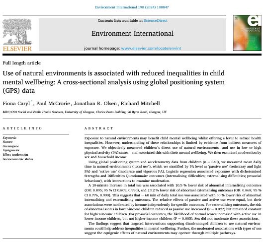
Implications: Encouraging time in nature could could be a simple yet effective way to help reduce inequalities in children's mental wellbeing 🌈
But local authorities need to ensure children have access to natural spaces, especially in disadvantaged areas 🌼
3️⃣ Benefits were stronger for children from lower-income households, but varied by activity level and outcome 💚
- Gentle activities in nature reduced behavioral difficulties 🚶♀️ 😊
- Vigorous activities promoted positive social behaviors 🏃♀️🤝
@undertheraedar This is such an impactful visual, Aliasdair! Love the use of mySociety IMD 👏 If I could make one suggestion: if you move "least deprived" legend label to top, next to decile 10, it will prevent people reading the gradient vertically. (Based on some comments)
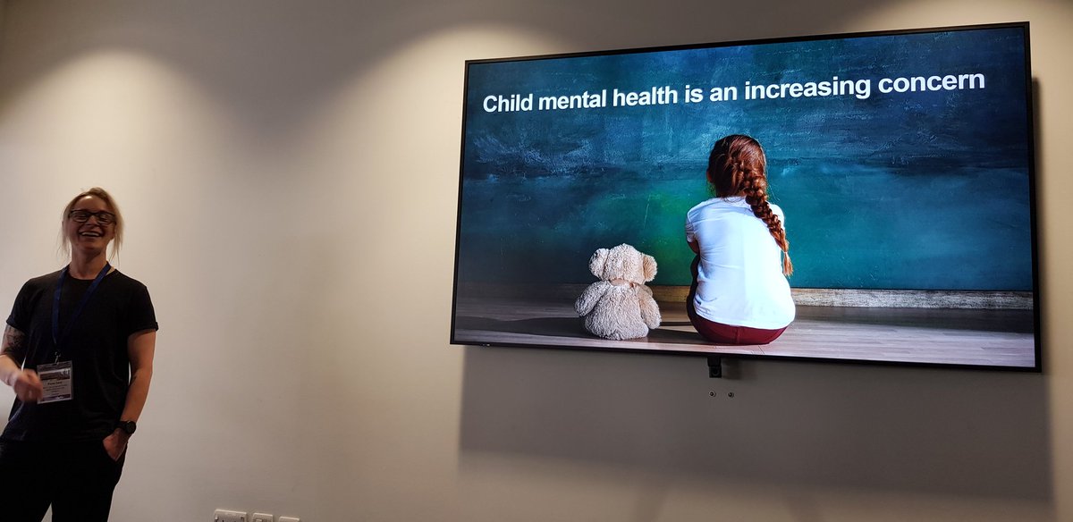
Children who spend more time in natural environments have significantly better mental health, according to research by UofG.
The study found that the benefits of spending time in nature were strongest for children from lower-income households.
More ➡️ https://t.co/kITaLikp6q
🌐 Exciting Opportunity! We're seeking a #ResearchAssociate with expert knowledge of #SpatialData science to contribute to an ESRC SDAI-funded project, and lead the production of new research publications and proposals at UBDC. Full details: https://t.co/PrIv2TV0Jg #DataJobs
📍How is Great Britain changing?
As part of #BECCA, we have created a national dataset that quantifies natural and built environment change across the whole of Great Britain🏢
Interactive map and data available soon... watch this space 👀
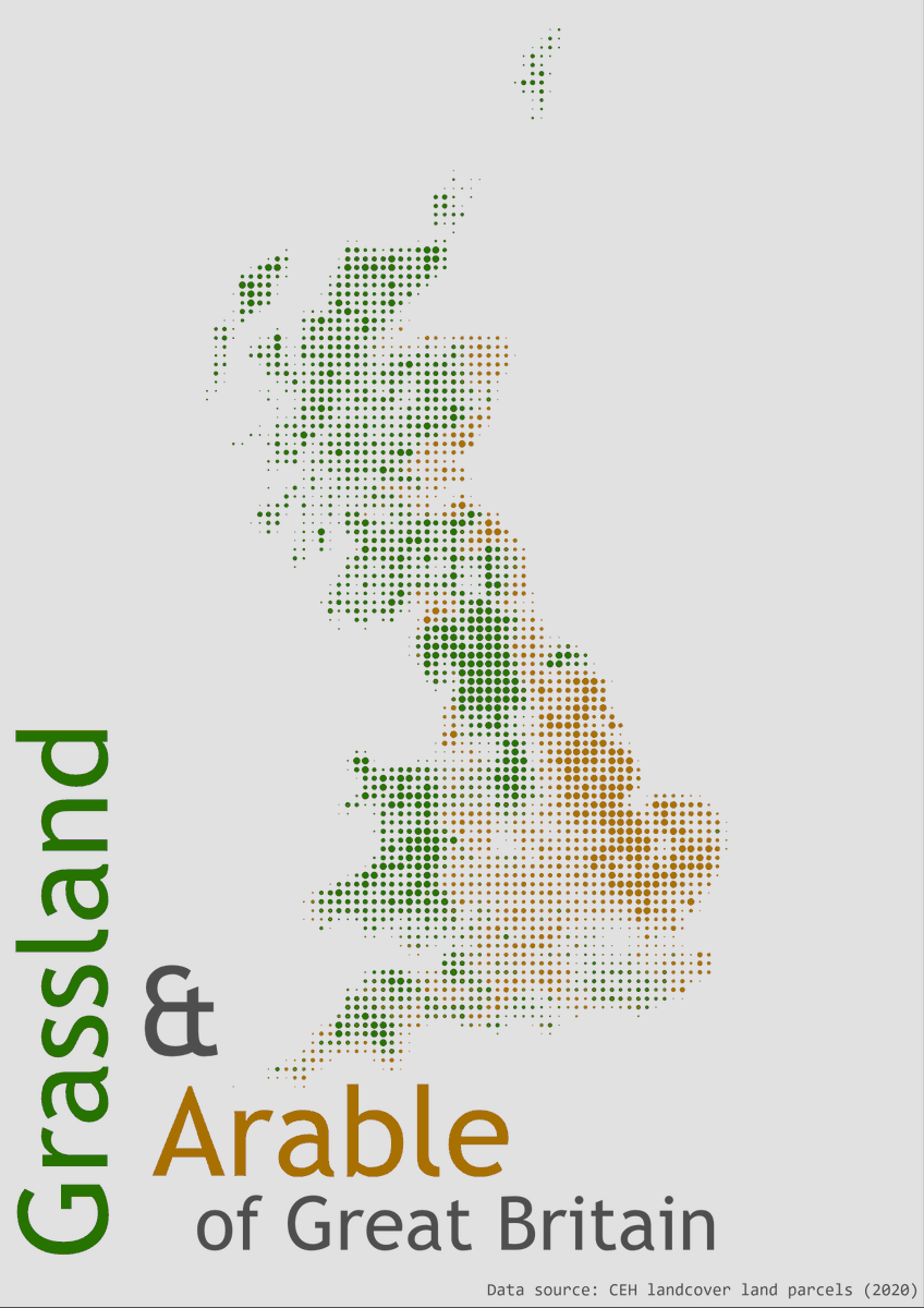
#30daymapchallenge | Day 21 - Raster
Arable🌾vs Grassland 🌱
Proportional 'points' showing % coverage of Arable and Grassland land cover across Great Britain.
Data sourced from @UK_CEH + compiled as part of our current project #BECCA... more to come soon 👀
#30daymapchallenge | Day 1 - Points
We're looking for someone to come and work with us (me, @thomasburgoine, @loudoestweet and @SorenBrage) on analysing GPS data to look at the relationship between environment, diet and activity https://t.co/At3yapdOmI Closing date: 8 Nov. Pls retweet.
Re-advertising exciting funded PhD studentship on physical health outcomes among transgender people using linked health datasets. Suits quant social scientists, statisticians, epi etc. Get in touch for more details: https://t.co/YueoqENqfz @CSO_Scotland@theSPHSU@SPHSU_ineq
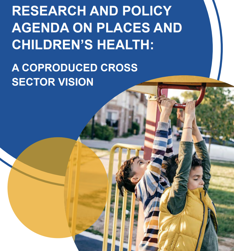
🚨 REPORT LAUNCH🚨
Places and Children’s Health: A Research and Policy Agenda 👉https://t.co/6zTzVjLOvm
This coproduced report summarises the most pressing research needs identified by stakeholders during a workshop held in May 2023.