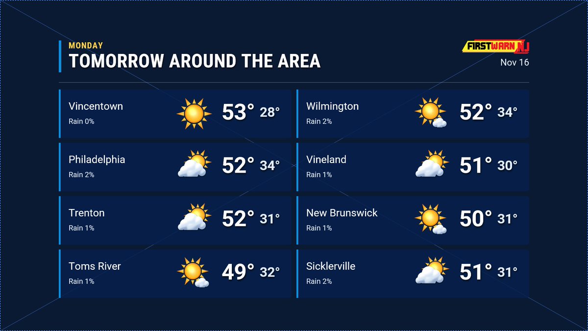
A dry week is expected with high temperatures gradually increasing with each passing day. There is uncertainty about Sunday, most models are dry, but one has a low coming up the coast instead of making a wide right. We'll keep an eye on it. #NJ#NJWX#WX#Weather
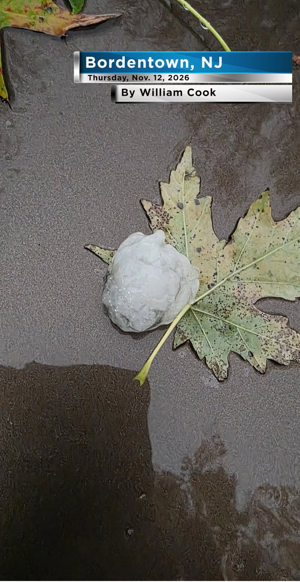
A trained weather spotter/viewer from Bordentown, William Cook, sent us this photo of a large hailstone that fell there this past Thursday, Nov. 12, with a severe thunderstorm.
The National Weather Service's Local Storm Report classified the hail size in Bordentown as reaching ping pong ball size, or 1.50." #NJ #NJWX #WX #Weather
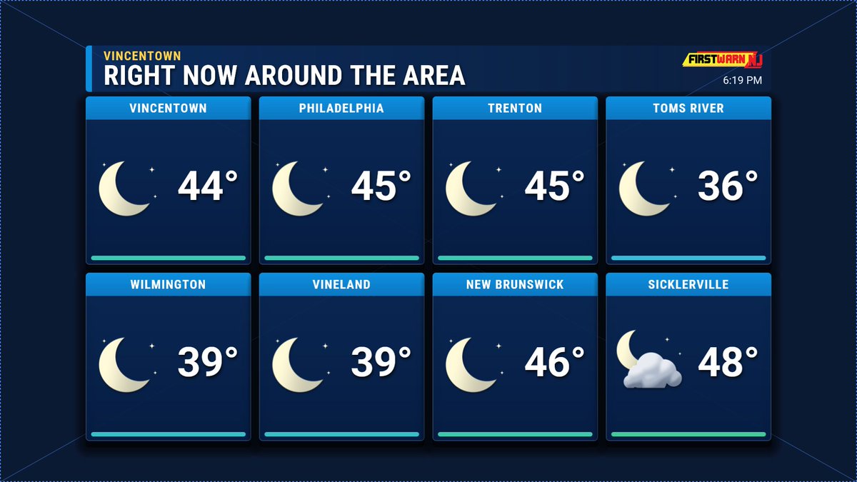
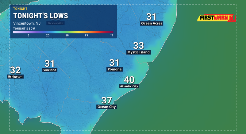
@NJexit114 Probably around 37-41 tonight for lows at the beaches, it is 41-48 now. Sicklerville got bumped toward the coast for some reason in the wide view, but here's a better view of the shore.
Right now, temperatures are dropping through the 40s, with the colder spots already dropping below 40 under mostly clear to clear skies. Many spots will fall below freezing overnight. Tomorrow, expect partly to mostly sunny skies. #NJ#NJWX#WX#Weather
Chilly end to the weekend. High pressure will be over the Mid Atlantic for much of the week with the next cold front now not until late next weekend or even a bit beyond that. That means plenty of sunshine. #NJ#NJWX#WX#Weather
Minor tidal flooding expected in Ocean and Coastal Ocean Counties until 4 AM Saturday, with up to a half foot of inundation near shorelines and tidal waterways, possible road closures in coastal and bayside areas, so avoid driving through standing water.
Minor tidal flooding up to half a foot above ground is expected in low-lying areas of Ocean and Coastal Ocean Counties until 4 PM, with the highest levels in the back bays; avoid flooded roads and never drive through standing water.
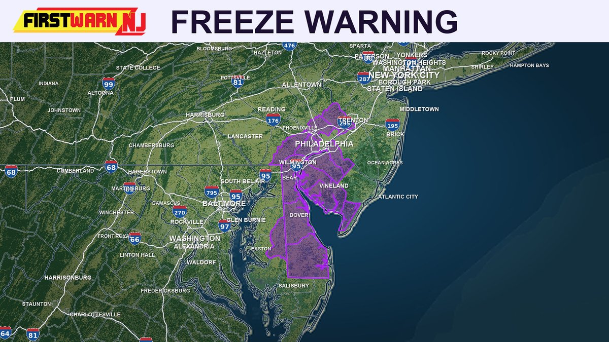
Freeze Warning in effect until 9 AM for parts of DE, northeast MD, southern NJ, and southeast PA with lows near 30, so protect tender plants and outdoor pipes now.
Freeze Warning midnight to 9 AM Saturday for parts of DE, NE Maryland, S New Jersey, and SE Pennsylvania with lows of 28 to 32 degrees possible, threatening crops and outdoor plumbing, so cover plants and protect pipes tonight.
Unseasonably chilly airmass will take hold this weekend into Monday. Saturday will be brisk and could even feature a passing flurry or sprinkle in our NW counties. Several nights will have lows below freezing. No big storms on the horizon through the end of next week. We will start to see temperatures more typical for November standards by the end of the week. #NJ #NJWX #WX #Weather
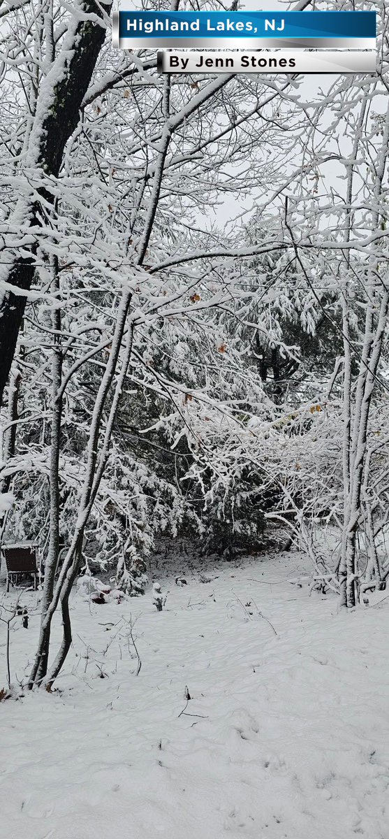
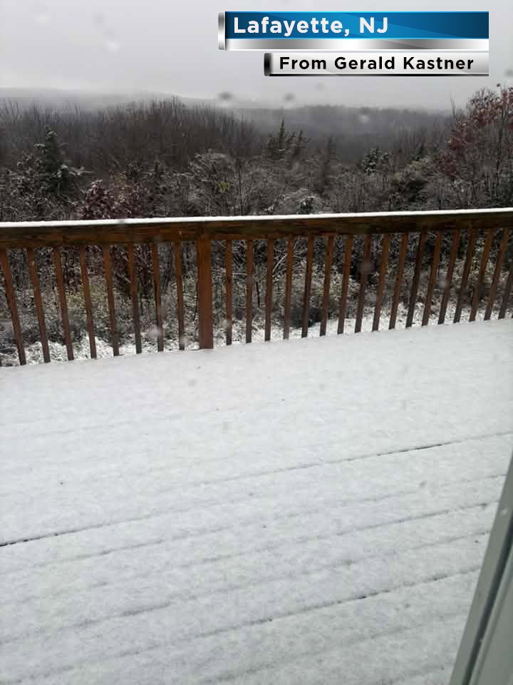
Parts of Northwest New Jersey had its first snowfall of the season today, especially in Sussex County. The wet snow accumulation on elevated surfaces made for picturesque scenes. Unofficial totals ranged from a coating to about two inches in most places.
Many of our Sussex County viewers provided us with great photos of the state's first snowfall. By all accounts, the highest accumulations occurred around Highland Lakes. We thank you all for the photos and getting us in the holiday spirit! #NJ #NJWX #WX #Weather
The Coastal Flood Advisory for Middlesex, Essex, and Eastern Monmouth Counties has been lifted as water levels have dropped below advisory thresholds and no further flooding is expected.
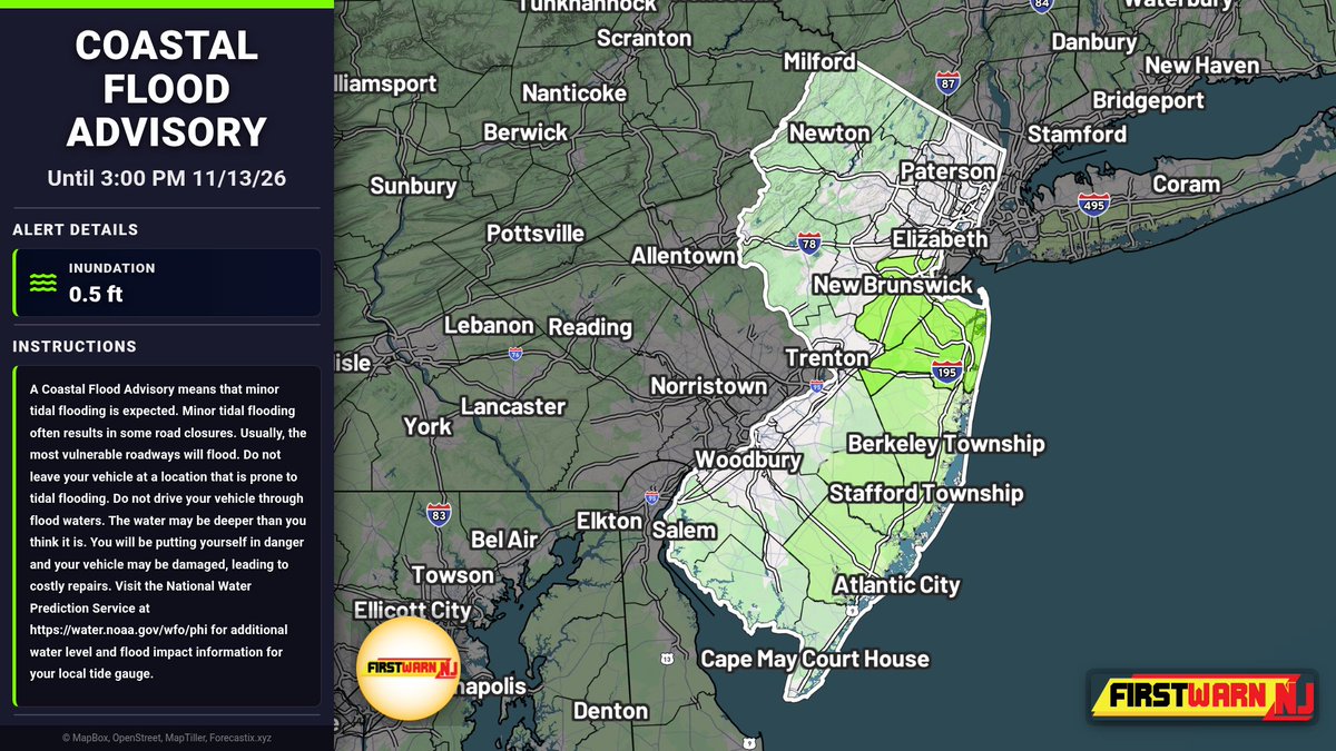
Minor tidal flooding up to half a foot above ground is expected in Middlesex, Essex, and Eastern Monmouth Counties from 9 AM to 3 PM Friday, with possible road closures in coastal and bayside areas, so avoid driving or parking in flood-prone spots.
Coastal Flood Warning remains in effect for Ocean and Coastal Ocean Counties until 4 AM Saturday, with up to half a foot of inundation possible in low-lying shoreline and tidal areas, so avoid roads prone to tidal flooding and never drive through standing water.
Coastal Flood Warning in effect for Ocean and Coastal Ocean Counties from 9 AM to 3 PM, with 1 to 2 feet of inundation expected in low-lying areas near shorelines and tidal waterways, making many roads impassable, so avoid all floodwater.
The Coastal Flood Advisory has been lifted for Atlantic, Middlesex, Cape May, Monmouth, and Morris Counties as water levels have dropped below flood thresholds and no further flooding is expected.
Minor tidal flooding is expected Friday 9 AM to 3 PM across Ocean, Coastal Ocean, and Southeastern Burlington Counties, with up to half a foot possible near shorelines and tidal waterways, so avoid flooded roads and move vehicles from flood-prone areas beforehand.
Light precipitation will continue through about 10 p.m. this evening, tapering off after that. Latest high resolution modeling shows a larger area will flip to snow down into some of the lower elevations of NW NJ before shutting off. #NJ#NJWX#WX#Weather
Got a few reports of an inch or two of snow in the higher elevations of Sussex County, NJ today. NJ's topography is quite different from north to south, but crazy to think tornado the day before, snow the following day in the same state. #NJ#NJWX#WX#Weather