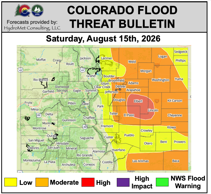
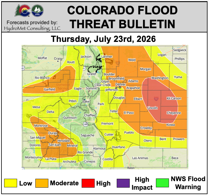
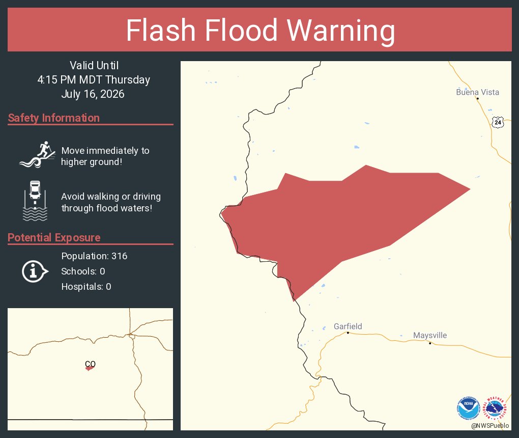
#FTB: Heavy rainfall and flooding remain a concern across southeastern Colorado today. Strong afternoon and evening thunderstorms are expected across eastern Colorado, with the potential for storms to linger overnight. A HIGH #COflood threat has been issued, with strong to severe storms also capable of producing large hail and damaging winds. #cowx
Stay weather aware by checking out the full post here: https://t.co/XnA7q3yTbe
#FTB: Heavy rainfall and flood threat once again! Strong PM t-storms are forecast over the I-25 corridor and eastward, with a chance of overnight heavy rainfall east. A HIGH #COflood threat has been issued. T-storms will also be capable damaging hail/winds. #cowx
Please stay aware of the weather today!
See the full post at: https://t.co/3j31eJRFuT
#FTB: Another day of active #cowx, with the high levels of moisture bringing a concern for heavy rainfall across the I-25 corridor and Palmer Ridge. There is the possibility for multiple rounds of afternoon/evening rainfall including during rush-hour. A HIGH #COflood threat has been issued.
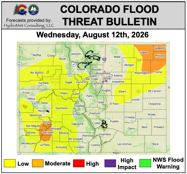
Rainfall continues over the mountains, with greatest concern for showers and t-storms over the San Juans and adjacent areas. A MODERATE #COflood threat has been issued.
Read the forecast details at: https://t.co/hn04CSBqHh
#FBF (Fire Burn Forecast): A HIGH #COflood threat has been issued for the #GoldMountain burn area. There are also 4 MODERATE #COflood threats + 5 LOW #COflood threats for other recent #cofire burn areas. #cowx
See burn area rainfall totals & previous forecasts: https://t.co/tJPugmjKPC
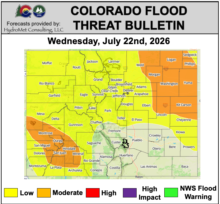
#FTB: Scattered to numerous PM t-storms over the west, with a greater likelihood for training storms over the San Juans. Evening severe t-storms over the NE plains with the potential for heavy rain and damaging wind gusts/hail. A MODERATE #COFlood threat has been issued. #cowx
Full post: https://t.co/29U8FT1tWY
#FTB: #Monsoon moisture continues to gradually increase across Colorado today, bringing scattered showers and thunderstorms. NO #COflood threat has been issued. #cowx
Read the full discussion: https://t.co/9T2PAR5Zi0
#FBF (Fire Burn Forecast): Two LOW #COflood threats have been issued for the #AspenAcres and #GoldMountain burn areas. #cowx#cofire
View rainfall totals & previous forecasts here: https://t.co/6aNc3IyAQi
#FBF (Fire Burn Forecast): A MODERATE #COflood threat has been issued for the #AspenAcres burn area, with a LOW #COflood threat for the #GoldMountain burn area. #cowx#cofire
See yesterday's burn area rainfall totals & previous forecasts here: https://t.co/mMk3k60kh3
#FTB: Decrease in #Monsoon moisture today, with higher moisture lingering across southern CO to support a few PM heavy rain cores. A LOW #COflood threat has been issued. #cowx
Check out the full post at: https://t.co/UdLCnxnpnH
#FBF (Fire Burn Forecast): A HIGH #COflood threat has been issued for the #AspenAcres#cofire burn area. There have also been 4 MODERATE & 1 LOW threat issued for other recent burn areas. #cowx
See yesterday's burn area rainfall totals & previous forecasts here: https://t.co/Olj0oqmgJP
☔️ #Monsoon storms continue today, spreading into the adjacent eastern plains later this afternoon. A couple of MODERATE #COflood threats have been issued. Flooding concerns continue overnight for the eastern plains. #cowx
More #FTB details here: https://t.co/dfsz45oQ1h
#FBF (Fire Burn Forecast): Flood threats across all burn scars today. 2 HIGH #COflood threats have been issued, with 5 MODERATE #COflood threats and 2 LOW #COFlood threats. #cowx#cofire
See previous forecasts here: https://t.co/mMk3k60kh3
#FTB: Continued monsoon moisture across the state. PM showers and thunderstorms as a low-pressure disturbance also helps to increase storm coverage. This supports an increased flood threat over the I-25 corridor and eastern plains, with the greatest threat over the eastern plains. A HIGH #COflood has been issued.
Another day of mountain storms. A MODERATE #COflood threat has been issued over the east-west oriented high terrain. Debris flows and mud flows are the greatest concern, especially over steep terrain and areas of saturated soils. #cowx #monsoon
Read the forecast details: https://t.co/Sj0Hlei4fH
#FTB: Widespread PM showers and thunderstorms across most of the state. A MODERATE #COflood remains, with the #COFlood threat expanding over the plains with the potential for overnight storms. #cowx#monsoon
Read the forecast details: https://t.co/ovmOkzPSzC
#FBF (Fire Burn Forecast): The #GoldMountain burn area is under a HIGH threat. A MODERATE threat has been issued for 7 other burn areas, and 1 burn area under is under a LOW threat #cofire#cowx
Archived forecasts here: https://t.co/mMk3k60kh3
#FBF (Fire Burn Forecast): Heavy rainfall returns to the mountain forecast, so does the chance for a storm to track or develop over a recent burn area. There are 4 MODERATE & 4 LOW #COflood threats issued. #cofire#cowx
Archived forecasts here: https://t.co/fspnEswAP3
A MODERATE #COflood threat returns to the #cowx forecast with ample #monsoon moisture statewide. A conditional LOW threat has also been issued for the Urban Corridor.
Read the full #FTB here: https://t.co/VBgFB12OEO