So you’ve heard about Human Centred Design (#HCD), but not sure how it works in practice? Check out our 6 steps to successfully #design for your users.👉
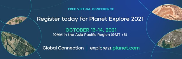
Tune in to @planet Explore21 to ask us anything about Managing Victoria's Bushfire Risk with SkySat Tasking, streaming 4pm AEST October 13th. Register today: https://t.co/iUAO12wq6V
Registration for @planet Explore 2021 is now open! Don’t miss this free opportunity to connect with EO leaders, industry experts, and researchers – including @FFMVic & @dahl_brittany about Managing Victoria’s Bushfire Risk https://t.co/iUAO12wq6V
Q: How do I get @planet imagery into #ArcMap?
A: Planet don't offer an ArcMap Add-in (only #ArcGISPro and #QGIS)! If you still use ArcMap you will need to add in the web services manually. View our tutorial detailing this process: https://t.co/p27GIKw5dZ
Do you have a @planet SkySat Tasking Subscription? Wondering how to view your tasks on a map? View our sixth video in the *HOW TO* Planet Imagery Series for a tutorial on the Tasking Dashboard (https://t.co/4FOnQJBkUK): https://t.co/t2rkb8Tyte
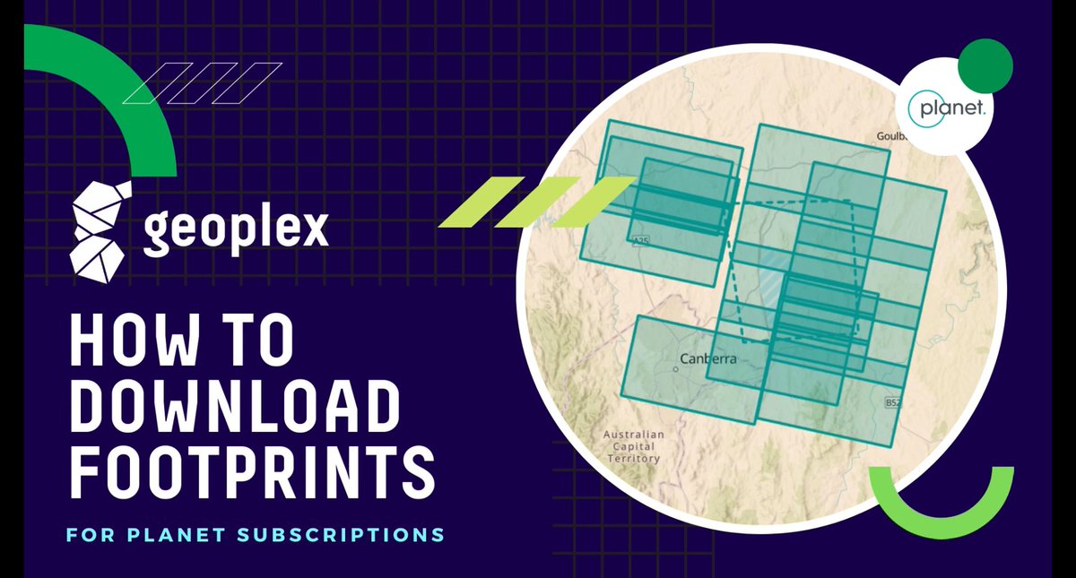
Thinking about downloading @Planet imagery? Ever wondered the easiest way to save the outlines (known as #footprints)? View our latest *How To* video - to Download Imagery Footprints using the QGIS Planet Imagery Plugin: https://t.co/oXHUPKL1F1
Ever wondered how to find daily @planet Imagery in
@Esri's ArcGIS Pro? Watch our fourth video in the *HOW TO* Planet Imagery Series: https://t.co/JRKICLzY4y
This video is a tutorial for finding Planet imagery and individual image WMTS URLs using the ArcGIS Pro Planet Add-in.
Join us tomorrow at 12pm for our webinar on the award winning Gold Coast #Beach#Management#System with Chris Drummond of @UNSWWRL! Thanks to @SSSI_AU for hosting us & organising this event: https://t.co/MpvJkqx1VM
Our third video in the *HOW TO* @planet Imagery Series - detailing how to find web map tile services (#WMTS) with your Planet Subscription, and your #API Key using Planet Explorer: https://t.co/c4pFVtsiEa
Useful for #streaming imagery in #GIS programs.
Questions? Get in touch!
Looking to view changes quickly over time? Visit our quick tutorial to make an easy & sharable online video of your @planet Imagery: https://t.co/4If87SDkhr Planet Stories (https://t.co/3n9eIoUclE) creates a timelapse CC-BY video available with a PlanetScope Access Subscription
Check out the easiest way to view daily imagery - with @planet Explorer! Watch our quick walk-through to view and download Planet imagery: https://t.co/GP9zP3uz4g
Geoplex provides #support and #managed#services to our enterprise customers. To focus that support on our customers we welcome Sharon Maqbool to the Geoplex Team as our Manager - Support and Managed Services. Sharon's team provide effective resolution to issues when they arise!
We’ve launched a series of *HOW TO* videos to help you get the most out of @Planet Imagery. Visit the Playlist on our YouTube channel where we’ll be posting a series of videos over the next two weeks: https://t.co/8VtAneeriQ
Find the most used rest stop in Australia using our 3D map in the National Freight Data Hub. Select a place, date, and time to see when congestion and use occurs. #NFDH https://t.co/6HoLrWp2VL
The National Freight Data Hub assists the freight industry, Governments, and researchers to better understand Australia's freight system, and to evaluate and optimise for the future of imports and export efficiency. #NFDH