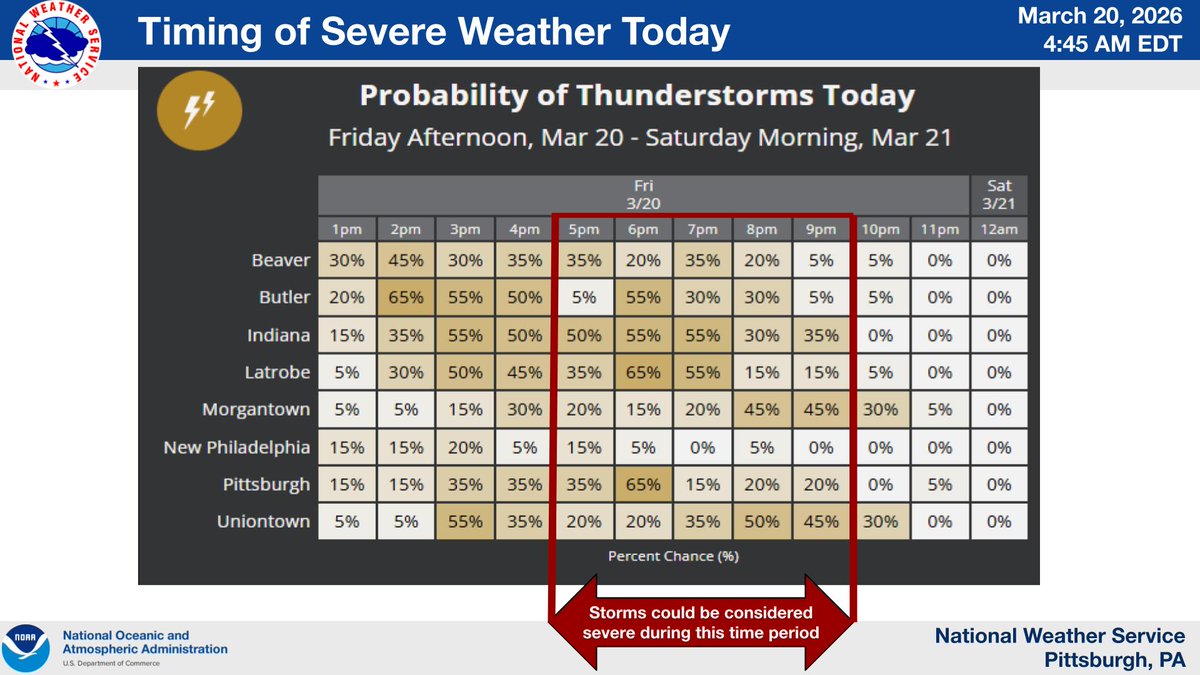
Our severe weather outlook remains largely unchanged for today. A passing cold front will reintroduce the potential for strong to severe storms. Thunderstorm chances will increase mainly after 2:00 PM and continue until just before midnight.
@SHEETZ I posted this on your page but in mere minutes it mysteriously disappeared. So here goes again. I notice Sheetz doesn't ask me to rate my experience anymore when I order. Judging from my order tonight, I think I know why.
A round of heavier, more persistent rain is moving into northern WV and southwestern PA this morning. In general, an additional half inch to inch of rainfall can be expected before it moves out of the area this afternoon. A few locally higher amounts to 1.5" will be possible.
@Pirates@PSaletrik@sheetz I'm holding out for a dollar bill autographed by the one and only Bob Nutsack. That is if they can get him to part with a dollar bill.
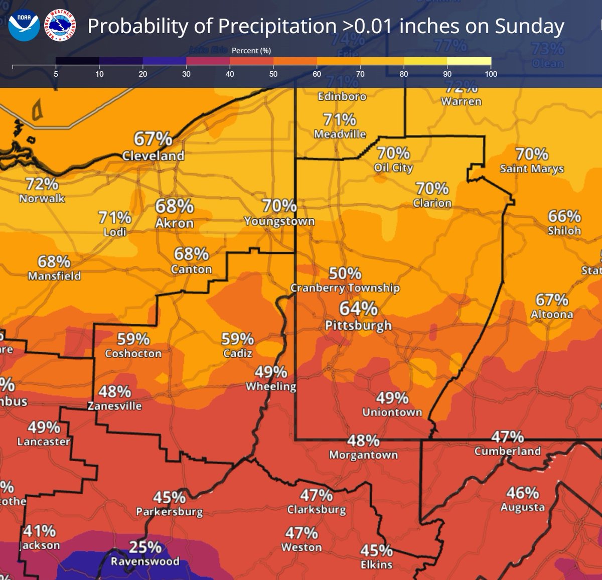
Dry conditions are forecast through tomorrow. On Sunday, we will see our next best chance for measurable precipitation. The northern counties have the highest probability for rain.
Synopsis: Light snow will move in on Wed ahead of a warm front. Rain will then move in from the south Wed evening/overnight as air aloft warms but surface temps remain below freezing. This will lead to a period of freezing rain, lasting longest in the higher terrain and N of PGH.
Keep an eye on the sky this morning for a potentially beautiful sunrise!
Yesterday, we started discussions on a weather pattern change that could bring snow. That pattern is also favored to result in multiple days with gusty wind, but is unlikely to reach warning criteria.
Cooler temperature is on tap for next week and it starts with the passage of a cold front Sunday afternoon evening. There is potential for a few of the thunderstorms the develop along the front to pose a damaging wind, hail, and tornadic threat, mainly between 4pm-9pm.