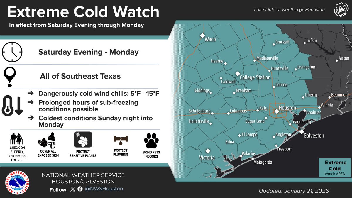
Dangerously cold weather arrives this weekend through early next week for all of Southeast TX.
An Extreme Cold Watch has been issued from Saturday evening through early next week.
Now is the time to prepare! Protect people, pets, plants and pipes from cold weather!
WINTER STORM WATCH: Areas along and north of I-10 are under a Watch this weekend. Freezing rain could lead to dangerous, icy conditions.
Remember: WATCH = BE PREPARED. Don't wait—prep now! Protect your home & plan to stay off the roads if conditions deteriorate.
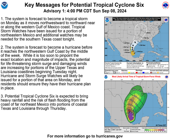
Potential Tropical Cyclone Six has formed in the southwestern Gulf of Mexico and is forecast to strengthen as it approaches the Upper Texas or Louisiana Coast on Wednesday. SE TX's best rain chances are currently Tuesday and Wednesday. #txwx#houwx#glswx#bcswx
GMRS weekly net on Thursday at 7:30 PM, utilizing the WRHV671 Carlos repeater and its corresponding frequency of 462.7250 MHz, with an offset of +5 and a PL tone of 141.3.
Question of the night is: do you have anything planned this weekend?
Must have a GMRS license!
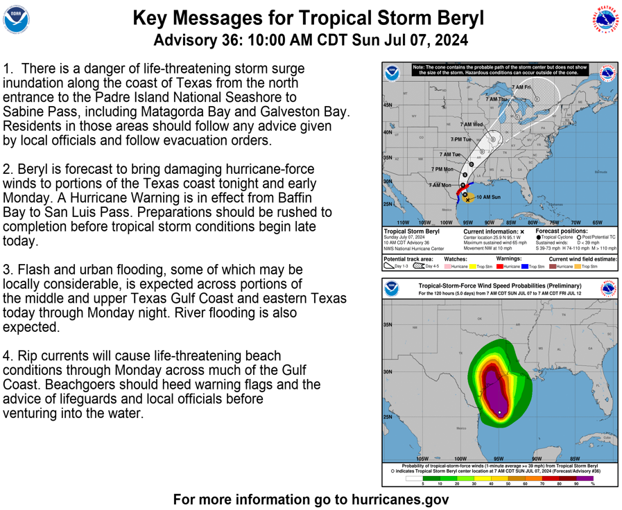
Here is our latest briefing on Beryl and its forecasted impacts for Southeast Texas. Its expected to bring all hazards potentially to portions of the area. High winds, storm surge, flooding rains, isolated tornadoes. #txwx#TSBeryl https://t.co/UZfEHTSSMH