Released today in the UK. ‘The Burning Earth’ by Sunil Amrith. Published by W W Norton, illustrated maps by Hand Made Maps. An examination of the world’s dwindling resources, exploitation, and the inevitable consequences.
@amrith_historian @yale_history@wwnortonuk
On the personal work front, my drawing 'Il Grande Cavallo 1482' has been awarded the Critics Prize at the Annual Exhibition the Royal Society of British Artists. On show at the Mall Galleries until Saturday 9th March.
Released 7th November 'The Picnic : A Dream of Freedom and the Collapse of the Iron Curtain' by Matthew Longo @matthewblongo Published by @wwnorton (interior maps by Hand Made Maps)
Private Commission: Illustrated map of the River Test in Hampshire and the origins of dry fly-fishing. inks/watercolour/coloured pencils. >swipe left to see artwork develop from initial masking to final state >swipe again for close-up video.
#illustratedmap#rivertest#flyfishing
@culturaltutor er, wasn’t the style used as a reference to where and when democracy originated? These buildings signify that they are the guardians of democracy - the least worst political system.
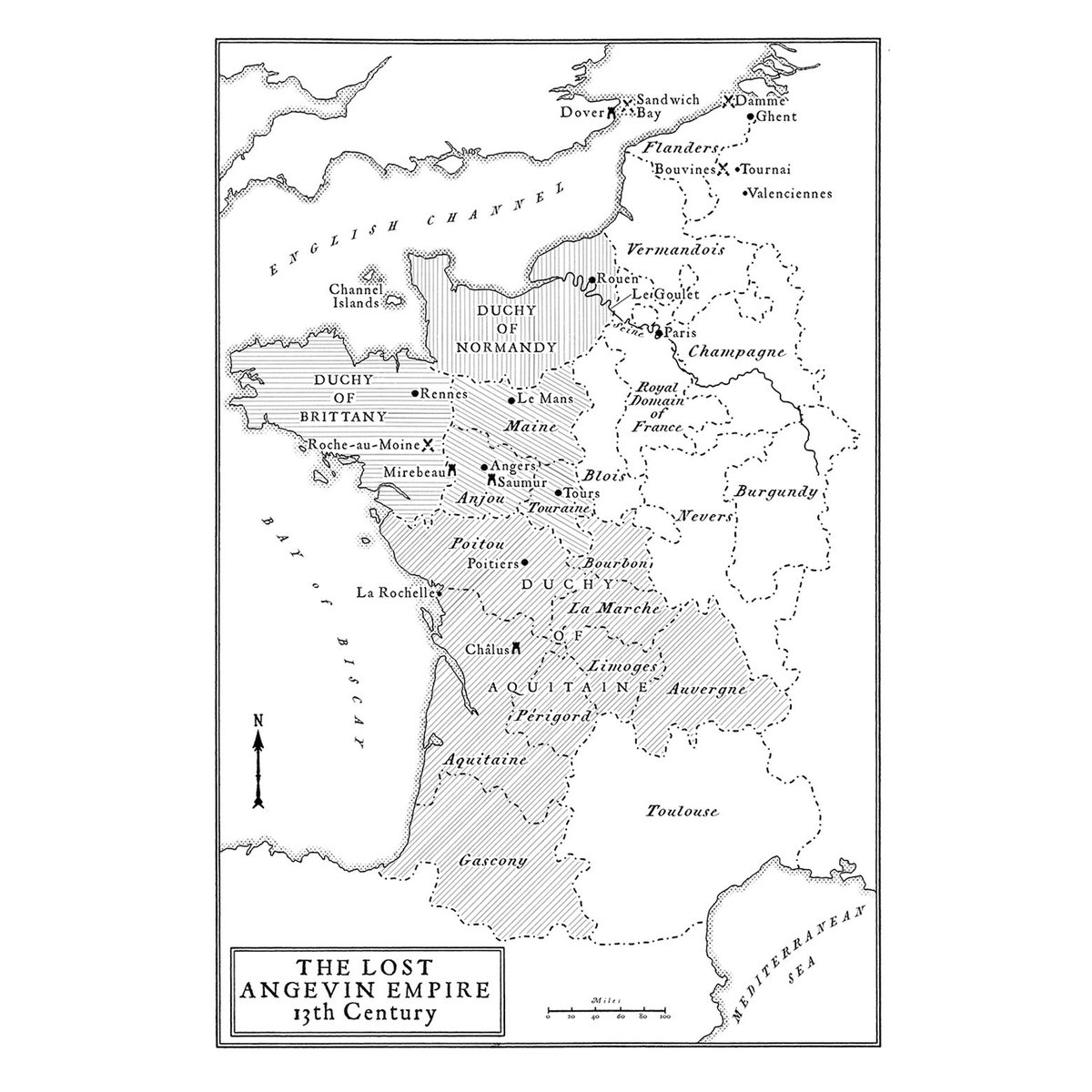
Published today ‘Sovereign of the Isles’ by Iain Milligan pub. @UnicornPubGroup Maps throughout by Hand Made Maps. A History of Britain told through the changing ownership of land. Ties together many historical reference points.